Pierron is a village in Bond and Madison counties, Illinois, United States. The population was 459 at the 2020 census, down from 600 at the 2010 census. The village is part of the St. Louis metropolitan area.
| Name: | Pierron village |
|---|---|
| LSAD Code: | 47 |
| LSAD Description: | village (suffix) |
| State: | Illinois |
| County: | Bond County, Madison County |
| Founded: | 1871 |
| Incorporated: | 1893 |
| Elevation: | 512 ft (156 m) |
| Total Area: | 0.73 sq mi (1.90 km²) |
| Land Area: | 0.73 sq mi (1.90 km²) |
| Water Area: | 0.00 sq mi (0.00 km²) 0% |
| Total Population: | 459 |
| Population Density: | 630/sq mi (240/km²) |
| ZIP code: | 62273 (Pierron) 62275 (Pocahontas) |
| Area code: | 618 |
| FIPS code: | 1759709 |
| GNISfeature ID: | 2399670 |
Online Interactive Map
Click on ![]() to view map in "full screen" mode.
to view map in "full screen" mode.
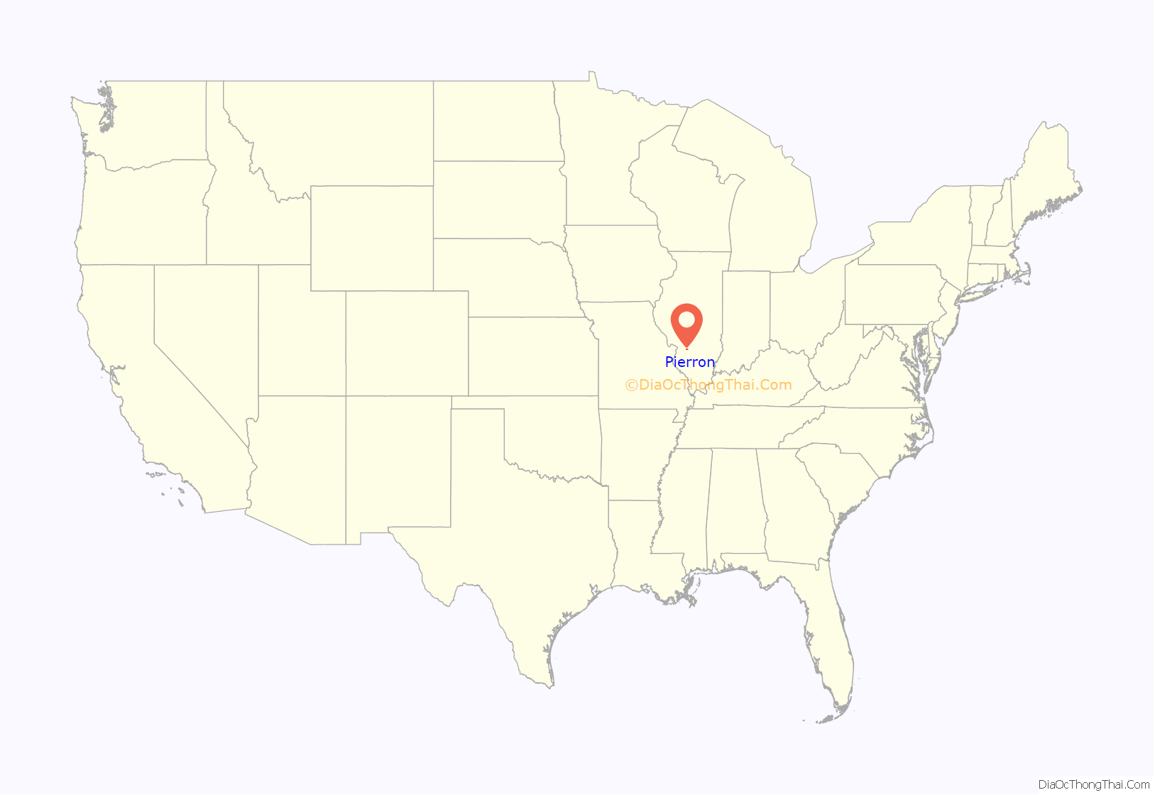
Pierron location map. Where is Pierron village?
History
The first post office was established at Pierron in 1870. Pierron was laid out as a village in 1871, and named for its founder Jacques Pierron. Pierron was incorporated as a village in 1893.
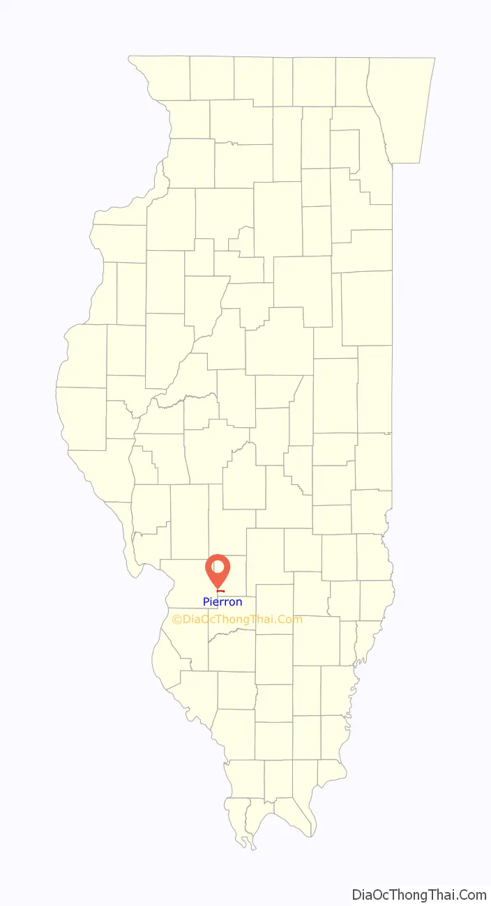
Pierron Road Map
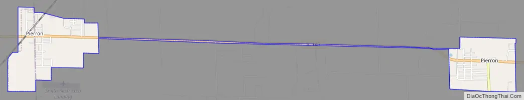
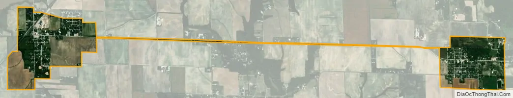
Pierron city Satellite Map
Geography
Pierron is located in southwestern Bond County and eastern Madison County. The village has two sections that are 4 miles (6 km) apart and connected by Illinois Route 143. The western section, also known as “Pierron Station” and crossed by the CSX Transportation St. Louis Line railroad, is on the Bond–Madison county line, while the eastern section, also known as “Millersburg”, is four miles to the east. Highland is 5 miles (8 km) southwest of the western part of Pierron, while Pocahontas is 4 miles (6 km) north of the eastern part.
According to the U.S. Census Bureau, Pierron has a total area of 0.73 square miles (1.89 km), all land. The western part of the village drains west to Sugar Creek, while the east part drains east to Shoal Creek, both of which are south-flowing tributaries of the Kaskaskia River.
See also
Map of Illinois State and its subdivision:- Adams
- Alexander
- Bond
- Boone
- Brown
- Bureau
- Calhoun
- Carroll
- Cass
- Champaign
- Christian
- Clark
- Clay
- Clinton
- Coles
- Cook
- Crawford
- Cumberland
- De Kalb
- De Witt
- Douglas
- Dupage
- Edgar
- Edwards
- Effingham
- Fayette
- Ford
- Franklin
- Fulton
- Gallatin
- Greene
- Grundy
- Hamilton
- Hancock
- Hardin
- Henderson
- Henry
- Iroquois
- Jackson
- Jasper
- Jefferson
- Jersey
- Jo Daviess
- Johnson
- Kane
- Kankakee
- Kendall
- Knox
- La Salle
- Lake
- Lake Michigan
- Lawrence
- Lee
- Livingston
- Logan
- Macon
- Macoupin
- Madison
- Marion
- Marshall
- Mason
- Massac
- McDonough
- McHenry
- McLean
- Menard
- Mercer
- Monroe
- Montgomery
- Morgan
- Moultrie
- Ogle
- Peoria
- Perry
- Piatt
- Pike
- Pope
- Pulaski
- Putnam
- Randolph
- Richland
- Rock Island
- Saint Clair
- Saline
- Sangamon
- Schuyler
- Scott
- Shelby
- Stark
- Stephenson
- Tazewell
- Union
- Vermilion
- Wabash
- Warren
- Washington
- Wayne
- White
- Whiteside
- Will
- Williamson
- Winnebago
- Woodford
- Alabama
- Alaska
- Arizona
- Arkansas
- California
- Colorado
- Connecticut
- Delaware
- District of Columbia
- Florida
- Georgia
- Hawaii
- Idaho
- Illinois
- Indiana
- Iowa
- Kansas
- Kentucky
- Louisiana
- Maine
- Maryland
- Massachusetts
- Michigan
- Minnesota
- Mississippi
- Missouri
- Montana
- Nebraska
- Nevada
- New Hampshire
- New Jersey
- New Mexico
- New York
- North Carolina
- North Dakota
- Ohio
- Oklahoma
- Oregon
- Pennsylvania
- Rhode Island
- South Carolina
- South Dakota
- Tennessee
- Texas
- Utah
- Vermont
- Virginia
- Washington
- West Virginia
- Wisconsin
- Wyoming


