Pontoosuc is a village in Hancock County, Illinois, United States. The population was 146 at the 2010 census, down from 171 at the 2000 census.
| Name: | Pontoosuc village |
|---|---|
| LSAD Code: | 47 |
| LSAD Description: | village (suffix) |
| State: | Illinois |
| County: | Hancock County |
| Elevation: | 528 ft (161 m) |
| Total Area: | 2.07 sq mi (5.37 km²) |
| Land Area: | 1.41 sq mi (3.64 km²) |
| Water Area: | 0.67 sq mi (1.73 km²) |
| Total Population: | 99 |
| Population Density: | 70.41/sq mi (27.19/km²) |
| Area code: | 217 |
| FIPS code: | 1761080 |
| GNISfeature ID: | 2398998 |
Online Interactive Map
Click on ![]() to view map in "full screen" mode.
to view map in "full screen" mode.
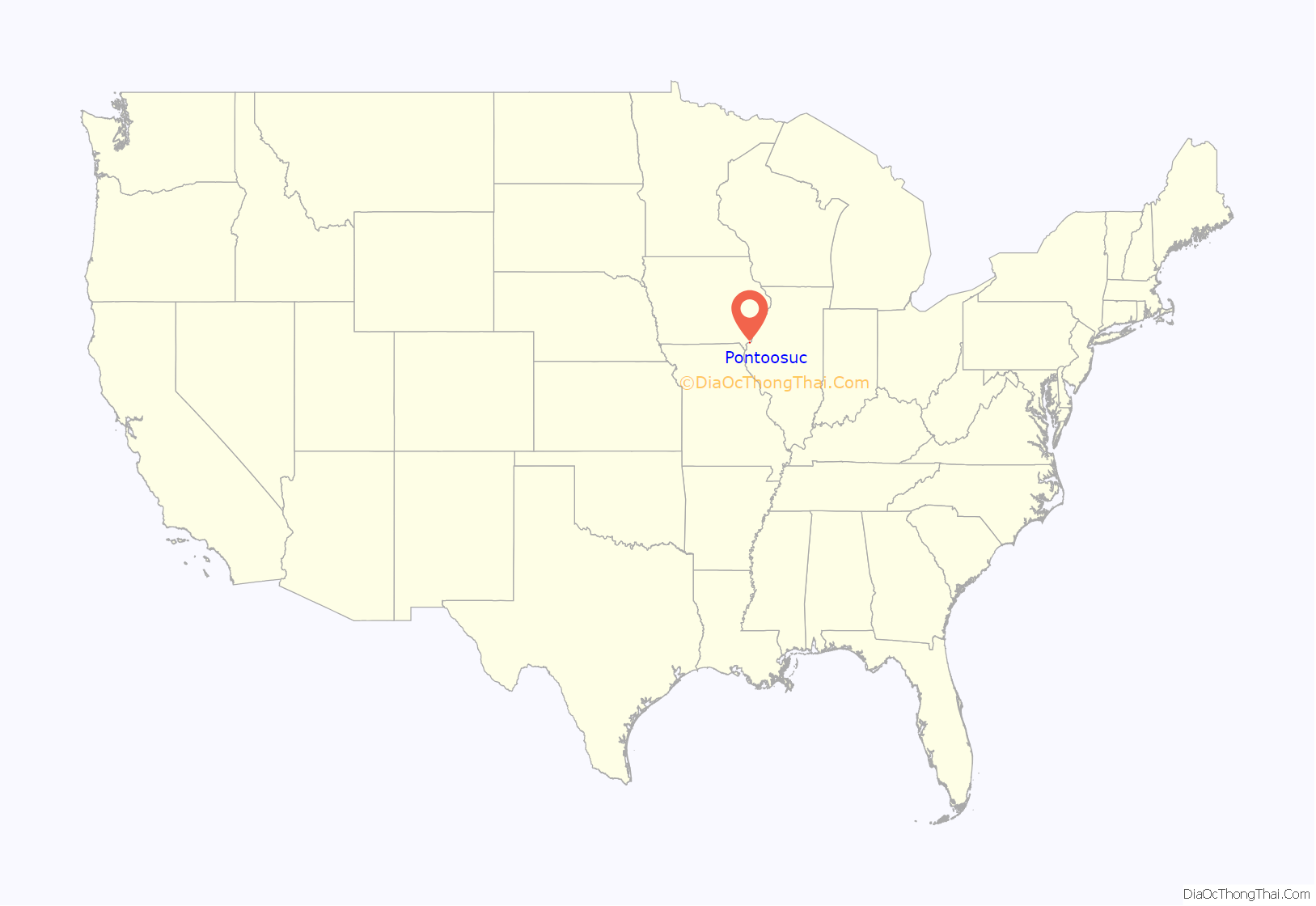
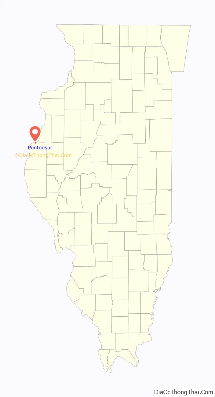
Pontoosuc location map. Where is Pontoosuc village?
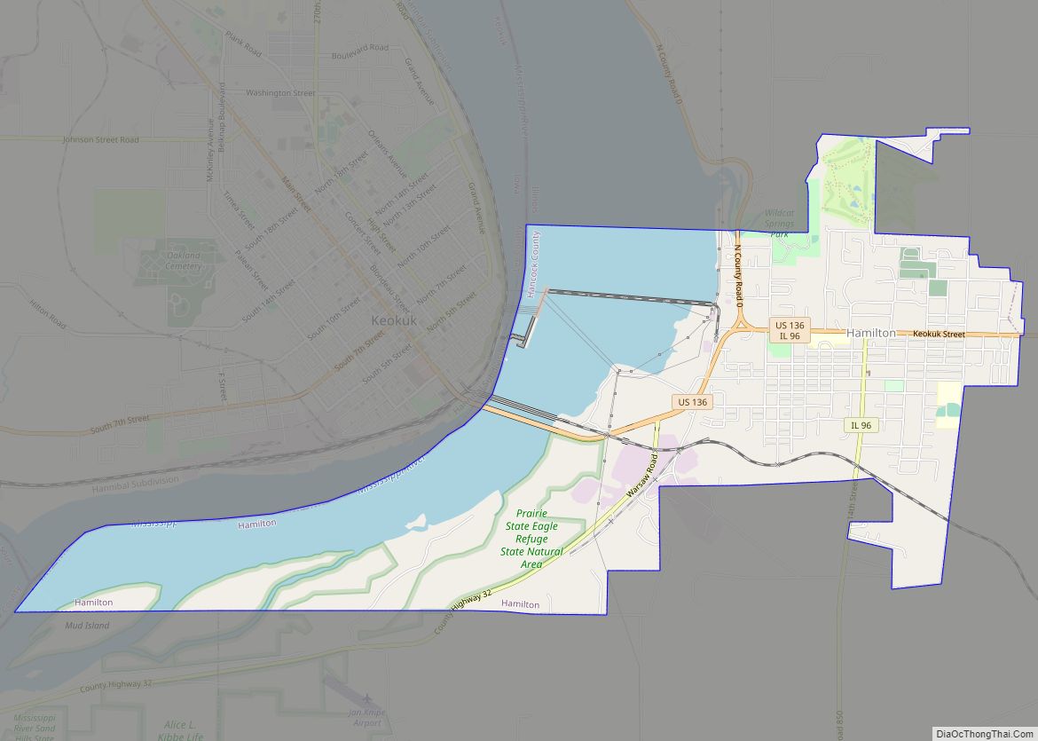
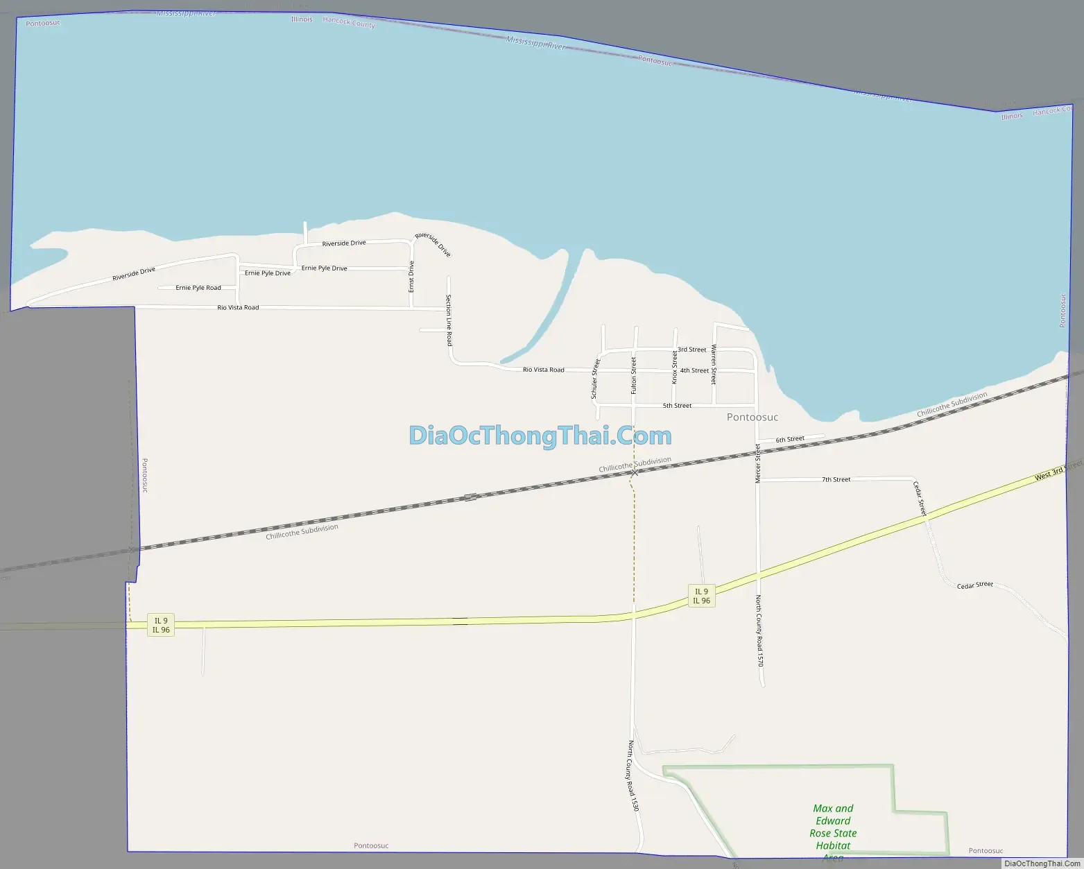
Pontoosuc Road Map
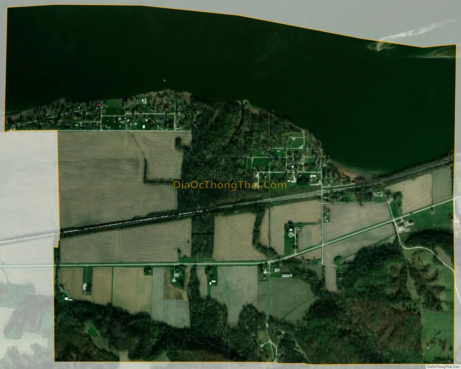
Pontoosuc city Satellite Map
Geography
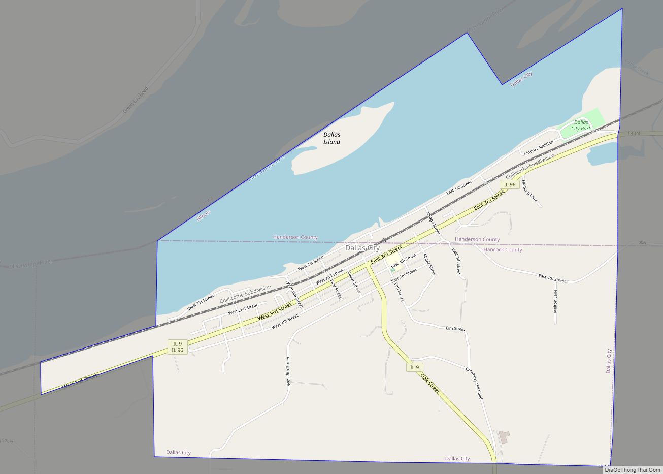
Pontoosuc is located in northern Hancock County at 40°37′46″N 91°12′35″W / 40.62944°N 91.20972°W / 40.62944; -91.20972 (40.629520, -91.209603). It is bordered to the north by the Mississippi River, which forms the state border with Iowa, and to the east by Dallas City. Illinois Route 9 passes through the village, leading east into Dallas City and west 5 miles (8 km) to the Fort Madison Toll Bridge over the Mississippi. Illinois Route 96 passes through Pontoosuc concurrently with IL-9 but leads southwest 13 miles (21 km) to Nauvoo.
According to the 2010 census, Pontoosuc has a total area of 2.077 square miles (5.38 km), of which 1.41 square miles (3.65 km) (or 67.89%) is land and 0.667 square miles (1.73 km) (or 32.11%) is water.
See also
Map of Illinois State and its subdivision:- Adams
- Alexander
- Bond
- Boone
- Brown
- Bureau
- Calhoun
- Carroll
- Cass
- Champaign
- Christian
- Clark
- Clay
- Clinton
- Coles
- Cook
- Crawford
- Cumberland
- De Kalb
- De Witt
- Douglas
- Dupage
- Edgar
- Edwards
- Effingham
- Fayette
- Ford
- Franklin
- Fulton
- Gallatin
- Greene
- Grundy
- Hamilton
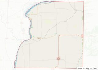
- Hancock
- Hardin
- Henderson
- Henry
- Iroquois
- Jackson
- Jasper
- Jefferson
- Jersey
- Jo Daviess
- Johnson
- Kane
- Kankakee
- Kendall
- Knox
- La Salle
- Lake
- Lake Michigan
- Lawrence
- Lee
- Livingston
- Logan
- Macon
- Macoupin
- Madison
- Marion
- Marshall
- Mason
- Massac
- McDonough
- McHenry
- McLean
- Menard
- Mercer
- Monroe
- Montgomery
- Morgan
- Moultrie
- Ogle
- Peoria
- Perry
- Piatt
- Pike
- Pope
- Pulaski
- Putnam
- Randolph
- Richland
- Rock Island
- Saint Clair
- Saline
- Sangamon
- Schuyler
- Scott
- Shelby
- Stark
- Stephenson
- Tazewell
- Union
- Vermilion
- Wabash
- Warren
- Washington
- Wayne
- White
- Whiteside
- Will
- Williamson
- Winnebago
- Woodford
- Alabama
- Alaska
- Arizona
- Arkansas
- California
- Colorado
- Connecticut
- Delaware
- District of Columbia
- Florida
- Georgia
- Hawaii
- Idaho
- Illinois
- Indiana
- Iowa
- Kansas
- Kentucky
- Louisiana
- Maine
- Maryland
- Massachusetts
- Michigan
- Minnesota
- Mississippi
- Missouri
- Montana
- Nebraska
- Nevada
- New Hampshire
- New Jersey
- New Mexico
- New York
- North Carolina
- North Dakota
- Ohio
- Oklahoma
- Oregon
- Pennsylvania
- Rhode Island
- South Carolina
- South Dakota
- Tennessee
- Texas
- Utah
- Vermont
- Virginia
- Washington
- West Virginia
- Wisconsin
- Wyoming