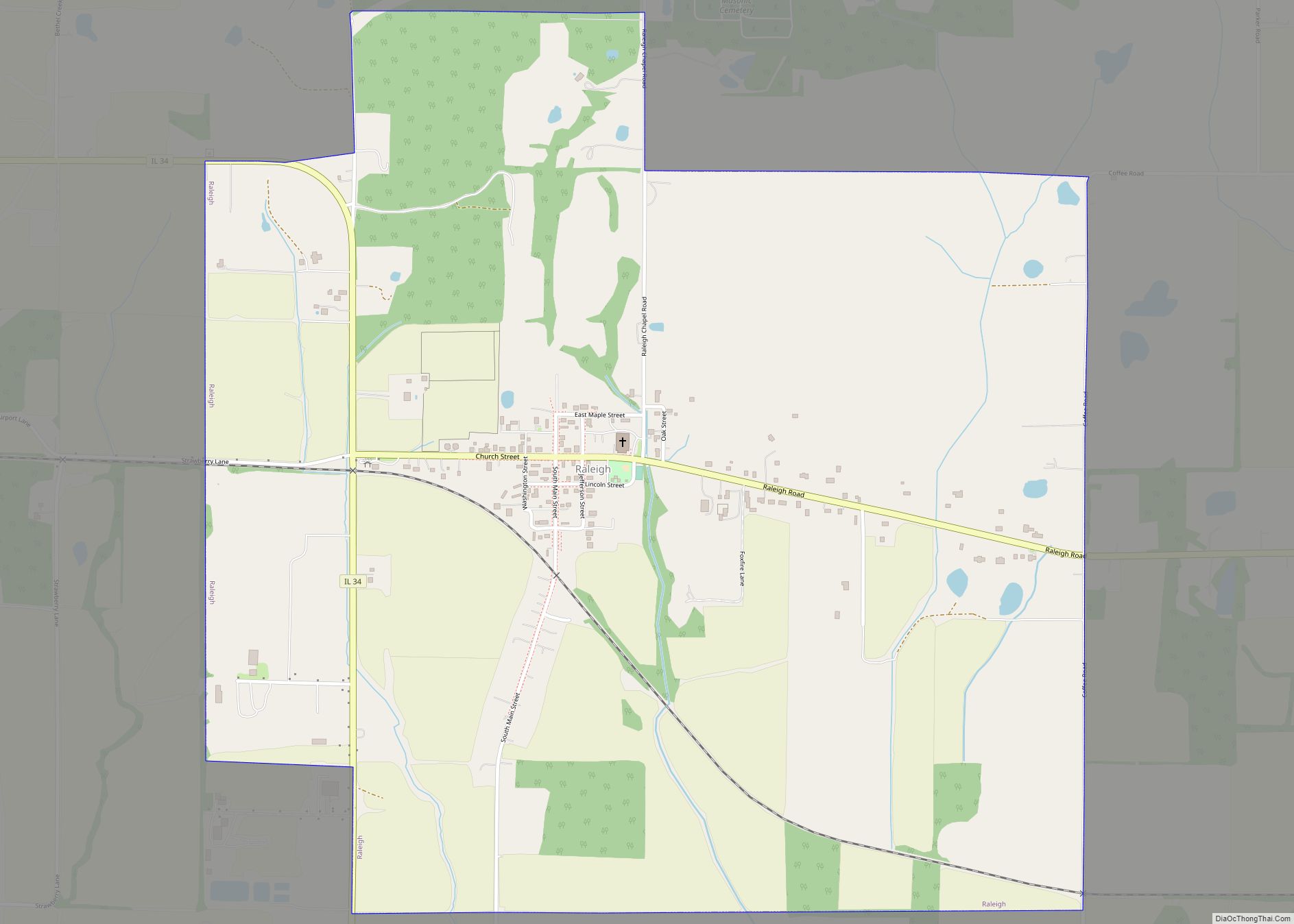
Raleigh is a village in Saline County, Illinois, United States. The population was 330 at the 2000 census.
| Name: | Raleigh village |
|---|---|
| LSAD Code: | 47 |
| LSAD Description: | village (suffix) |
| State: | Illinois |
| County: | Saline County |
| Total Area: | 1.98 sq mi (5.12 km²) |
| Land Area: | 1.98 sq mi (5.12 km²) |
| Water Area: | 0.00 sq mi (0.01 km²) |
| Total Population: | 284 |
| Population Density: | 143.72/sq mi (55.49/km²) |
| Area code: | 618 |
| FIPS code: | 1762588 |
Online Interactive Map
Click on ![]() to view map in "full screen" mode.
to view map in "full screen" mode.
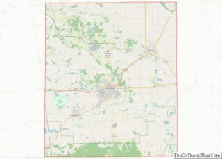
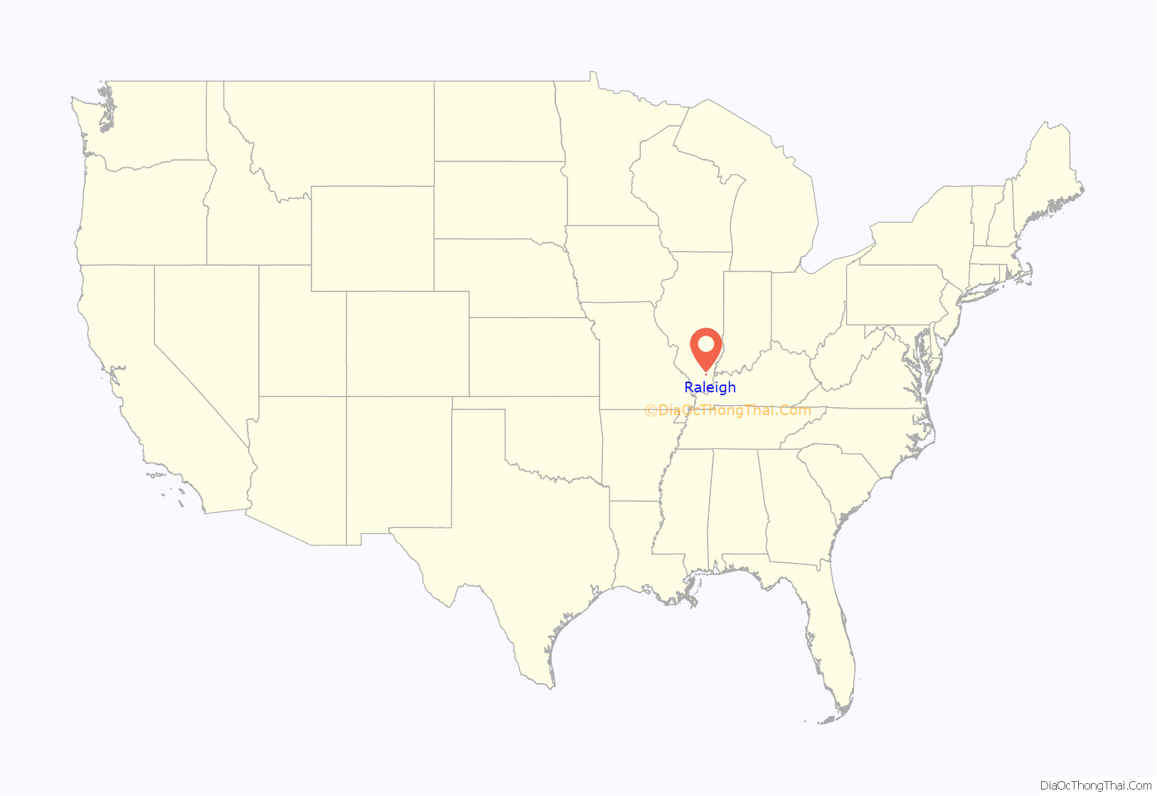
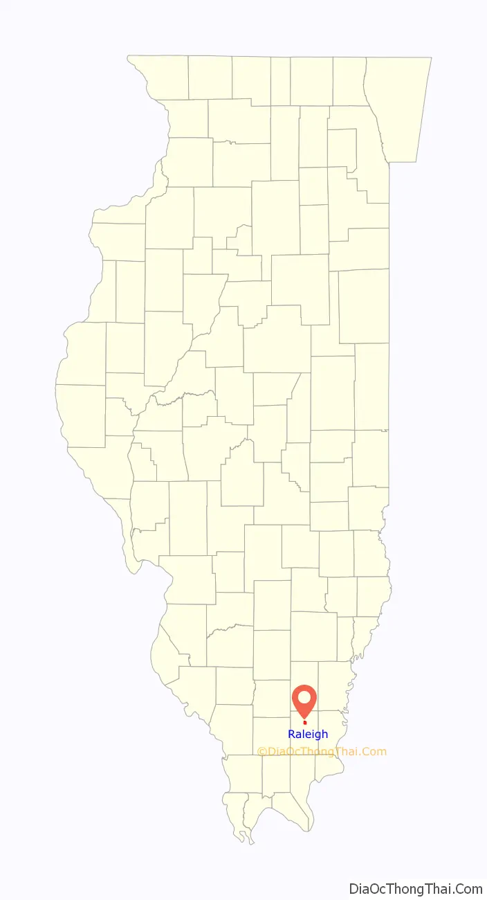
Raleigh location map. Where is Raleigh village?
History
The village of Raleigh was the seat of Saline County following the county’s troubled creation in 1847. Raleigh had its own school, several stores, and was a bustling village. Now, along with many Saline County towns, Raleigh has been abandoned by business and commerce, leaving only 350 residents.
On October 11, 1847, at a meeting of the County Commissioners held in Curran, a location and name for a County Seat for the newly formed Saline County was established. The Musgrave family, having moved from Raleigh, North Carolina, convinced the group to name the new county seat “Raleigh”. William St. C. Clark, Israel W. Crawford, and Martin Kittinger helped Archibald Sloan survey the town. George Bond, William Carr, and Williams Stricklin were to build a county road reaching from Raleigh to the boundary line of Saline and Williamson Counties. Raleigh Township was six square miles. When the surveying was completed, there were only three families living in Raleigh. The family of Andrew Musgrave owned 200 acres of farm ground. Mrs. (William) Crawford and Archibald Sloan were the other two occupants.
Lots in the town were sold to raise money to pay for the construction of a new county courthouse. Some of the earliest Raleigh residents were: Alfred Aldrich from Posey County, Indiana (built a log house and opened a store), John F. Ammon (station agent), John Choisser from Kaskaskia, James M. Gaston, Henry Goodrich (blacksmith), Mr. McElvain, Tom Mitchell, Osborn Powell (blacksmith).
The first courthouse was a 20′ x 24′ building constructed by James M. Gaston from logs. It was two stories tall. The courtroom occupied the entire first floor. The second story held two rooms and a hallway, used during court proceedings for grant or petit purposes. The courthouse was finished August 15, 1858 at a cost of $5,500.00. About 8 months after completion of the new building, a group began scheming to have the courthouse, and hence the County Seat, moved out of Raleigh.
The subject of taking the County Seat away from Raleigh was a very heated, hostile event. Arguments held that Harrisburg was a more central location. Petitions were passed around that put the issue on the ballot; a margin of 15 votes decided the fate of Raleigh. Raleigh filed suit but they never got their day in court because each time a date was set the hearing was postponed with no action every being taken and the suit was finally thrown out of court. It is rumored, and is included in the records in the Inventory of the County Archives of Illinois that some Harrisburg residents bribed the court. Accusations have been made that a group of people actually sneaked into Raleigh one night, broke into the Courthouse, stole the county records, and took them to Harrisburg. Only two families were living in Harrisburg at the time Harrisburg became the County Seat. The last County Court held in Raleigh was in June 1858.
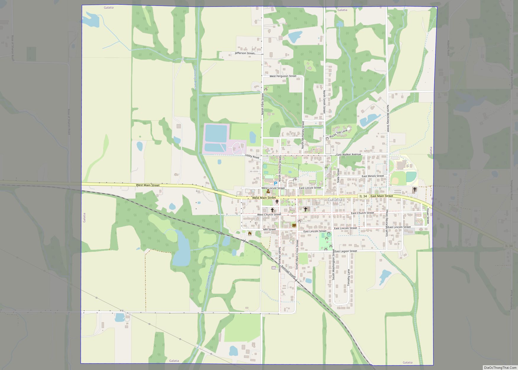
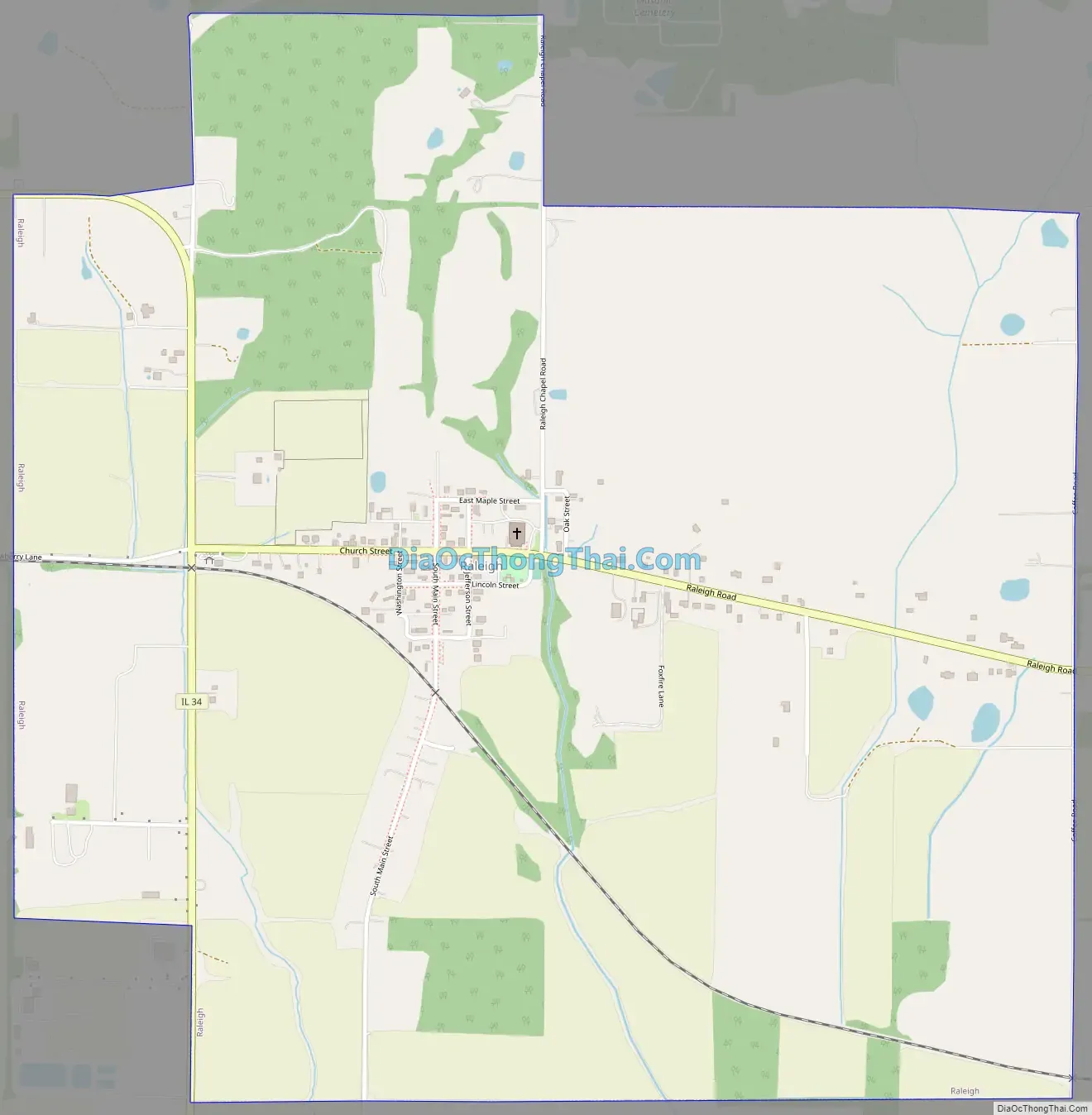
Raleigh Road Map
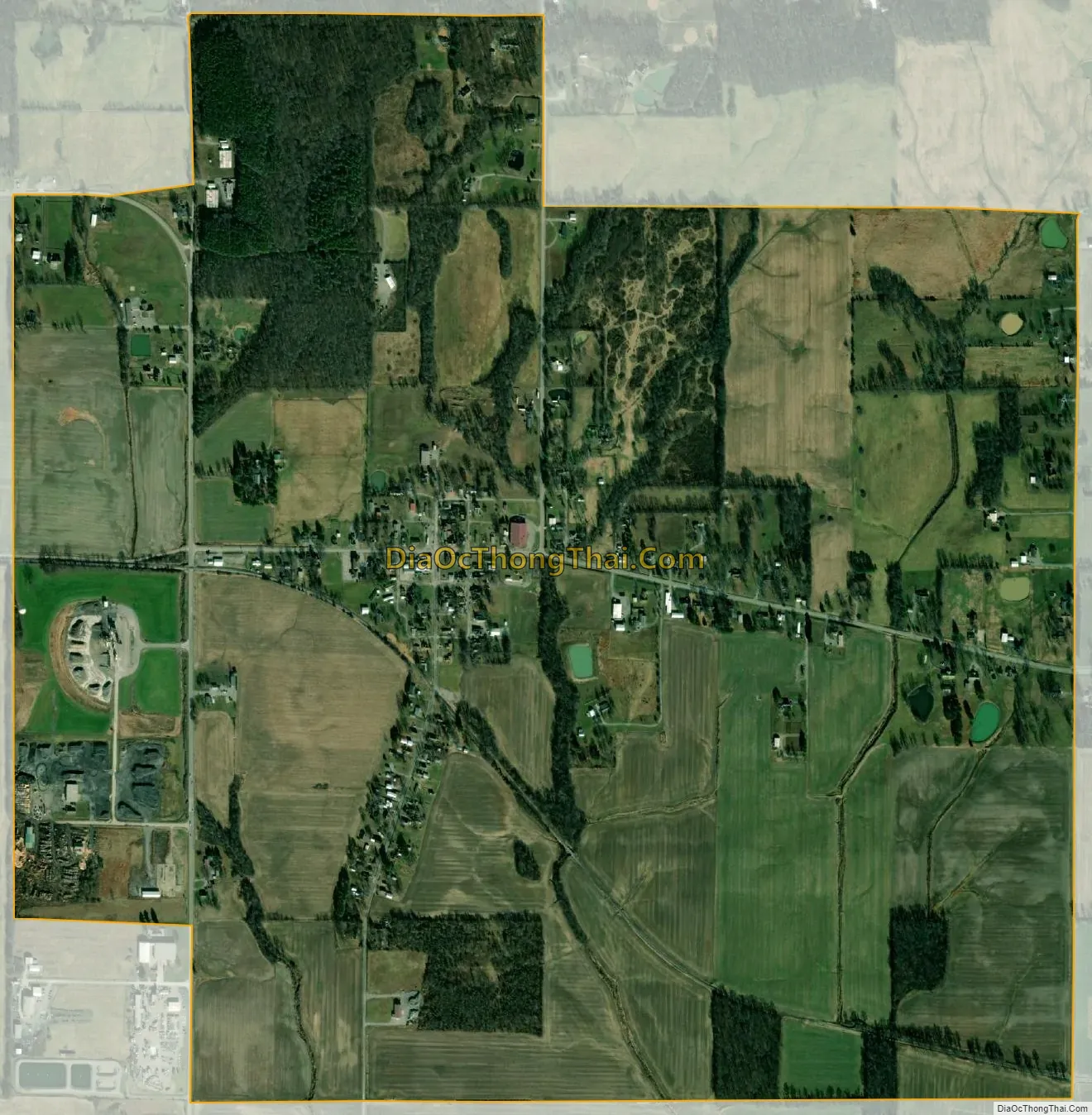
Raleigh city Satellite Map
Geography
Raleigh is located at 37°49′38″N 88°32′01″W / 37.827084°N 88.533738°W / 37.827084; -88.533738.
According to the 2010 census, Raleigh has a total area of 1.983 square miles (5.14 km), of which 1.98 square miles (5.13 km) (or 99.85%) is land and 0.003 square miles (0.01 km) (or 0.15%) is water.
See also
Map of Illinois State and its subdivision:- Adams
- Alexander
- Bond
- Boone
- Brown
- Bureau
- Calhoun
- Carroll
- Cass
- Champaign
- Christian
- Clark
- Clay
- Clinton
- Coles
- Cook
- Crawford
- Cumberland
- De Kalb
- De Witt
- Douglas
- Dupage
- Edgar
- Edwards
- Effingham
- Fayette
- Ford
- Franklin
- Fulton
- Gallatin
- Greene
- Grundy
- Hamilton
- Hancock
- Hardin
- Henderson
- Henry
- Iroquois
- Jackson
- Jasper
- Jefferson
- Jersey
- Jo Daviess
- Johnson
- Kane
- Kankakee
- Kendall
- Knox
- La Salle
- Lake
- Lake Michigan
- Lawrence
- Lee
- Livingston
- Logan
- Macon
- Macoupin
- Madison
- Marion
- Marshall
- Mason
- Massac
- McDonough
- McHenry
- McLean
- Menard
- Mercer
- Monroe
- Montgomery
- Morgan
- Moultrie
- Ogle
- Peoria
- Perry
- Piatt
- Pike
- Pope
- Pulaski
- Putnam
- Randolph
- Richland
- Rock Island
- Saint Clair
- Saline
- Sangamon
- Schuyler
- Scott
- Shelby
- Stark
- Stephenson
- Tazewell
- Union
- Vermilion
- Wabash
- Warren
- Washington
- Wayne
- White
- Whiteside
- Will
- Williamson
- Winnebago
- Woodford
- Alabama
- Alaska
- Arizona
- Arkansas
- California
- Colorado
- Connecticut
- Delaware
- District of Columbia
- Florida
- Georgia
- Hawaii
- Idaho
- Illinois
- Indiana
- Iowa
- Kansas
- Kentucky
- Louisiana
- Maine
- Maryland
- Massachusetts
- Michigan
- Minnesota
- Mississippi
- Missouri
- Montana
- Nebraska
- Nevada
- New Hampshire
- New Jersey
- New Mexico
- New York
- North Carolina
- North Dakota
- Ohio
- Oklahoma
- Oregon
- Pennsylvania
- Rhode Island
- South Carolina
- South Dakota
- Tennessee
- Texas
- Utah
- Vermont
- Virginia
- Washington
- West Virginia
- Wisconsin
- Wyoming