River Forest is a suburban village adjacent to Chicago in Cook County, Illinois, United States. Per the 2020 census, the population was 11,717. Two universities make their home in River Forest, Dominican University and Concordia University Chicago. The village is closely tied to the larger neighboring community of Oak Park. There are significant architectural designs located in River Forest such as the Winslow House by Frank Lloyd Wright. River Forest has a railroad station with service to Chicago on Metra’s Union Pacific/West Line.
| Name: | River Forest village |
|---|---|
| LSAD Code: | 47 |
| LSAD Description: | village (suffix) |
| State: | Illinois |
| County: | Cook County |
| Total Area: | 2.48 sq mi (6.43 km²) |
| Land Area: | 2.48 sq mi (6.42 km²) |
| Water Area: | 0.00 sq mi (0.00 km²) |
| Total Population: | 11,717 |
| Population Density: | 4,724.60/sq mi (1,824.37/km²) |
| Area code: | 708 |
| FIPS code: | 1764304 |
| Website: | www.vrf.us |
Online Interactive Map
Click on ![]() to view map in "full screen" mode.
to view map in "full screen" mode.
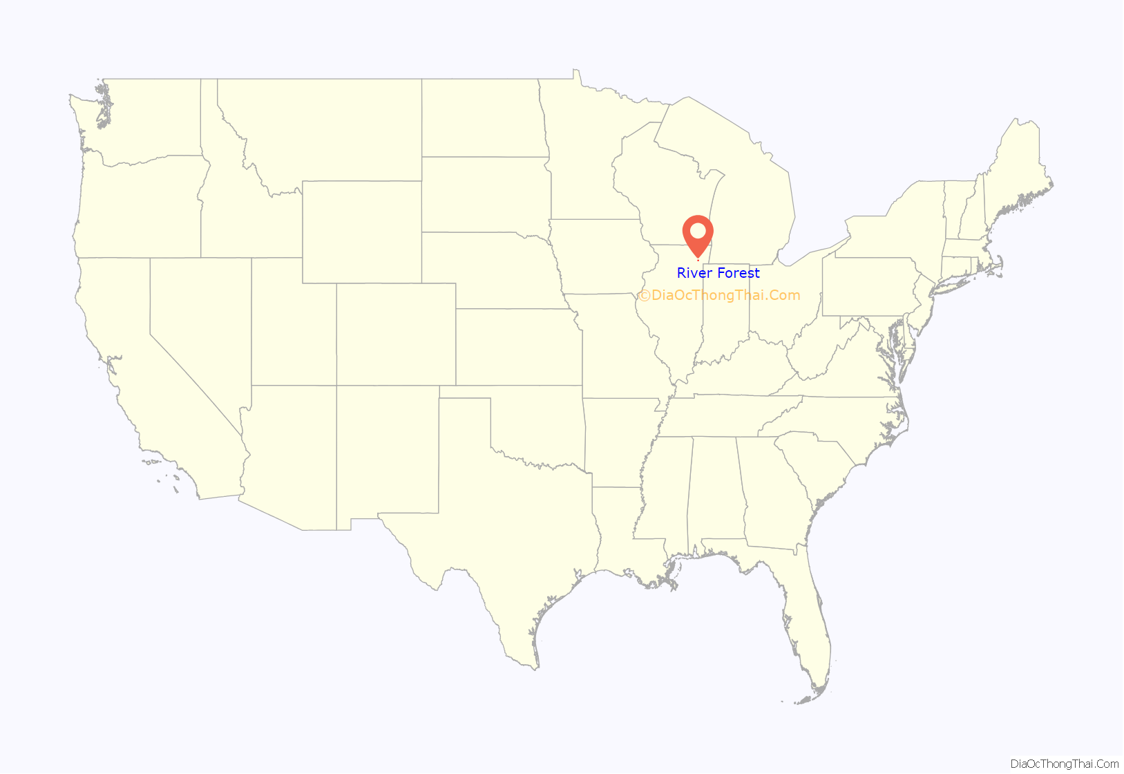
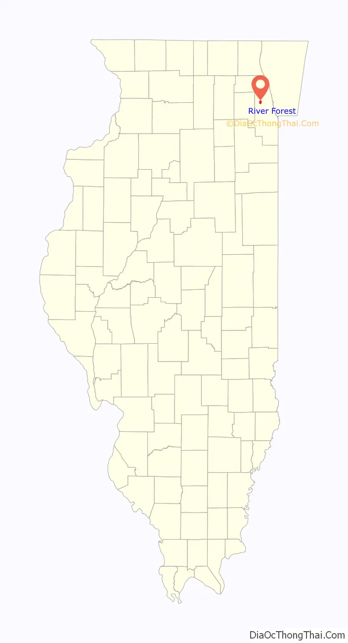
River Forest location map. Where is River Forest village?
History
The Native American history of the area is closely tied to the Des Plaines River and includes Menominee and Chippewa settlements near what is now the Desplaines Avenue and Roosevelt Road forest preserves of Cook County. The Menominees would eventually be driven out by the Potowatomi Nation in 1810. The establishment of a steam sawmill on the east bank of the Des Plaines River in 1831, and the proximity to Chicago, were some of the reasons that attracted non-indigenous settlers to the area. In 1842, the first planked road in River Forest, now Lake Street (Chicago), was created, and would eventually connect to the Lake Street extending into downtown Chicago. In 1848 the Galena and Chicago Union Railroad completed construction of tracks westward from Chicago, and train service commenced in January, 1849. The G&CU was later absorbed by the Chicago & Northwestern Railway in 1859 and the C&NW was consolidated into the Union Pacific Railroad in 1995. This line, now called the Union Pacific/West Line between Chicago and Elburn, Illinois is a busy commuter service, jointly operated by Union Pacific and Metra.
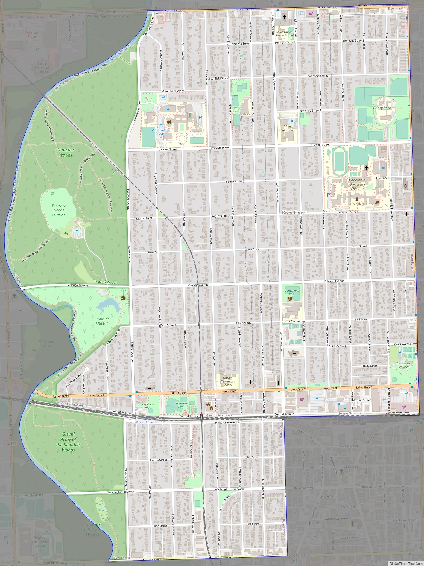
River Forest Road Map
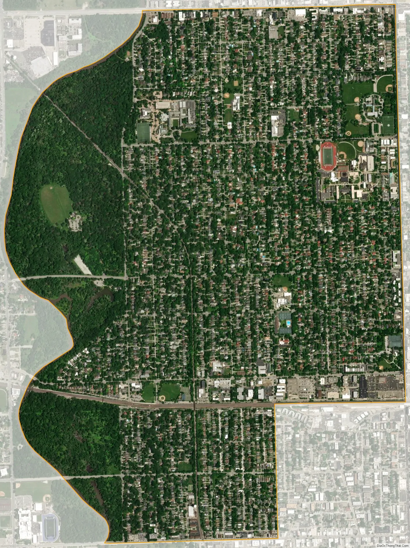
River Forest city Satellite Map
Geography
River Forest lies along the Des Plaines River to the west and is bordered by Illinois Route 43 to the east and Illinois Route 64 to the north. Along with the Des Plaines River, much of the western boundary of River Forest consists of the Thatcher Woods forest preserve of Cook County and the Des Plaines River Trail. According to the 2010 census, River Forest has a total area of 2.482 square miles (6.43 km), of which 2.48 square miles (6.42 km) (or 99.92%) is land and 0.002 square miles (0.01 km) (or 0.08%) is water.
See also
Map of Illinois State and its subdivision:- Adams
- Alexander
- Bond
- Boone
- Brown
- Bureau
- Calhoun
- Carroll
- Cass
- Champaign
- Christian
- Clark
- Clay
- Clinton
- Coles
- Cook
- Crawford
- Cumberland
- De Kalb
- De Witt
- Douglas
- Dupage
- Edgar
- Edwards
- Effingham
- Fayette
- Ford
- Franklin
- Fulton
- Gallatin
- Greene
- Grundy
- Hamilton
- Hancock
- Hardin
- Henderson
- Henry
- Iroquois
- Jackson
- Jasper
- Jefferson
- Jersey
- Jo Daviess
- Johnson
- Kane
- Kankakee
- Kendall
- Knox
- La Salle
- Lake
- Lake Michigan
- Lawrence
- Lee
- Livingston
- Logan
- Macon
- Macoupin
- Madison
- Marion
- Marshall
- Mason
- Massac
- McDonough
- McHenry
- McLean
- Menard
- Mercer
- Monroe
- Montgomery
- Morgan
- Moultrie
- Ogle
- Peoria
- Perry
- Piatt
- Pike
- Pope
- Pulaski
- Putnam
- Randolph
- Richland
- Rock Island
- Saint Clair
- Saline
- Sangamon
- Schuyler
- Scott
- Shelby
- Stark
- Stephenson
- Tazewell
- Union
- Vermilion
- Wabash
- Warren
- Washington
- Wayne
- White
- Whiteside
- Will
- Williamson
- Winnebago
- Woodford
- Alabama
- Alaska
- Arizona
- Arkansas
- California
- Colorado
- Connecticut
- Delaware
- District of Columbia
- Florida
- Georgia
- Hawaii
- Idaho
- Illinois
- Indiana
- Iowa
- Kansas
- Kentucky
- Louisiana
- Maine
- Maryland
- Massachusetts
- Michigan
- Minnesota
- Mississippi
- Missouri
- Montana
- Nebraska
- Nevada
- New Hampshire
- New Jersey
- New Mexico
- New York
- North Carolina
- North Dakota
- Ohio
- Oklahoma
- Oregon
- Pennsylvania
- Rhode Island
- South Carolina
- South Dakota
- Tennessee
- Texas
- Utah
- Vermont
- Virginia
- Washington
- West Virginia
- Wisconsin
- Wyoming


