Riverwoods is a village in Lake County, Illinois, United States. It was established on the banks of the Des Plaines River in 1959 by local steel magnate Jay Peterson. Per the 2020 census, the population was 3,790. The corporate headquarters of Discover Financial and CCH are located there, as well as Orphans of the Storm, an animal shelter founded in 1928 by famous dancer Irene Castle. The village used to host the annual “Arts & Riverwoods” festival.
| Name: | Riverwoods village |
|---|---|
| LSAD Code: | 47 |
| LSAD Description: | village (suffix) |
| State: | Illinois |
| County: | Lake County |
| Total Area: | 4.01 sq mi (10.40 km²) |
| Land Area: | 3.97 sq mi (10.27 km²) |
| Water Area: | 0.05 sq mi (0.12 km²) |
| Total Population: | 3,790 |
| Population Density: | 955.38/sq mi (368.86/km²) |
| Area code: | 224 847 |
| FIPS code: | 1764538 |
| Website: | villageofriverwoods.com |
Online Interactive Map
Click on ![]() to view map in "full screen" mode.
to view map in "full screen" mode.
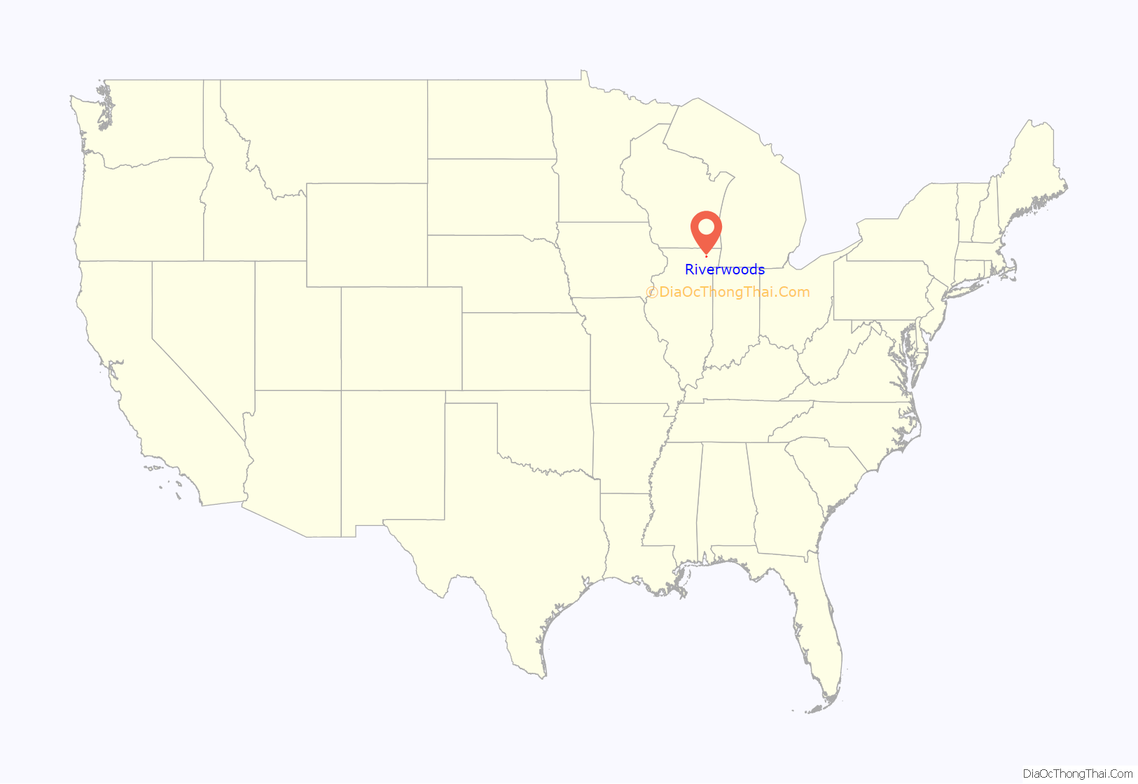
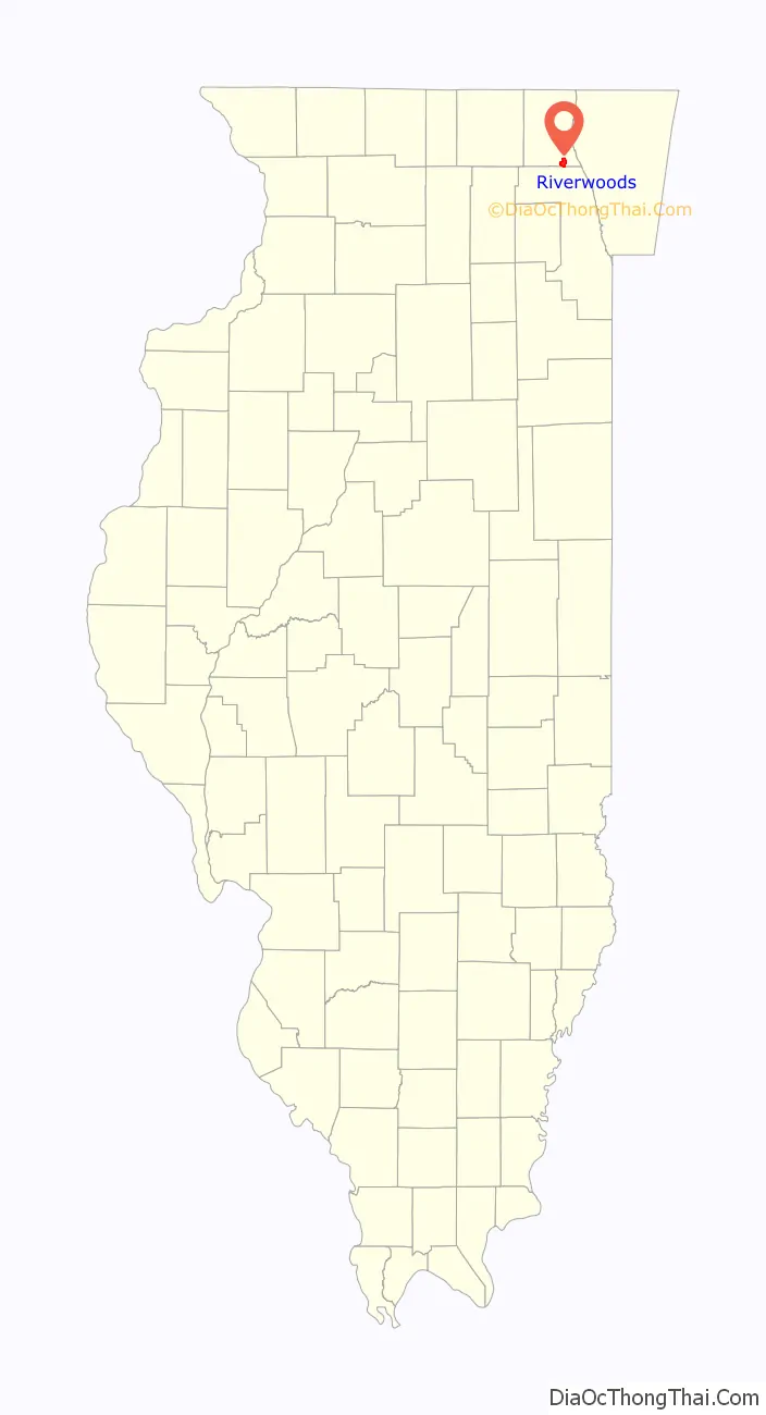
Riverwoods location map. Where is Riverwoods village?
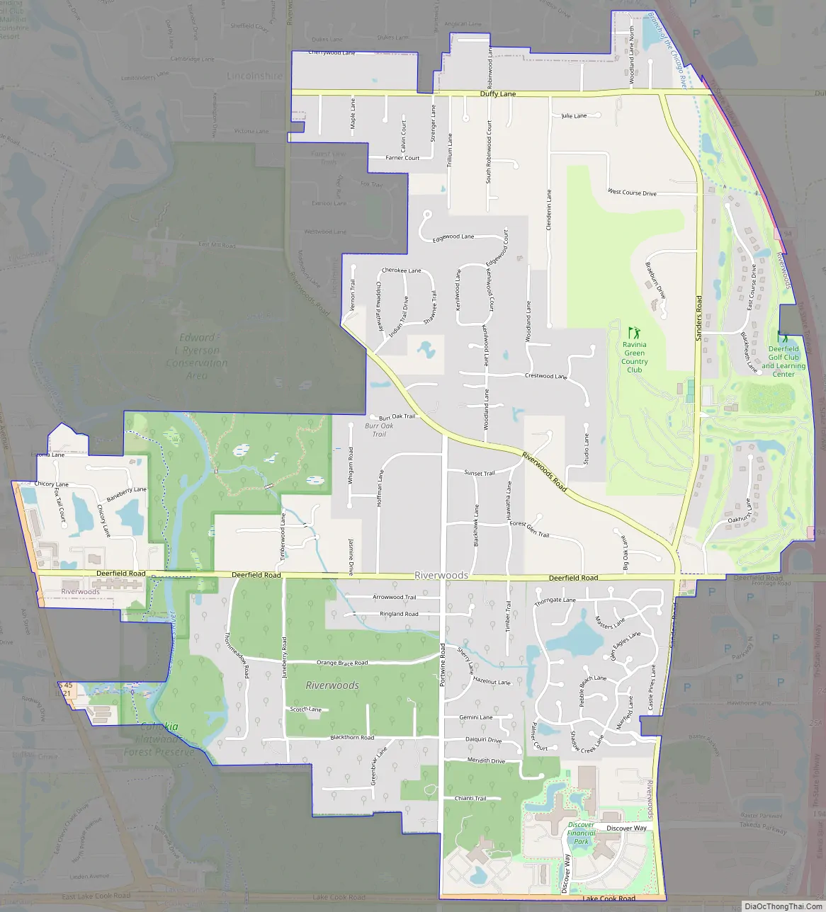
Riverwoods Road Map
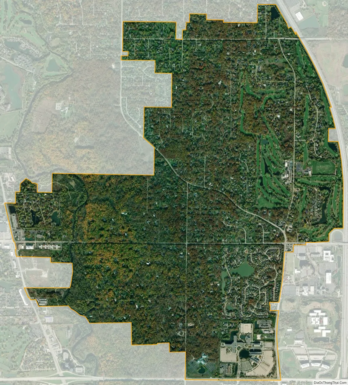
Riverwoods city Satellite Map
Geography
Riverwoods is located at 42°10′15″N 87°53′45″W / 42.17083°N 87.89583°W / 42.17083; -87.89583.
According to the 2010 census, Riverwoods has a total area of 4.016 square miles (10.40 km), of which 3.97 square miles (10.28 km) (or 98.85%) is land and 0.046 square miles (0.12 km) (or 1.15%) is water.
See also
Map of Illinois State and its subdivision:- Adams
- Alexander
- Bond
- Boone
- Brown
- Bureau
- Calhoun
- Carroll
- Cass
- Champaign
- Christian
- Clark
- Clay
- Clinton
- Coles
- Cook
- Crawford
- Cumberland
- De Kalb
- De Witt
- Douglas
- Dupage
- Edgar
- Edwards
- Effingham
- Fayette
- Ford
- Franklin
- Fulton
- Gallatin
- Greene
- Grundy
- Hamilton
- Hancock
- Hardin
- Henderson
- Henry
- Iroquois
- Jackson
- Jasper
- Jefferson
- Jersey
- Jo Daviess
- Johnson
- Kane
- Kankakee
- Kendall
- Knox
- La Salle
- Lake
- Lake Michigan
- Lawrence
- Lee
- Livingston
- Logan
- Macon
- Macoupin
- Madison
- Marion
- Marshall
- Mason
- Massac
- McDonough
- McHenry
- McLean
- Menard
- Mercer
- Monroe
- Montgomery
- Morgan
- Moultrie
- Ogle
- Peoria
- Perry
- Piatt
- Pike
- Pope
- Pulaski
- Putnam
- Randolph
- Richland
- Rock Island
- Saint Clair
- Saline
- Sangamon
- Schuyler
- Scott
- Shelby
- Stark
- Stephenson
- Tazewell
- Union
- Vermilion
- Wabash
- Warren
- Washington
- Wayne
- White
- Whiteside
- Will
- Williamson
- Winnebago
- Woodford
- Alabama
- Alaska
- Arizona
- Arkansas
- California
- Colorado
- Connecticut
- Delaware
- District of Columbia
- Florida
- Georgia
- Hawaii
- Idaho
- Illinois
- Indiana
- Iowa
- Kansas
- Kentucky
- Louisiana
- Maine
- Maryland
- Massachusetts
- Michigan
- Minnesota
- Mississippi
- Missouri
- Montana
- Nebraska
- Nevada
- New Hampshire
- New Jersey
- New Mexico
- New York
- North Carolina
- North Dakota
- Ohio
- Oklahoma
- Oregon
- Pennsylvania
- Rhode Island
- South Carolina
- South Dakota
- Tennessee
- Texas
- Utah
- Vermont
- Virginia
- Washington
- West Virginia
- Wisconsin
- Wyoming


