Robbins is a village southwest of Chicago in Cook County, Illinois, United States. The population was 4,629 at the 2020 census. Darren E. Bryant is the current mayor of Robbins. It is the second oldest Black incorporated town in the north following Brooklyn, Illinois and was home to the country’s first black-owned airport.
| Name: | Robbins village |
|---|---|
| LSAD Code: | 47 |
| LSAD Description: | village (suffix) |
| State: | Illinois |
| County: | Cook County |
| Incorporated: | 1917 |
| Total Area: | 1.45 sq mi (3.75 km²) |
| Land Area: | 1.45 sq mi (3.75 km²) |
| Water Area: | 0.00 sq mi (0.00 km²) 0% |
| Total Population: | 4,629 |
| Population Density: | 3,194.62/sq mi (1,233.52/km²) |
| Area code: | 708/464 |
| FIPS code: | 1764616 |
| Website: | www.robbins-il.com |
Online Interactive Map
Click on ![]() to view map in "full screen" mode.
to view map in "full screen" mode.
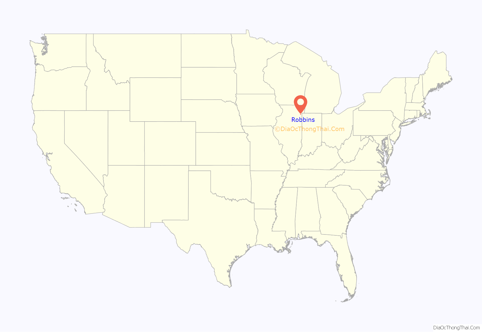
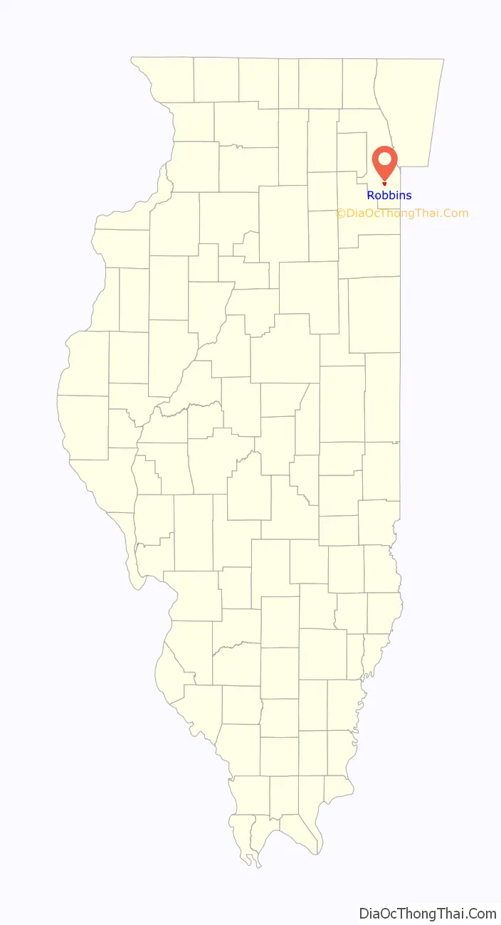
Robbins location map. Where is Robbins village?
History
Robbins was incorporated on December 14, 1917 and named for Eugene S. Robbins, a real estate developer who laid out the village’s early subdivisions. The village’s founder and first mayor was Thomas J. Kellar, who noted in an early interview “Our people in Robbins are mostly people who got tired of the white fights and the crowded city. They come out here to raise chickens, make gardens, and be a little more free”. Robbins was the only municipality in the north that was entirely governed by African-Americans. Kellar, who was a clerk for the Cook County Board of Assessors, was tasked with investigating the procedures of incorporation. Thomas J. Kellar School in Robbins was named in his honor and first opened for the 1954 school year.
After incorporation the community became a popular recreation spot for black Chicagoans, who crowded its picnic grounds and nightclubs on summer weekends.
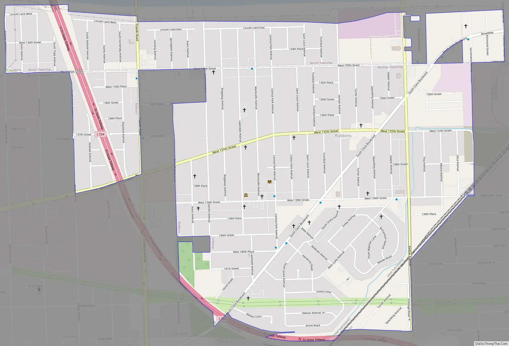
Robbins Road Map
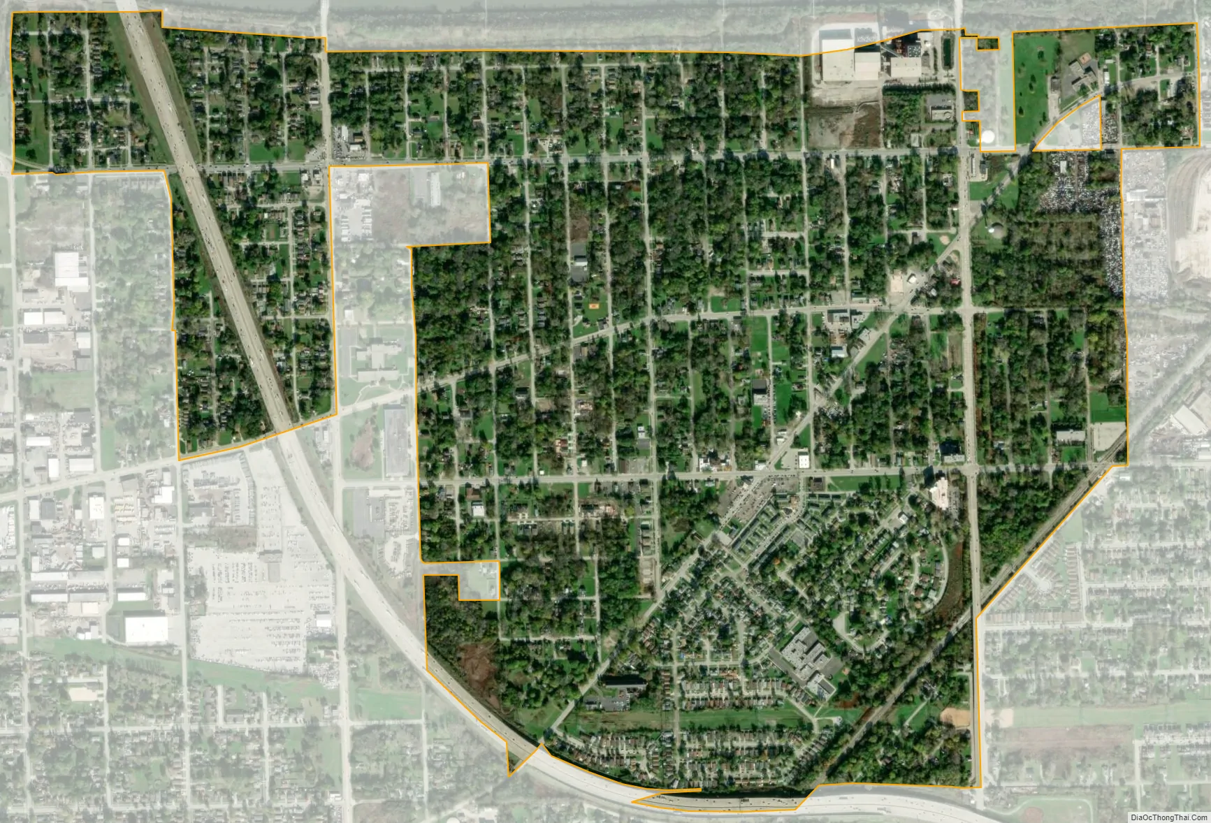
Robbins city Satellite Map
Geography
According to the 2010 census, Robbins has a total area of 1.45 square miles (3.76 km), all land.
See also
Map of Illinois State and its subdivision:- Adams
- Alexander
- Bond
- Boone
- Brown
- Bureau
- Calhoun
- Carroll
- Cass
- Champaign
- Christian
- Clark
- Clay
- Clinton
- Coles
- Cook
- Crawford
- Cumberland
- De Kalb
- De Witt
- Douglas
- Dupage
- Edgar
- Edwards
- Effingham
- Fayette
- Ford
- Franklin
- Fulton
- Gallatin
- Greene
- Grundy
- Hamilton
- Hancock
- Hardin
- Henderson
- Henry
- Iroquois
- Jackson
- Jasper
- Jefferson
- Jersey
- Jo Daviess
- Johnson
- Kane
- Kankakee
- Kendall
- Knox
- La Salle
- Lake
- Lake Michigan
- Lawrence
- Lee
- Livingston
- Logan
- Macon
- Macoupin
- Madison
- Marion
- Marshall
- Mason
- Massac
- McDonough
- McHenry
- McLean
- Menard
- Mercer
- Monroe
- Montgomery
- Morgan
- Moultrie
- Ogle
- Peoria
- Perry
- Piatt
- Pike
- Pope
- Pulaski
- Putnam
- Randolph
- Richland
- Rock Island
- Saint Clair
- Saline
- Sangamon
- Schuyler
- Scott
- Shelby
- Stark
- Stephenson
- Tazewell
- Union
- Vermilion
- Wabash
- Warren
- Washington
- Wayne
- White
- Whiteside
- Will
- Williamson
- Winnebago
- Woodford
- Alabama
- Alaska
- Arizona
- Arkansas
- California
- Colorado
- Connecticut
- Delaware
- District of Columbia
- Florida
- Georgia
- Hawaii
- Idaho
- Illinois
- Indiana
- Iowa
- Kansas
- Kentucky
- Louisiana
- Maine
- Maryland
- Massachusetts
- Michigan
- Minnesota
- Mississippi
- Missouri
- Montana
- Nebraska
- Nevada
- New Hampshire
- New Jersey
- New Mexico
- New York
- North Carolina
- North Dakota
- Ohio
- Oklahoma
- Oregon
- Pennsylvania
- Rhode Island
- South Carolina
- South Dakota
- Tennessee
- Texas
- Utah
- Vermont
- Virginia
- Washington
- West Virginia
- Wisconsin
- Wyoming


