Brooklyn (popularly known as Lovejoy), is a village in St. Clair County, Illinois, United States. Located two miles north of East St. Louis, Illinois and three miles northeast of downtown St. Louis, Missouri, it is the oldest town incorporated by African Americans in the United States. Its motto is “Founded by Chance, Sustained by Courage.” The mayor is Mayor Vera Banks-Glasper.
A missionary AME Church was established in the new settlement in 1836. Now known as Quinn’s Chapel AME, its congregation is believed to have supported the Underground Railroad and aided fugitive slaves to freedom, together with members of the Antioch Baptist Church established in 1838.
An early interracial community, it suffered from structural discrimination; transport lines were routed to bypass and isolate it rather than connecting it, and economic development projects passed over it, and indeed were set up in competition to it. In 2015, the county’s state attorney Brendan Kelly described the village as a ‘failed state.’
| Name: | Brooklyn village |
|---|---|
| LSAD Code: | 47 |
| LSAD Description: | village (suffix) |
| State: | Illinois |
| County: | St. Clair County |
| Elevation: | 410 ft (120 m) |
| Total Area: | 0.81 sq mi (2.10 km²) |
| Land Area: | 0.81 sq mi (2.10 km²) |
| Water Area: | 0.00 sq mi (0.00 km²) |
| Total Population: | 649 |
| Population Density: | 800.25/sq mi (308.89/km²) |
| Area code: | 618 |
| FIPS code: | 1708667 |
| GNISfeature ID: | 2397466 |
| Website: | thevillageofbrooklyn.org |
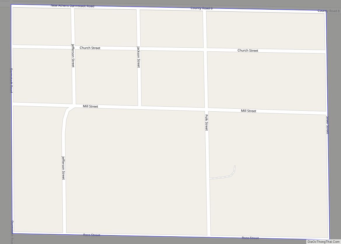
Online Interactive Map
Click on ![]() to view map in "full screen" mode.
to view map in "full screen" mode.
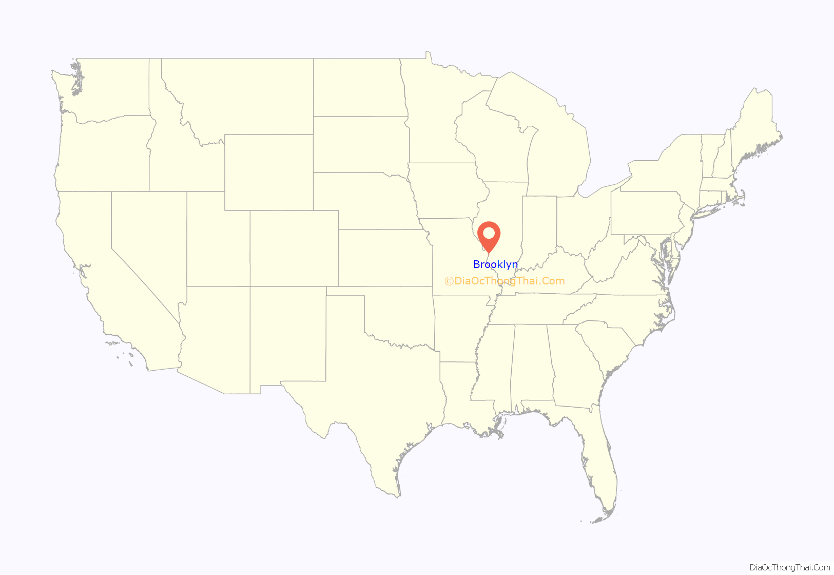
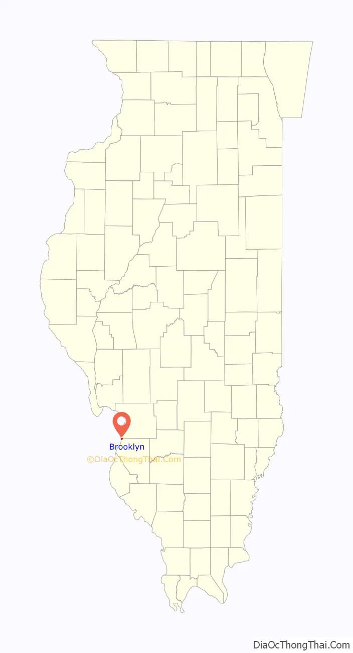
Brooklyn location map. Where is Brooklyn village?
History
According to oral history tradition, by 1829 “Mother” Priscilla Baltimore led a group of eleven families, composed of both fugitive and free African Americans, to flee slavery in St. Louis, Missouri. They crossed the Mississippi River to the free state of Illinois, where they established a freedom village in the American Bottoms. “Mother” Baltimore was said to have purchased her freedom as an adult from her master. She also bought the freedom of members of her family. Born in Kentucky, she tracked her white father to Missouri and bought her mother’s freedom from him. The earliest black families included Anderson, Sullivan, Singleton, Wilson, Cox, Wyatt, and Carper.
Miranda Yancey-Bailey, an archeologist working on a 21st-century project in Brooklyn, has found written evidence that Baltimore still lived in St. Louis in the 1830s; the first documentation of her associated with Brooklyn is from 1839. She may have been traveling between these locations for a time.
Baltimore had become a Methodist preacher and participated in the religious life of the new settlement. William Paul Quinn, then a missionary of the newly formed African Methodist Episcopal Church (AME), visited the settlement in 1836 and helped found the Brooklyn AME church that year. He had been assigned as a missionary that year to what was then called the Northwest, including Indiana and Ohio. Quinn was also active in planting new congregations in Kentucky and Missouri; he later became the fourth bishop of the AME Church. Brooklyn AME Church is thought to be the first AME Church west of the Appalachian Mountains. It is now known as Quinn’s Chapel AME Church in his honor.
In 1837, five white abolitionists platted the land and created an unincorporated nearly all-black town. Thomas Osburn was one of them, and he is documented as having lived in the area for decades. Priscilla Baltimore built a house on his former land, which she occupied from 1851 to 1872. In the 1840s and 1850s, the African-American population of the village was about 200.
From the beginnings of Brookyln, the ministers of the Quinn Chapel AME Church and Antioch Baptist Church (1838) used their churches as Underground Railroad stations to aid slaves escaping to freedom in Canada. William Paul Quinn and Priscilla Baltimore visited slaves in neighboring towns to inform them of the Underground Railroad’s existence, and housed slaves in the churches before sending them to the next station. At one point, Quinn was captured by Missouri slave-catchers while on a missionary tour, but presented himself as a citizen of British India and was set free. Both of these church buildings have survived.
On July 8, 1873, Brooklyn was incorporated. By 1880, its population included 371 African-American and 203 European-American residents. In the late 19th century, its residents joined in taking new industrial jobs, commuting to those in East St. Louis and nearby areas. “Blacks who migrated to what became known as Brooklyn were attracted to the possibilities of working in an industrialized settlement that would enjoy race autonomy and self-determinism.” In 1886, the African-American majority worked to register voters and gained political control of the village. As with most political enterprises, factions developed within the community.
Regional capital investment largely bypassed Brooklyn, taking place in the competing East St. Louis, Illinois, which gained the all-important railroad connection. Other white-majority towns also benefited by being part of the network of investment. “[A]lmost none of the all-Black towns obtained a railroad.” The small village soon became all black.
In 1891, then-Mayor Evans dedicated the town’s new post office with the name Lovejoy (after the abolitionist Elijah P. Lovejoy, who had been assassinated in Alton, Illinois, in 1837). The later high school was also named after him. Around the turn of the 20th century, the high school had a high reputation in the area.
20th century
Black autonomy did not automatically yield unity in the village. Tensions ran high with class and color conflicts by the early decades of the twentieth century, and evidence of political corruption. In addition, with the growth in number of young, single male workers, attracted to industrial jobs, the demographics changed and family life in the village declined. In 1915, two rival gangs attempting to declare themselves police chief had a shootout in front of a grocery store, resulting in three deaths. In 1933, the police chief ran an extortion ring and dissolved the city council at gunpoint, causing the county board of supervisors to replace the entire police force.
In 1940, it was reported that the town had fewer than ten white inhabitants, but the most prosperous businesses in the town were all white-owned. Furthermore, the local school had declined in quality. Black residents blamed a sense of fatalism.
Brooklyn was unaffected by the black nationalism movement in the 1960s, but in 1972, a small armed group called the United Front migrated from East St. Louis, professing a desire to create a sort of black nationalist intentional community. The mayor of the city, concerned that functions of city government might be usurped, deputized several men, who used the opportunity to gain social power in the city. Finally, in 1973, the mayor named a police chief in order to disarm the deputies, which resulted in one of them being shot dead after refusing to disarm. The chief was acquitted of murder in 1975.
With the decline of industry, from the mid-20th century on and the loss of jobs, Brooklyn has suffered high unemployment and problems similar to those of East St. Louis. It has struggled with persistent crime, and a limited economy and tax base. A cluster of bars and strip clubs provide a primary source of revenue in its limited economy. In June 2007, it was reported that three-quarters of Brooklyn’s revenue of $380,000 comes through sales tax and a $30,000 licensing fee from the adult clubs.
Brooklyn Road Map

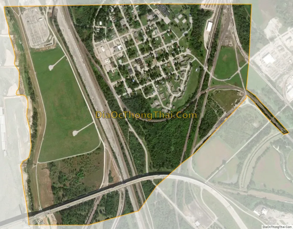
Brooklyn city Satellite Map
Geography
Brooklyn, Illinois, is located at 38°39′24″N 90°09′55″W / 38.656800°N 90.165412°W / 38.656800; -90.165412.
According to the 2010 census, Brooklyn has a total area of 0.83 square miles (2.15 km), all land.
See also
Map of Illinois State and its subdivision:- Adams
- Alexander
- Bond
- Boone
- Brown
- Bureau
- Calhoun
- Carroll
- Cass
- Champaign
- Christian
- Clark
- Clay
- Clinton
- Coles
- Cook
- Crawford
- Cumberland
- De Kalb
- De Witt
- Douglas
- Dupage
- Edgar
- Edwards
- Effingham
- Fayette
- Ford
- Franklin
- Fulton
- Gallatin
- Greene
- Grundy
- Hamilton
- Hancock
- Hardin
- Henderson
- Henry
- Iroquois
- Jackson
- Jasper
- Jefferson
- Jersey
- Jo Daviess
- Johnson
- Kane
- Kankakee
- Kendall
- Knox
- La Salle
- Lake
- Lake Michigan
- Lawrence
- Lee
- Livingston
- Logan
- Macon
- Macoupin
- Madison
- Marion
- Marshall
- Mason
- Massac
- McDonough
- McHenry
- McLean
- Menard
- Mercer
- Monroe
- Montgomery
- Morgan
- Moultrie
- Ogle
- Peoria
- Perry
- Piatt
- Pike
- Pope
- Pulaski
- Putnam
- Randolph
- Richland
- Rock Island
- Saint Clair
- Saline
- Sangamon
- Schuyler
- Scott
- Shelby
- Stark
- Stephenson
- Tazewell
- Union
- Vermilion
- Wabash
- Warren
- Washington
- Wayne
- White
- Whiteside
- Will
- Williamson
- Winnebago
- Woodford
- Alabama
- Alaska
- Arizona
- Arkansas
- California
- Colorado
- Connecticut
- Delaware
- District of Columbia
- Florida
- Georgia
- Hawaii
- Idaho
- Illinois
- Indiana
- Iowa
- Kansas
- Kentucky
- Louisiana
- Maine
- Maryland
- Massachusetts
- Michigan
- Minnesota
- Mississippi
- Missouri
- Montana
- Nebraska
- Nevada
- New Hampshire
- New Jersey
- New Mexico
- New York
- North Carolina
- North Dakota
- Ohio
- Oklahoma
- Oregon
- Pennsylvania
- Rhode Island
- South Carolina
- South Dakota
- Tennessee
- Texas
- Utah
- Vermont
- Virginia
- Washington
- West Virginia
- Wisconsin
- Wyoming