Sandwich is a city in DeKalb and Kendall counties in the U.S. state of Illinois. Its population was 7,421 at the 2010 census and 7,221 at the 2020 census.
| Name: | Sandwich city |
|---|---|
| LSAD Code: | 25 |
| LSAD Description: | city (suffix) |
| State: | Illinois |
| County: | DeKalb County, Kendall County |
| Elevation: | 669 ft (204 m) |
| Total Area: | 4.75 sq mi (12.31 km²) |
| Land Area: | 4.74 sq mi (12.27 km²) |
| Water Area: | 0.02 sq mi (0.05 km²) |
| Total Population: | 7,221 |
| Population Density: | 1,520.2/sq mi (587.0/km²) |
| ZIP code: | 60548 |
| FIPS code: | 1767548 |
| GNISfeature ID: | 2396534 |
| Website: | www.sandwich.il.us |
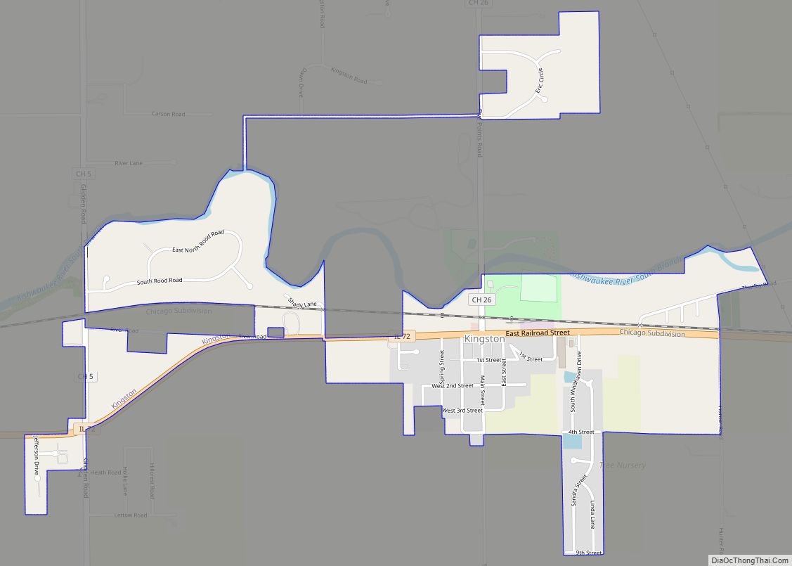
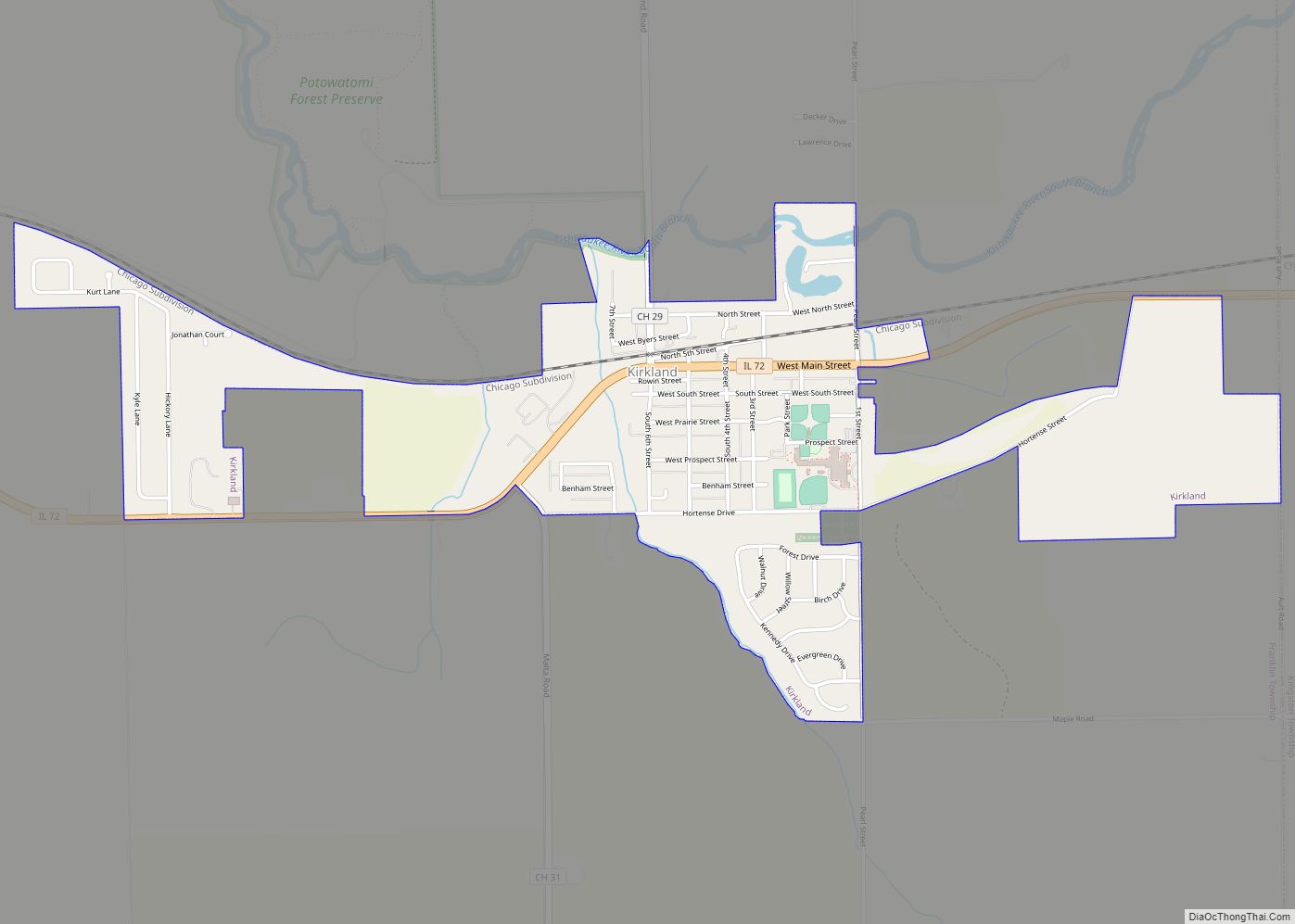
Online Interactive Map
Click on ![]() to view map in "full screen" mode.
to view map in "full screen" mode.
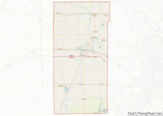
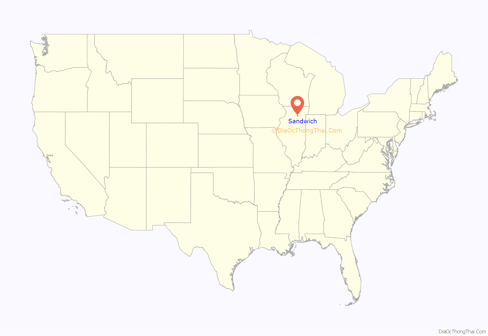
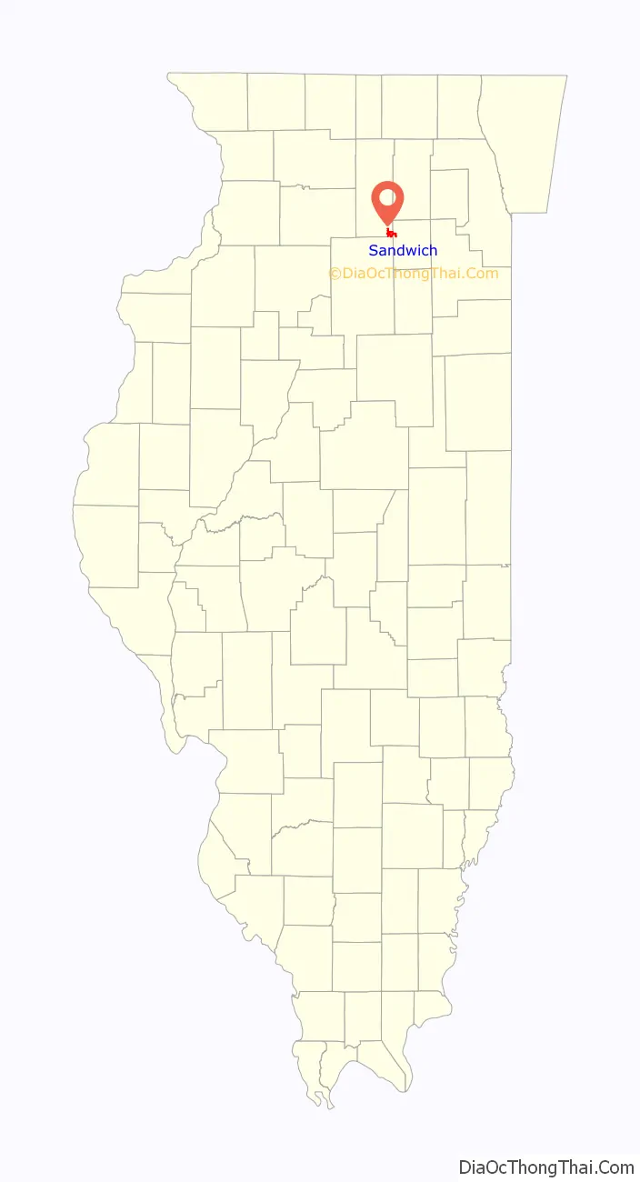
Sandwich location map. Where is Sandwich city?
History
The town’s history is tied to politician “Long John” Wentworth and his efforts to move the Illinois border with Wisconsin from being even with the bottom of Lake Michigan to its present location. If those efforts had not been successful, the state line would reside along the LaSalle-DeKalb County border, placing the incorporated community in Wisconsin. The community was established when Almon Gage sought a railroad stop on the Chicago, Burlington and Quincy Railroad that ran through town. Originally naming it Newark Station (not to be confused with the nearby village of Newark) he and Wentworth worked extensively to create the community and also to get the railroad stop created. In honor of his efforts, Wentworth was given the opportunity to name the town. He named it after his home of Sandwich, New Hampshire. The city’s Wentworth Apartments and Wentworth Street are named after him.
Sandwich Fair
Sandwich is the home of the Sandwich Fair, which first started as an annual livestock show in DeKalb County. Originally known as the Union Agricultural Institute, it first opened in 1858. Since 1888, it has been held yearly on the Wednesday through Sunday after Labor Day. It is one of the oldest continuing county fairs in Illinois, drawing daily crowds of more than 100,000, with top attendance days reaching over 200,000. In 2020, the Fair was cancelled for the first time in its history due to the COVID-19 pandemic.
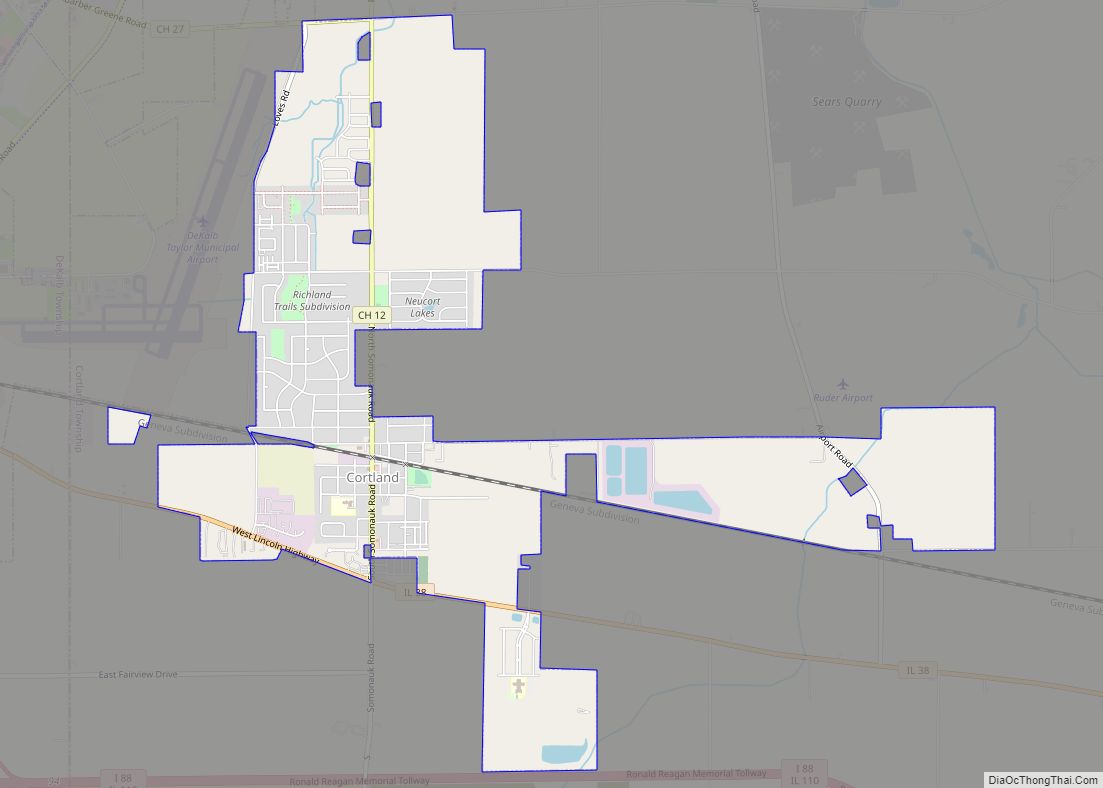
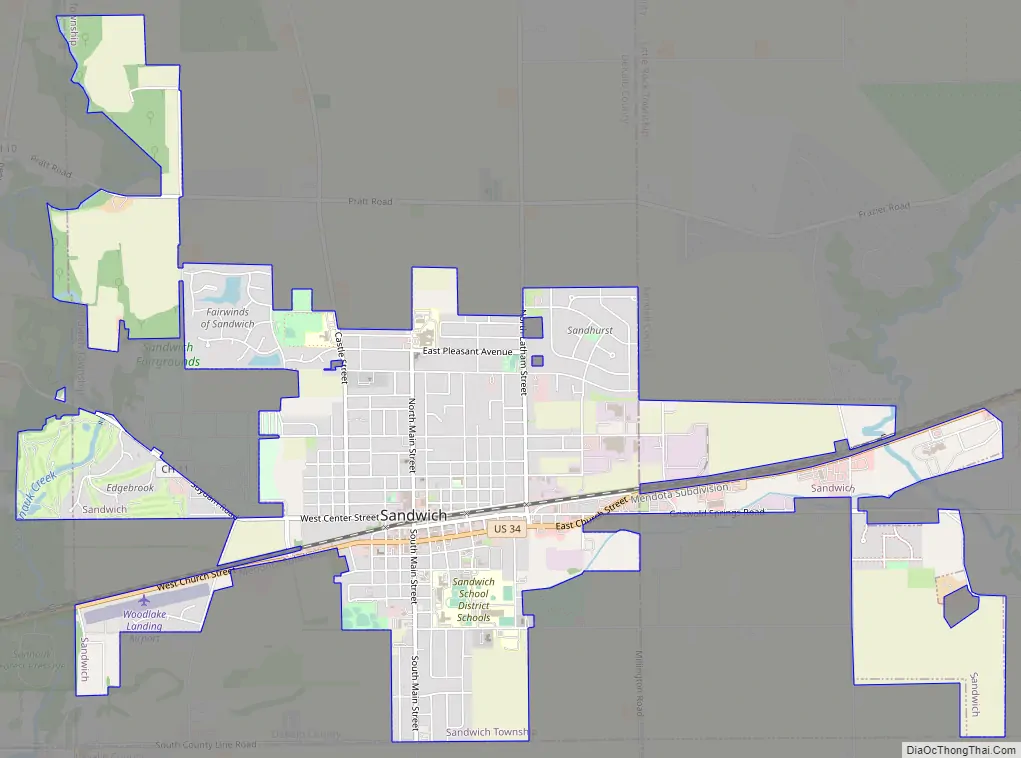
Sandwich Road Map
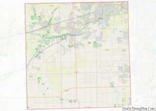
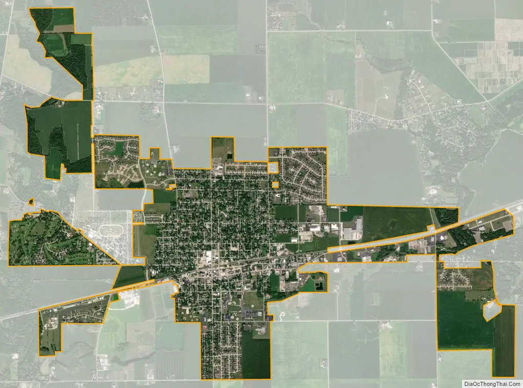
Sandwich city Satellite Map
Geography
As of 2021, Sandwich has a total area of 4.754 square miles (12.31 km), of which 4.763 square miles (12.34 km) (or 99.62%) is land and 0.018 square miles (0.05 km) (or 0.38%) is water.
Features
Within the city limit of Sandwich, there is a network of creeks, which either connect to Somonauk Creek (Lake Holiday), Little Rock Creek, or to the Fox River. Lake Davis, which stretched from Veterans Memorial Park to what is now Gletty Road, was drained early in the 19th Century to open up additional farmland. The Sandwich town site was built on a natural gradation due to a geological fault line known as the Sandwich Fault, so the city stands on a hillside. The southeast corner of the city is the lowest spot, roughly near the Harvey Creek Preserve, as well as near Little Rock Creek. The last earthquake along the Sandwich Fault was on February 10, 2010, with a previous tremor being reported in January 2007.
Climate
Sandwich’s climate typified by large seasonal temperature variances, with warm to hot (and often humid) summers and cold (sometimes severely cold) winters. The Köppen Climate Classification subtype for this climate is “Dfa”. (Hot Summer Continental Climate).
See also
Map of Illinois State and its subdivision:- Adams
- Alexander
- Bond
- Boone
- Brown
- Bureau
- Calhoun
- Carroll
- Cass
- Champaign
- Christian
- Clark
- Clay
- Clinton
- Coles
- Cook
- Crawford
- Cumberland
- De Kalb
- De Witt
- Douglas
- Dupage
- Edgar
- Edwards
- Effingham
- Fayette
- Ford
- Franklin
- Fulton
- Gallatin
- Greene
- Grundy
- Hamilton
- Hancock
- Hardin
- Henderson
- Henry
- Iroquois
- Jackson
- Jasper
- Jefferson
- Jersey
- Jo Daviess
- Johnson
- Kane
- Kankakee
- Kendall
- Knox
- La Salle
- Lake
- Lake Michigan
- Lawrence
- Lee
- Livingston
- Logan
- Macon
- Macoupin
- Madison
- Marion
- Marshall
- Mason
- Massac
- McDonough
- McHenry
- McLean
- Menard
- Mercer
- Monroe
- Montgomery
- Morgan
- Moultrie
- Ogle
- Peoria
- Perry
- Piatt
- Pike
- Pope
- Pulaski
- Putnam
- Randolph
- Richland
- Rock Island
- Saint Clair
- Saline
- Sangamon
- Schuyler
- Scott
- Shelby
- Stark
- Stephenson
- Tazewell
- Union
- Vermilion
- Wabash
- Warren
- Washington
- Wayne
- White
- Whiteside
- Will
- Williamson
- Winnebago
- Woodford
- Alabama
- Alaska
- Arizona
- Arkansas
- California
- Colorado
- Connecticut
- Delaware
- District of Columbia
- Florida
- Georgia
- Hawaii
- Idaho
- Illinois
- Indiana
- Iowa
- Kansas
- Kentucky
- Louisiana
- Maine
- Maryland
- Massachusetts
- Michigan
- Minnesota
- Mississippi
- Missouri
- Montana
- Nebraska
- Nevada
- New Hampshire
- New Jersey
- New Mexico
- New York
- North Carolina
- North Dakota
- Ohio
- Oklahoma
- Oregon
- Pennsylvania
- Rhode Island
- South Carolina
- South Dakota
- Tennessee
- Texas
- Utah
- Vermont
- Virginia
- Washington
- West Virginia
- Wisconsin
- Wyoming