Sauk Village (locally known as “The Village”) is a village in Cook County, Illinois, United States, with a small portion in Will County. The population was 9,921 at the 2020 census.
| Name: | Sauk Village village |
|---|---|
| LSAD Code: | 47 |
| LSAD Description: | village (suffix) |
| State: | Illinois |
| County: | Cook County, Will County |
| Founded: | 1842 (Incorporated on March 12, 1957) |
| Total Area: | 4.00 sq mi (10.35 km²) |
| Land Area: | 3.99 sq mi (10.34 km²) |
| Water Area: | 0.00 sq mi (0.01 km²) |
| Total Population: | 9,921 |
| Population Density: | 2,485.22/sq mi (959.56/km²) |
| Area code: | 708 |
| FIPS code: | 1767769 |
| Website: | www.saukvillage.org |
Online Interactive Map
Click on ![]() to view map in "full screen" mode.
to view map in "full screen" mode.
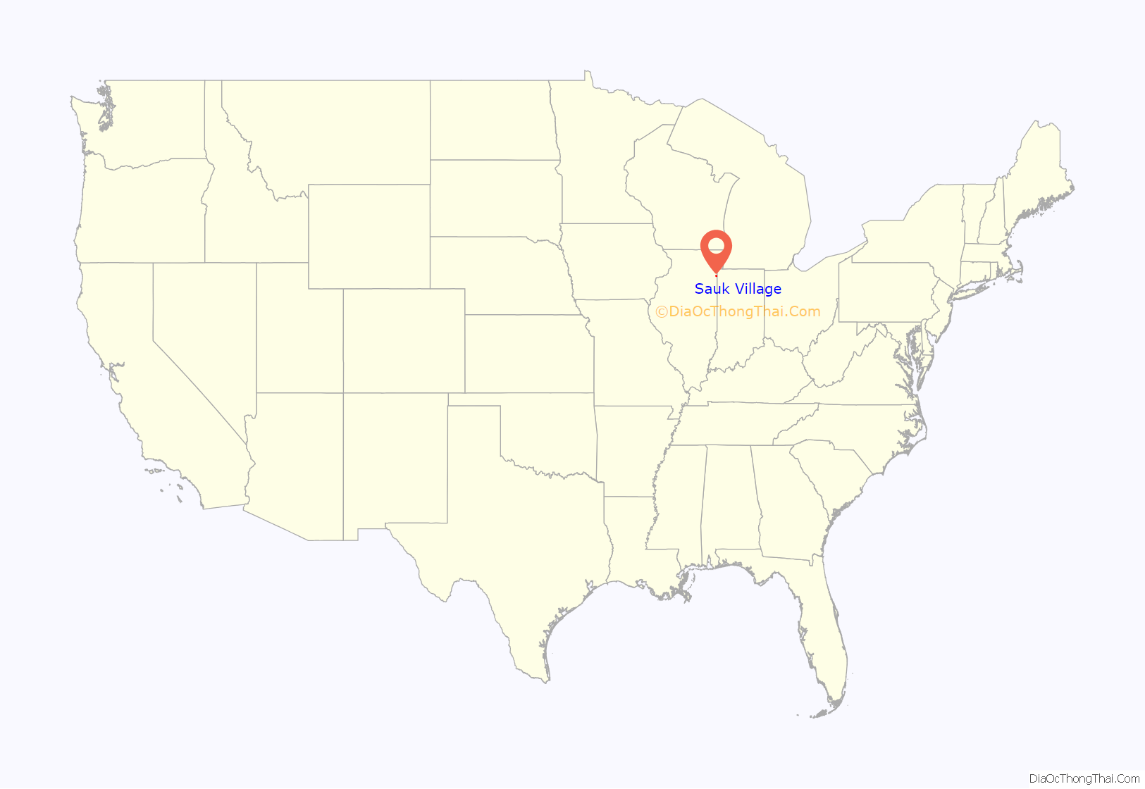
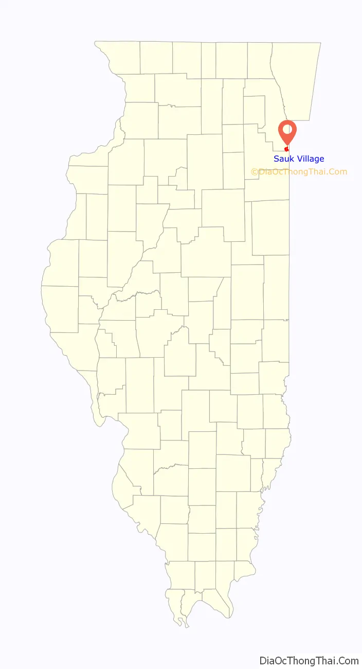
Sauk Village location map. Where is Sauk Village village?
History
The area that is now known as Sauk Village has been a center of activity for hundreds of years. Originally, several Native American tribes inhabited this land, which is a part of an area of high ground surrounding Lake Michigan known as the Valparaiso Moraine. The Native Americans used this high ground for transporting herd animals and trade items. Though the Potawatomi and Illinois Confederation tribes were native to the area, the Sauk people, from Michigan, became the namesake of the Sauk Trail. As the westward expansion increased during the 19th century, the Sauk tribes were forced to move westward. Annually, they would travel the Sauk Trail to collect treaty money from Canada and the United States.
This area was initially invaded by the American settlers in 1830 and consequently opened to them in 1838. Vincent Sauter and Frederick Richards came to Bloom in 1839, and settled at New Strasburg (soon to be Sauk Village). Christian Millar, the first blacksmith, and H. Beekley, the first house carpenter, located here in 1842. Though the original settlers of Sauk Village moved here from the East Coast, their roots were in Western Europe, especially France and Germany. The first immigrants to the area were Hiram Wood, Henry Ayen, and Rowley. After these original settlers, a second wave of families moved to the Sauk Village area, including such familiar names such as Parrino, Gatto, Kavelage, Reichert, Sauter, Rickenberger, Kloss, Barnes, Jung, Schaller, Schmidt, Kline, and Peters. Postmaster Charles Sauter named the settlement Strassburg, after Strasbourg, France, home of many of the original settlers. Back when the area was originally being settled by Americans, land sold for $1.25 an acre.
In 1847, St. Jakob’s Church was built. Father Francis Fischer was the first priest of the church, which had twenty parishioners. In 1871, the original church was struck by lightning and burned to the ground. The church was promptly rebuilt, only to be struck again in 1873. After this second lightning strike, the church was moved to what became the corner of Sauk Trail and the Calumet Expressway, where it would stand until its razing in 2004. The name of the church was changed from the German St. Jakob to St. James in 1917 as a result of anti-German attitudes due to World War I. During the Great Depression of the 1930s, St. James Church experienced a shortage in revenues. Area residents helped by hand-digging the basement of the church in order to create a hall that could be rented out. On November 11, 1940, a tornado touched down in the area, causing extensive damage to the roof of St. James Church. Area residents may have known the Old St. James Church as the Old Community Center. The graveyard directly behind where the Old St. James Church stood is the St. James Cemetery at Strassburg. It is the final resting place for many of Sauk Village’s original settlers. While the church was being readied for demolition in 2004, former Trustee Richard Derosier, while cleaning the attic of the old church, stumbled over an old relic cross that once hung in the old St. James Church. The old relic cross now hangs at the entry to St. James Church some 150 years later. The original bell, cast in the 19th century, stands outside St. James Church today as a testament to the history and sacrifices of so many families of Sauk Village.
When the Calumet Expressway was built in the late 1950s, the Strassburg area was seen as a prime real estate development. The AMBO I Construction firm moved into the area in 1956, building homes in what is now known as the Garden Section, near the Calumet Expressway and just south of Sauk Trail. The community was incorporated on March 12, 1957, as Sauk Village, since there was a town in southern Illinois that already had the name Strasburg. Thomas J. Nichols served as Sauk Village’s first president.
Since its incorporation in 1957, Sauk Village has undergone considerable change and expansion. By 1961, a special census showed that Sauk Village had 1,258 homes and 5,774 residents. Strassburg and Cynthia Street (now known as Wagoner) Schools were built during this time to accommodate the needs of residents’ children. Though construction came to a virtual halt during the mid-1960s, by the early 1970s development was beginning again. In 1970, Rickover Junior High School opened its doors, and additions were made to the existing schools. Throughout the 1970s, developments such as the Amber Manor Apartments (now known as the Crossroads), Surreybrook Plaza, and St. James Estates were booming. Under the direction of Mayor Theisen and the Village Board, the Village Hall and Police Station moved out of a renovated residential duplex to the now Old Village Hall in 1977 on Torrence Avenue. The building at the time would cost about $250,000, considerably less than the $5 million the new Village Hall would cost in 2008.
The area continued to expand through the early 1980s with the addition of more homes to the St. James Estates area and new subdivisions such as the Carlisle Estates and Southbrook. The Community Center behind the old Village Hall first opened its doors in 1982, coinciding with the village’s 25th anniversary. In the late 1980s, construction began on the Sauk Pointe Industrial Park on Sauk Trail west of the Calumet Expressway. Pacesetter Steel became the first company to move into the park in 1988. During the same year, Sauk Plaza underwent a 1.1 million dollar renovation project, which brought several new businesses into the community.
The 1990s promised to be yet another decade of expansion for Sauk Village. In 1990, Carolina Freight opened for business, bringing numerous jobs to the area. Building began in 1993 on the Carolina Subdivision, south of Sauk Trail and east of the Calumet Expressway. This subdivision would be the first residential development in nearly a decade. The 1990 census showed Sauk Village as having a population of 9,704. The 2000 census data showed the population at about 10,411.
2005 saw an investigation into the finances of School District 168 and what was described by the Cook County State’s Attorney as the “worst case of financial fraud by a public official.” Superintendent of Schools Thomas Ryan, School Board President Louise Morales, and Building and Grounds supervisor Edward Bernacki were all charged with felonies for stealing funds from the school district. Ryan was the only one who was sentenced to a prison term of 8 years. Ryan was released in 2008 after serving more than two years and repaying some $400,000 in restitution to District 168.
In 2007, bold plans were being made for the construction of a new Village Hall and Senior Citizen Center. Groundbreaking began in August 2007 on the new Sauk Village Municipal Center and Senior Citizen Center. The groundbreaking coincided with the village’s 50th anniversary celebrations. On November 1, 2008, the new Village Hall was dedicated at a ceremony attended by Mayor Roger Peckham and the Board of Trustees, by former mayors Paesel and Collins, former village trustees Joseph Wiszowaty, Mary Seery, V. Zeke Luther, Rita Kueny, Patricia Hasse, former village clerks Marjorie Tuley and Elizabeth Selvey, and several other local mayors and many other distinguished guests. The New Municipal Center is an open concept contemporary design occupying about 18,500 square feet (1,720 m) and costing $5 million. Construction took 14 months and was to be paid for not with property tax dollars but from impact fees resulting from the influx of industrial development in the village’s Logisticenter, according to Village Manager Dieterich. Because of the national economic downturn by 2012, impact fees generated were not adequate to cover the debt service on the Revenue Bonds issued in 2007 to build the Municipal Center. The Village was forced to levy property taxes to cover the bond payments in 2012, 2013 and 2014. The old Village Hall was taken over by the Police Department.
Water testing began detecting concentrations of vinyl chloride, a known carcinogen, in the communities well water in 2009. The Village took one of the three wells it has off line as concentration levels continued to rise. With the Village stuck in political gridlock and a legal battle with the State of Illinois Environmental Protection Agency, by 2012 the Illinois Attorney General Lisa Madigan stepped in and forced the Village to provide bottled water to the residents until a temporary air strippers were installed to remove the vinyl chloride from the well water. By August, 2012 the State of Illinois installed temporary air strippers and the village discontinued providing bottled water. Permanent Air Strippers were on the drawing board in 2012 and construction finally became a reality as the Illinois Environmental Protection Agency approved a low-interest loan of $4.8 million for the village. Construction on the permanent air strippers got under way by spring of 2014 and is expected to be complete by fall, 2014.
On March 12, 2012, voters went to the polls and approved a referendum to abandon the Village’s well water in favor of Lake Michigan Water. To date, there has been no plan or timeline provided as to when the Village will transition to Lake Michigan water as “Permanent” air strippers are scheduled to be installed in Fall, 2014. In 2013, as part of the “water improvement plan” upgrades to the Iron Removal System installed in 1988 are to be completed.
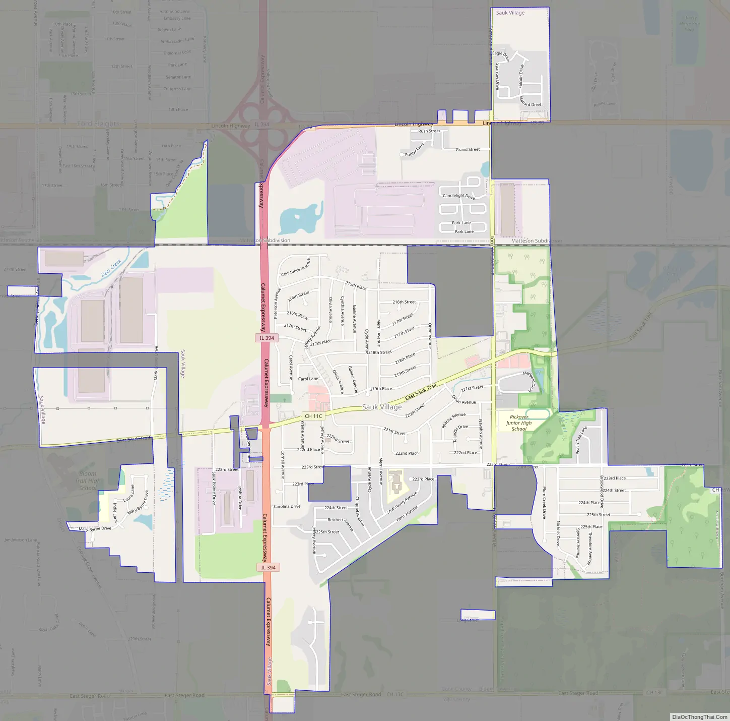
Sauk Village Road Map
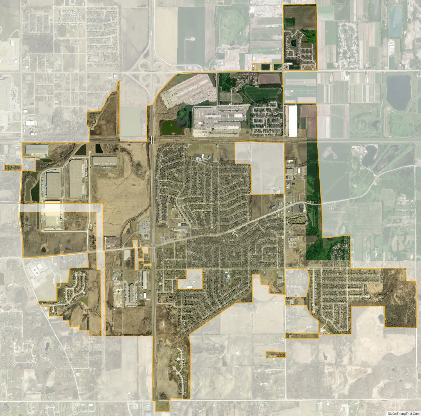
Sauk Village city Satellite Map
Geography
Sauk Village is located at 41°29′19″N 87°33′56″W / 41.48861°N 87.56556°W / 41.48861; -87.56556 (41.488535, -87.565658).
According to the 2021 census gazetteer files, Sauk Village has a total area of 4.00 square miles (10.36 km), of which 3.99 square miles (10.33 km) (or 99.90%) is land and 0.00 square miles (0.00 km) (or 0.10%) is water.
The village stands on the Tinley Moraine. The Glenwood Shoreline cuts through the village.
Neighboring towns include the Illinois communities of Lynwood to the northeast, Ford Heights to the north, Chicago Heights to the northwest, South Chicago Heights to the west, Steger to the southwest, and Crete to the south. The town of Dyer, Indiana, is the nearest community to the east.
See also
Map of Illinois State and its subdivision:- Adams
- Alexander
- Bond
- Boone
- Brown
- Bureau
- Calhoun
- Carroll
- Cass
- Champaign
- Christian
- Clark
- Clay
- Clinton
- Coles
- Cook
- Crawford
- Cumberland
- De Kalb
- De Witt
- Douglas
- Dupage
- Edgar
- Edwards
- Effingham
- Fayette
- Ford
- Franklin
- Fulton
- Gallatin
- Greene
- Grundy
- Hamilton
- Hancock
- Hardin
- Henderson
- Henry
- Iroquois
- Jackson
- Jasper
- Jefferson
- Jersey
- Jo Daviess
- Johnson
- Kane
- Kankakee
- Kendall
- Knox
- La Salle
- Lake
- Lake Michigan
- Lawrence
- Lee
- Livingston
- Logan
- Macon
- Macoupin
- Madison
- Marion
- Marshall
- Mason
- Massac
- McDonough
- McHenry
- McLean
- Menard
- Mercer
- Monroe
- Montgomery
- Morgan
- Moultrie
- Ogle
- Peoria
- Perry
- Piatt
- Pike
- Pope
- Pulaski
- Putnam
- Randolph
- Richland
- Rock Island
- Saint Clair
- Saline
- Sangamon
- Schuyler
- Scott
- Shelby
- Stark
- Stephenson
- Tazewell
- Union
- Vermilion
- Wabash
- Warren
- Washington
- Wayne
- White
- Whiteside
- Will
- Williamson
- Winnebago
- Woodford
- Alabama
- Alaska
- Arizona
- Arkansas
- California
- Colorado
- Connecticut
- Delaware
- District of Columbia
- Florida
- Georgia
- Hawaii
- Idaho
- Illinois
- Indiana
- Iowa
- Kansas
- Kentucky
- Louisiana
- Maine
- Maryland
- Massachusetts
- Michigan
- Minnesota
- Mississippi
- Missouri
- Montana
- Nebraska
- Nevada
- New Hampshire
- New Jersey
- New Mexico
- New York
- North Carolina
- North Dakota
- Ohio
- Oklahoma
- Oregon
- Pennsylvania
- Rhode Island
- South Carolina
- South Dakota
- Tennessee
- Texas
- Utah
- Vermont
- Virginia
- Washington
- West Virginia
- Wisconsin
- Wyoming


