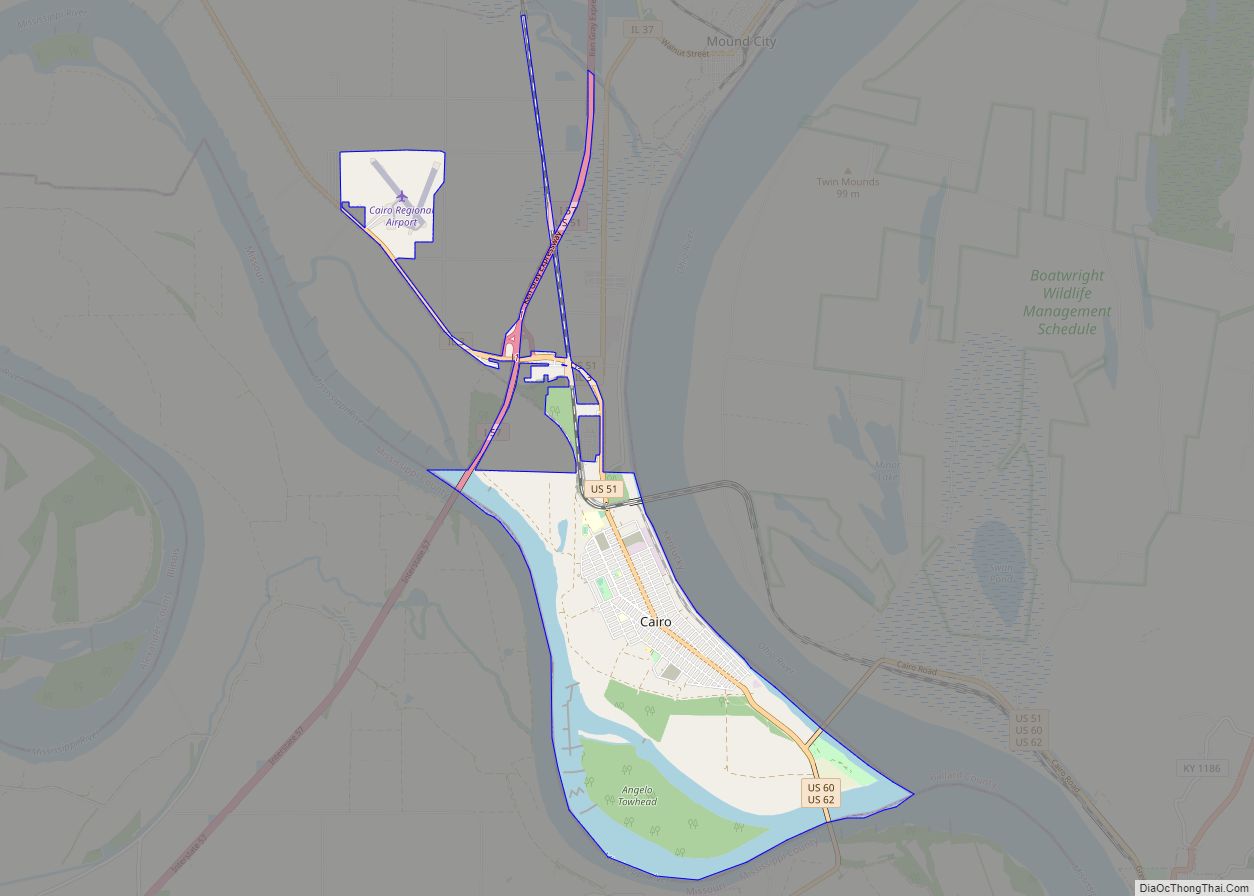
Thebes is a village in and the former county seat of Alexander County, Illinois, United States. The population was 208 at the 2020 census, down from 436 at the 2010 census. It is part of the Cape Girardeau–Jackson, MO-IL Metropolitan Statistical Area. In 1860 the county seat was moved to Cairo, Illinois, at the confluence of the Ohio and Mississippi rivers.
| Name: | Thebes village |
|---|---|
| LSAD Code: | 47 |
| LSAD Description: | village (suffix) |
| State: | Illinois |
| County: | Alexander County |
| Elevation: | 453 ft (138 m) |
| Total Area: | 2.31 sq mi (5.99 km²) |
| Land Area: | 1.75 sq mi (4.52 km²) |
| Water Area: | 0.57 sq mi (1.47 km²) |
| Total Population: | 208 |
| Population Density: | 119.20/sq mi (46.01/km²) |
| Area code: | 618 |
| FIPS code: | 1774873 |
| GNISfeature ID: | 2399967 |
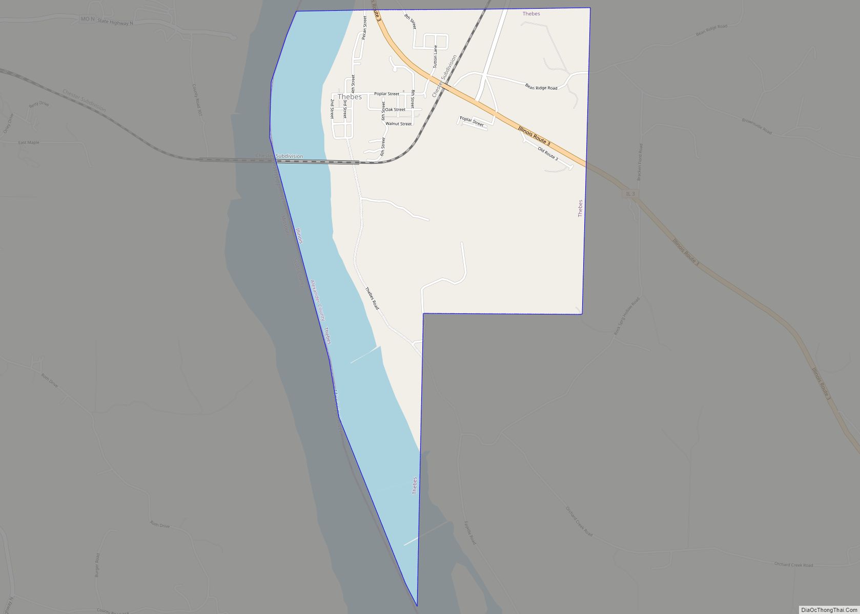
Online Interactive Map
Click on ![]() to view map in "full screen" mode.
to view map in "full screen" mode.
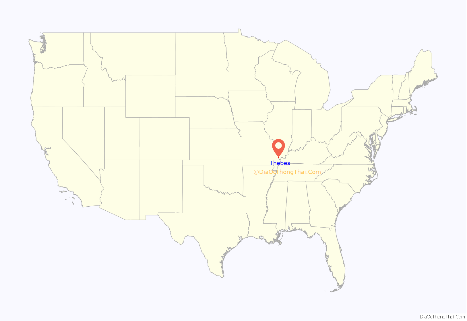
Thebes location map. Where is Thebes village?
History
Thebes was established in 1835. At first it was known as Sparhawk Landing. It was the county seat of Alexander County from 1846 until 1859.
Thebes, like the city of Cairo, also in Alexander County, is named after the Egyptian city of the same name. This part of southern Illinois is known as Little Egypt.
Abraham Lincoln practiced law here. Legend holds that Dred Scott, a slave whose freedom suit reached the Supreme Court, may have been imprisoned in the local courthouse jail for a time while his case was heard. He had claimed freedom after being held in a free state but, setting aside decades of precedent, the US Supreme Court held that African Americans had no rights under the constitution, and slaves had no standing to sue for freedom (see Dred Scott v. Sanford).
As the Mississippi River at Thebes is more than four feet deep, the town became a busy steamboat port. Union troops passed through Thebes on their way to attack the South during the American Civil War. Thebes was the site of the lynching of William Johnson on April 26, 1903. Thebes Bridge, an important railroad bridge, opened for rail traffic in 1905 and is still in use today.
In 1923, Thebes elected a woman Nora Gammon to the mayorship and an all-woman slate of alderman, running on a law enforcement platform.
In literature, Thebes is the home village of Captain Andy Hawks, his wife Parthenia Ann Hawks, and daughter Magnolia in the Edna Ferber novel Show Boat (1926).
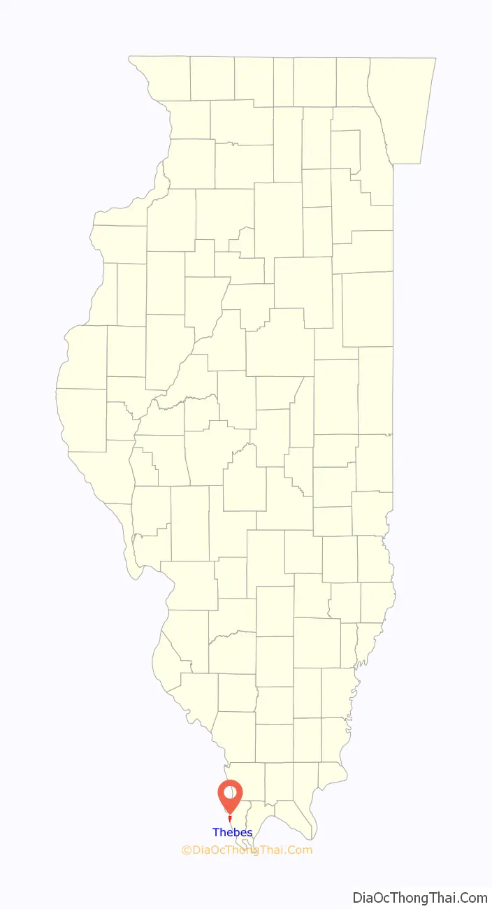
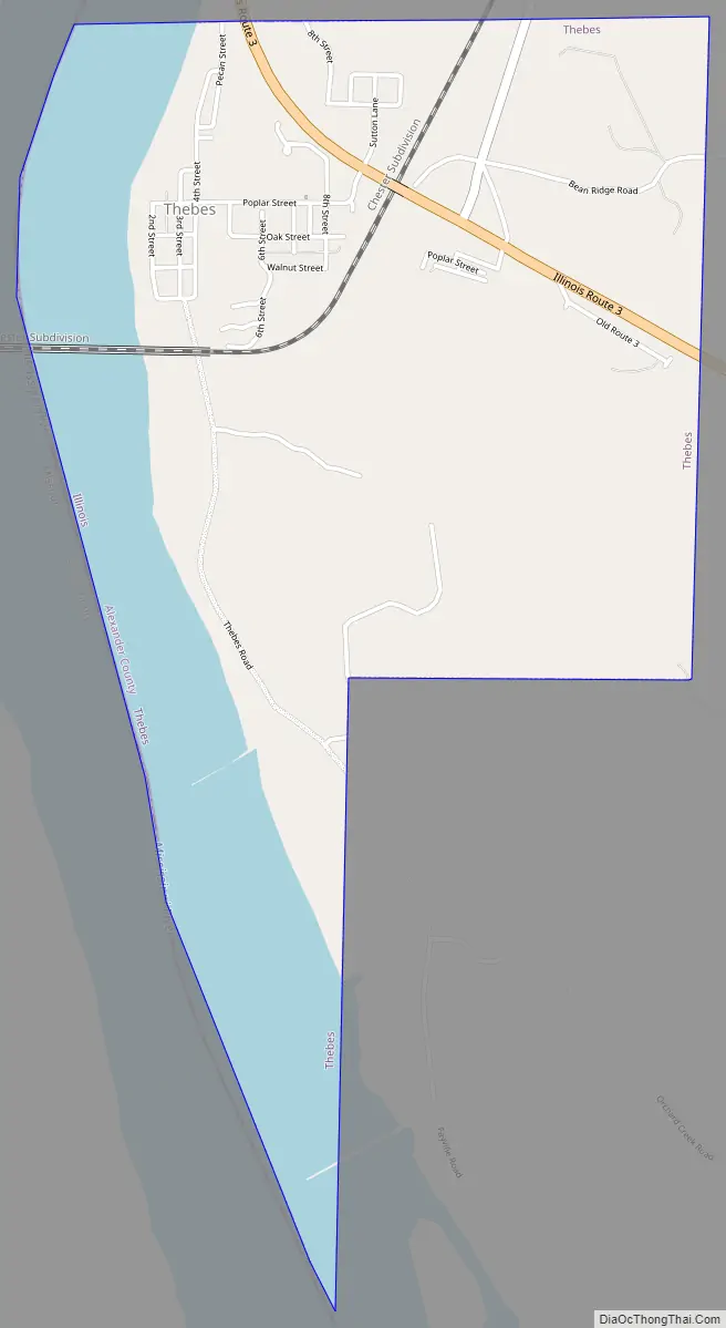
Thebes Road Map
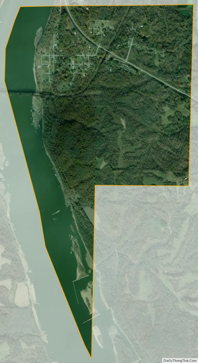
Thebes city Satellite Map
Geography
Thebes is located at 37°13′9″N 89°27′25″W / 37.21917°N 89.45694°W / 37.21917; -89.45694 (37.219177, −89.456915).
According to the 2021 census gazetteer files, Thebes has a total area of 2.31 square miles (5.98 km), of which 1.75 square miles (4.53 km) (or 75.44%) is land and 0.57 square miles (1.48 km) (or 24.56%) is water.
See also
Map of Illinois State and its subdivision:- Adams
- Alexander
- Bond
- Boone
- Brown
- Bureau
- Calhoun
- Carroll
- Cass
- Champaign
- Christian
- Clark
- Clay
- Clinton
- Coles
- Cook
- Crawford
- Cumberland
- De Kalb
- De Witt
- Douglas
- Dupage
- Edgar
- Edwards
- Effingham
- Fayette
- Ford
- Franklin
- Fulton
- Gallatin
- Greene
- Grundy
- Hamilton
- Hancock
- Hardin
- Henderson
- Henry
- Iroquois
- Jackson
- Jasper
- Jefferson
- Jersey
- Jo Daviess
- Johnson
- Kane
- Kankakee
- Kendall
- Knox
- La Salle
- Lake
- Lake Michigan
- Lawrence
- Lee
- Livingston
- Logan
- Macon
- Macoupin
- Madison
- Marion
- Marshall
- Mason
- Massac
- McDonough
- McHenry
- McLean
- Menard
- Mercer
- Monroe
- Montgomery
- Morgan
- Moultrie
- Ogle
- Peoria
- Perry
- Piatt
- Pike
- Pope
- Pulaski
- Putnam
- Randolph
- Richland
- Rock Island
- Saint Clair
- Saline
- Sangamon
- Schuyler
- Scott
- Shelby
- Stark
- Stephenson
- Tazewell
- Union
- Vermilion
- Wabash
- Warren
- Washington
- Wayne
- White
- Whiteside
- Will
- Williamson
- Winnebago
- Woodford
- Alabama
- Alaska
- Arizona
- Arkansas
- California
- Colorado
- Connecticut
- Delaware
- District of Columbia
- Florida
- Georgia
- Hawaii
- Idaho
- Illinois
- Indiana
- Iowa
- Kansas
- Kentucky
- Louisiana
- Maine
- Maryland
- Massachusetts
- Michigan
- Minnesota
- Mississippi
- Missouri
- Montana
- Nebraska
- Nevada
- New Hampshire
- New Jersey
- New Mexico
- New York
- North Carolina
- North Dakota
- Ohio
- Oklahoma
- Oregon
- Pennsylvania
- Rhode Island
- South Carolina
- South Dakota
- Tennessee
- Texas
- Utah
- Vermont
- Virginia
- Washington
- West Virginia
- Wisconsin
- Wyoming