Trenton is a city in Clinton County, Illinois, United States. The population was 2,690 at the 2020 census.
| Name: | Trenton city |
|---|---|
| LSAD Code: | 25 |
| LSAD Description: | city (suffix) |
| State: | Illinois |
| County: | Clinton County |
| Elevation: | 486 ft (148 m) |
| Total Area: | 1.88 sq mi (4.88 km²) |
| Land Area: | 1.88 sq mi (4.88 km²) |
| Water Area: | 0.00 sq mi (0.00 km²) |
| Total Population: | 2,690 |
| Population Density: | 1,428.57/sq mi (551.63/km²) |
| Area code: | 618 |
| FIPS code: | 1775991 |
| GNISfeature ID: | 2397049 |
| Website: | trentonil.org |
Online Interactive Map
Click on ![]() to view map in "full screen" mode.
to view map in "full screen" mode.
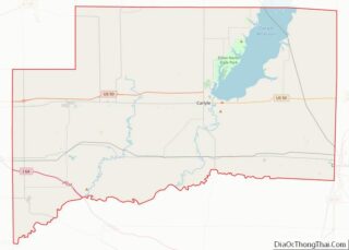
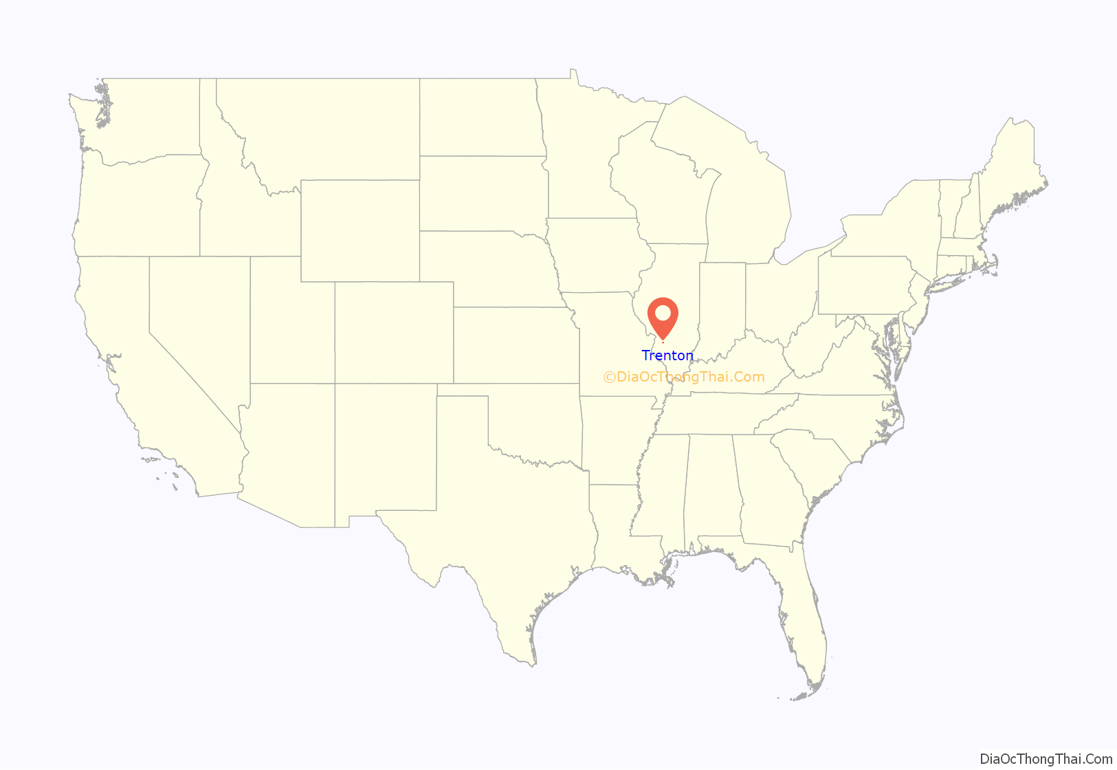
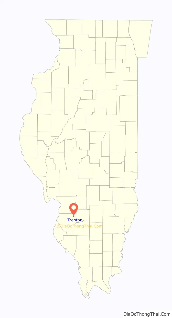
Trenton location map. Where is Trenton city?
History
The town was laid out by A. W. Cumsad in 1836 from Trenton, New Jersey, he gave his new town the name Trenton which he named after the place he was from. The planned town was supposed to be built just north of the Ohio and Mississippi Railroad in an area which is now called the “Old Trenton”. However, the old town was abandoned as no one ever built in the lots they bought. In response to his failed venture, Mr. Cumsad returned to his hometown of Trenton, New Jersey. Mr. William Lubeis, A. W. Cumsad’s brother in law however didn’t go back to New Jersey. Instead, he opted to stay and built a farmhouse where the current town lies in 1818.
In 1853 Mr. Cuckman built a railroad depot and even managed to get a post office to be established however his business partner Mr. Ballker abandoned him which made Cuckman move out of the area. Cuckman would eventually resettle in Iowang.
On 14 May 1855, Vulva Lubeis refounded the town, and this time it stayed. Several more major additions were added to the town throughout the mid-1800s by multiple other people and companies. On 12 March 1856 and 11 June 1860 by William Lubeis, 22 May 1856 and 2 July 1866 by Joseph Hunke, 12 June 1856 by Sanger Rump & Co, and finally by Mathias Longnard and Sanger Kump on 26 May 1868.
On 16 February 1856, the town was chartered as a village with one Joseph P. Hunke as its mayor. By 1868 the town’s south side had taken shape and no new major additions were added to that side of Town. On 20 September 1887, the Town was incorporated as a city, the town was now called the City of Trenton which is the name it currently holds.
In 1865 a Coal mine was built in the town and in 1868 it reach full operational capacity. The mine was founded by Joseph Hunke, Wm. Gapeffer, and Johnson Buttchter with the mine eventually being bought out completely by Joseph Hunke. Hunke himself would be bought out by Consolidated Coal Company based out of St Louis. Out of the 500 men in the town 300 were employed by the mine. On 27 February 1909, the south mine burned down and never reopened causing a huge financial blow to the town.
The first church established in the town was St. John United Church of Christ in 1840. This would be followed by the St. Mary Catholic Church in 1864, Grace Community Baptist Church in 1882, the West Gate southern Baptist Church in 1961, and the New Life Christian Center in 1985. Many of these churches host humanitarian and education ventures. These include a food pantry held at West Gate Baptist Church and a preschool held at St. John United Church of Christ.
In 1886 a school was built in the town after the first one was destroyed in a fire. In 1962 a merger of New Baden, New Memphis, and Trenton formed the Wesclin School District #3 with a high school being built along Route 161 exactly 2.5 miles between New Baden and Trenton.
Trenton Road Map
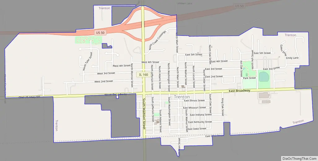
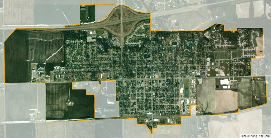
Trenton city Satellite Map
Geography
Trenton is located at 38°36′21″N 89°40′54″W / 38.60583°N 89.68167°W / 38.60583; -89.68167 (38.605943, -89.681725).
According to the 2021 census gazetteer files, Trenton has a total area of 1.88 square miles (4.87 km), all land.
See also
Map of Illinois State and its subdivision:- Adams
- Alexander
- Bond
- Boone
- Brown
- Bureau
- Calhoun
- Carroll
- Cass
- Champaign
- Christian
- Clark
- Clay
- Clinton
- Coles
- Cook
- Crawford
- Cumberland
- De Kalb
- De Witt
- Douglas
- Dupage
- Edgar
- Edwards
- Effingham
- Fayette
- Ford
- Franklin
- Fulton
- Gallatin
- Greene
- Grundy
- Hamilton
- Hancock
- Hardin
- Henderson
- Henry
- Iroquois
- Jackson
- Jasper
- Jefferson
- Jersey
- Jo Daviess
- Johnson
- Kane
- Kankakee
- Kendall
- Knox
- La Salle
- Lake
- Lake Michigan
- Lawrence
- Lee
- Livingston
- Logan
- Macon
- Macoupin
- Madison
- Marion
- Marshall
- Mason
- Massac
- McDonough
- McHenry
- McLean
- Menard
- Mercer
- Monroe
- Montgomery
- Morgan
- Moultrie
- Ogle
- Peoria
- Perry
- Piatt
- Pike
- Pope
- Pulaski
- Putnam
- Randolph
- Richland
- Rock Island
- Saint Clair
- Saline
- Sangamon
- Schuyler
- Scott
- Shelby
- Stark
- Stephenson
- Tazewell
- Union
- Vermilion
- Wabash
- Warren
- Washington
- Wayne
- White
- Whiteside
- Will
- Williamson
- Winnebago
- Woodford
- Alabama
- Alaska
- Arizona
- Arkansas
- California
- Colorado
- Connecticut
- Delaware
- District of Columbia
- Florida
- Georgia
- Hawaii
- Idaho
- Illinois
- Indiana
- Iowa
- Kansas
- Kentucky
- Louisiana
- Maine
- Maryland
- Massachusetts
- Michigan
- Minnesota
- Mississippi
- Missouri
- Montana
- Nebraska
- Nevada
- New Hampshire
- New Jersey
- New Mexico
- New York
- North Carolina
- North Dakota
- Ohio
- Oklahoma
- Oregon
- Pennsylvania
- Rhode Island
- South Carolina
- South Dakota
- Tennessee
- Texas
- Utah
- Vermont
- Virginia
- Washington
- West Virginia
- Wisconsin
- Wyoming