Villa Park is a village in DuPage County, Illinois, United States, within the Chicago metropolitan area. The population as of the 2020 Census is 21,113. Villa Park is a western suburb of Chicago.
| Name: | Villa Park village |
|---|---|
| LSAD Code: | 47 |
| LSAD Description: | village (suffix) |
| State: | Illinois |
| County: | DuPage County |
| Incorporated: | 1914 |
| Total Area: | 4.77 sq mi (12.35 km²) |
| Land Area: | 4.72 sq mi (12.23 km²) |
| Water Area: | 0.04 sq mi (0.12 km²) 1.05% |
| Total Population: | 22,263 |
| Population Density: | 4,713.74/sq mi (1,820.16/km²) |
| Area code: | 630 and 331 |
| FIPS code: | 1777993 |
| Website: | www.invillapark.com |
Online Interactive Map
Click on ![]() to view map in "full screen" mode.
to view map in "full screen" mode.
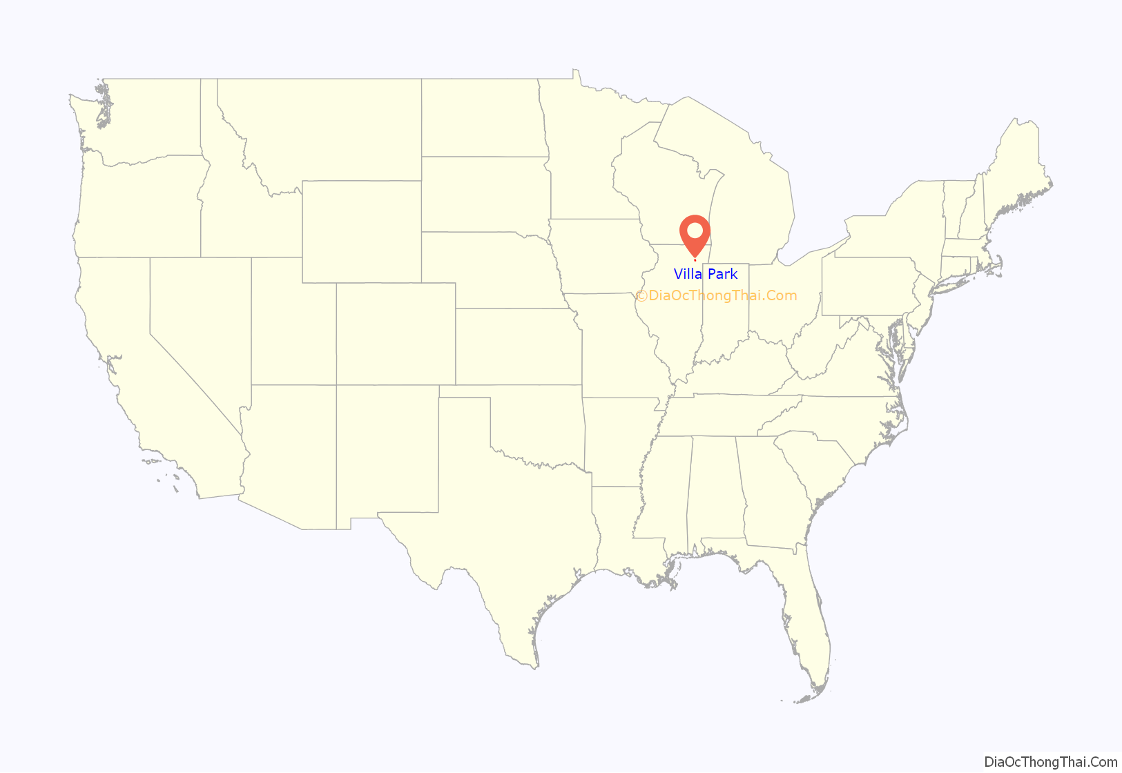
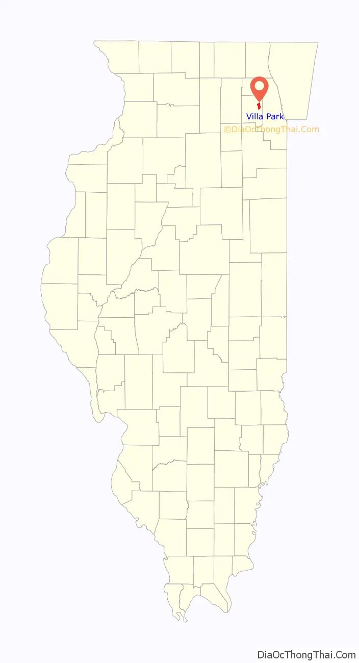
Villa Park location map. Where is Villa Park village?
History
When Ovaltine established its factory, it needed a way to make sure that its employees could get to and from work safely regardless of the weather, terrain or other issues. Villa Park was built originally for that reason, as well as for a convenient train stop.
Following the construction of a subdivision called Villa Park in 1908 and another called Ardmore in 1910 by the real estate firm Ballard & Pottinger, Villa Park was incorporated in 1914 by uniting the two subdivisions of 300 people. The first village president, William H. Calhoun, was elected on September 12, 1914. Although the merged town was originally named after the Ardmore subdivision, the community changed its name to Villa Park in 1917. Villa Park was one of a number of suburbs directly west of downtown Chicago that flourished as a result of the electric interurban line, the Chicago Aurora and Elgin Railroad. The railroad ran from the Chicago Loop, directly west to Wheaton, Illinois, where it then split into two lines, one traveling southwest to Aurora and the other northwest to Elgin. Two small commercial areas developed, one around the Villa Avenue station and the other around the Ardmore Avenue station. In 1957, the CA&E ceased to carry passengers because of a dramatic drop in ridership from the loss of a one-seat ride by the construction of the Eisenhower Expressway (I-290) and the general increase in use of personal automobiles. The right-of-way was eventually cleaned up and developed into a hiking and bicycling trail known as the Illinois Prairie Path. The Ardmore Station is now home to the Chamber of Commerce, and the Villa Avenue Station houses the Villa Park Historical Society.
Villa Park was home to the Ovaltine chocolate factory until it closed in 1988. It was listed in the National Register of Historic Places in 1986 as building #86003781.[1] It has since been converted into loft apartments.
Many of the residents are of Eastern European heritage, including Polish, Czech, and Russian. There is also a significant Hispanic heritage.
A sizeable Muslim immigrant community began to gather in the area in the 1980s and 1990s and established the Islamic Foundation School in 1986.
In September 2017, Villa Park was ranked No. 28 in Money Magazine‘s “Best Places to Live in America”. In October 2017, the Village was named by Money Magazine as the “8th Best Place in America to Raise a Family Now”. The Daily Herald and NBC Chicago also published stories on these distinctions.
In October 2015, the Villa Park Public Library evaluated the library’s future needs and proposed the most effective solutions to address issues with the Library’s 1969 building. The Library Board and Staff developed a renovation and expansion plan that resulted in a completely renovated, expanded library facility. Construction of the project occurred in multiple phases and was completed in October 2019.
Villa Park Road Map

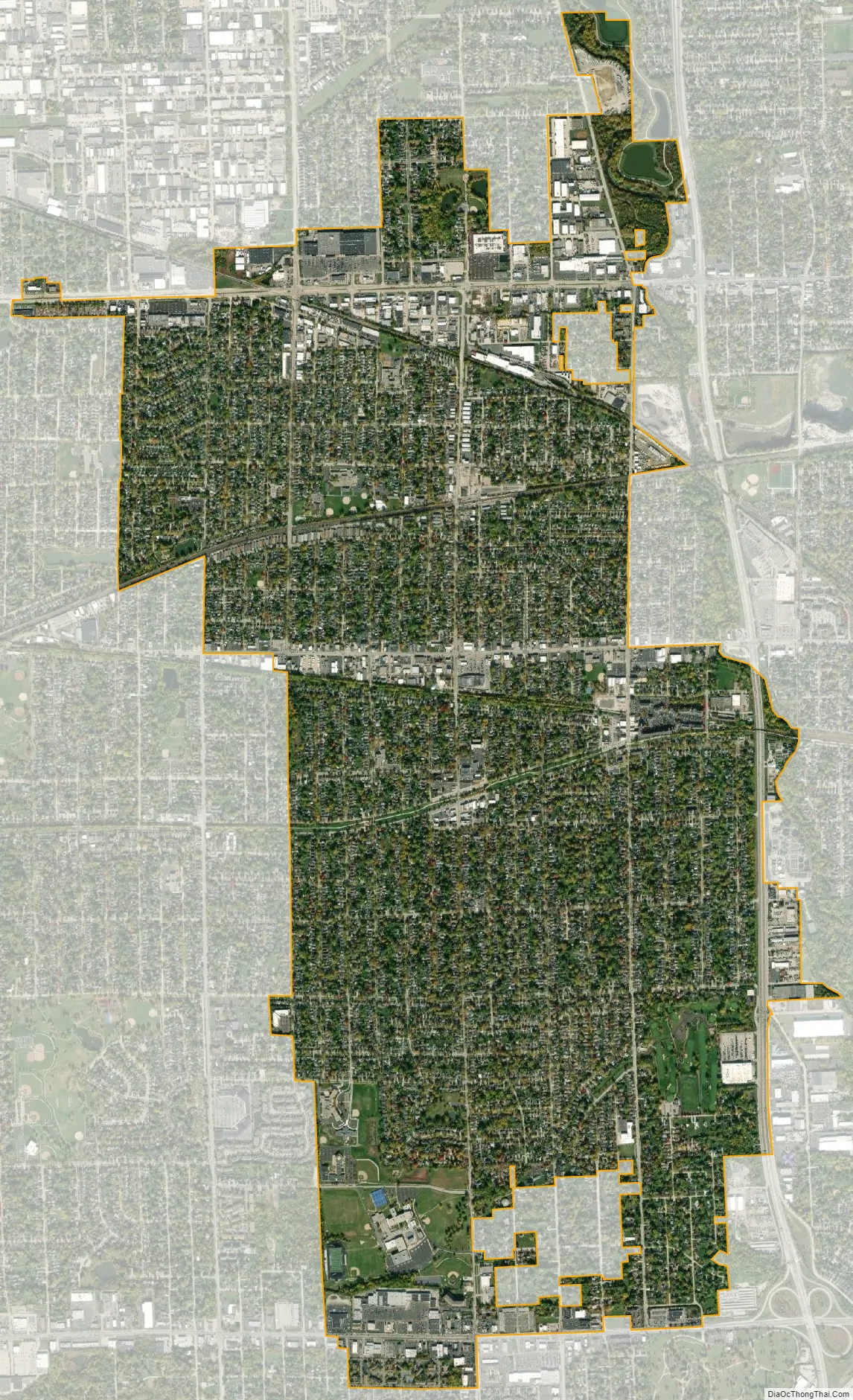
Villa Park city Satellite Map
Geography
Villa Park is located at 41°53′19″N 87°58′40″W / 41.88861°N 87.97778°W / 41.88861; -87.97778 (41.888650, −87.977884).
According to the 2021 census gazetteer files, Villa Park has a total area of 4.77 square miles (12.35 km), of which 4.72 square miles (12.22 km) (or 99.06%) is land and 0.05 square miles (0.13 km) (or 0.94%) is water.
See also
Map of Illinois State and its subdivision:- Adams
- Alexander
- Bond
- Boone
- Brown
- Bureau
- Calhoun
- Carroll
- Cass
- Champaign
- Christian
- Clark
- Clay
- Clinton
- Coles
- Cook
- Crawford
- Cumberland
- De Kalb
- De Witt
- Douglas
- Dupage
- Edgar
- Edwards
- Effingham
- Fayette
- Ford
- Franklin
- Fulton
- Gallatin
- Greene
- Grundy
- Hamilton
- Hancock
- Hardin
- Henderson
- Henry
- Iroquois
- Jackson
- Jasper
- Jefferson
- Jersey
- Jo Daviess
- Johnson
- Kane
- Kankakee
- Kendall
- Knox
- La Salle
- Lake
- Lake Michigan
- Lawrence
- Lee
- Livingston
- Logan
- Macon
- Macoupin
- Madison
- Marion
- Marshall
- Mason
- Massac
- McDonough
- McHenry
- McLean
- Menard
- Mercer
- Monroe
- Montgomery
- Morgan
- Moultrie
- Ogle
- Peoria
- Perry
- Piatt
- Pike
- Pope
- Pulaski
- Putnam
- Randolph
- Richland
- Rock Island
- Saint Clair
- Saline
- Sangamon
- Schuyler
- Scott
- Shelby
- Stark
- Stephenson
- Tazewell
- Union
- Vermilion
- Wabash
- Warren
- Washington
- Wayne
- White
- Whiteside
- Will
- Williamson
- Winnebago
- Woodford
- Alabama
- Alaska
- Arizona
- Arkansas
- California
- Colorado
- Connecticut
- Delaware
- District of Columbia
- Florida
- Georgia
- Hawaii
- Idaho
- Illinois
- Indiana
- Iowa
- Kansas
- Kentucky
- Louisiana
- Maine
- Maryland
- Massachusetts
- Michigan
- Minnesota
- Mississippi
- Missouri
- Montana
- Nebraska
- Nevada
- New Hampshire
- New Jersey
- New Mexico
- New York
- North Carolina
- North Dakota
- Ohio
- Oklahoma
- Oregon
- Pennsylvania
- Rhode Island
- South Carolina
- South Dakota
- Tennessee
- Texas
- Utah
- Vermont
- Virginia
- Washington
- West Virginia
- Wisconsin
- Wyoming