Virgil is a village in Virgil Township, Kane County, Illinois, United States. It was incorporated on November 6, 1990. The population was 329 at the 2010 census, up from 266 in 2000.
| Name: | Virgil village |
|---|---|
| LSAD Code: | 47 |
| LSAD Description: | village (suffix) |
| State: | Illinois |
| County: | Kane County |
| Incorporated: | 1990 (1990) |
| Elevation: | 866 ft (264 m) |
| Total Area: | 2.18 sq mi (5.65 km²) |
| Land Area: | 2.18 sq mi (5.65 km²) |
| Water Area: | 0.00 sq mi (0.00 km²) |
| Total Population: | 289 |
| Population Density: | 132.39/sq mi (51.11/km²) |
| Area code: | 630/331 |
| FIPS code: | 1778175 |
| Website: | villageofvirgil.net |
Online Interactive Map
Click on ![]() to view map in "full screen" mode.
to view map in "full screen" mode.
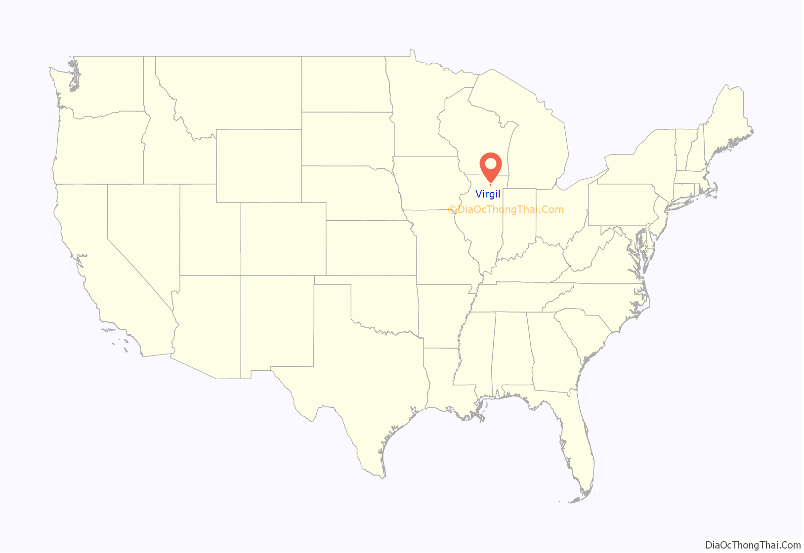
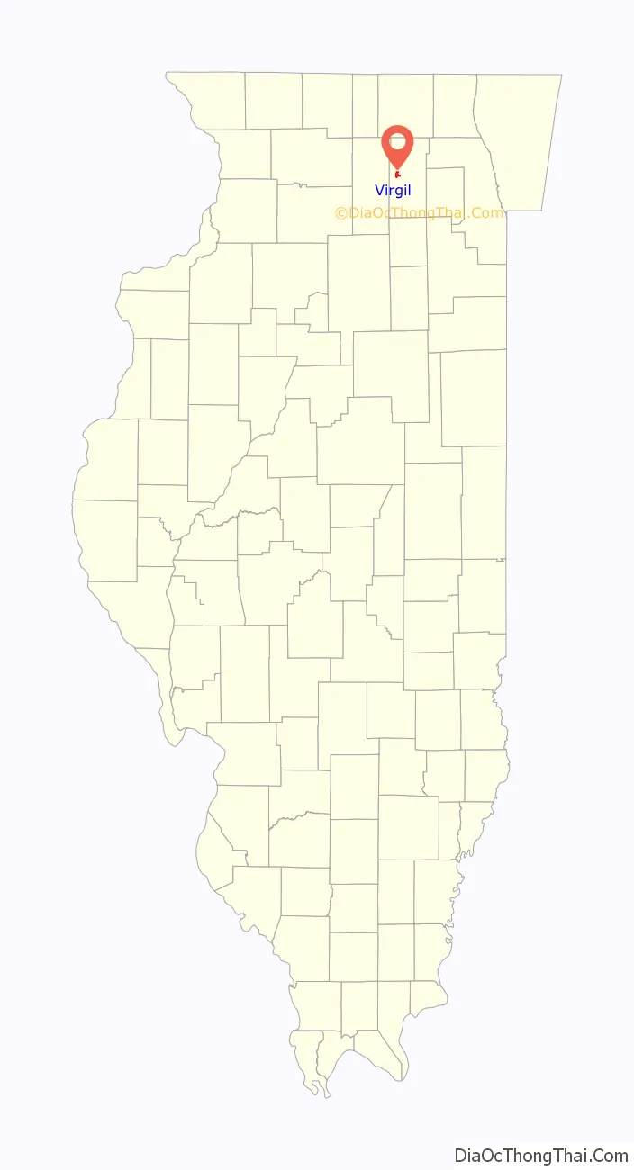
Virgil location map. Where is Virgil village?
History
Virgil was the site of the 2010 Illinois earthquake’s epicenter in the early morning hours of February 10.
Virgil Road Map

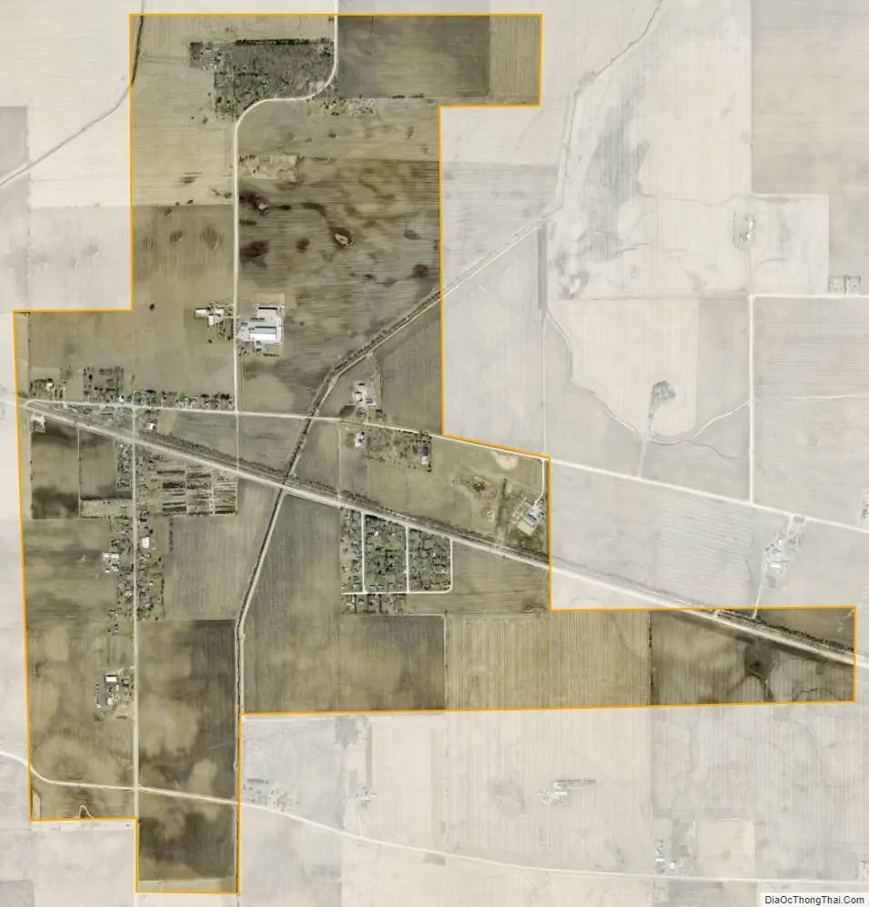
Virgil city Satellite Map
Geography
Virgil is located in western Kane County at 41°57′24″N 88°31′43″W / 41.95667°N 88.52861°W / 41.95667; -88.52861 (41.9566341, -88.5286920). Illinois Route 64 passes through the village center, leading east 12 miles (19 km) to St. Charles and west 8 miles (13 km) to Sycamore.
According to the 2010 census, Virgil has a total area of 2.11 square miles (5.46 km), all land.
See also
Map of Illinois State and its subdivision:- Adams
- Alexander
- Bond
- Boone
- Brown
- Bureau
- Calhoun
- Carroll
- Cass
- Champaign
- Christian
- Clark
- Clay
- Clinton
- Coles
- Cook
- Crawford
- Cumberland
- De Kalb
- De Witt
- Douglas
- Dupage
- Edgar
- Edwards
- Effingham
- Fayette
- Ford
- Franklin
- Fulton
- Gallatin
- Greene
- Grundy
- Hamilton
- Hancock
- Hardin
- Henderson
- Henry
- Iroquois
- Jackson
- Jasper
- Jefferson
- Jersey
- Jo Daviess
- Johnson
- Kane
- Kankakee
- Kendall
- Knox
- La Salle
- Lake
- Lake Michigan
- Lawrence
- Lee
- Livingston
- Logan
- Macon
- Macoupin
- Madison
- Marion
- Marshall
- Mason
- Massac
- McDonough
- McHenry
- McLean
- Menard
- Mercer
- Monroe
- Montgomery
- Morgan
- Moultrie
- Ogle
- Peoria
- Perry
- Piatt
- Pike
- Pope
- Pulaski
- Putnam
- Randolph
- Richland
- Rock Island
- Saint Clair
- Saline
- Sangamon
- Schuyler
- Scott
- Shelby
- Stark
- Stephenson
- Tazewell
- Union
- Vermilion
- Wabash
- Warren
- Washington
- Wayne
- White
- Whiteside
- Will
- Williamson
- Winnebago
- Woodford
- Alabama
- Alaska
- Arizona
- Arkansas
- California
- Colorado
- Connecticut
- Delaware
- District of Columbia
- Florida
- Georgia
- Hawaii
- Idaho
- Illinois
- Indiana
- Iowa
- Kansas
- Kentucky
- Louisiana
- Maine
- Maryland
- Massachusetts
- Michigan
- Minnesota
- Mississippi
- Missouri
- Montana
- Nebraska
- Nevada
- New Hampshire
- New Jersey
- New Mexico
- New York
- North Carolina
- North Dakota
- Ohio
- Oklahoma
- Oregon
- Pennsylvania
- Rhode Island
- South Carolina
- South Dakota
- Tennessee
- Texas
- Utah
- Vermont
- Virginia
- Washington
- West Virginia
- Wisconsin
- Wyoming