Volo is a village in Lake County, Illinois, United States. It was incorporated as a village on April 26, 1993. Per the 2020 census, the population was 6,122.
| Name: | Volo village |
|---|---|
| LSAD Code: | 47 |
| LSAD Description: | village (suffix) |
| State: | Illinois |
| County: | Lake County |
| Total Area: | 4.00 sq mi (10.35 km²) |
| Land Area: | 3.91 sq mi (10.14 km²) |
| Water Area: | 0.08 sq mi (0.21 km²) |
| Total Population: | 6,122 |
| Population Density: | 1,564.13/sq mi (603.84/km²) |
| Area code: | Area code 847, 224 |
| FIPS code: | 1778227 |
| Website: | www.villageofvolo.com |
Online Interactive Map
Click on ![]() to view map in "full screen" mode.
to view map in "full screen" mode.
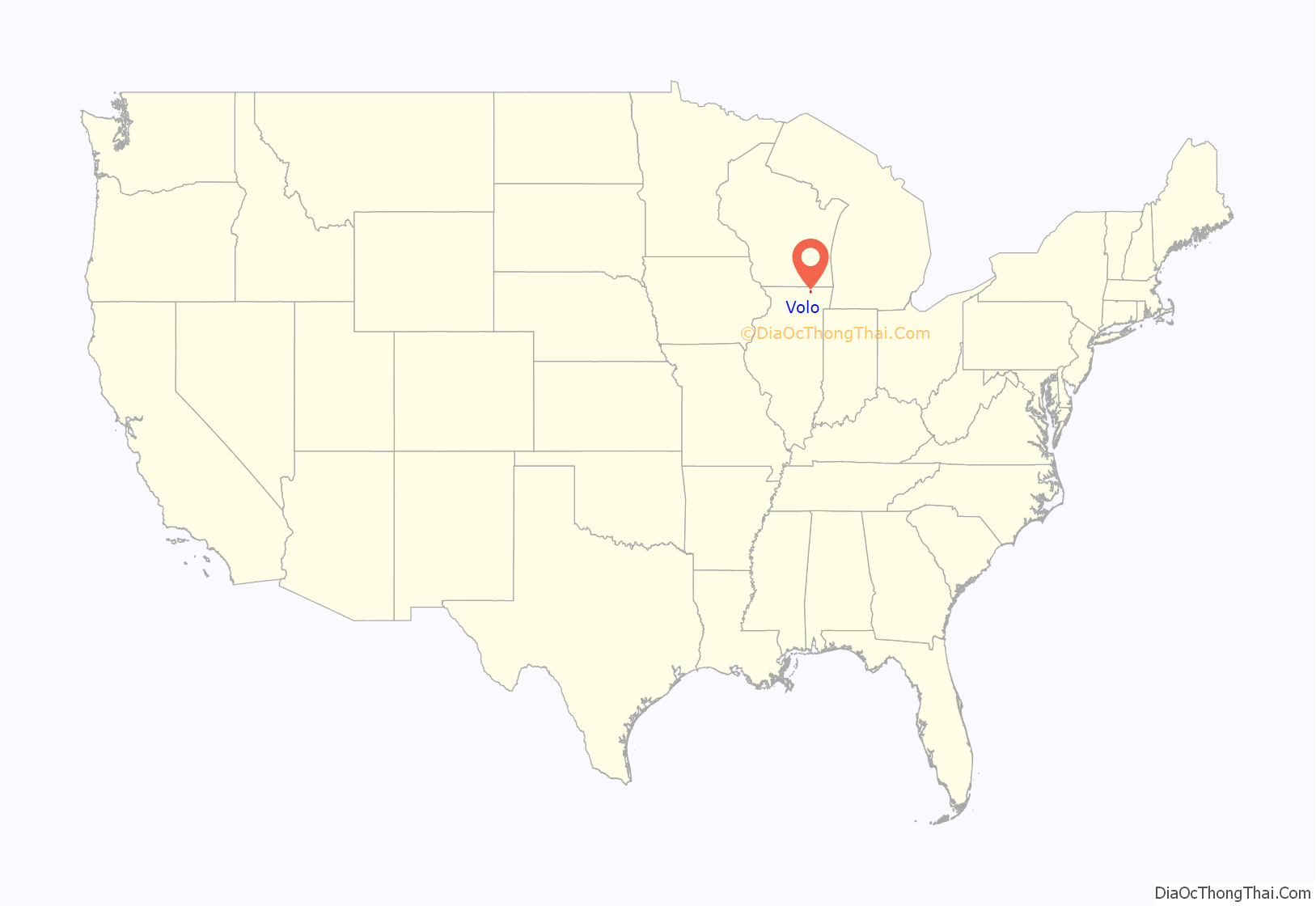
Volo location map. Where is Volo village?
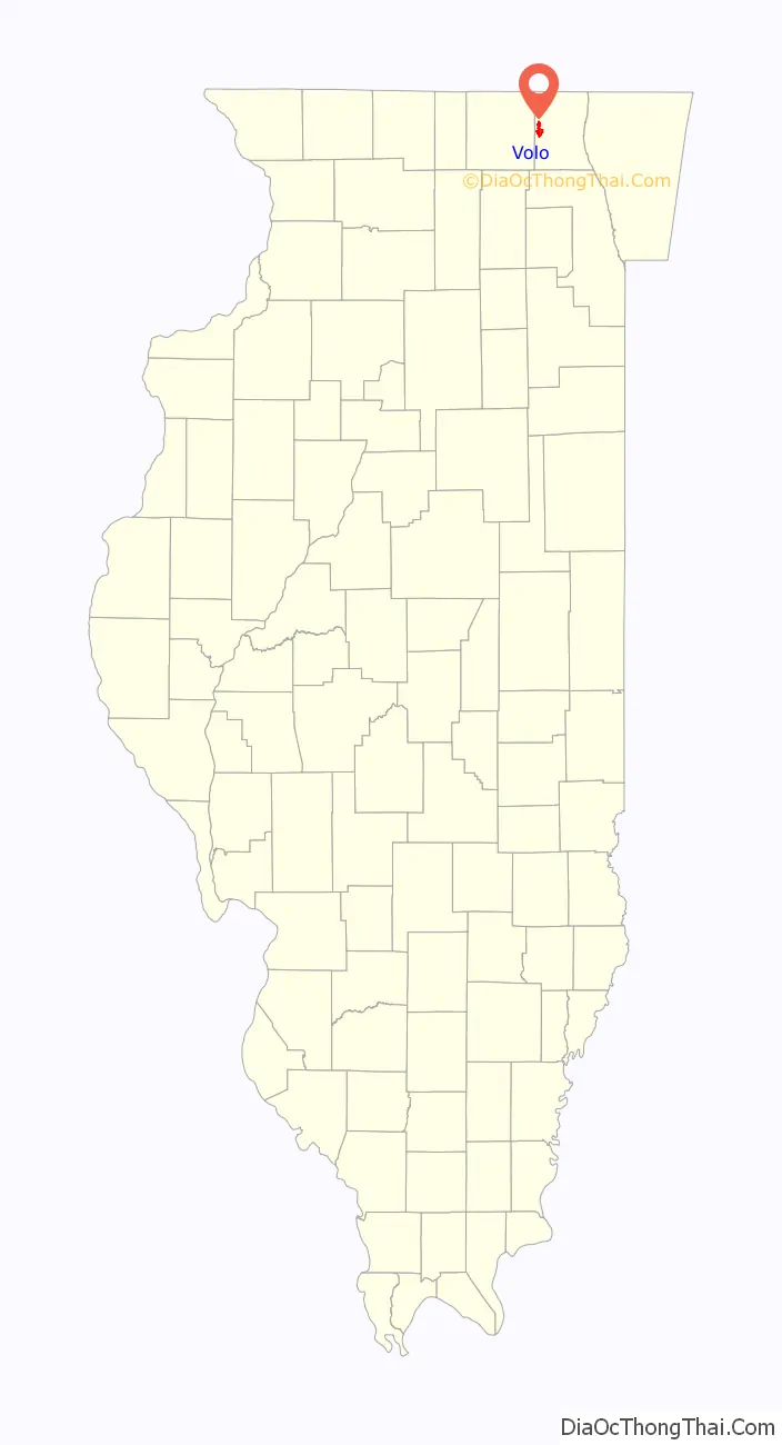
Volo Road Map
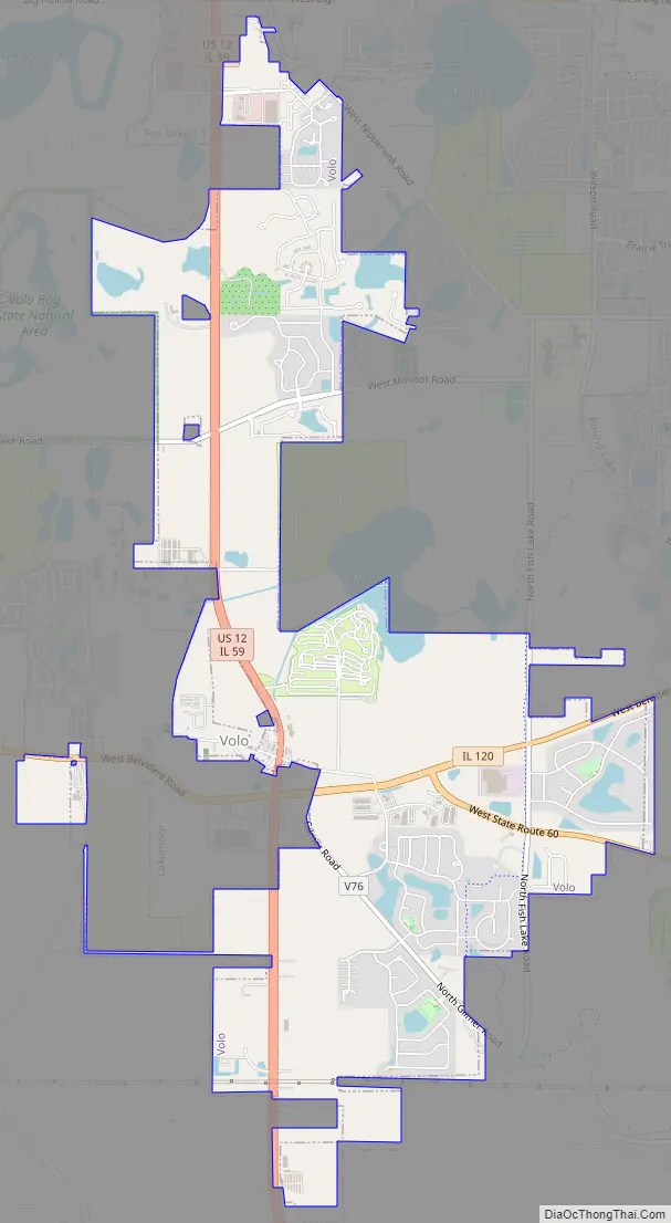
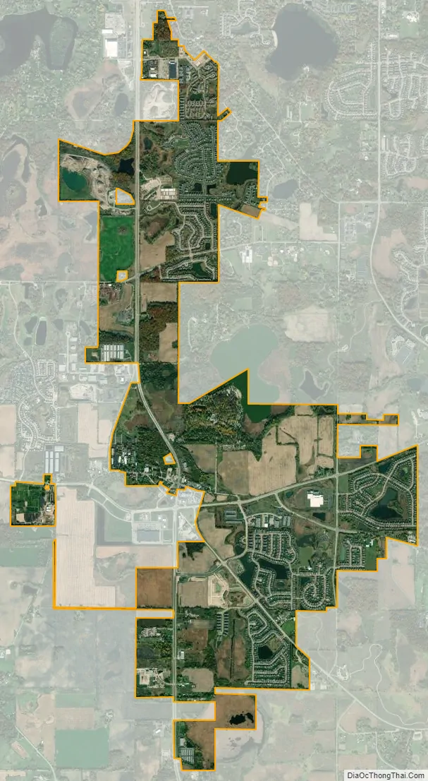
Volo city Satellite Map
Geography
Volo is located at 42°19′52″N 88°9′40″W / 42.33111°N 88.16111°W / 42.33111; -88.16111 (42.331047, -88.160975).
According to the 2010 census, Volo has a total area of 3.998 square miles (10.35 km), of which 3.92 square miles (10.15 km) (or 98.05%) is land and 0.078 square miles (0.20 km) (or 1.95%) is water.
Major streets
- US Route 12
- Illinois Route 59
- Illinois Route 60
- Illinois Route 120 (Belvidere Road)
- Nippersink Road
- Molidor Road
- Fish Lake Road
- Gilmer Road
- Sullivan Lake Road
- Fox Lake Road
- Volo Village Road
See also
Map of Illinois State and its subdivision:- Adams
- Alexander
- Bond
- Boone
- Brown
- Bureau
- Calhoun
- Carroll
- Cass
- Champaign
- Christian
- Clark
- Clay
- Clinton
- Coles
- Cook
- Crawford
- Cumberland
- De Kalb
- De Witt
- Douglas
- Dupage
- Edgar
- Edwards
- Effingham
- Fayette
- Ford
- Franklin
- Fulton
- Gallatin
- Greene
- Grundy
- Hamilton
- Hancock
- Hardin
- Henderson
- Henry
- Iroquois
- Jackson
- Jasper
- Jefferson
- Jersey
- Jo Daviess
- Johnson
- Kane
- Kankakee
- Kendall
- Knox
- La Salle
- Lake
- Lake Michigan
- Lawrence
- Lee
- Livingston
- Logan
- Macon
- Macoupin
- Madison
- Marion
- Marshall
- Mason
- Massac
- McDonough
- McHenry
- McLean
- Menard
- Mercer
- Monroe
- Montgomery
- Morgan
- Moultrie
- Ogle
- Peoria
- Perry
- Piatt
- Pike
- Pope
- Pulaski
- Putnam
- Randolph
- Richland
- Rock Island
- Saint Clair
- Saline
- Sangamon
- Schuyler
- Scott
- Shelby
- Stark
- Stephenson
- Tazewell
- Union
- Vermilion
- Wabash
- Warren
- Washington
- Wayne
- White
- Whiteside
- Will
- Williamson
- Winnebago
- Woodford
- Alabama
- Alaska
- Arizona
- Arkansas
- California
- Colorado
- Connecticut
- Delaware
- District of Columbia
- Florida
- Georgia
- Hawaii
- Idaho
- Illinois
- Indiana
- Iowa
- Kansas
- Kentucky
- Louisiana
- Maine
- Maryland
- Massachusetts
- Michigan
- Minnesota
- Mississippi
- Missouri
- Montana
- Nebraska
- Nevada
- New Hampshire
- New Jersey
- New Mexico
- New York
- North Carolina
- North Dakota
- Ohio
- Oklahoma
- Oregon
- Pennsylvania
- Rhode Island
- South Carolina
- South Dakota
- Tennessee
- Texas
- Utah
- Vermont
- Virginia
- Washington
- West Virginia
- Wisconsin
- Wyoming


