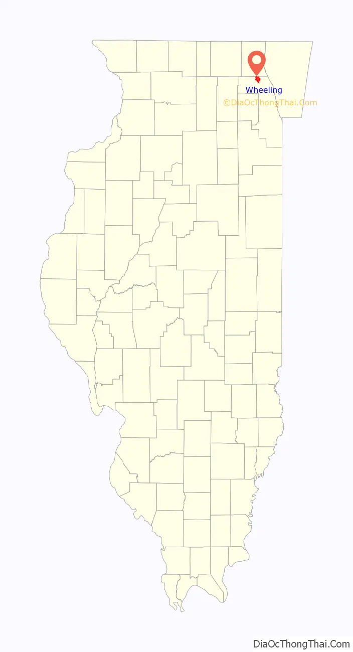
Wheeling is a village in Cook and Lake counties in the U.S. state of Illinois. A suburb of Chicago, it is primarily in Cook County, approximately 23 mi (37 km) northwest of downtown Chicago. Per the 2020 census, the population was 39,137. Wheeling is named for Wheeling, West Virginia.
| Name: | Wheeling village |
|---|---|
| LSAD Code: | 47 |
| LSAD Description: | village (suffix) |
| State: | Illinois |
| County: | Cook County, Lake County |
| Founded: | 1894 |
| Elevation: | 650 ft (200 m) |
| Total Area: | 8.73 sq mi (22.61 km²) |
| Land Area: | 8.67 sq mi (22.46 km²) |
| Water Area: | 0.06 sq mi (0.15 km²) |
| Total Population: | 39,137 |
| Population Density: | 4,513.03/sq mi (1,742.46/km²) |
| Area code: | 847 and 224 |
| FIPS code: | 1781087 |
| GNISfeature ID: | 421000 |
| Website: | www.wheelingil.gov |
Online Interactive Map
Click on ![]() to view map in "full screen" mode.
to view map in "full screen" mode.
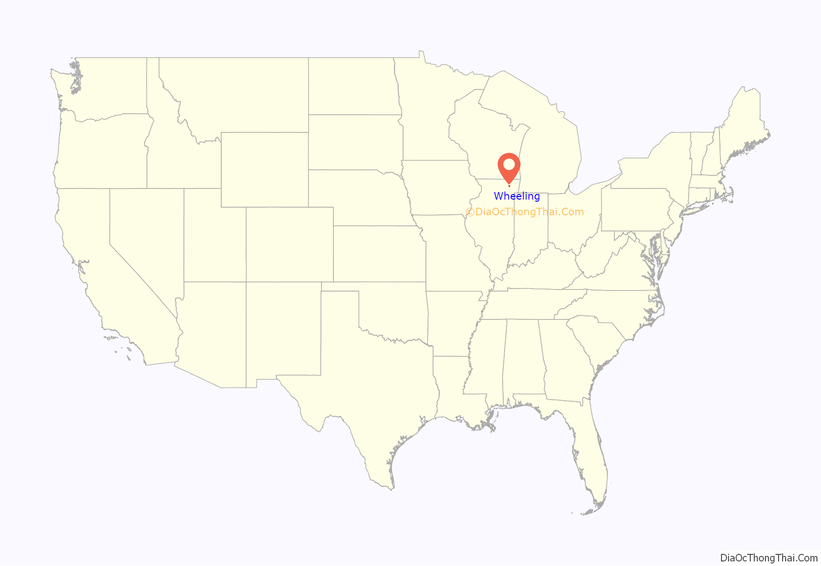
Wheeling location map. Where is Wheeling village?
History
The land that is now Wheeling, Illinois, was controlled by the Miami Confederacy which contained the Illini and Kickapoo tribes) starting in the early 1680s. The Confederacy was driven from the area by the Iroquois and Fox in the early 1700s.
The French-allied Potawatomi began to raid and take possession of Northern Illinois in the 1700s. In the late 1700s and early 1800s, the Potawatomi expanded southwards from their territory in Green Bay and westward from their holdings in Detroit, until they controlled in an L-shaped swath of territory from Green Bay to the Illinois River, and from the Mississippi River to the Maumee River.
The descendants of the Potawatomi who once inhabited the land that is now Wheeling currently live on a reservation in Mayette, Kansas.
The first cabin in Wheeling Township was built by a Mr. Sweet in 1833. He sold it to George Strong for $60, making Mr. Strong the first permanent resident in Wheeling Township.
In 1834, Joseph Filkins opened the first tavern-hotel in the township at the intersection of Dundee Road and Milwaukee Avenue. By 1835, there were 18 cabins in the township, and a post office was established in Filkins’ Tavern.
In 1837, Russell Wheeler and Charles Daniels opened a general store and trading post next to Filkins’ Tavern. The settlers who migrated to that area formed the Village of East Wheeling, which later became known as simply Wheeling.
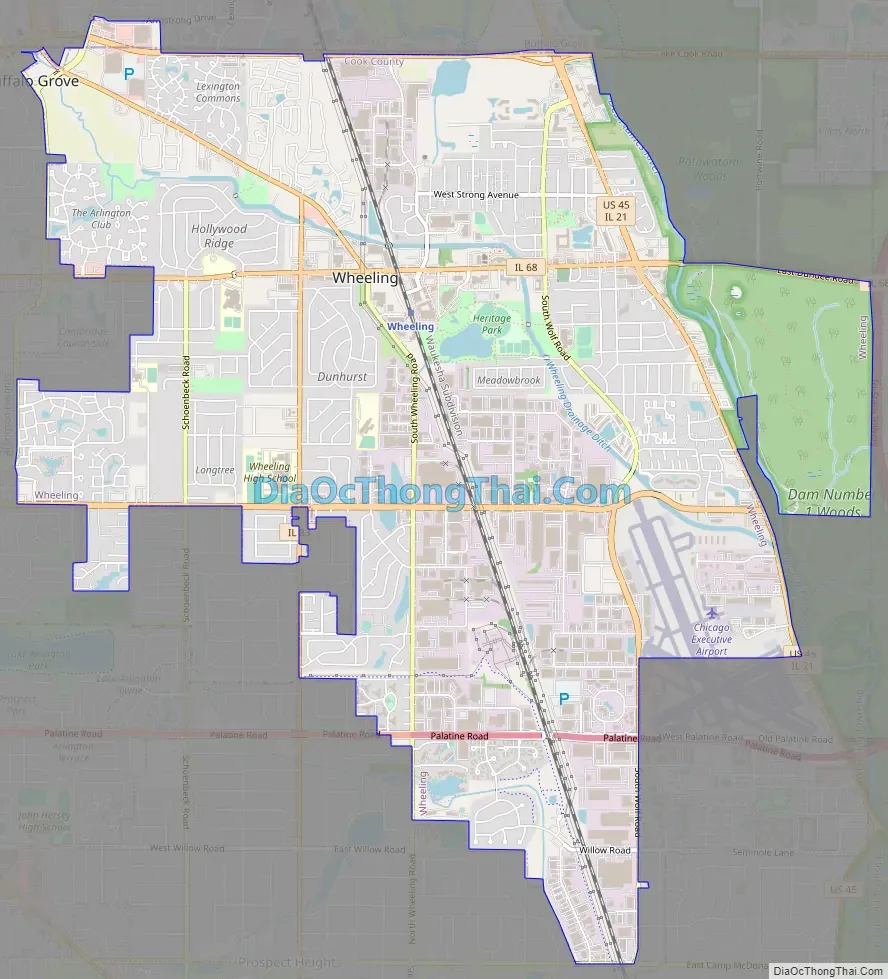
Wheeling Road Map
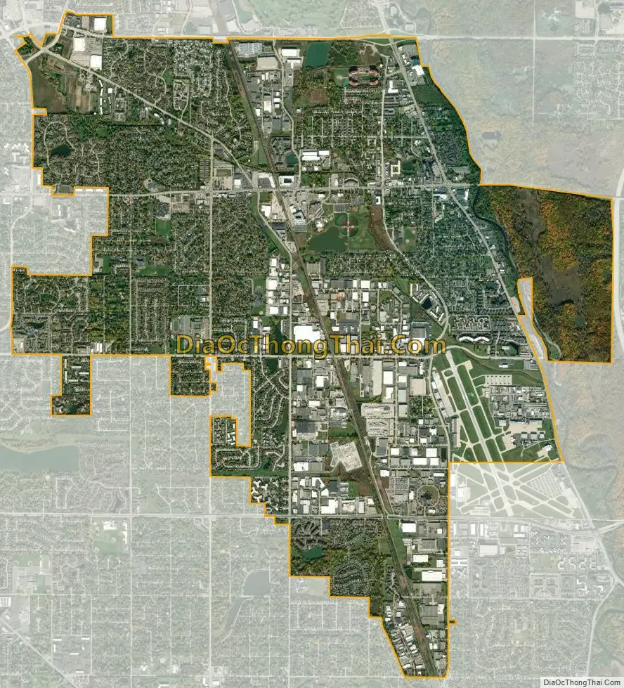
Wheeling city Satellite Map
Geography
According to the 2010 census, the village has a total area of 8.74 square miles (22.6 km), of which 8.74 square miles (22.6 km) (or 97.26%) is land and 0.24 square miles (0.62 km) (or 2.74%) is water.
Climate
The climate in Wheeling can be classified as temperate. Winters are usually very cold and snowy. Summers are often hot and humid, but can be pleasantly warm as well. Precipitation is uniformly distributed throughout the year.
See also
Map of Illinois State and its subdivision:- Adams
- Alexander
- Bond
- Boone
- Brown
- Bureau
- Calhoun
- Carroll
- Cass
- Champaign
- Christian
- Clark
- Clay
- Clinton
- Coles
- Cook
- Crawford
- Cumberland
- De Kalb
- De Witt
- Douglas
- Dupage
- Edgar
- Edwards
- Effingham
- Fayette
- Ford
- Franklin
- Fulton
- Gallatin
- Greene
- Grundy
- Hamilton
- Hancock
- Hardin
- Henderson
- Henry
- Iroquois
- Jackson
- Jasper
- Jefferson
- Jersey
- Jo Daviess
- Johnson
- Kane
- Kankakee
- Kendall
- Knox
- La Salle
- Lake
- Lake Michigan
- Lawrence
- Lee
- Livingston
- Logan
- Macon
- Macoupin
- Madison
- Marion
- Marshall
- Mason
- Massac
- McDonough
- McHenry
- McLean
- Menard
- Mercer
- Monroe
- Montgomery
- Morgan
- Moultrie
- Ogle
- Peoria
- Perry
- Piatt
- Pike
- Pope
- Pulaski
- Putnam
- Randolph
- Richland
- Rock Island
- Saint Clair
- Saline
- Sangamon
- Schuyler
- Scott
- Shelby
- Stark
- Stephenson
- Tazewell
- Union
- Vermilion
- Wabash
- Warren
- Washington
- Wayne
- White
- Whiteside
- Will
- Williamson
- Winnebago
- Woodford
- Alabama
- Alaska
- Arizona
- Arkansas
- California
- Colorado
- Connecticut
- Delaware
- District of Columbia
- Florida
- Georgia
- Hawaii
- Idaho
- Illinois
- Indiana
- Iowa
- Kansas
- Kentucky
- Louisiana
- Maine
- Maryland
- Massachusetts
- Michigan
- Minnesota
- Mississippi
- Missouri
- Montana
- Nebraska
- Nevada
- New Hampshire
- New Jersey
- New Mexico
- New York
- North Carolina
- North Dakota
- Ohio
- Oklahoma
- Oregon
- Pennsylvania
- Rhode Island
- South Carolina
- South Dakota
- Tennessee
- Texas
- Utah
- Vermont
- Virginia
- Washington
- West Virginia
- Wisconsin
- Wyoming


