Wilmette is a village in New Trier Township, Cook County, Illinois, United States. Bordering Lake Michigan and Evanston, Illinois, it is located 14 miles (23 km) north of Chicago’s downtown district. Wilmette had a population of 28,170 at the 2020 census. The first and only Baháʼí House of Worship in North America is located here. Wilmette is also home to Central Elementary School and Romona Elementary School, both recent recipients of the National Blue Ribbon award bestowed by the U.S. Department of Education.
| Name: | Wilmette village |
|---|---|
| LSAD Code: | 47 |
| LSAD Description: | village (suffix) |
| State: | Illinois |
| County: | Cook County |
| Founded: | 1872 |
| Elevation: | 636 ft (194 m) |
| Total Area: | 5.41 sq mi (14.01 km²) |
| Land Area: | 5.40 sq mi (13.99 km²) |
| Water Area: | 0.01 sq mi (0.02 km²) |
| Total Population: | 28,170 |
| Population Density: | 5,215.70/sq mi (2,013.63/km²) |
| Area code: | 847 and 224 |
| FIPS code: | 1782075 |
| Website: | www.wilmette.com |
Online Interactive Map
Click on ![]() to view map in "full screen" mode.
to view map in "full screen" mode.
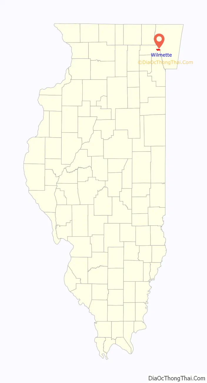
Wilmette location map. Where is Wilmette village?

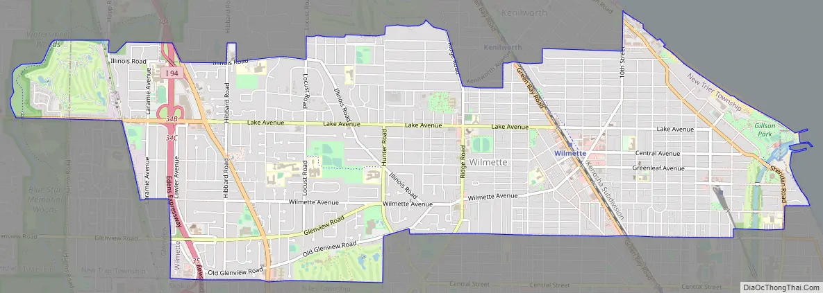
Wilmette Road Map
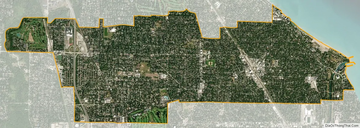
Wilmette city Satellite Map
Geography
Wilmette is located on the western shore of Lake Michigan and is a near northern suburb of Chicago, immediately North of Evanston at 42°4′38″N 87°43′25″W / 42.07722°N 87.72361°W / 42.07722; -87.72361 (42.077178, -87.723736). The North Shore Channel drainage canal is supplied with water from Lake Michigan at Wilmette Harbor.
According to the 2010 census, Wilmette has a total area of 5.409 square miles (14.01 km), of which 5.4 square miles (13.99 km) (or 99.83%) is land and 0.009 square miles (0.02 km) (or 0.17%) is water.
Wilmette has a well-developed urban forest and since 1983 has enjoyed “Tree City” status. As of 2006, village parkways hosted more than 18,600 trees comprising 150 species and sub-species.
See also
Map of Illinois State and its subdivision:- Adams
- Alexander
- Bond
- Boone
- Brown
- Bureau
- Calhoun
- Carroll
- Cass
- Champaign
- Christian
- Clark
- Clay
- Clinton
- Coles
- Cook
- Crawford
- Cumberland
- De Kalb
- De Witt
- Douglas
- Dupage
- Edgar
- Edwards
- Effingham
- Fayette
- Ford
- Franklin
- Fulton
- Gallatin
- Greene
- Grundy
- Hamilton
- Hancock
- Hardin
- Henderson
- Henry
- Iroquois
- Jackson
- Jasper
- Jefferson
- Jersey
- Jo Daviess
- Johnson
- Kane
- Kankakee
- Kendall
- Knox
- La Salle
- Lake
- Lake Michigan
- Lawrence
- Lee
- Livingston
- Logan
- Macon
- Macoupin
- Madison
- Marion
- Marshall
- Mason
- Massac
- McDonough
- McHenry
- McLean
- Menard
- Mercer
- Monroe
- Montgomery
- Morgan
- Moultrie
- Ogle
- Peoria
- Perry
- Piatt
- Pike
- Pope
- Pulaski
- Putnam
- Randolph
- Richland
- Rock Island
- Saint Clair
- Saline
- Sangamon
- Schuyler
- Scott
- Shelby
- Stark
- Stephenson
- Tazewell
- Union
- Vermilion
- Wabash
- Warren
- Washington
- Wayne
- White
- Whiteside
- Will
- Williamson
- Winnebago
- Woodford
- Alabama
- Alaska
- Arizona
- Arkansas
- California
- Colorado
- Connecticut
- Delaware
- District of Columbia
- Florida
- Georgia
- Hawaii
- Idaho
- Illinois
- Indiana
- Iowa
- Kansas
- Kentucky
- Louisiana
- Maine
- Maryland
- Massachusetts
- Michigan
- Minnesota
- Mississippi
- Missouri
- Montana
- Nebraska
- Nevada
- New Hampshire
- New Jersey
- New Mexico
- New York
- North Carolina
- North Dakota
- Ohio
- Oklahoma
- Oregon
- Pennsylvania
- Rhode Island
- South Carolina
- South Dakota
- Tennessee
- Texas
- Utah
- Vermont
- Virginia
- Washington
- West Virginia
- Wisconsin
- Wyoming


