Leitchfield is the county seat of Grayson County, Kentucky, United States. Leitchfield is a home rule-class city with a population of 6,404 as of the 2020 census.
| Name: | Leitchfield city |
|---|---|
| LSAD Code: | 25 |
| LSAD Description: | city (suffix) |
| State: | Kentucky |
| County: | Grayson County |
| Incorporated: | 1866 |
| Elevation: | 745 ft (227 m) |
| Total Area: | 10.79 sq mi (27.96 km²) |
| Land Area: | 10.76 sq mi (27.86 km²) |
| Water Area: | 0.04 sq mi (0.10 km²) |
| Total Population: | 6,404 |
| Population Density: | 595.33/sq mi (229.85/km²) |
| ZIP code: | 42726, 42054, 42755 |
| Area code: | 270 & 364 |
| FIPS code: | 2144686 |
| GNISfeature ID: | 0496280 |
| Website: | www.leitchfield.org |
Online Interactive Map
Click on ![]() to view map in "full screen" mode.
to view map in "full screen" mode.
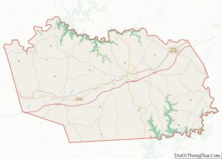
Leitchfield location map. Where is Leitchfield city?


History
The town was named for Major David Leitch, an aide to Gen. George Washington and the original owner of much land in the county, including the town site, at the eastern end of his holdings. The city was formally incorporated by the state assembly in 1866.
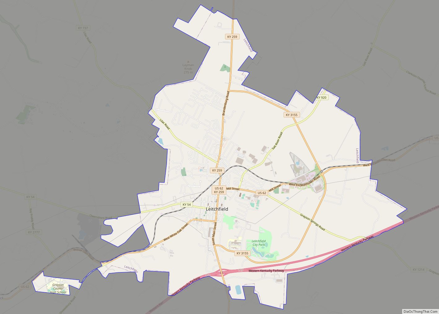
Leitchfield Road Map

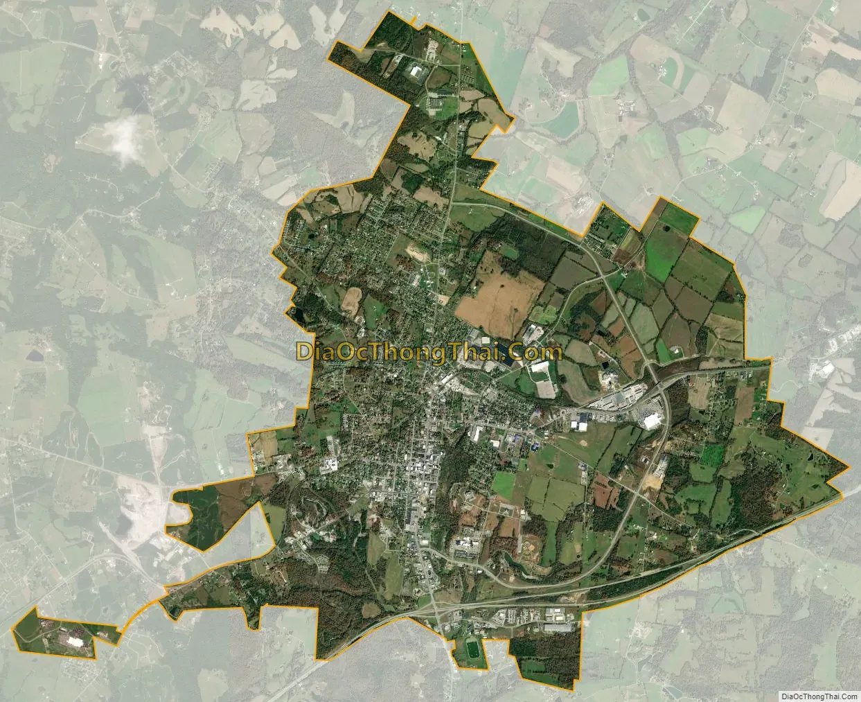
Leitchfield city Satellite Map
Geography
Leitchfield lies in the Clifty Area, the sandstone-dominated belt that is usually classified as part of the West Kentucky Coal Field but separates the coalfield from the limestone-rich Pennyroyal Plateau. A fault running through the area puts limestone at or near the surface, and there are quarries west of town. The city is located along the Western Kentucky Parkway at the junction of Kentucky Route 259. U.S. Route 62 intersects 259 near the middle of town. Leitchfield is situated between Rough River Lake to the north and Nolin River Lake to the south.
According to the United States Census Bureau, the city has a total area of 10.9 square miles (28.2 km), of which 10.8 square miles (28.1 km) is land and 0.04 square miles (0.1 km), or 0.38%, is water.
Climate
The climate in this area is characterized by hot, humid summers and generally mild to cool winters. According to the Köppen Climate Classification system, Leitchfield has a humid subtropical climate, abbreviated “Cfa” on climate maps.
See also
Map of Kentucky State and its subdivision:- Adair
- Allen
- Anderson
- Ballard
- Barren
- Bath
- Bell
- Boone
- Bourbon
- Boyd
- Boyle
- Bracken
- Breathitt
- Breckinridge
- Bullitt
- Butler
- Caldwell
- Calloway
- Campbell
- Carlisle
- Carroll
- Carter
- Casey
- Christian
- Clark
- Clay
- Clinton
- Crittenden
- Cumberland
- Daviess
- Edmonson
- Elliott
- Estill
- Fayette
- Fleming
- Floyd
- Franklin
- Fulton
- Gallatin
- Garrard
- Grant
- Graves
- Grayson
- Green
- Greenup
- Hancock
- Hardin
- Harlan
- Harrison
- Hart
- Henderson
- Henry
- Hickman
- Hopkins
- Jackson
- Jefferson
- Jessamine
- Johnson
- Kenton
- Knott
- Knox
- Larue
- Laurel
- Lawrence
- Lee
- Leslie
- Letcher
- Lewis
- Lincoln
- Livingston
- Logan
- Lyon
- Madison
- Magoffin
- Marion
- Marshall
- Martin
- Mason
- McCracken
- McCreary
- McLean
- Meade
- Menifee
- Mercer
- Metcalfe
- Monroe
- Montgomery
- Morgan
- Muhlenberg
- Nelson
- Nicholas
- Ohio
- Oldham
- Owen
- Owsley
- Pendleton
- Perry
- Pike
- Powell
- Pulaski
- Robertson
- Rockcastle
- Rowan
- Russell
- Scott
- Shelby
- Simpson
- Spencer
- Taylor
- Todd
- Trigg
- Trimble
- Union
- Warren
- Washington
- Wayne
- Webster
- Whitley
- Wolfe
- Woodford
- Alabama
- Alaska
- Arizona
- Arkansas
- California
- Colorado
- Connecticut
- Delaware
- District of Columbia
- Florida
- Georgia
- Hawaii
- Idaho
- Illinois
- Indiana
- Iowa
- Kansas
- Kentucky
- Louisiana
- Maine
- Maryland
- Massachusetts
- Michigan
- Minnesota
- Mississippi
- Missouri
- Montana
- Nebraska
- Nevada
- New Hampshire
- New Jersey
- New Mexico
- New York
- North Carolina
- North Dakota
- Ohio
- Oklahoma
- Oregon
- Pennsylvania
- Rhode Island
- South Carolina
- South Dakota
- Tennessee
- Texas
- Utah
- Vermont
- Virginia
- Washington
- West Virginia
- Wisconsin
- Wyoming