Manchester is a home rule-class city in Clay County, Kentucky, in the United States. It is the seat of its county and the home of a minimum- and medium-security federal prison. The city’s population was 1,255 at the 2010 census.
| Name: | Manchester city |
|---|---|
| LSAD Code: | 25 |
| LSAD Description: | city (suffix) |
| State: | Kentucky |
| County: | Clay County |
| Incorporated: | February 6, 1844 |
| Elevation: | 869 ft (265 m) |
| Total Area: | 2.96 sq mi (7.65 km²) |
| Land Area: | 2.93 sq mi (7.58 km²) |
| Water Area: | 0.03 sq mi (0.07 km²) |
| Total Population: | 1,512 |
| Population Density: | 516.57/sq mi (199.44/km²) |
| ZIP code: | 40962 |
| Area code: | 606 |
| FIPS code: | 2149656 |
| GNISfeature ID: | 0513768 |
| Website: | welovemanchester.com |
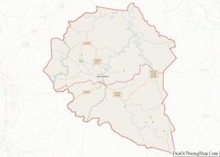
Online Interactive Map
Click on ![]() to view map in "full screen" mode.
to view map in "full screen" mode.
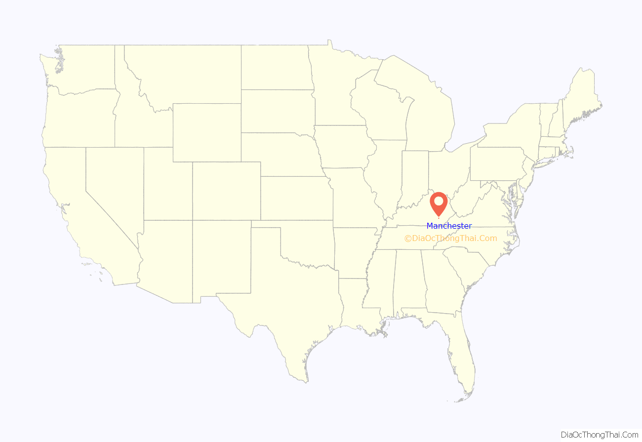
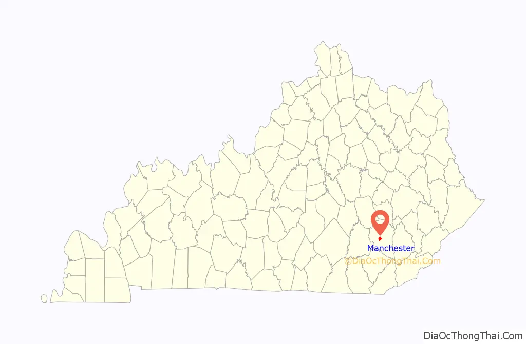
Manchester location map. Where is Manchester city?
History
The town was founded to be the seat of the newly formed Clay Co. in 1807 on a 10-acre (4.0 ha) parcel near the Lower Goose Creek Salt Works. The county court stipulated that the town be named Greenville in honor of the War-of-1812 general who gave the county its name. The Greenville in Muhlenberg County had already preëmpted that name, however, and it was changed to “Manchester” in December. There was a local legend in the town that this was in honor of the hometown of Gen. Garrard’s second wife Lucy Lees, but a prominent local family, the Hollingsworth, were originally from Manchester, England. Rennick points out that Lucy Lees was born well after the naming of the city. He opines that it is more likely that the local businessmen simply wanted a name evocative of the English industrial success.
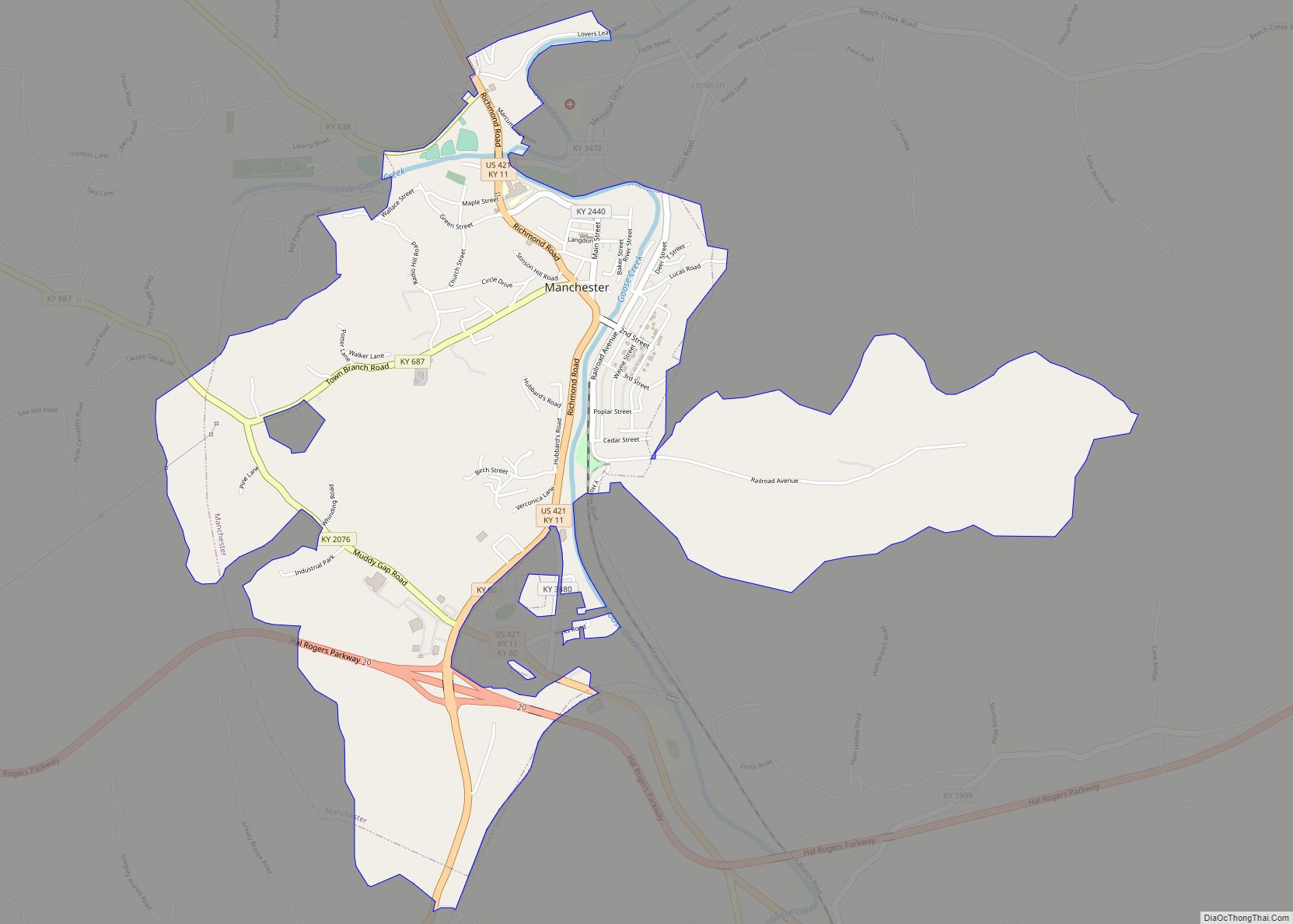
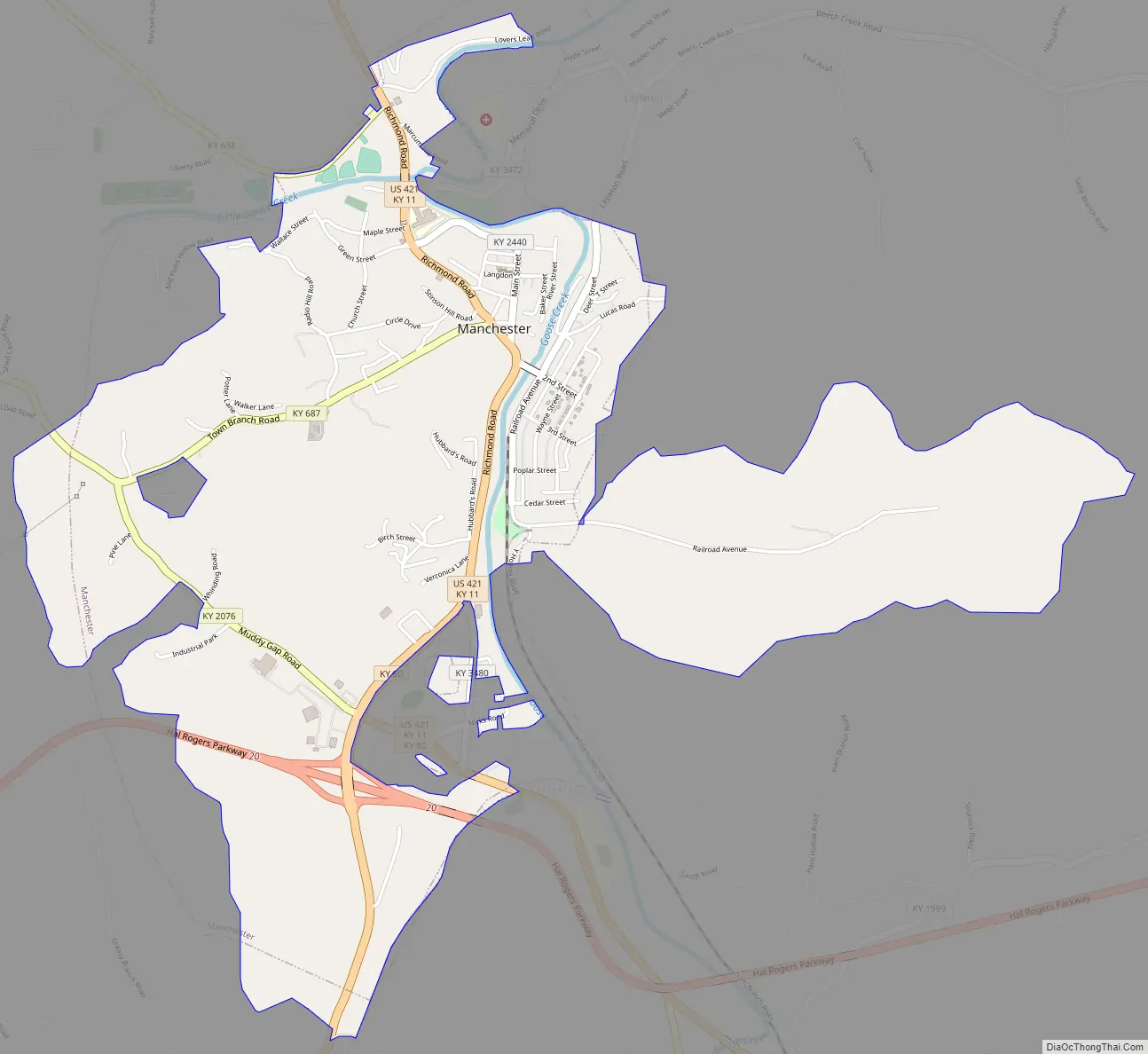
Manchester Road Map
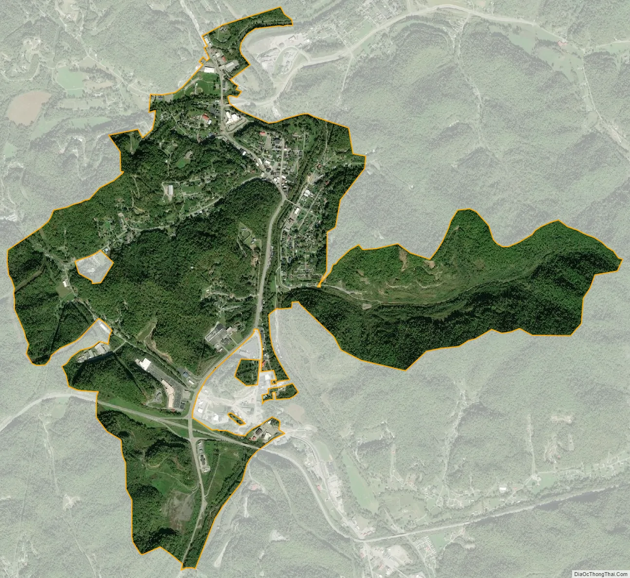
Manchester city Satellite Map
Geography
Manchester is located at 37°9′10″N 83°45′48″W / 37.15278°N 83.76333°W / 37.15278; -83.76333 (37.152818, -83.763403). According to the United States Census Bureau, the city has a total area of 1.5 square miles (3.9 km), all land.
See also
Map of Kentucky State and its subdivision:- Adair
- Allen
- Anderson
- Ballard
- Barren
- Bath
- Bell
- Boone
- Bourbon
- Boyd
- Boyle
- Bracken
- Breathitt
- Breckinridge
- Bullitt
- Butler
- Caldwell
- Calloway
- Campbell
- Carlisle
- Carroll
- Carter
- Casey
- Christian
- Clark
- Clay
- Clinton
- Crittenden
- Cumberland
- Daviess
- Edmonson
- Elliott
- Estill
- Fayette
- Fleming
- Floyd
- Franklin
- Fulton
- Gallatin
- Garrard
- Grant
- Graves
- Grayson
- Green
- Greenup
- Hancock
- Hardin
- Harlan
- Harrison
- Hart
- Henderson
- Henry
- Hickman
- Hopkins
- Jackson
- Jefferson
- Jessamine
- Johnson
- Kenton
- Knott
- Knox
- Larue
- Laurel
- Lawrence
- Lee
- Leslie
- Letcher
- Lewis
- Lincoln
- Livingston
- Logan
- Lyon
- Madison
- Magoffin
- Marion
- Marshall
- Martin
- Mason
- McCracken
- McCreary
- McLean
- Meade
- Menifee
- Mercer
- Metcalfe
- Monroe
- Montgomery
- Morgan
- Muhlenberg
- Nelson
- Nicholas
- Ohio
- Oldham
- Owen
- Owsley
- Pendleton
- Perry
- Pike
- Powell
- Pulaski
- Robertson
- Rockcastle
- Rowan
- Russell
- Scott
- Shelby
- Simpson
- Spencer
- Taylor
- Todd
- Trigg
- Trimble
- Union
- Warren
- Washington
- Wayne
- Webster
- Whitley
- Wolfe
- Woodford
- Alabama
- Alaska
- Arizona
- Arkansas
- California
- Colorado
- Connecticut
- Delaware
- District of Columbia
- Florida
- Georgia
- Hawaii
- Idaho
- Illinois
- Indiana
- Iowa
- Kansas
- Kentucky
- Louisiana
- Maine
- Maryland
- Massachusetts
- Michigan
- Minnesota
- Mississippi
- Missouri
- Montana
- Nebraska
- Nevada
- New Hampshire
- New Jersey
- New Mexico
- New York
- North Carolina
- North Dakota
- Ohio
- Oklahoma
- Oregon
- Pennsylvania
- Rhode Island
- South Carolina
- South Dakota
- Tennessee
- Texas
- Utah
- Vermont
- Virginia
- Washington
- West Virginia
- Wisconsin
- Wyoming