Stanton is a home rule-class city in and the county seat of Powell County, Kentucky, United States. The population was 2,733 at the 2010 census.
Stanton is the birthplace of Hall of Fame thoroughbred horse trainer Woody Stephens.
| Name: | Stanton city |
|---|---|
| LSAD Code: | 25 |
| LSAD Description: | city (suffix) |
| State: | Kentucky |
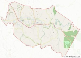
| County: | Powell County |
| Incorporated: | March 9, 1854 |
| Elevation: | 673 ft (205 m) |
| Total Area: | 2.28 sq mi (5.91 km²) |
| Land Area: | 2.28 sq mi (5.90 km²) |
| Water Area: | 0.01 sq mi (0.01 km²) |
| Total Population: | 3,251 |
| Population Density: | 1,428.38/sq mi (551.47/km²) |
| ZIP code: | 40380 |
| Area code: | 606 |
| FIPS code: | 2173164 |
| GNISfeature ID: | 0515661 |
| Website: | www.stantonky.gov |
Online Interactive Map
Click on ![]() to view map in "full screen" mode.
to view map in "full screen" mode.
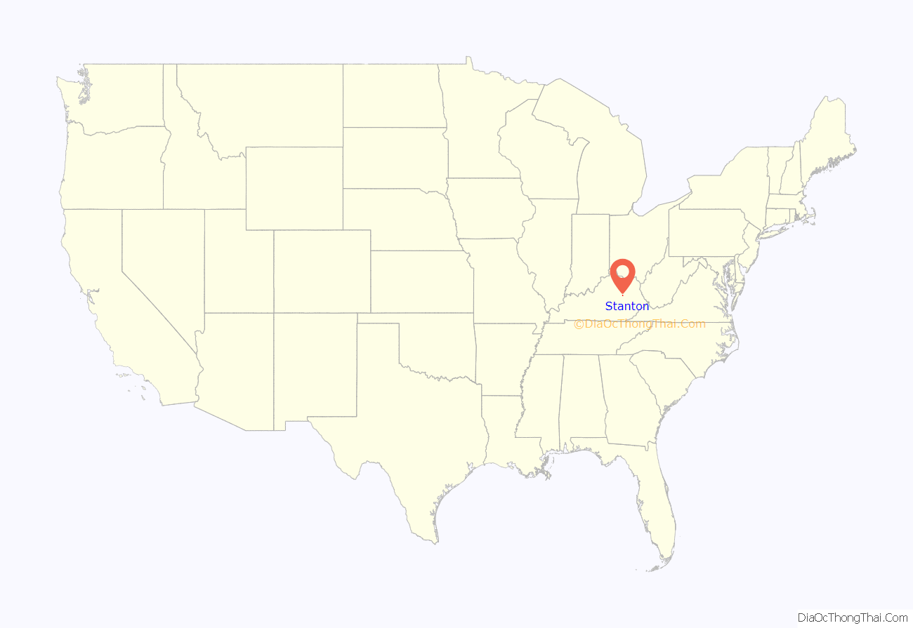
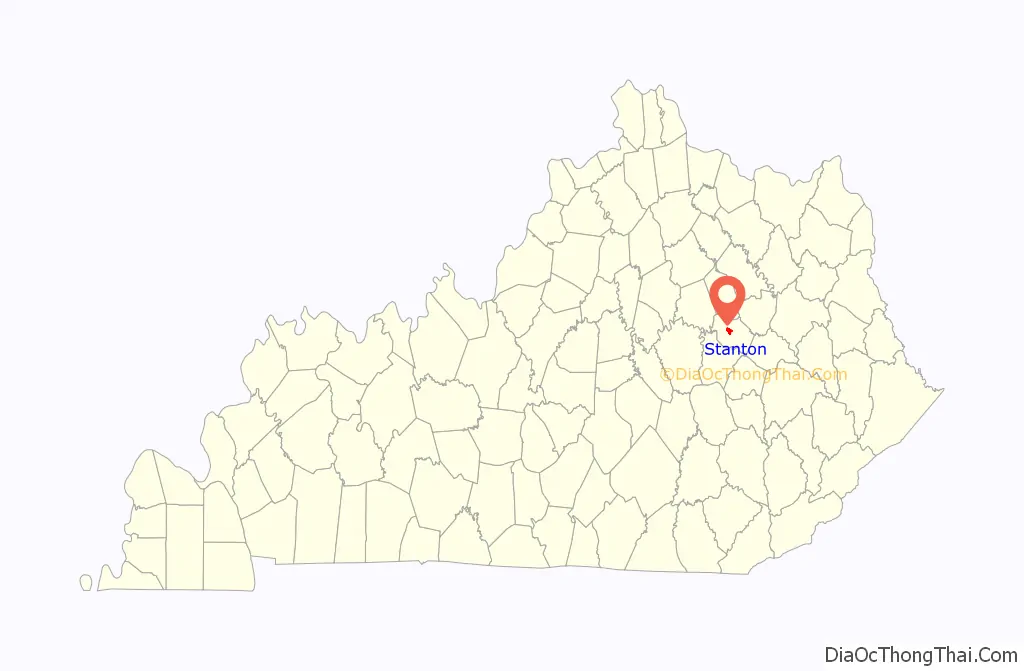
Stanton location map. Where is Stanton city?
History
The first post office to be located in present-day Stanton was established on July 7, 1849 and was named Beaver Pond, because of the settlement’s proximity to a small body of water resulting from a beaver dam. In 1852, both the post office and the settlement were renamed Stanton for Richard H. Stanton, who served in Congress from 1849 to 1855 and later as a U.S. senator.
In the late 1800s and early 1900s, Stanton (and nearby Clay City) were booming logging centers for Eastern Kentucky. The city was also connected to much of the country by a railroad that went through the city and county. Since then the railroad has been removed. The original train depot still exists and is home to the Powell County Tourism Association.
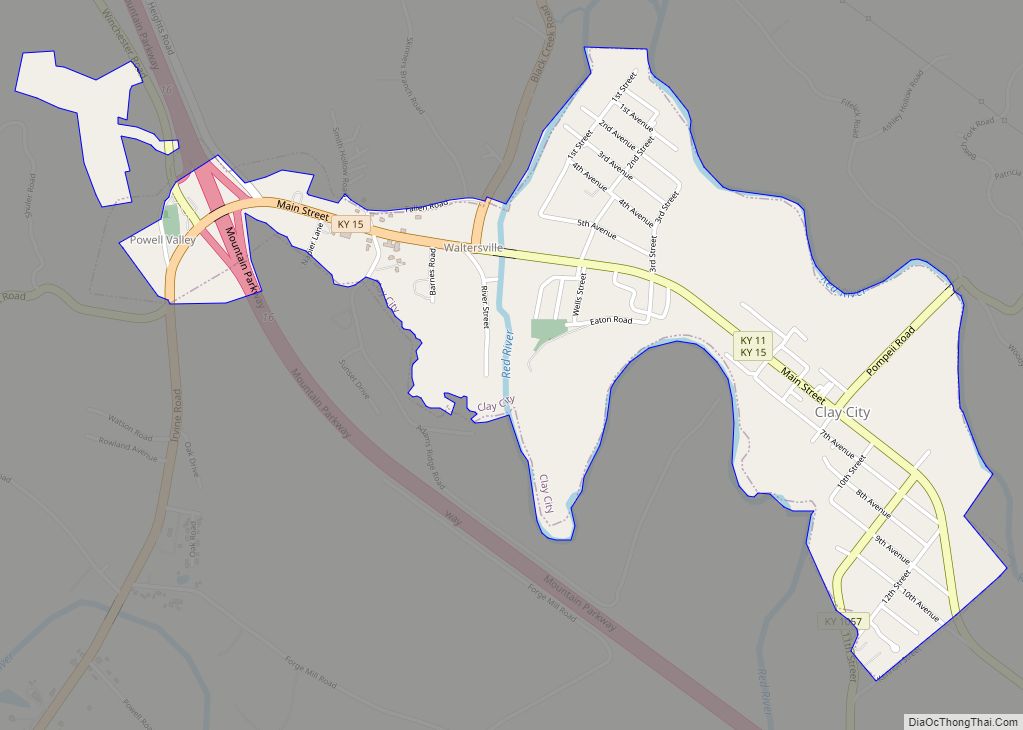
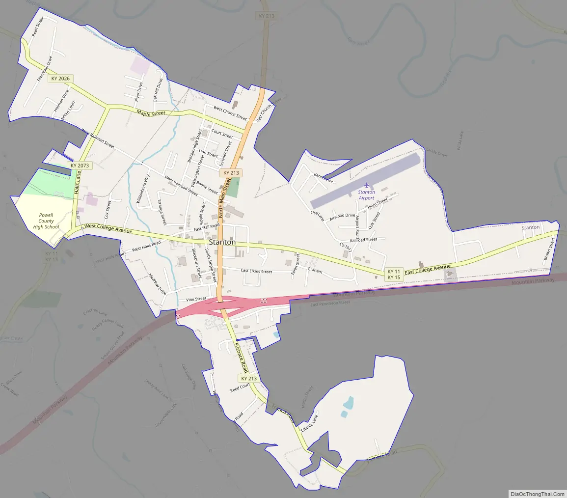
Stanton Road Map
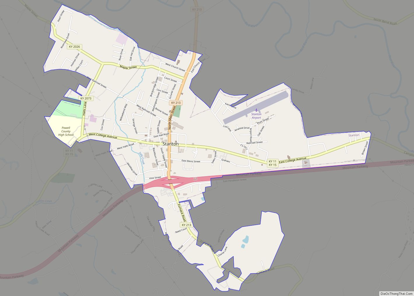
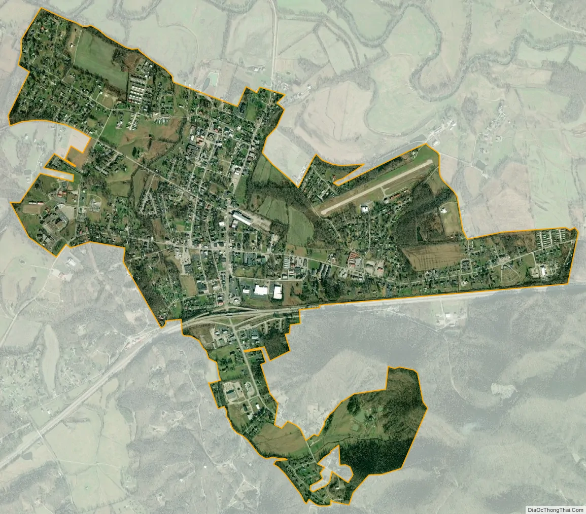
Stanton city Satellite Map
Geography
Stanton is located at 37°50′51″N 83°51′33″W / 37.84750°N 83.85917°W / 37.84750; -83.85917 (37.847610, -83.859250). Stanton lies in the floodplain of the Red River.
According to the United States Census Bureau, the city has a total area of 2.0 square miles (5.2 km), all land.
See also
Map of Kentucky State and its subdivision:- Adair
- Allen
- Anderson
- Ballard
- Barren
- Bath
- Bell
- Boone
- Bourbon
- Boyd
- Boyle
- Bracken
- Breathitt
- Breckinridge
- Bullitt
- Butler
- Caldwell
- Calloway
- Campbell
- Carlisle
- Carroll
- Carter
- Casey
- Christian
- Clark
- Clay
- Clinton
- Crittenden
- Cumberland
- Daviess
- Edmonson
- Elliott
- Estill
- Fayette
- Fleming
- Floyd
- Franklin
- Fulton
- Gallatin
- Garrard
- Grant
- Graves
- Grayson
- Green
- Greenup
- Hancock
- Hardin
- Harlan
- Harrison
- Hart
- Henderson
- Henry
- Hickman
- Hopkins
- Jackson
- Jefferson
- Jessamine
- Johnson
- Kenton
- Knott
- Knox
- Larue
- Laurel
- Lawrence
- Lee
- Leslie
- Letcher
- Lewis
- Lincoln
- Livingston
- Logan
- Lyon
- Madison
- Magoffin
- Marion
- Marshall
- Martin
- Mason
- McCracken
- McCreary
- McLean
- Meade
- Menifee
- Mercer
- Metcalfe
- Monroe
- Montgomery
- Morgan
- Muhlenberg
- Nelson
- Nicholas
- Ohio
- Oldham
- Owen
- Owsley
- Pendleton
- Perry
- Pike
- Powell
- Pulaski
- Robertson
- Rockcastle
- Rowan
- Russell
- Scott
- Shelby
- Simpson
- Spencer
- Taylor
- Todd
- Trigg
- Trimble
- Union
- Warren
- Washington
- Wayne
- Webster
- Whitley
- Wolfe
- Woodford
- Alabama
- Alaska
- Arizona
- Arkansas
- California
- Colorado
- Connecticut
- Delaware
- District of Columbia
- Florida
- Georgia
- Hawaii
- Idaho
- Illinois
- Indiana
- Iowa
- Kansas
- Kentucky
- Louisiana
- Maine
- Maryland
- Massachusetts
- Michigan
- Minnesota
- Mississippi
- Missouri
- Montana
- Nebraska
- Nevada
- New Hampshire
- New Jersey
- New Mexico
- New York
- North Carolina
- North Dakota
- Ohio
- Oklahoma
- Oregon
- Pennsylvania
- Rhode Island
- South Carolina
- South Dakota
- Tennessee
- Texas
- Utah
- Vermont
- Virginia
- Washington
- West Virginia
- Wisconsin
- Wyoming