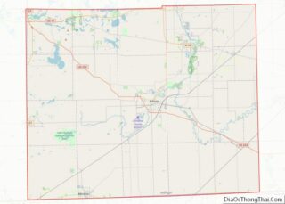
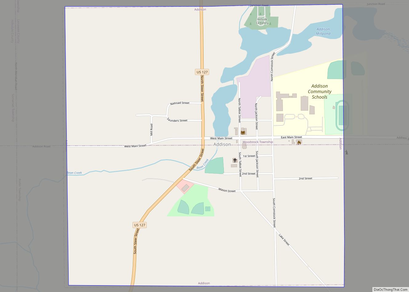
Addison is a village in Lenawee County of the U.S. state of Michigan. The population was 573 at the 2020 census. The village is located on the boundary between Rollin Township on the south and Woodstock Township on the north.
| Name: | Addison village |
|---|---|
| LSAD Code: | 47 |
| LSAD Description: | village (suffix) |
| State: | Michigan |
| County: | Lenawee County |
| Incorporated: | 1893 |
| Elevation: | 1,066 ft (325 m) |
| Total Area: | 1.00 sq mi (2.59 km²) |
| Land Area: | 0.95 sq mi (2.47 km²) |
| Water Area: | 0.04 sq mi (0.11 km²) |
| Total Population: | 573 |
| Population Density: | 600.00/sq mi (231.57/km²) |
| Area code: | 517 |
| FIPS code: | 2600380 |
| GNISfeature ID: | 2397912 |
Online Interactive Map
Click on ![]() to view map in "full screen" mode.
to view map in "full screen" mode.
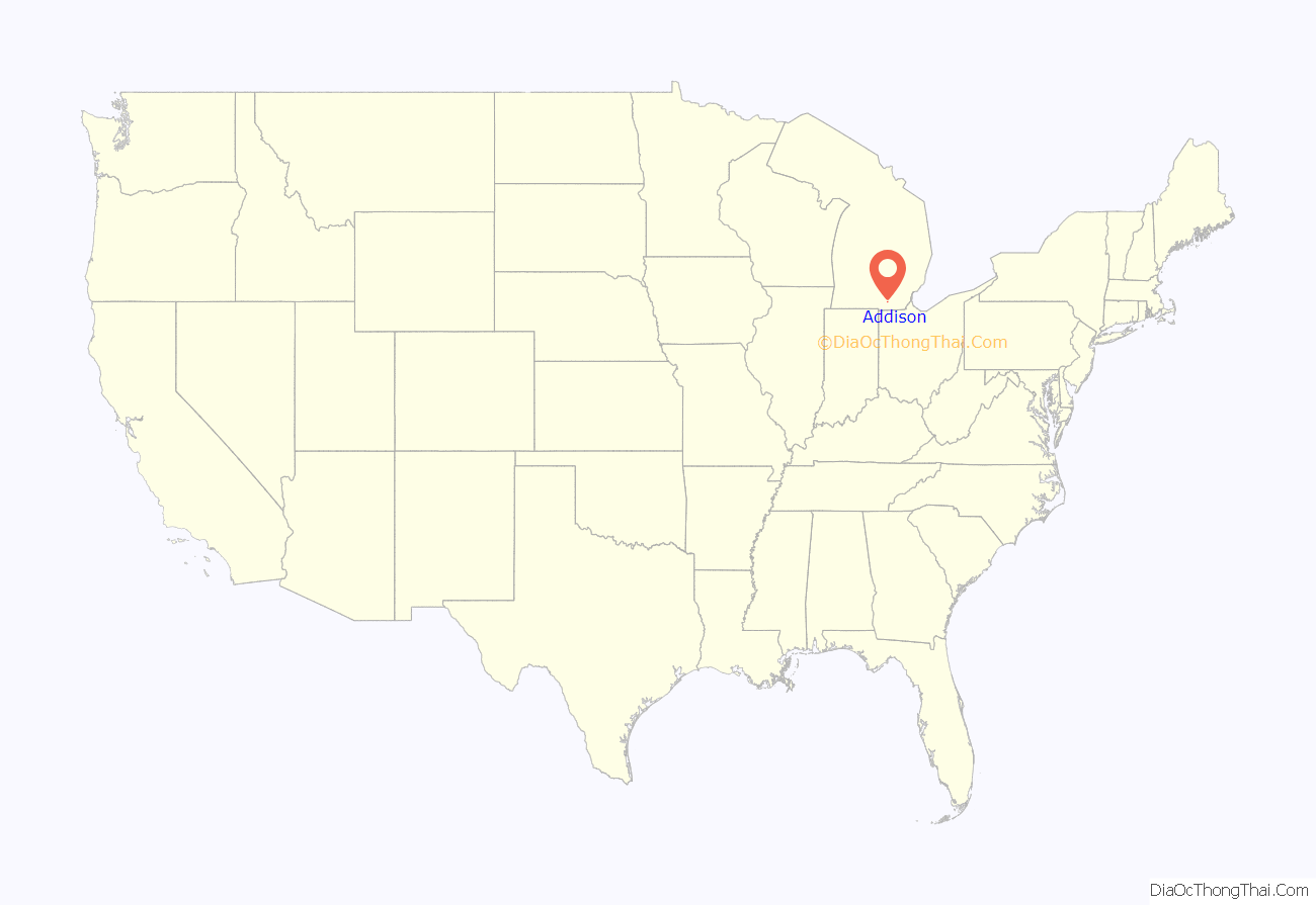
Addison location map. Where is Addison village?

History
In 1834, when John Talbot settled along a winding creek in the infancy of southeast Michigan’s history, the area was a vast forest, dotted with clear blue lakes and occupied by the Potawatomi. With the raising of a simple grist mill along Bean Creek around December 1835, Addison’s history was started, operating under the settlement name “Manetue.”
Having failed to secure a spot along the river that provided enough water power to run his mill, Talbot dismantled the settlement and moved to the present location of Addison, and by the fall of 1836, milling operations restarted. The town was renamed “Peru” by 1838, and over the next generation would be given several other monikers before the final name of Addison was entered onto plat maps in 1851. Addison J. Comstock, a banker from Adrian, Michigan, purchased a sizable plat of the pioneer town and changed the identity to reflect this acquisition. The village itself was incorporated as such in 1893.
The village grew sufficiently to attract the railroad in 1883, an event which contributed to a sudden expansion of the local economy. Businesses came to Addison in great numbers including a three-story hotel, designed to cater to the visiting tourist. The Addison Courier newspaper started its 76-year run in 1884, and the economic upturn brought on by the railroad continued well after the line ceased to operate through Addison.
One of Addison’s last landmarks, the old grist mill built in 1848, was removed in 1980. Despite the economic downturn of the village in the last half of the 20th century, a large 3-day sesquicentennial celebration was held in 1984. Additionally, a 175th Anniversary celebration spanning only one day was held in the village on August 8, 2009. In the later 2010s, the medical cannabis industry identified Addison as a community open to economic expansion with provisioning and grow centers. As of 2022, Addison has two open facilities and two additional operations under construction.
Two history books have been written on the village in recent years, “The History of Addison, Michigan” in 1996 and “Memories of Addison” in 2013, both by village historian Dan Cherry. Among the early village historians were A.J. Kempton, Richard DeGreene, J. DeWitt McLouth and Alice Slocum.
Addison got its own radio station in August 2014 with the sign-on of WQAR-LP “Q95 the Panther” at 95.7 FM. The station is owned by Addison Community Schools and programmed by students with classic rock music.
Addison Community Schools is a K-12 central campus with 729 students. The current superintendent, set to retire June 30, 2022, is Steve Guerra. The incoming superintendent is Daniel Patterson. The school mascot is a black panther.
Addison Road Map
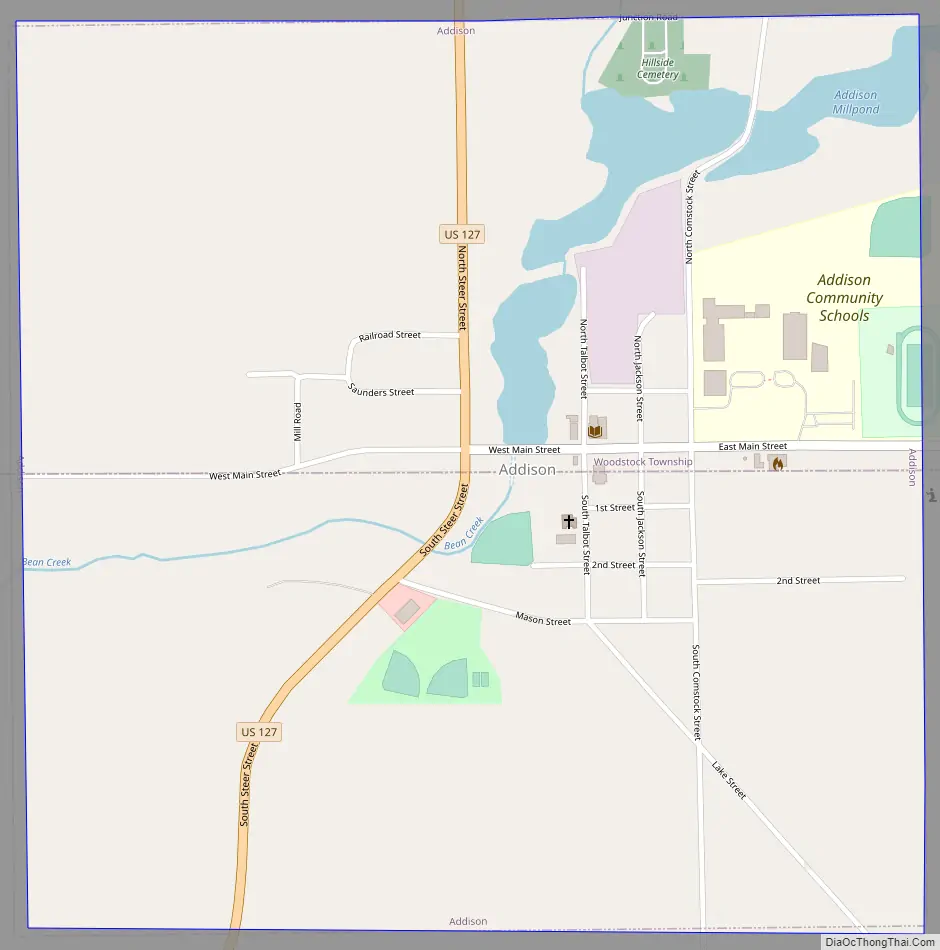
Addison city Satellite Map

Geography
According to the United States Census Bureau, the village has a total area of 1.00 square mile (2.59 km), of which 0.96 square miles (2.49 km) is land and 0.04 square miles (0.10 km) is water.
See also
Map of Michigan State and its subdivision:- Alcona
- Alger
- Allegan
- Alpena
- Antrim
- Arenac
- Baraga
- Barry
- Bay
- Benzie
- Berrien
- Branch
- Calhoun
- Cass
- Charlevoix
- Cheboygan
- Chippewa
- Clare
- Clinton
- Crawford
- Delta
- Dickinson
- Eaton
- Emmet
- Genesee
- Gladwin
- Gogebic
- Grand Traverse
- Gratiot
- Hillsdale
- Houghton
- Huron
- Ingham
- Ionia
- Iosco
- Iron
- Isabella
- Jackson
- Kalamazoo
- Kalkaska
- Kent
- Keweenaw
- Lake
- Lake Hurron
- Lake Michigan
- Lake St. Clair
- Lake Superior
- Lapeer
- Leelanau
- Lenawee
- Livingston
- Luce
- Mackinac
- Macomb
- Manistee
- Marquette
- Mason
- Mecosta
- Menominee
- Midland
- Missaukee
- Monroe
- Montcalm
- Montmorency
- Muskegon
- Newaygo
- Oakland
- Oceana
- Ogemaw
- Ontonagon
- Osceola
- Oscoda
- Otsego
- Ottawa
- Presque Isle
- Roscommon
- Saginaw
- Saint Clair
- Saint Joseph
- Sanilac
- Schoolcraft
- Shiawassee
- Tuscola
- Van Buren
- Washtenaw
- Wayne
- Wexford
- Alabama
- Alaska
- Arizona
- Arkansas
- California
- Colorado
- Connecticut
- Delaware
- District of Columbia
- Florida
- Georgia
- Hawaii
- Idaho
- Illinois
- Indiana
- Iowa
- Kansas
- Kentucky
- Louisiana
- Maine
- Maryland
- Massachusetts
- Michigan
- Minnesota
- Mississippi
- Missouri
- Montana
- Nebraska
- Nevada
- New Hampshire
- New Jersey
- New Mexico
- New York
- North Carolina
- North Dakota
- Ohio
- Oklahoma
- Oregon
- Pennsylvania
- Rhode Island
- South Carolina
- South Dakota
- Tennessee
- Texas
- Utah
- Vermont
- Virginia
- Washington
- West Virginia
- Wisconsin
- Wyoming