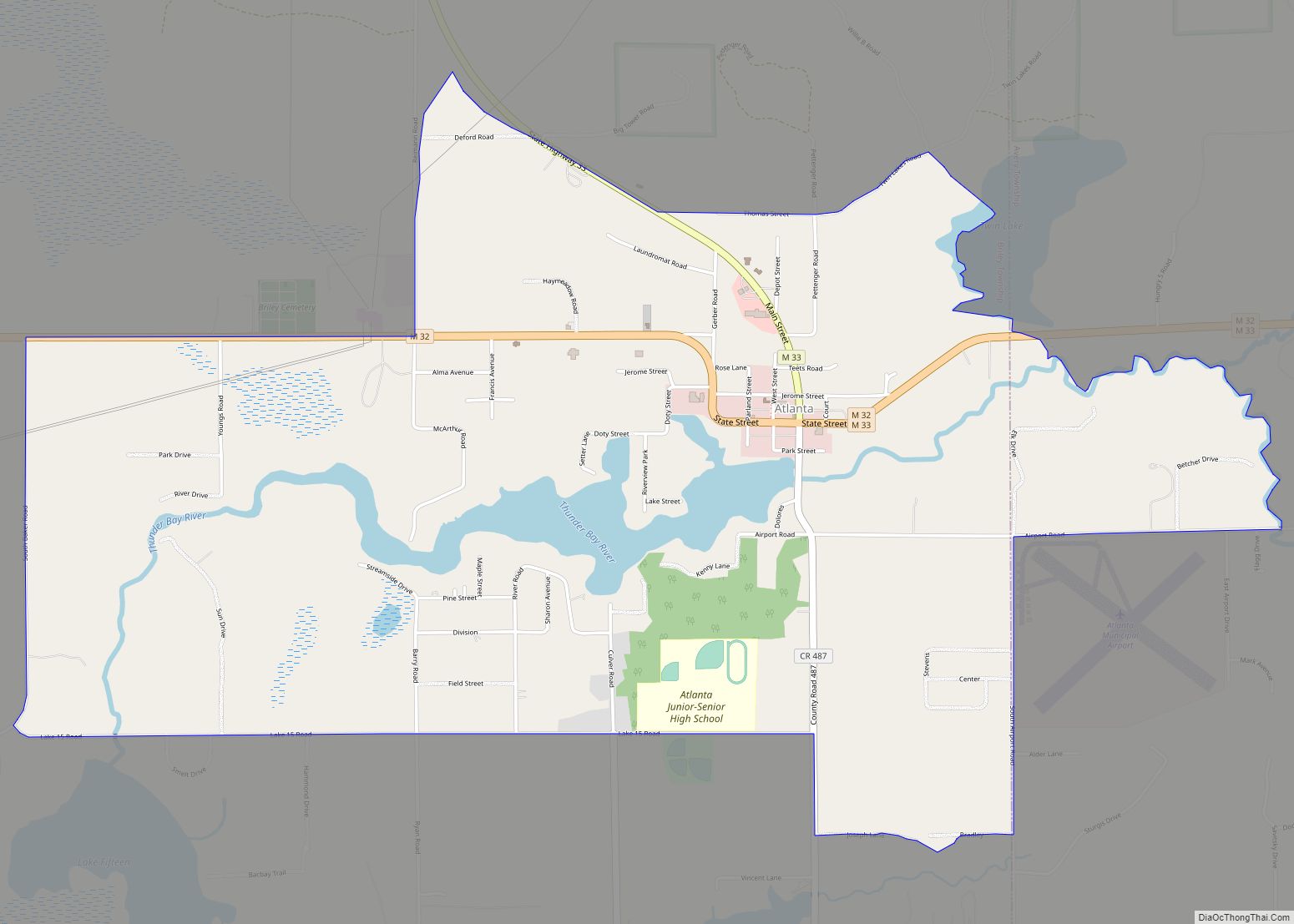
Atlanta is an unincorporated community in the U.S. state of Michigan, along the 45th parallel. It is a census-designated place (CDP) for statistical purposes and does not have any legal status as an incorporated municipality. The population was 757 at the 2000 census. It is the county seat of Montmorency County.
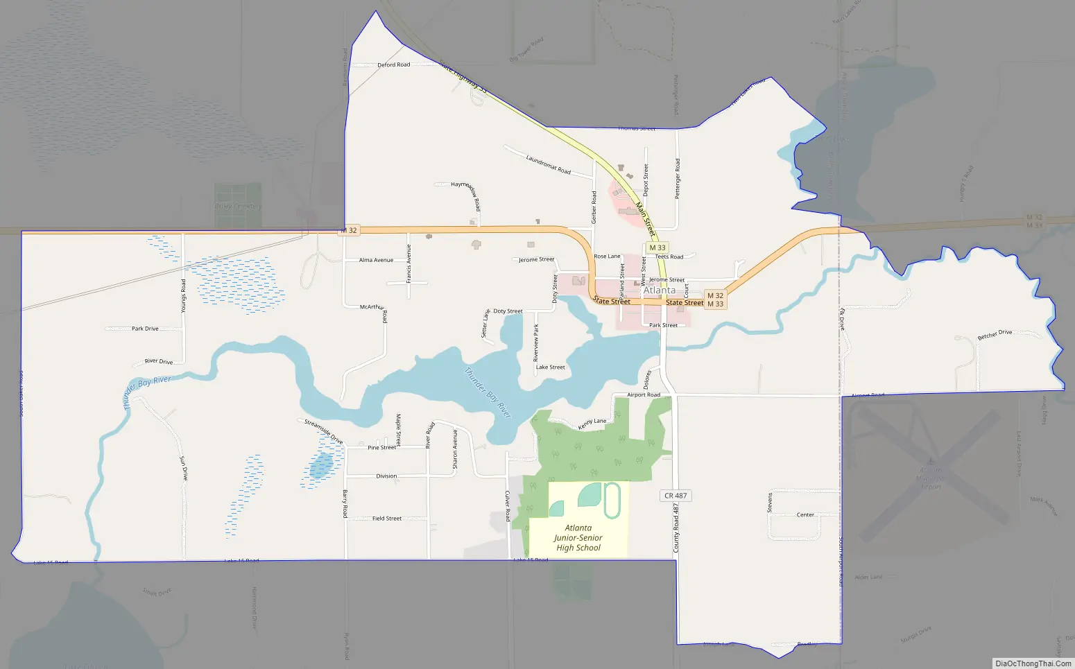
The community is centered on the junction between M-32 and M-33 at 45°00′17″N 84°08′38″W / 45.00472°N 84.14389°W / 45.00472; -84.14389 in the east-central portion of Briley Township. East of Atlanta, M-32 and M-33 run concurrently for about six miles. The CDP also includes a small portion of Avery Township east of Atlanta and south of the Thunder Bay River. The Atlanta post office opened under the name Big Rock on March 24, 1882; the name was changed to Atlanta on October 2, 1882.
The Sno*Drift rally racing event is held in Atlanta annually. The event is currently the first Rally America National Rally Championship event of the season.
| Name: | Atlanta CDP |
|---|---|
| LSAD Code: | 57 |
| LSAD Description: | CDP (suffix) |
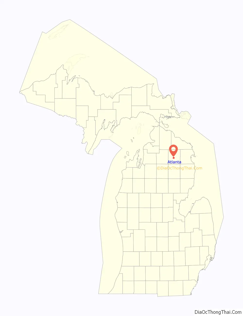
| State: | Michigan |
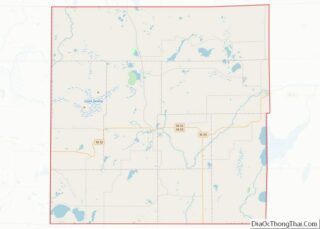
| County: | Montmorency County |
| Elevation: | 892 ft (272 m) |
| Total Area: | 3.78 sq mi (9.80 km²) |
| Land Area: | 3.61 sq mi (9.35 km²) |
| Water Area: | 0.17 sq mi (0.45 km²) |
| Total Population: | 720 |
| Population Density: | 199.39/sq mi (76.98/km²) |
| ZIP code: | 49709 |
| Area code: | 989 |
| FIPS code: | 2603920 |
| GNISfeature ID: | 0620305 |
Online Interactive Map
Click on ![]() to view map in "full screen" mode.
to view map in "full screen" mode.
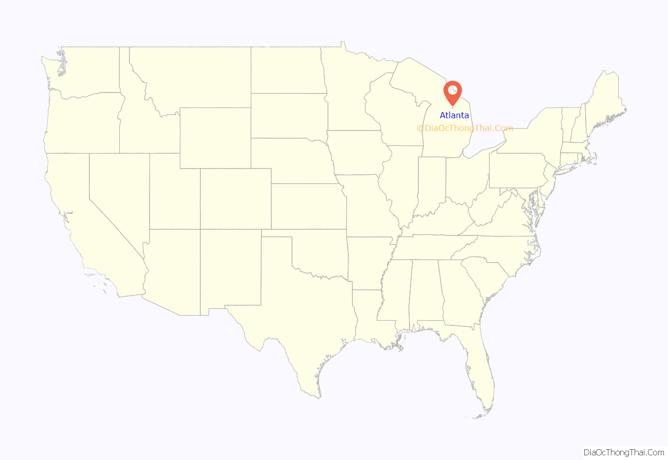
Atlanta location map. Where is Atlanta CDP?
History
Atlanta was established in 1881 by Alfred J. West.
Atlanta Road Map
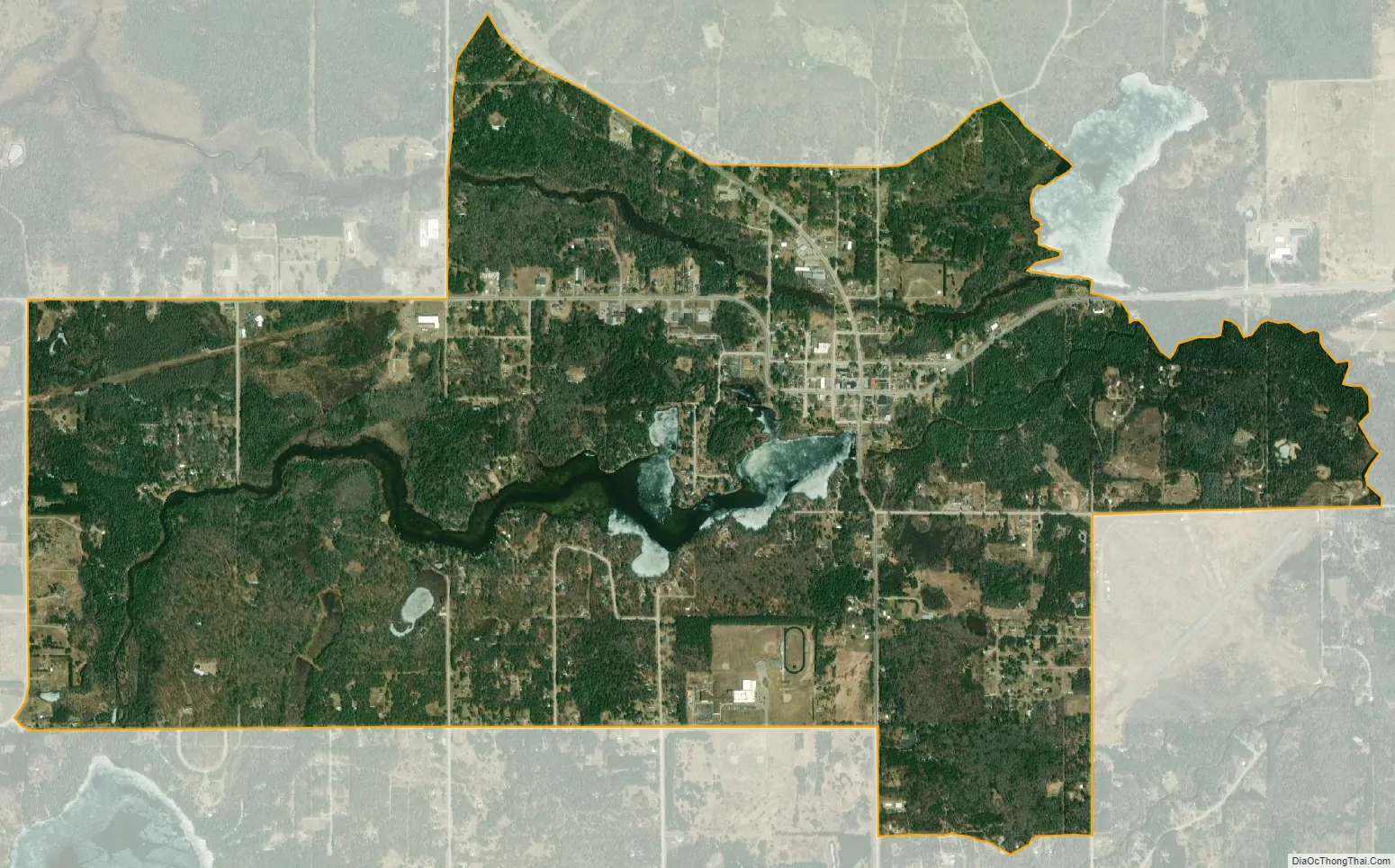
Atlanta city Satellite Map
Geography
According to the United States Census Bureau, the CDP has a total area of 2.9 square miles (7.5 km), of which, 2.7 square miles (7.0 km) of it is land and 0.2 square miles (0.52 km) of it (5.90%) is water. The Thunder Bay River flows into the community from the southwest and exits to the southeast.
See also
Map of Michigan State and its subdivision:- Alcona
- Alger
- Allegan
- Alpena
- Antrim
- Arenac
- Baraga
- Barry
- Bay
- Benzie
- Berrien
- Branch
- Calhoun
- Cass
- Charlevoix
- Cheboygan
- Chippewa
- Clare
- Clinton
- Crawford
- Delta
- Dickinson
- Eaton
- Emmet
- Genesee
- Gladwin
- Gogebic
- Grand Traverse
- Gratiot
- Hillsdale
- Houghton
- Huron
- Ingham
- Ionia
- Iosco
- Iron
- Isabella
- Jackson
- Kalamazoo
- Kalkaska
- Kent
- Keweenaw
- Lake
- Lake Hurron
- Lake Michigan
- Lake St. Clair
- Lake Superior
- Lapeer
- Leelanau
- Lenawee
- Livingston
- Luce
- Mackinac
- Macomb
- Manistee
- Marquette
- Mason
- Mecosta
- Menominee
- Midland
- Missaukee
- Monroe
- Montcalm
- Montmorency
- Muskegon
- Newaygo
- Oakland
- Oceana
- Ogemaw
- Ontonagon
- Osceola
- Oscoda
- Otsego
- Ottawa
- Presque Isle
- Roscommon
- Saginaw
- Saint Clair
- Saint Joseph
- Sanilac
- Schoolcraft
- Shiawassee
- Tuscola
- Van Buren
- Washtenaw
- Wayne
- Wexford
- Alabama
- Alaska
- Arizona
- Arkansas
- California
- Colorado
- Connecticut
- Delaware
- District of Columbia
- Florida
- Georgia
- Hawaii
- Idaho
- Illinois
- Indiana
- Iowa
- Kansas
- Kentucky
- Louisiana
- Maine
- Maryland
- Massachusetts
- Michigan
- Minnesota
- Mississippi
- Missouri
- Montana
- Nebraska
- Nevada
- New Hampshire
- New Jersey
- New Mexico
- New York
- North Carolina
- North Dakota
- Ohio
- Oklahoma
- Oregon
- Pennsylvania
- Rhode Island
- South Carolina
- South Dakota
- Tennessee
- Texas
- Utah
- Vermont
- Virginia
- Washington
- West Virginia
- Wisconsin
- Wyoming