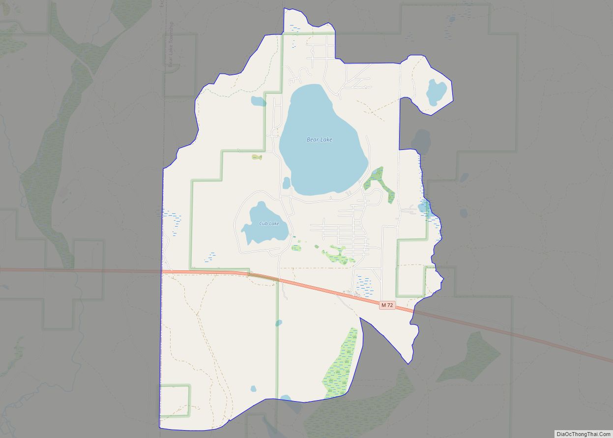
Bear Lake is an unincorporated community and census-designated place (CDP) in Kalkaska County in the U.S. state of Michigan. At the 2010 census, the CDP had a population of 327. Bear Lake is located within Bear Lake Township.
| Name: | Bear Lake CDP |
|---|---|
| LSAD Code: | 57 |
| LSAD Description: | CDP (suffix) |
| State: | Michigan |
| County: | Kalkaska County |
| Elevation: | 1,217 ft (371 m) |
| Total Area: | 6.40 sq mi (16.57 km²) |
| Land Area: | 5.76 sq mi (14.92 km²) |
| Water Area: | 0.64 sq mi (1.64 km²) |
| Total Population: | 366 |
| Population Density: | 63.53/sq mi (24.53/km²) |
| Area code: | 231 |
| FIPS code: | 2606430 |
| GNISfeature ID: | 2583720 |
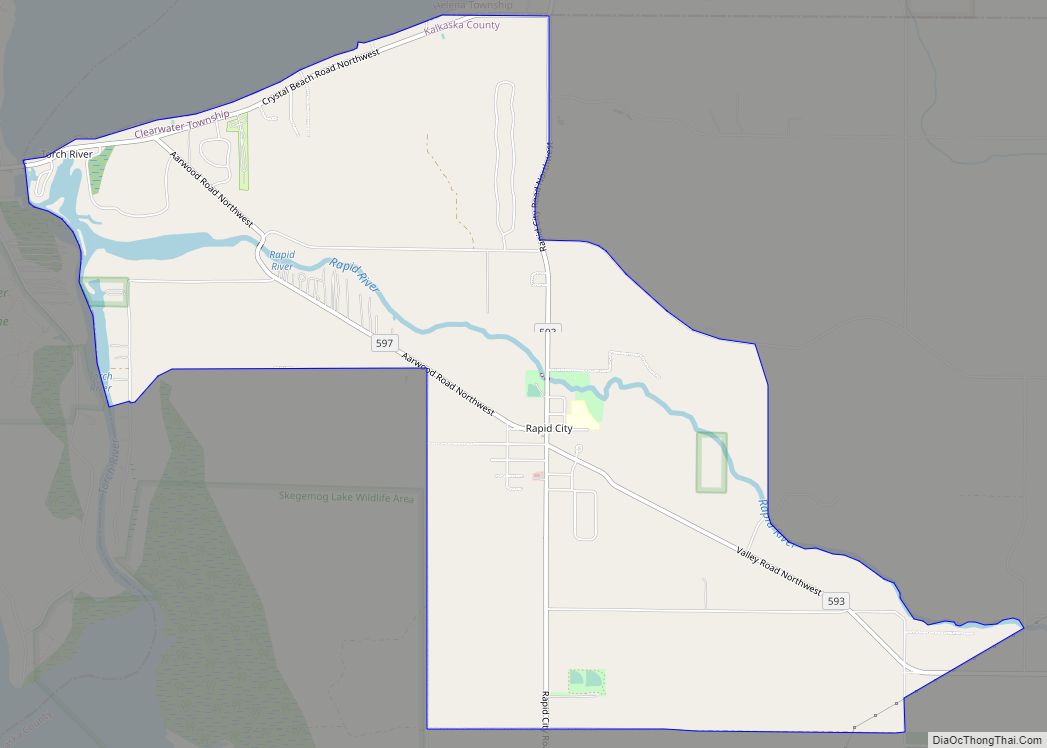
Online Interactive Map
Click on ![]() to view map in "full screen" mode.
to view map in "full screen" mode.
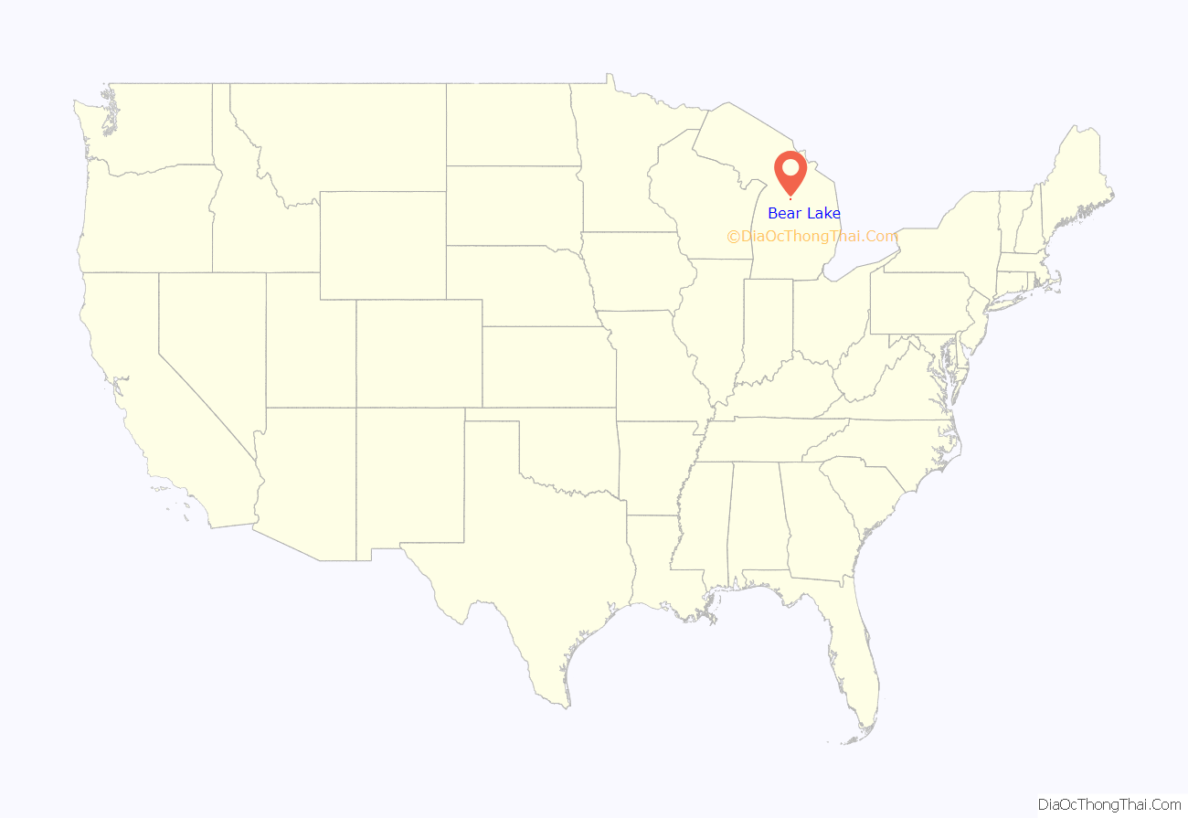
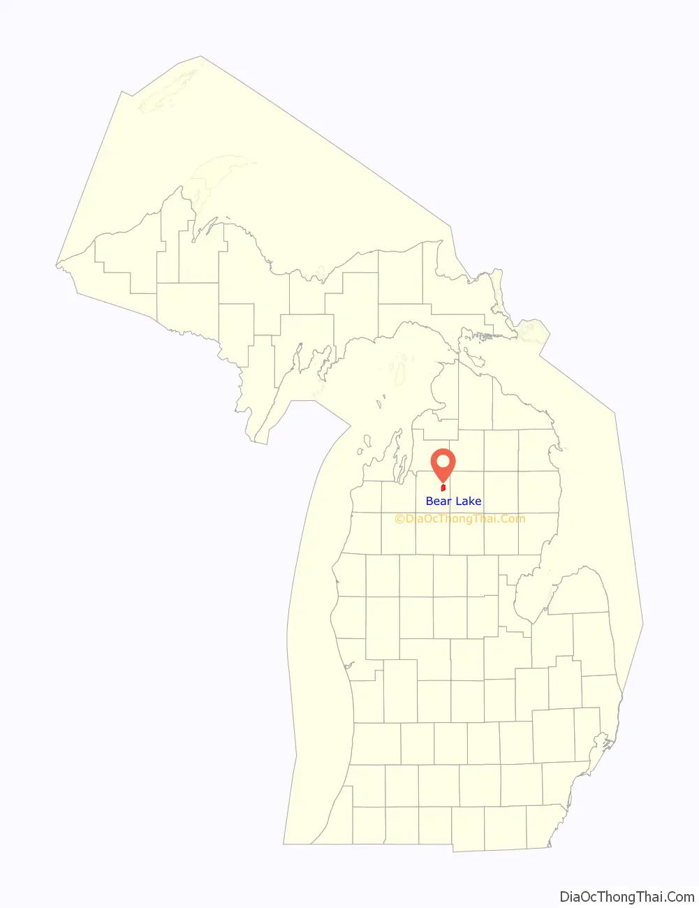
Bear Lake location map. Where is Bear Lake CDP?
History
The community of Bear Lake was listed as a newly-organized census-designated place for the 2010 census, meaning it now has officially defined boundaries and population statistics for the first time. The CDP is organized for statistical purposes only and has no legal status as an incorporated municipality.
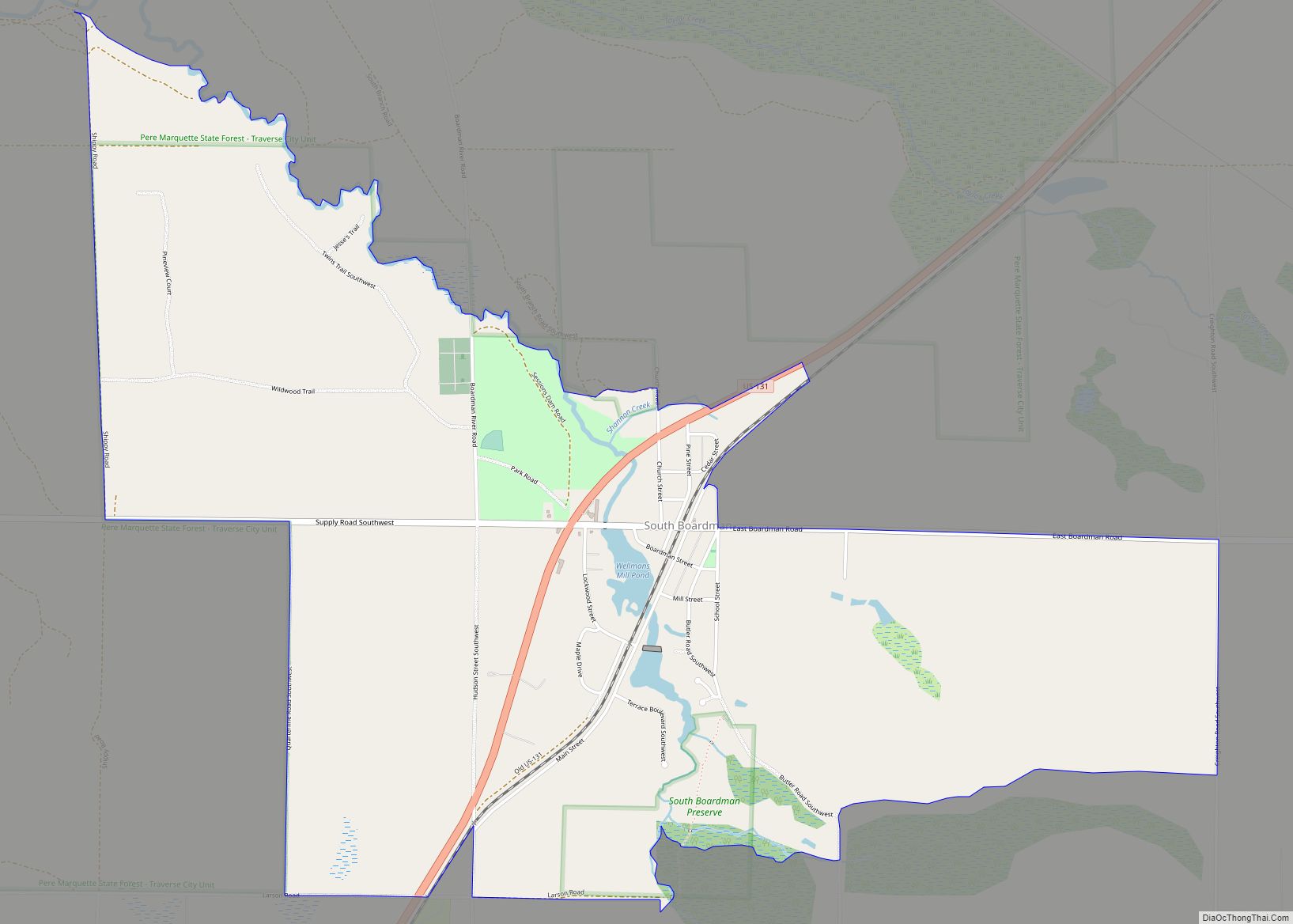
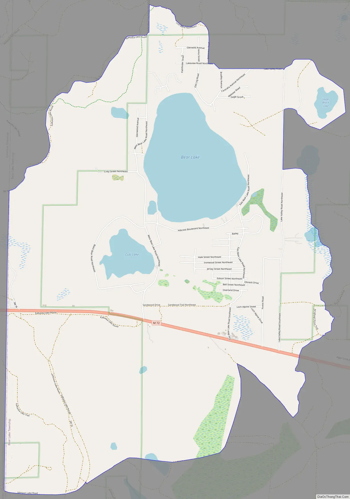
Bear Lake Road Map
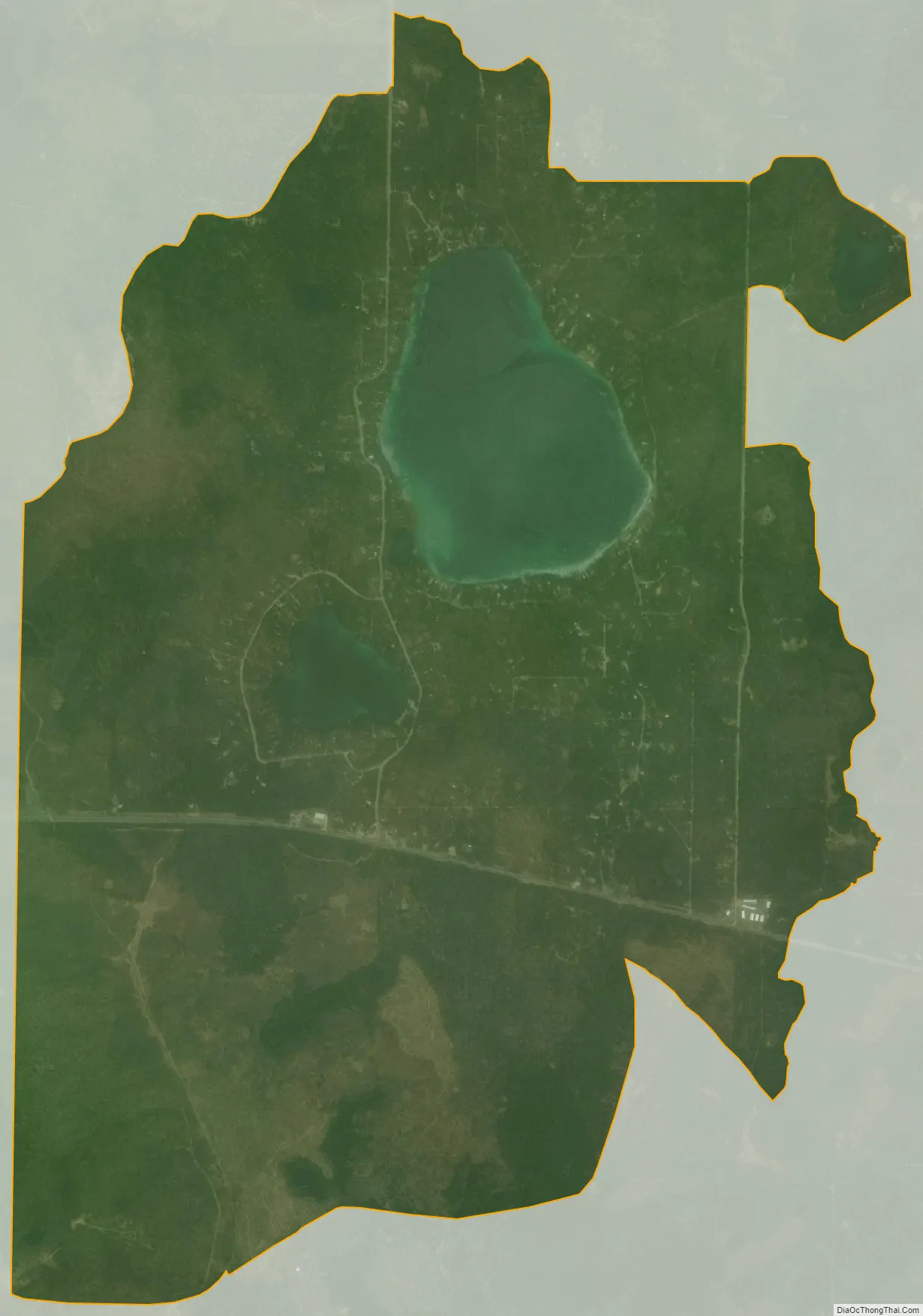
Bear Lake city Satellite Map
Geography
According to the United States Census Bureau, the Bear Lake CDP has an area of 6.42 square miles (16.63 km), of which 5.76 square miles (14.92 km) is land and 0.66 square miles (1.71 km) (10.28%) is water.
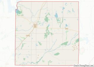
The community is located in the northwest portion of Bear Lake Township in Kalkaska County. The community’s namesake is Bear Lake, and other lakes include the smaller Cub Lake, Mallard Lake, Upper Black Lake, and South Black Lake. M-72 runs east–west through the southern portion of the CDP and connects to Grayling to the east and Kalkaska to the west.
See also
Map of Michigan State and its subdivision:- Alcona
- Alger
- Allegan
- Alpena
- Antrim
- Arenac
- Baraga
- Barry
- Bay
- Benzie
- Berrien
- Branch
- Calhoun
- Cass
- Charlevoix
- Cheboygan
- Chippewa
- Clare
- Clinton
- Crawford
- Delta
- Dickinson
- Eaton
- Emmet
- Genesee
- Gladwin
- Gogebic
- Grand Traverse
- Gratiot
- Hillsdale
- Houghton
- Huron
- Ingham
- Ionia
- Iosco
- Iron
- Isabella
- Jackson
- Kalamazoo
- Kalkaska
- Kent
- Keweenaw
- Lake
- Lake Hurron
- Lake Michigan
- Lake St. Clair
- Lake Superior
- Lapeer
- Leelanau
- Lenawee
- Livingston
- Luce
- Mackinac
- Macomb
- Manistee
- Marquette
- Mason
- Mecosta
- Menominee
- Midland
- Missaukee
- Monroe
- Montcalm
- Montmorency
- Muskegon
- Newaygo
- Oakland
- Oceana
- Ogemaw
- Ontonagon
- Osceola
- Oscoda
- Otsego
- Ottawa
- Presque Isle
- Roscommon
- Saginaw
- Saint Clair
- Saint Joseph
- Sanilac
- Schoolcraft
- Shiawassee
- Tuscola
- Van Buren
- Washtenaw
- Wayne
- Wexford
- Alabama
- Alaska
- Arizona
- Arkansas
- California
- Colorado
- Connecticut
- Delaware
- District of Columbia
- Florida
- Georgia
- Hawaii
- Idaho
- Illinois
- Indiana
- Iowa
- Kansas
- Kentucky
- Louisiana
- Maine
- Maryland
- Massachusetts
- Michigan
- Minnesota
- Mississippi
- Missouri
- Montana
- Nebraska
- Nevada
- New Hampshire
- New Jersey
- New Mexico
- New York
- North Carolina
- North Dakota
- Ohio
- Oklahoma
- Oregon
- Pennsylvania
- Rhode Island
- South Carolina
- South Dakota
- Tennessee
- Texas
- Utah
- Vermont
- Virginia
- Washington
- West Virginia
- Wisconsin
- Wyoming