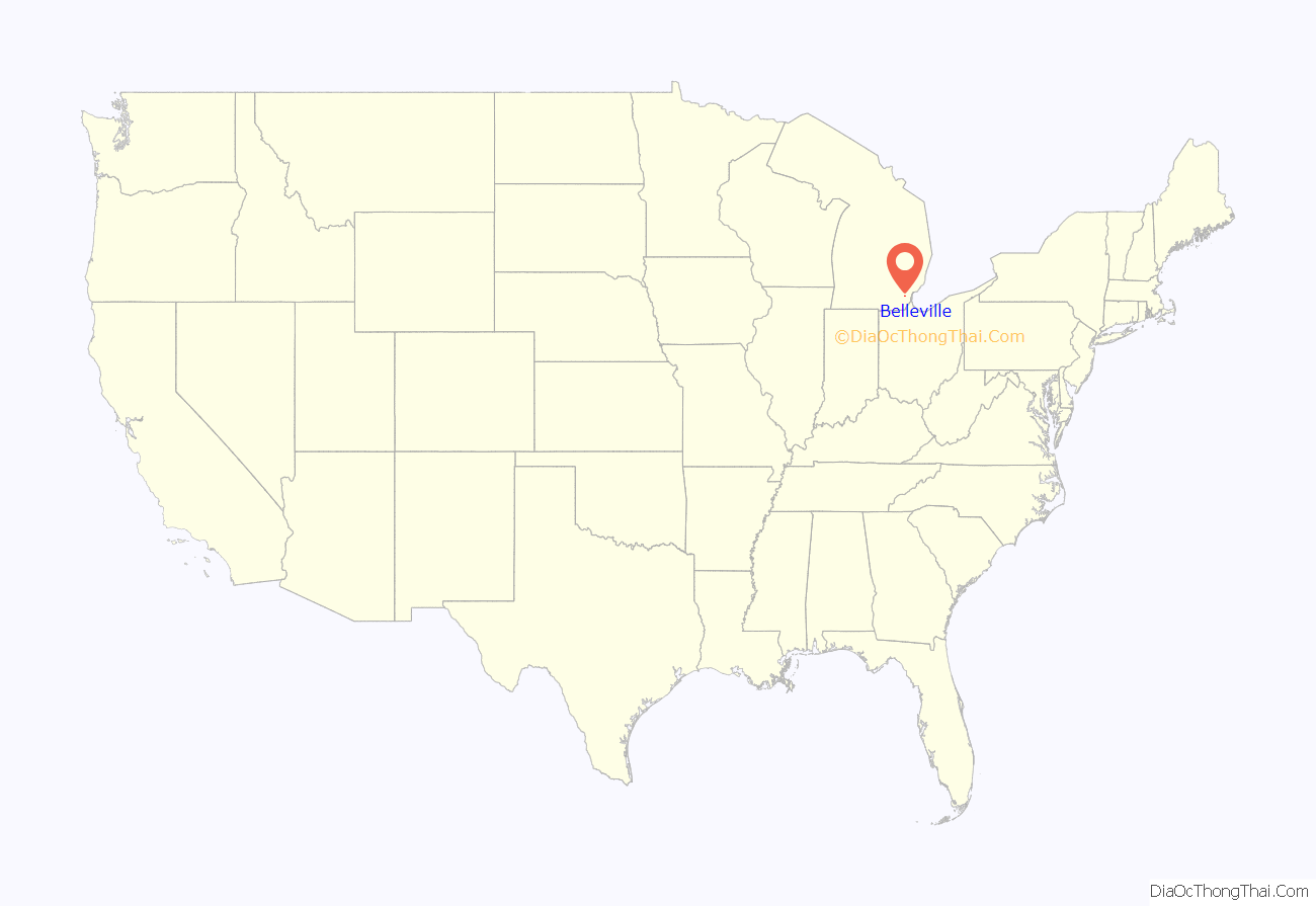
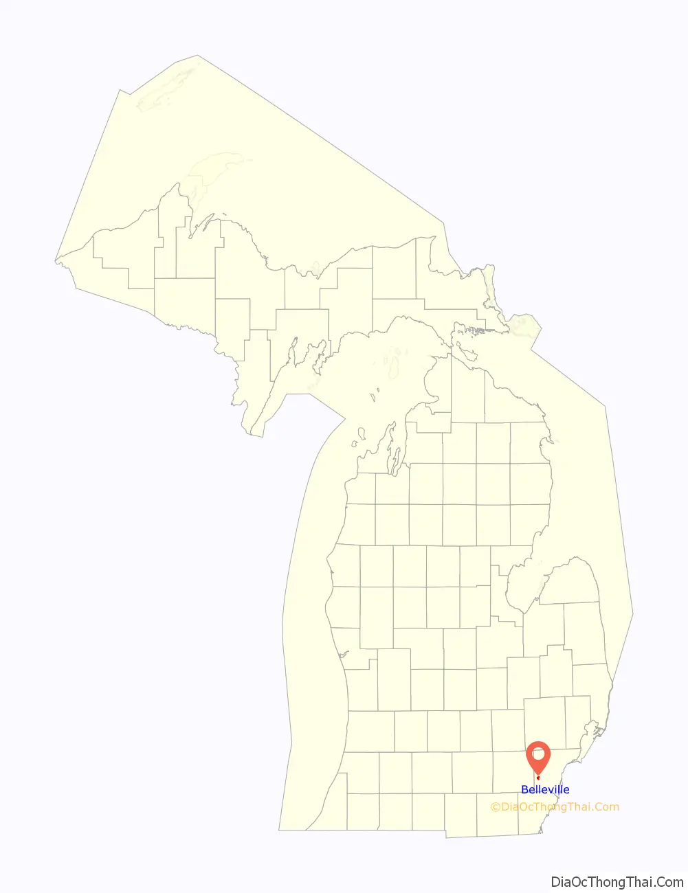
Belleville is a city in Wayne County in the U.S. state Michigan. The population was 3,991 at the 2010 census.
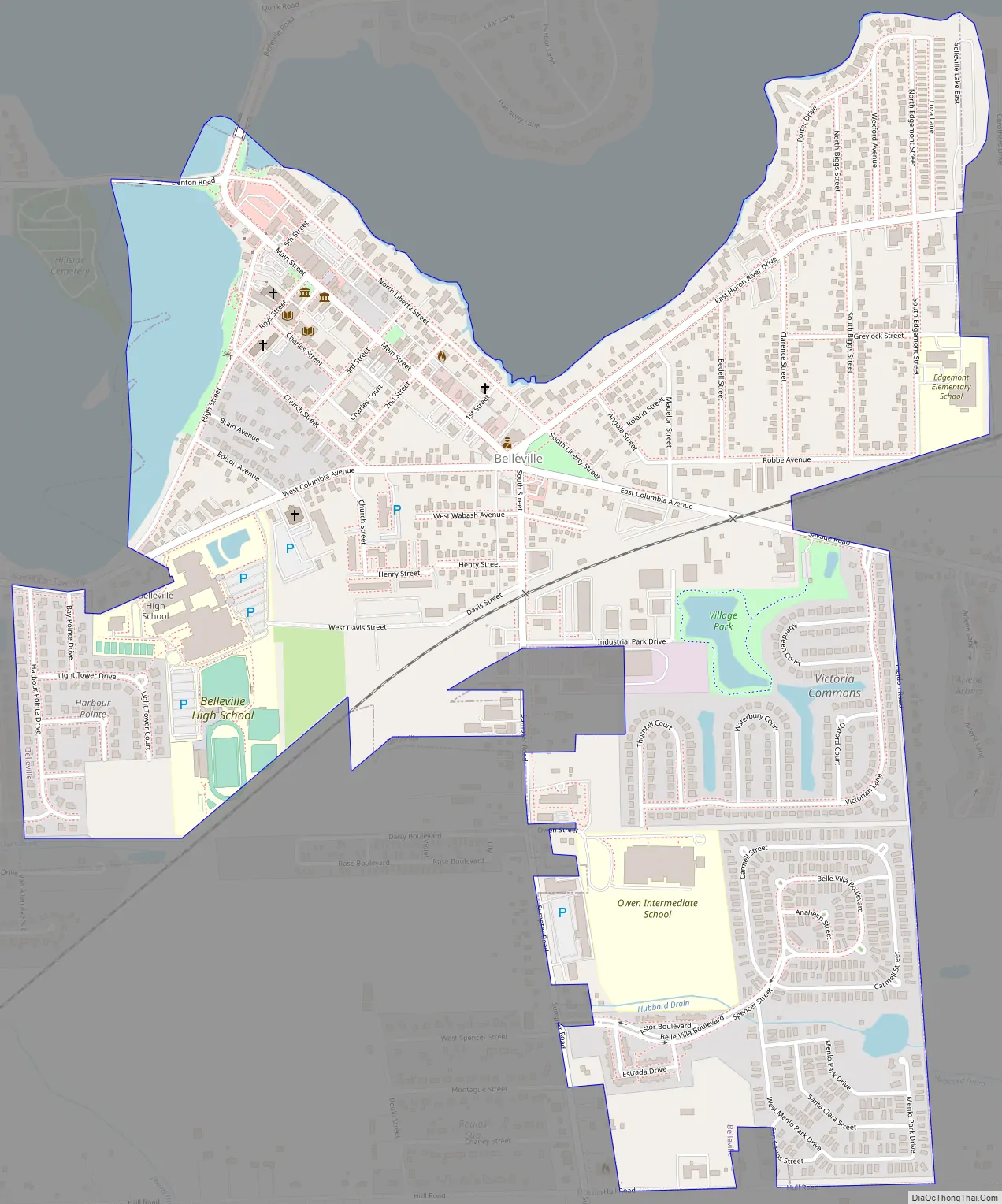
As a western suburb of Metro Detroit, Belleville is 18 miles (29 km) southeast of Ann Arbor and 20 miles (32 km) southwest of Detroit. Belleville is located just south of Interstate 94 and is surrounded by Van Buren Township. Belleville Lake is the principal geographic feature, and the city is also home to the National Strawberry Festival.
| Name: | Belleville city |
|---|---|
| LSAD Code: | 25 |
| LSAD Description: | city (suffix) |
| State: | Michigan |
| County: | Wayne County |
| Incorporated: | 1905 (village) 1946 (city) |
| Elevation: | 673 ft (205 m) |
| Land Area: | 1.13 sq mi (2.93 km²) |
| Water Area: | 0.05 sq mi (0.14 km²) |
| Population Density: | 3,540.64/sq mi (1,366.73/km²) |
| Area code: | 734 |
| FIPS code: | 2607020 |
| GNISfeature ID: | 0621058 |
Online Interactive Map
Click on ![]() to view map in "full screen" mode.
to view map in "full screen" mode.
Belleville location map. Where is Belleville city?
History
The community was named in honor of landowner James Bell by adroitly choosing the French word for “beautiful town”. The hamlet was platted in 1847 with the main thoroughfares still used today designated Main, Liberty, and High Street. About 1881, the Belleville depot on the Detroit line of the Wabash Railroad began serving travelers from across the region and the country.
Belleville was established as a village in 1905, when its governance separated from Van Buren Township by an act of the State Legislature. Located on the Huron River which was a natural trade route, the village had long been a thriving center for lumber businesses with saw mills located along the shores of the river. The large expanses of woodlands were removed to make way for farmland, industry and increasing population.
To generate more electrical power in the region, in early 1926 the Detroit Edison Company built the French Landing Dam on the river east of Belleville, thereby creating Belleville Lake. Belleville Lake is the largest inland lake in Wayne County, stretching 6 miles and covering 1,200 acres. The traditional downtown is nestled on the southern shore of Belleville Lake. Belleville achieved city status on 14 May 1946.
Belleville Road Map
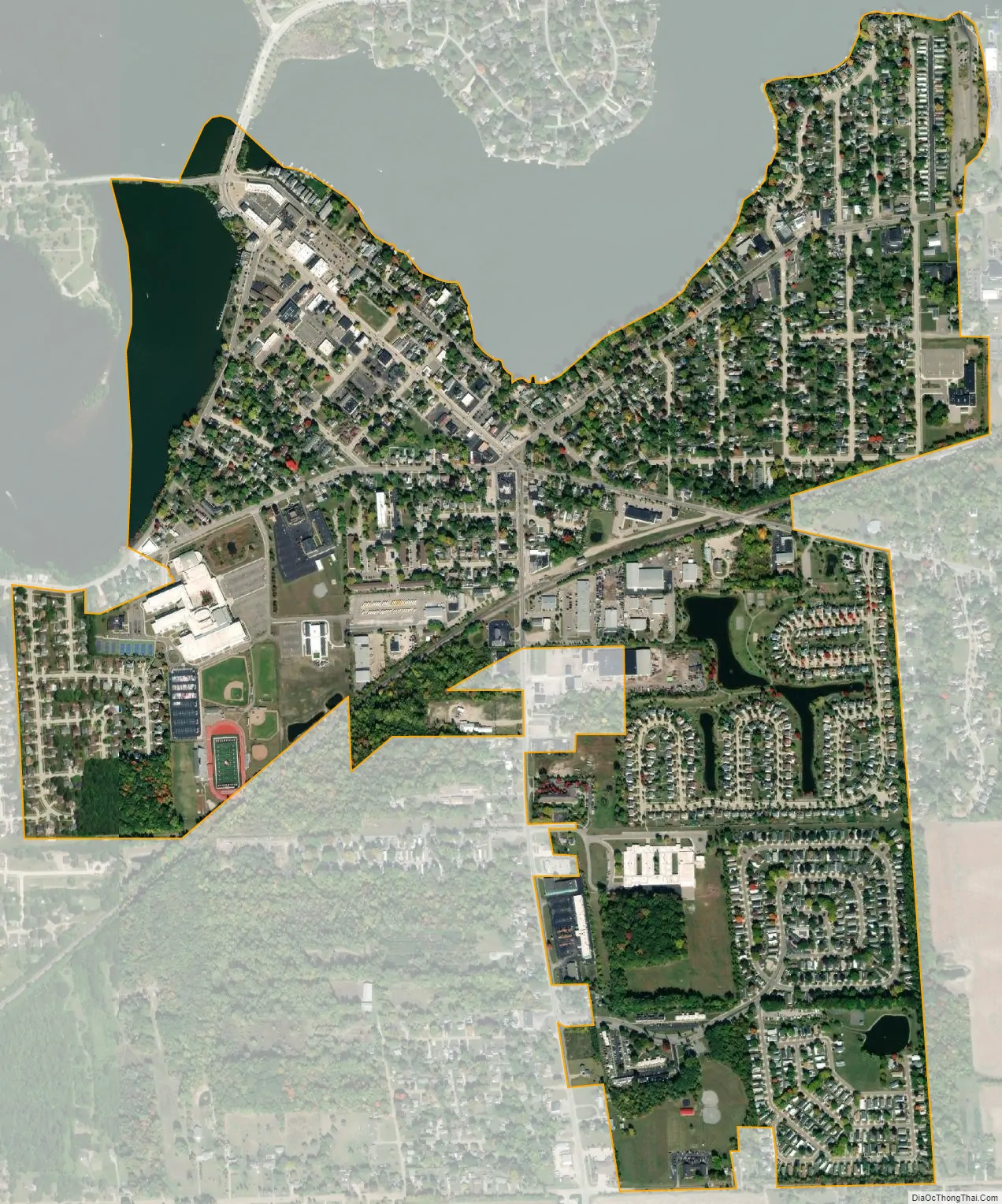
Belleville city Satellite Map
Geography
According to the United States Census Bureau, the city has a total area of 1.20 square miles (3.11 km), of which 1.14 square miles (2.95 km) is land and 0.06 square miles (0.16 km) (5.00%) is water.
Belleville Lake was created by damming the Huron River when the French Landing Dam and Powerhouse was built in 1925 in neighboring Van Buren Township.
See also
Map of Michigan State and its subdivision:- Alcona
- Alger
- Allegan
- Alpena
- Antrim
- Arenac
- Baraga
- Barry
- Bay
- Benzie
- Berrien
- Branch
- Calhoun
- Cass
- Charlevoix
- Cheboygan
- Chippewa
- Clare
- Clinton
- Crawford
- Delta
- Dickinson
- Eaton
- Emmet
- Genesee
- Gladwin
- Gogebic
- Grand Traverse
- Gratiot
- Hillsdale
- Houghton
- Huron
- Ingham
- Ionia
- Iosco
- Iron
- Isabella
- Jackson
- Kalamazoo
- Kalkaska
- Kent
- Keweenaw
- Lake
- Lake Hurron
- Lake Michigan
- Lake St. Clair
- Lake Superior
- Lapeer
- Leelanau
- Lenawee
- Livingston
- Luce
- Mackinac
- Macomb
- Manistee
- Marquette
- Mason
- Mecosta
- Menominee
- Midland
- Missaukee
- Monroe
- Montcalm
- Montmorency
- Muskegon
- Newaygo
- Oakland
- Oceana
- Ogemaw
- Ontonagon
- Osceola
- Oscoda
- Otsego
- Ottawa
- Presque Isle
- Roscommon
- Saginaw
- Saint Clair
- Saint Joseph
- Sanilac
- Schoolcraft
- Shiawassee
- Tuscola
- Van Buren
- Washtenaw
- Wayne
- Wexford
- Alabama
- Alaska
- Arizona
- Arkansas
- California
- Colorado
- Connecticut
- Delaware
- District of Columbia
- Florida
- Georgia
- Hawaii
- Idaho
- Illinois
- Indiana
- Iowa
- Kansas
- Kentucky
- Louisiana
- Maine
- Maryland
- Massachusetts
- Michigan
- Minnesota
- Mississippi
- Missouri
- Montana
- Nebraska
- Nevada
- New Hampshire
- New Jersey
- New Mexico
- New York
- North Carolina
- North Dakota
- Ohio
- Oklahoma
- Oregon
- Pennsylvania
- Rhode Island
- South Carolina
- South Dakota
- Tennessee
- Texas
- Utah
- Vermont
- Virginia
- Washington
- West Virginia
- Wisconsin
- Wyoming


