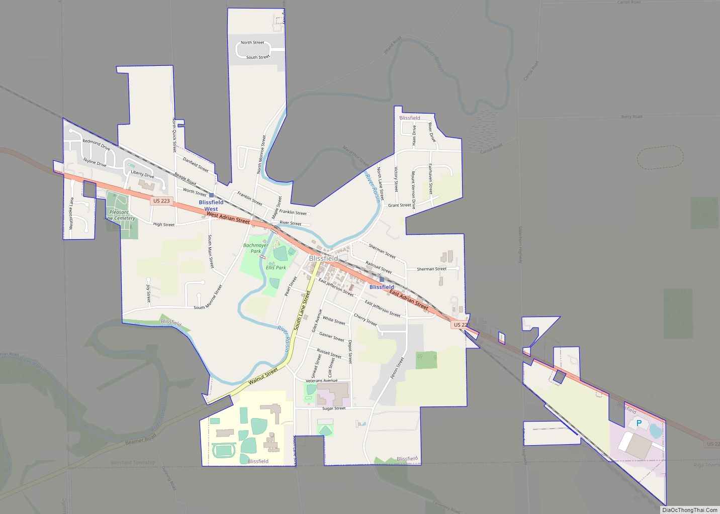
Blissfield is a village in Lenawee County in the U.S. state of Michigan. The population was 3,340 at the 2010 census. The village is mostly located within Blissfield Township with only very small portions extending west into Palmyra Township and south into Riga Township. The Blissfield post office first opened March 28, 1828. Hervey Bliss, who was the first white settler in 1824 and for whom the town is named, was the first postmaster.
| Name: | Blissfield village |
|---|---|
| LSAD Code: | 47 |
| LSAD Description: | village (suffix) |
| State: | Michigan |
| County: | Lenawee County |
| Incorporated: | 1875 |
| Elevation: | 689 ft (210 m) |
| Total Area: | 2.27 sq mi (5.88 km²) |
| Land Area: | 2.22 sq mi (5.74 km²) |
| Water Area: | 0.06 sq mi (0.14 km²) |
| Total Population: | 3,277 |
| Population Density: | 1,478.12/sq mi (570.68/km²) |
| Area code: | 517 |
| FIPS code: | 2609000 |
| GNISfeature ID: | 2398133 |
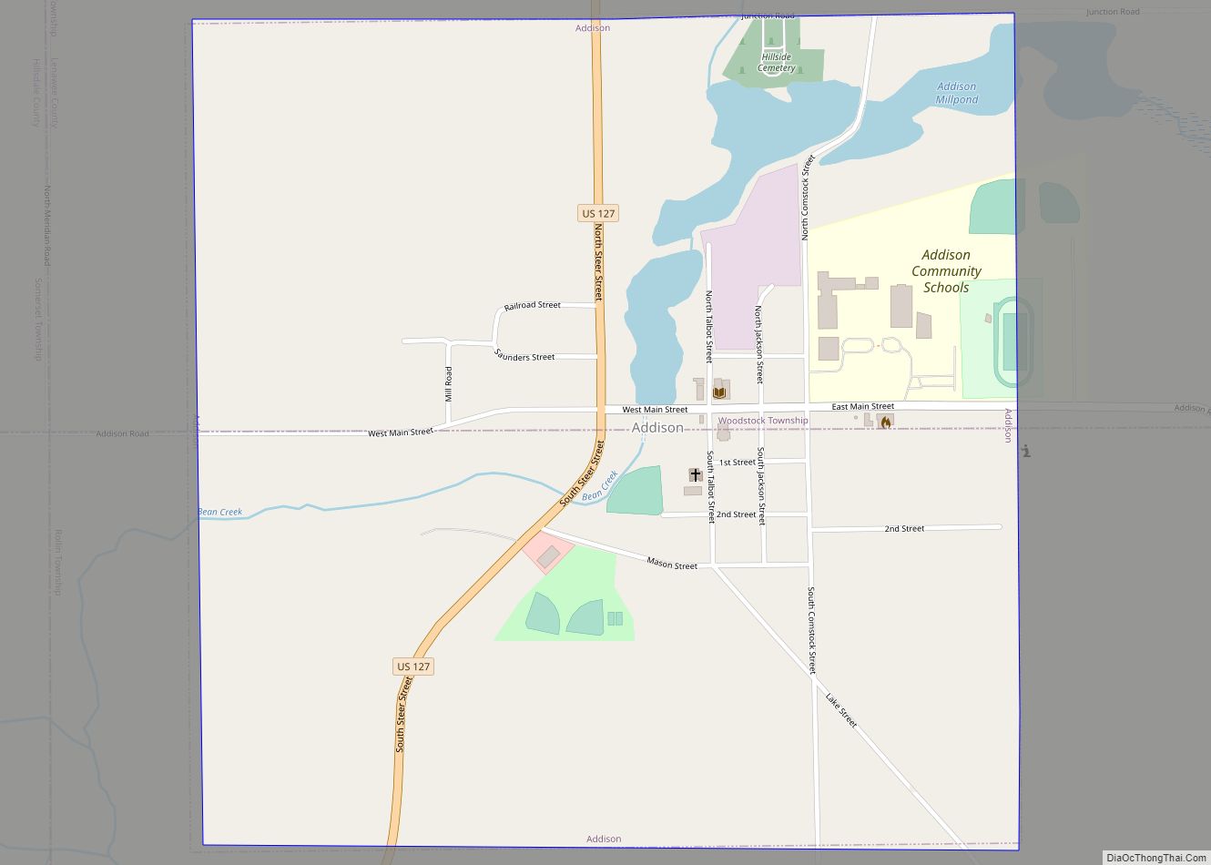
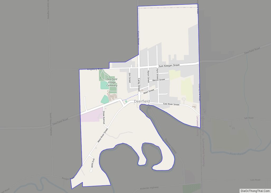
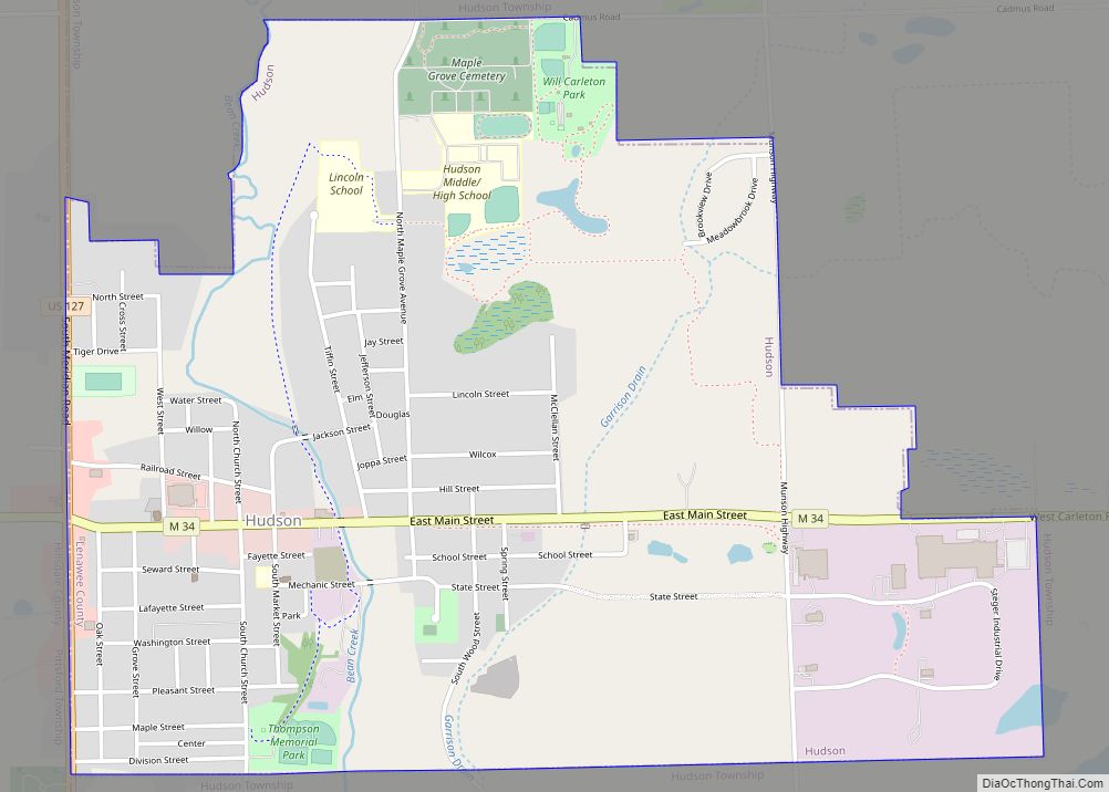
Online Interactive Map
Click on ![]() to view map in "full screen" mode.
to view map in "full screen" mode.
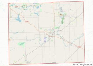
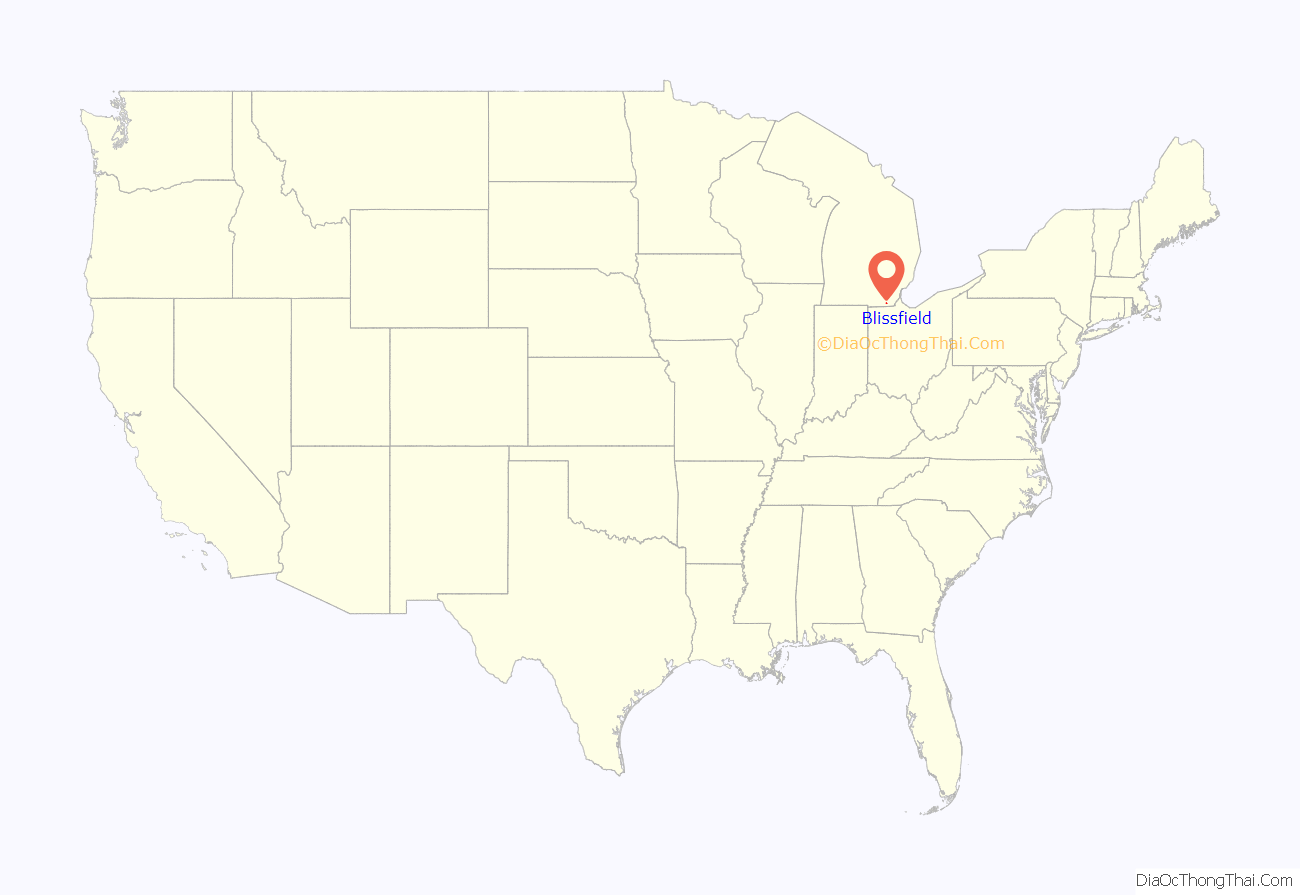
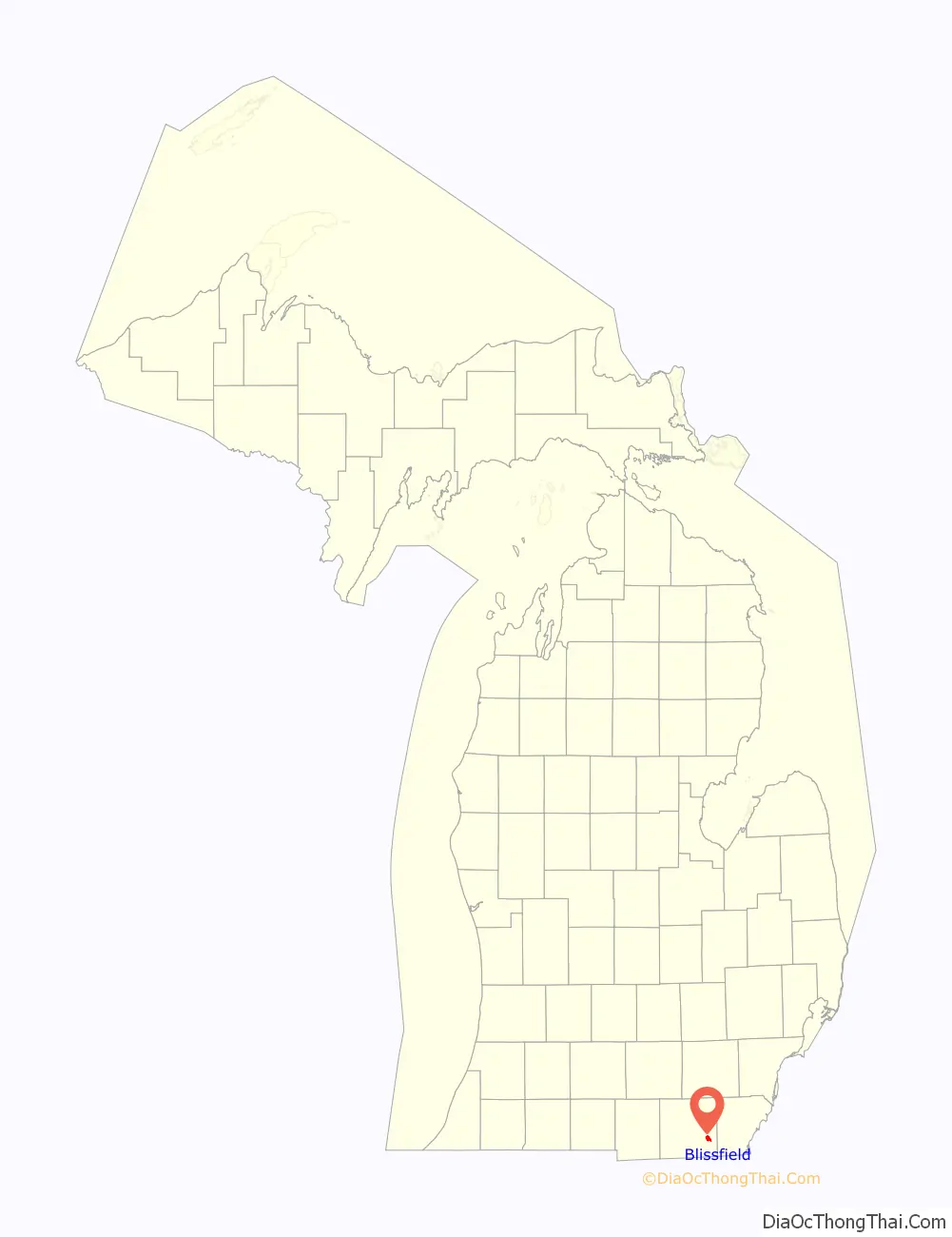
Blissfield location map. Where is Blissfield village?
History
During World War II, 16 German POWs, who were working on a sugar beet farm near Blissfield, were killed in an accident when their truck collided with a train as they were returning to Fort Custer. They are now buried at Fort Custer National Cemetery.
According to local legend, Blissfield was home to the first set of Triple Bridges in the world. These three bridges stood directly next to each other and crossed the River Raisin to accommodate train and vehicular travel. The interurban bridge was torn down and the road bridge was replaced with a larger bridge in place of both bridges.
In September–October 2014 Blissfield’s village hall was moved to a former KeyBank location in the business district of the village. It is now two doors down from the Township offices. The police department was also moved with it.
Blissfield High School is the home of the Royals. The baseball team has won seven state titles, while the girls volleyball team won their first state title in 2005.
The village contains three properties listed on the National Register of Historic Places: Blissfield Downtown Historic District, the David Carpenter House, and the First Presbyterian Church of Blissfield.
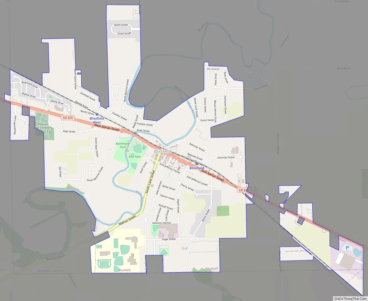
Blissfield Road Map
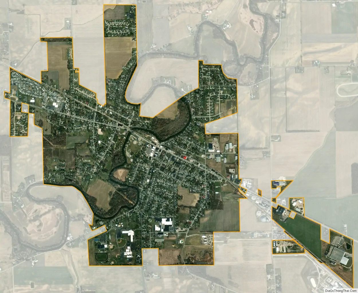
Blissfield city Satellite Map
Geography
According to the United States Census Bureau, the village has a total area of 2.30 square miles (5.96 km), of which 2.24 square miles (5.80 km) is land and 0.06 square miles (0.16 km) is water.
The village occupies portions of three civil townships: Blissfield, Palmyra, and Riga. Of the township’s 2.30 square miles (5.96 km) of total area, 2.27 square miles (5.88 km), or 98.7%, is located within Blissfield Township. Of the population of 3,340 at 2010 census, all but eight residents lived within Blissfield Township. The remaining eight lived in Palmyra Township, and no residents lived in the Riga Township portion of the village of Blissfield.
See also
Map of Michigan State and its subdivision:- Alcona
- Alger
- Allegan
- Alpena
- Antrim
- Arenac
- Baraga
- Barry
- Bay
- Benzie
- Berrien
- Branch
- Calhoun
- Cass
- Charlevoix
- Cheboygan
- Chippewa
- Clare
- Clinton
- Crawford
- Delta
- Dickinson
- Eaton
- Emmet
- Genesee
- Gladwin
- Gogebic
- Grand Traverse
- Gratiot
- Hillsdale
- Houghton
- Huron
- Ingham
- Ionia
- Iosco
- Iron
- Isabella
- Jackson
- Kalamazoo
- Kalkaska
- Kent
- Keweenaw
- Lake
- Lake Hurron
- Lake Michigan
- Lake St. Clair
- Lake Superior
- Lapeer
- Leelanau
- Lenawee
- Livingston
- Luce
- Mackinac
- Macomb
- Manistee
- Marquette
- Mason
- Mecosta
- Menominee
- Midland
- Missaukee
- Monroe
- Montcalm
- Montmorency
- Muskegon
- Newaygo
- Oakland
- Oceana
- Ogemaw
- Ontonagon
- Osceola
- Oscoda
- Otsego
- Ottawa
- Presque Isle
- Roscommon
- Saginaw
- Saint Clair
- Saint Joseph
- Sanilac
- Schoolcraft
- Shiawassee
- Tuscola
- Van Buren
- Washtenaw
- Wayne
- Wexford
- Alabama
- Alaska
- Arizona
- Arkansas
- California
- Colorado
- Connecticut
- Delaware
- District of Columbia
- Florida
- Georgia
- Hawaii
- Idaho
- Illinois
- Indiana
- Iowa
- Kansas
- Kentucky
- Louisiana
- Maine
- Maryland
- Massachusetts
- Michigan
- Minnesota
- Mississippi
- Missouri
- Montana
- Nebraska
- Nevada
- New Hampshire
- New Jersey
- New Mexico
- New York
- North Carolina
- North Dakota
- Ohio
- Oklahoma
- Oregon
- Pennsylvania
- Rhode Island
- South Carolina
- South Dakota
- Tennessee
- Texas
- Utah
- Vermont
- Virginia
- Washington
- West Virginia
- Wisconsin
- Wyoming