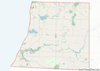
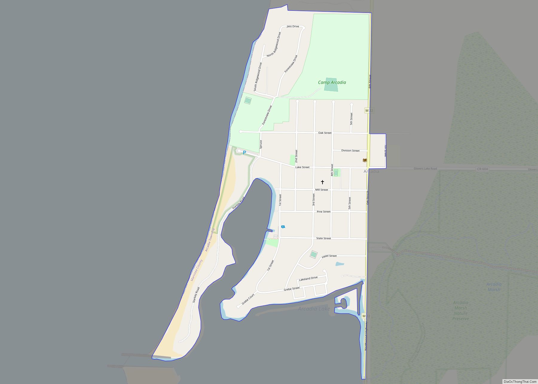
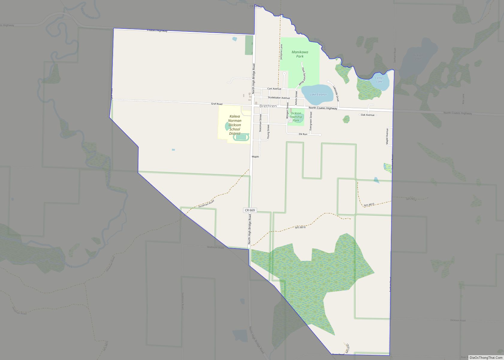
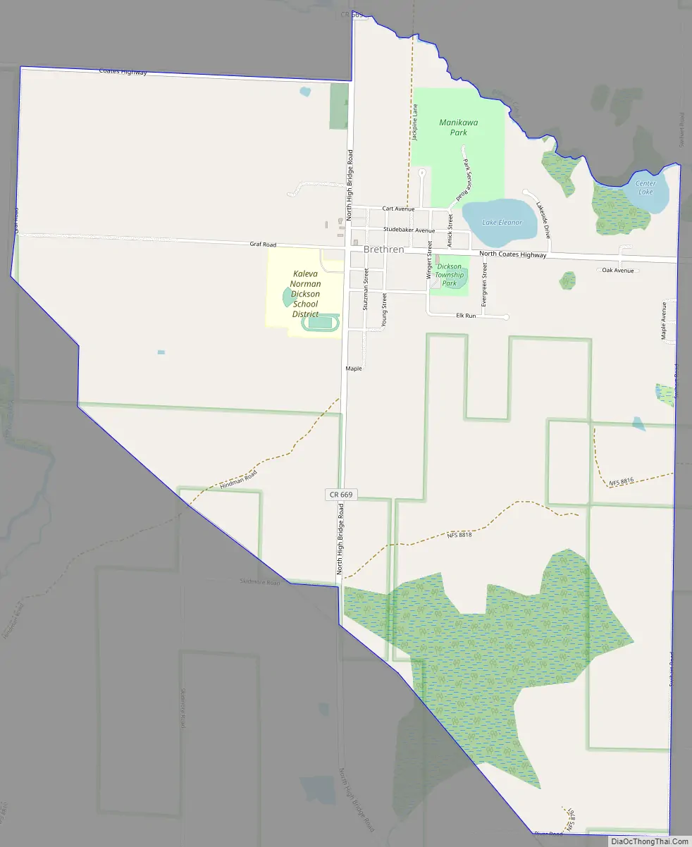
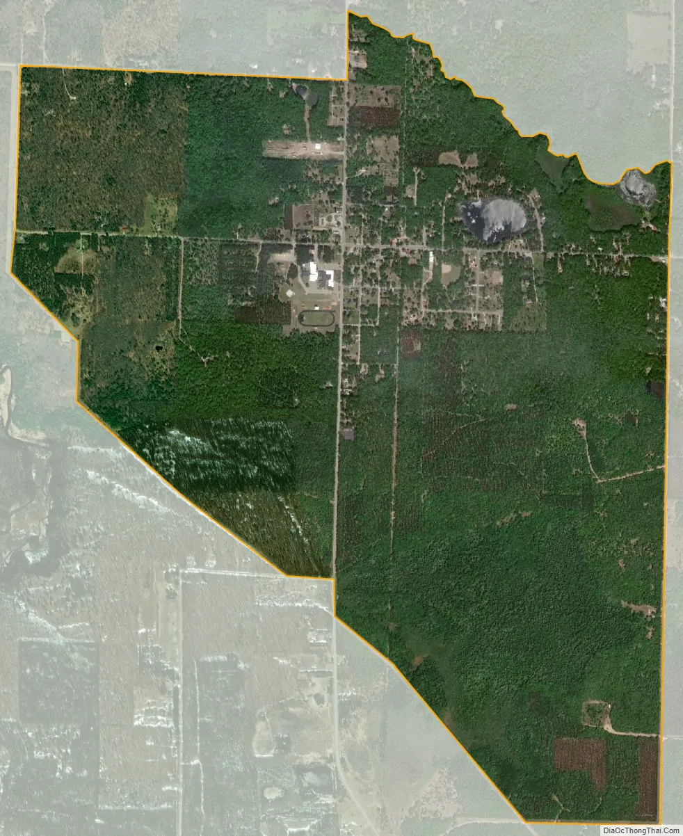
Brethren is an unincorporated community and census-designated place in Dickson Township, Manistee County, Michigan, United States. Its population was 410 as of the 2010 census. The community is located in the Manistee National Forest roughly 15 miles (24 km) east of Manistee. Brethren has a post office with ZIP code 49619.
According to the U.S. Census Bureau, the community has an area of 3.152 square miles (8.16 km), of which 3.117 square miles (8.07 km) is land and 0.035 square miles (0.091 km) is water.
Brethren was founded in 1900 by Samuel S. Thorpe as a colony of the German Baptist Brethren Church. A post office was established in 1901 with Thorpe as the first postmaster. The Pere Marquette Railway established a station here in 1901.
| Name: | Brethren CDP |
|---|---|
| LSAD Code: | 57 |
| LSAD Description: | CDP (suffix) |
| State: | Michigan |
| County: | Manistee County |
| Elevation: | 722 ft (220 m) |
| Total Area: | 1.31 sq mi (3.40 km²) |
| Land Area: | 1.28 sq mi (3.31 km²) |
| Water Area: | 0.04 sq mi (0.09 km²) |
| Total Population: | 331 |
| Population Density: | 258.80/sq mi (99.94/km²) |
| ZIP code: | 49619 |
| Area code: | 231 |
| FIPS code: | 2610300 |
| GNISfeature ID: | 621929 |
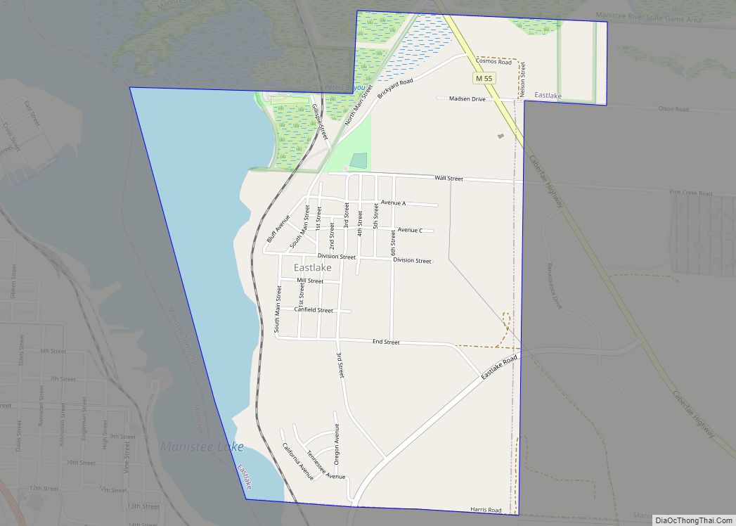
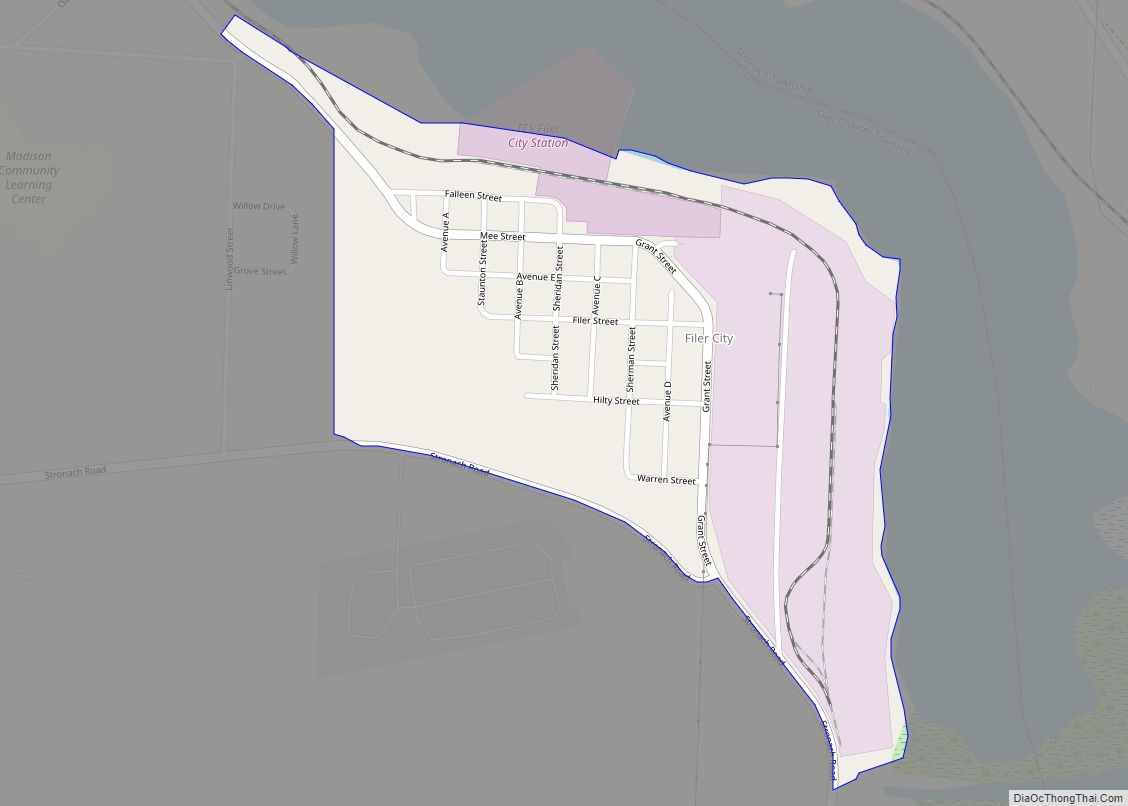
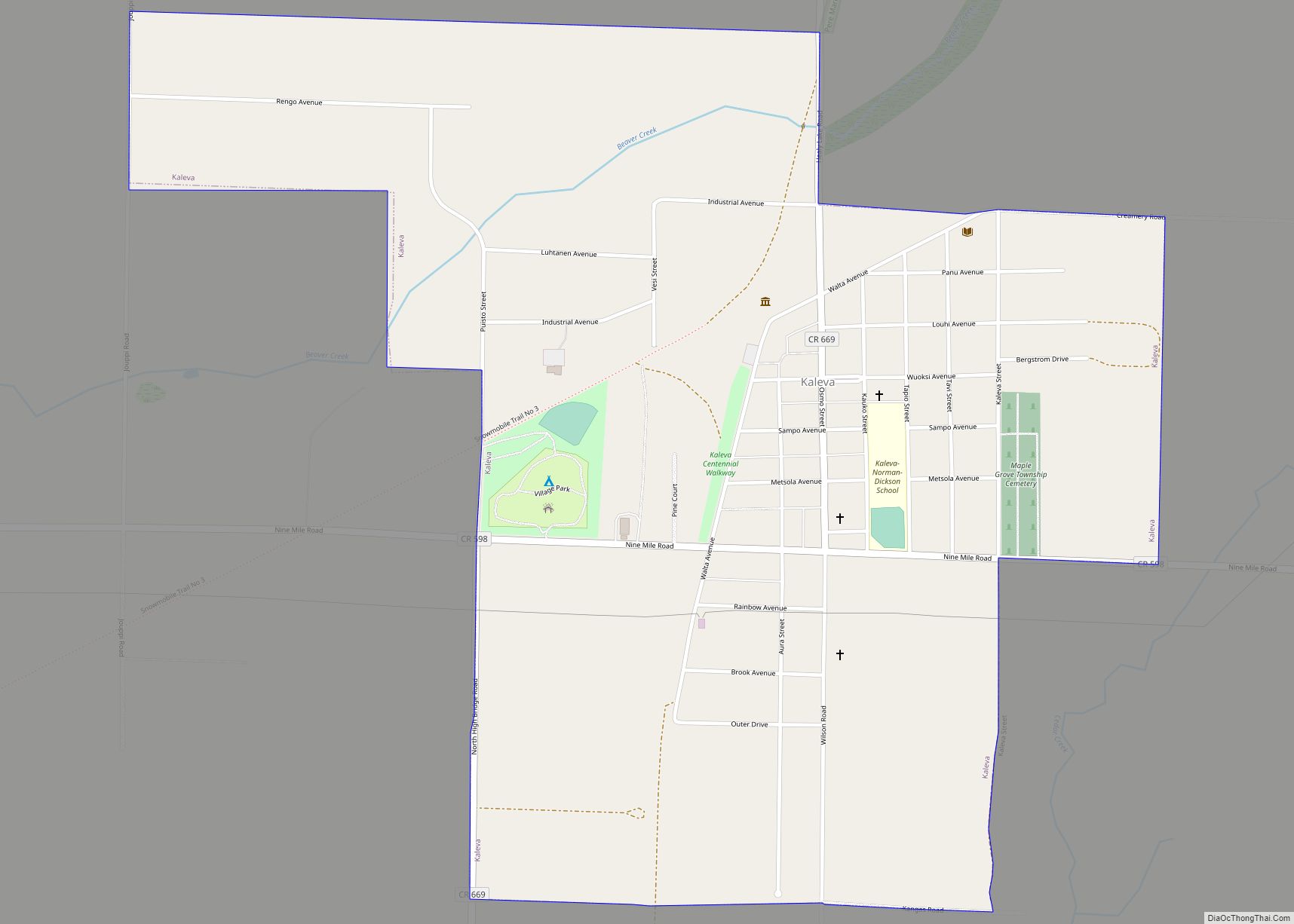
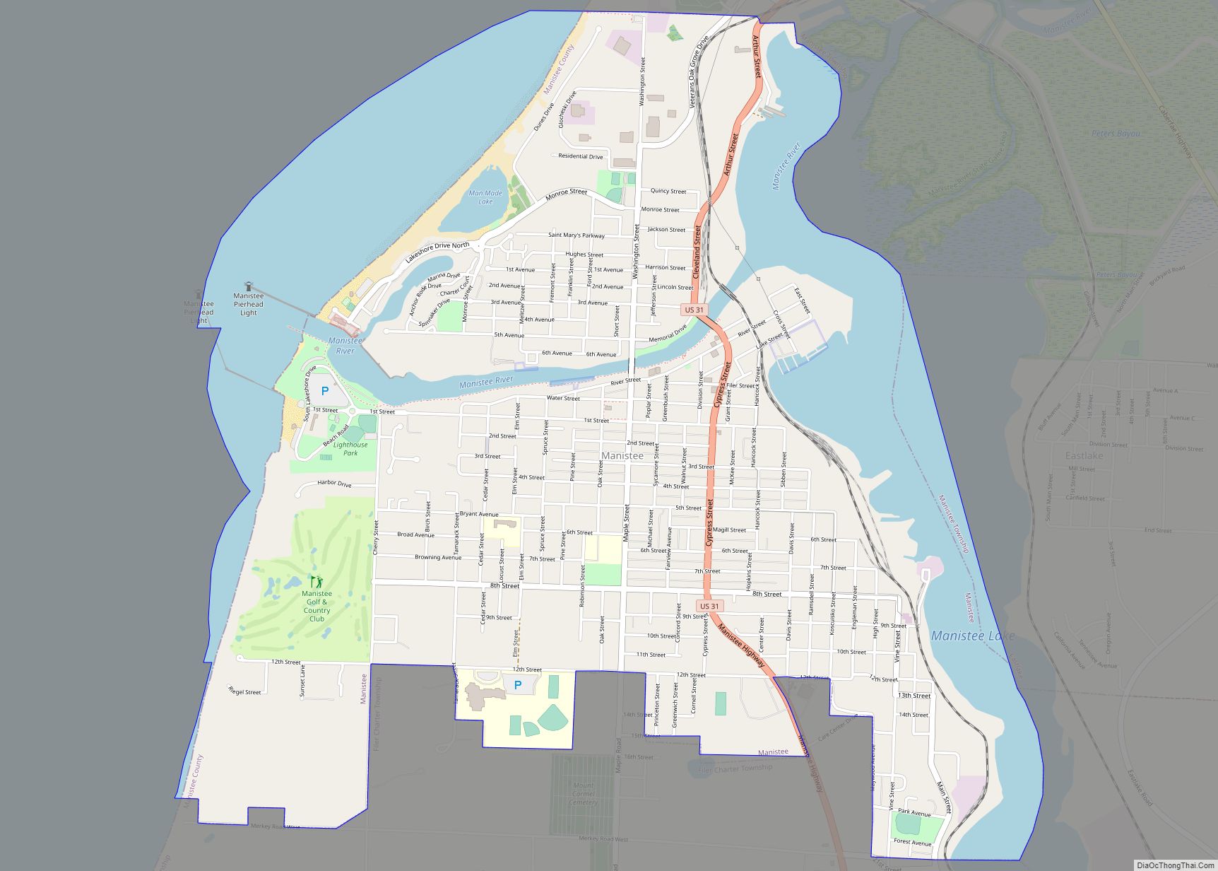
Online Interactive Map
Click on ![]() to view map in "full screen" mode.
to view map in "full screen" mode.
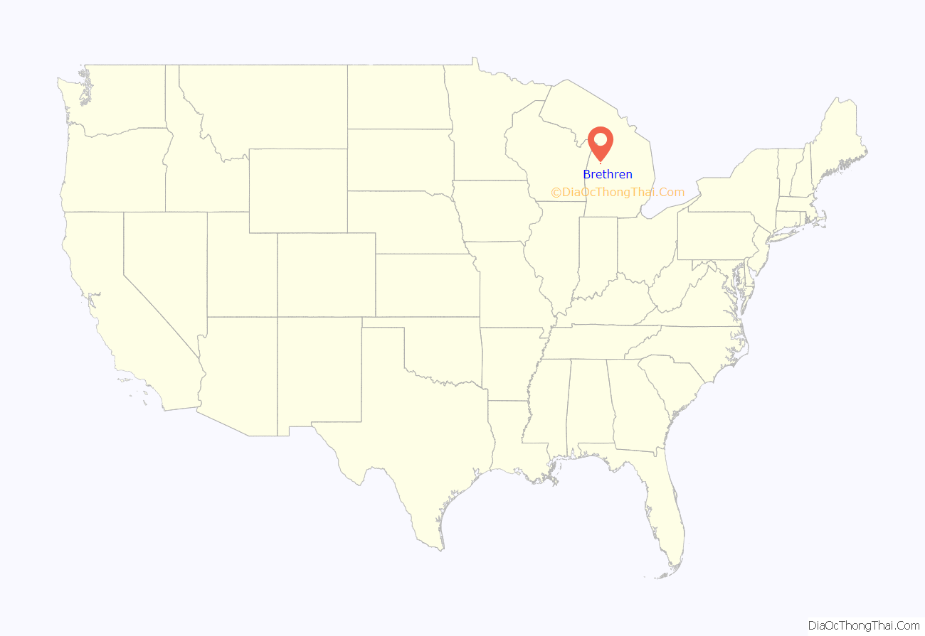
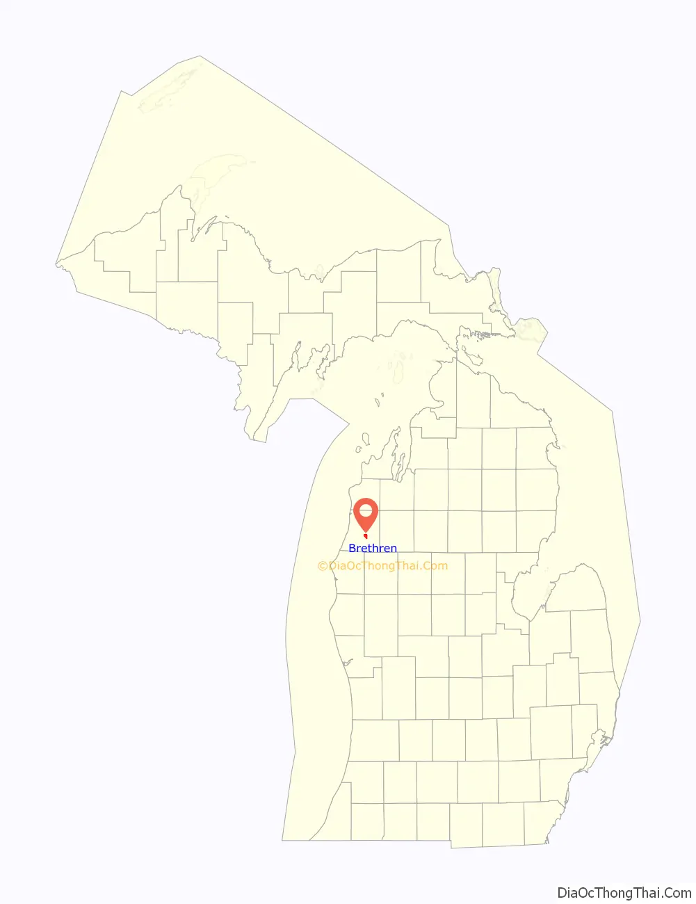
Brethren location map. Where is Brethren CDP?
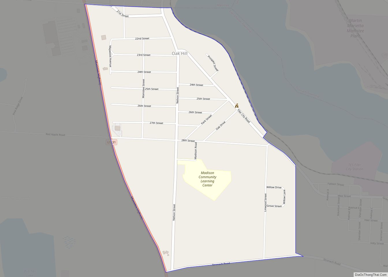
Brethren Road Map
Brethren city Satellite Map
See also
Map of Michigan State and its subdivision:- Alcona
- Alger
- Allegan
- Alpena
- Antrim
- Arenac
- Baraga
- Barry
- Bay
- Benzie
- Berrien
- Branch
- Calhoun
- Cass
- Charlevoix
- Cheboygan
- Chippewa
- Clare
- Clinton
- Crawford
- Delta
- Dickinson
- Eaton
- Emmet
- Genesee
- Gladwin
- Gogebic
- Grand Traverse
- Gratiot
- Hillsdale
- Houghton
- Huron
- Ingham
- Ionia
- Iosco
- Iron
- Isabella
- Jackson
- Kalamazoo
- Kalkaska
- Kent
- Keweenaw
- Lake
- Lake Hurron
- Lake Michigan
- Lake St. Clair
- Lake Superior
- Lapeer
- Leelanau
- Lenawee
- Livingston
- Luce
- Mackinac
- Macomb
- Manistee
- Marquette
- Mason
- Mecosta
- Menominee
- Midland
- Missaukee
- Monroe
- Montcalm
- Montmorency
- Muskegon
- Newaygo
- Oakland
- Oceana
- Ogemaw
- Ontonagon
- Osceola
- Oscoda
- Otsego
- Ottawa
- Presque Isle
- Roscommon
- Saginaw
- Saint Clair
- Saint Joseph
- Sanilac
- Schoolcraft
- Shiawassee
- Tuscola
- Van Buren
- Washtenaw
- Wayne
- Wexford
- Alabama
- Alaska
- Arizona
- Arkansas
- California
- Colorado
- Connecticut
- Delaware
- District of Columbia
- Florida
- Georgia
- Hawaii
- Idaho
- Illinois
- Indiana
- Iowa
- Kansas
- Kentucky
- Louisiana
- Maine
- Maryland
- Massachusetts
- Michigan
- Minnesota
- Mississippi
- Missouri
- Montana
- Nebraska
- Nevada
- New Hampshire
- New Jersey
- New Mexico
- New York
- North Carolina
- North Dakota
- Ohio
- Oklahoma
- Oregon
- Pennsylvania
- Rhode Island
- South Carolina
- South Dakota
- Tennessee
- Texas
- Utah
- Vermont
- Virginia
- Washington
- West Virginia
- Wisconsin
- Wyoming