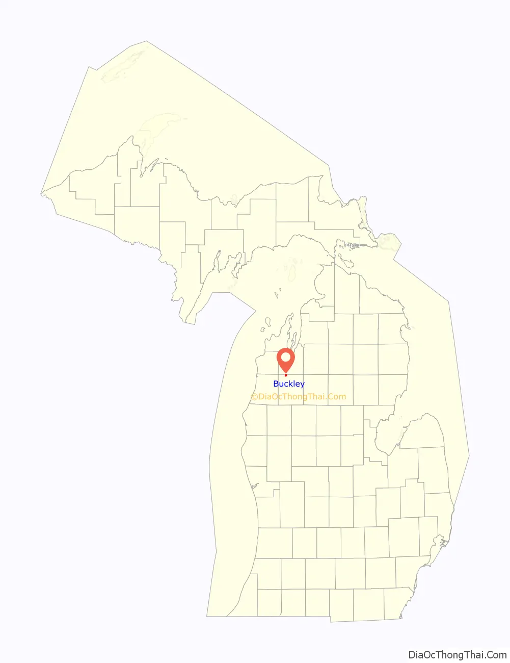
Buckley is a village in Wexford County in the U.S. state of Michigan. The population was 775 at the 2020 census. The village is located within Hanover Township.
| Name: | Buckley village |
|---|---|
| LSAD Code: | 47 |
| LSAD Description: | village (suffix) |
| State: | Michigan |
| County: | Wexford County |
| Founded: | 1905 |
| Incorporated: | 1907 |
| Elevation: | 1,050 ft (320 m) |
| Total Area: | 1.89 sq mi (4.88 km²) |
| Land Area: | 1.82 sq mi (4.72 km²) |
| Water Area: | 0.07 sq mi (0.17 km²) |
| Total Population: | 775 |
| Population Density: | 425.59/sq mi (164.28/km²) |
| Area code: | 231 |
| FIPS code: | 2611480 |
| GNISfeature ID: | 2397486 |
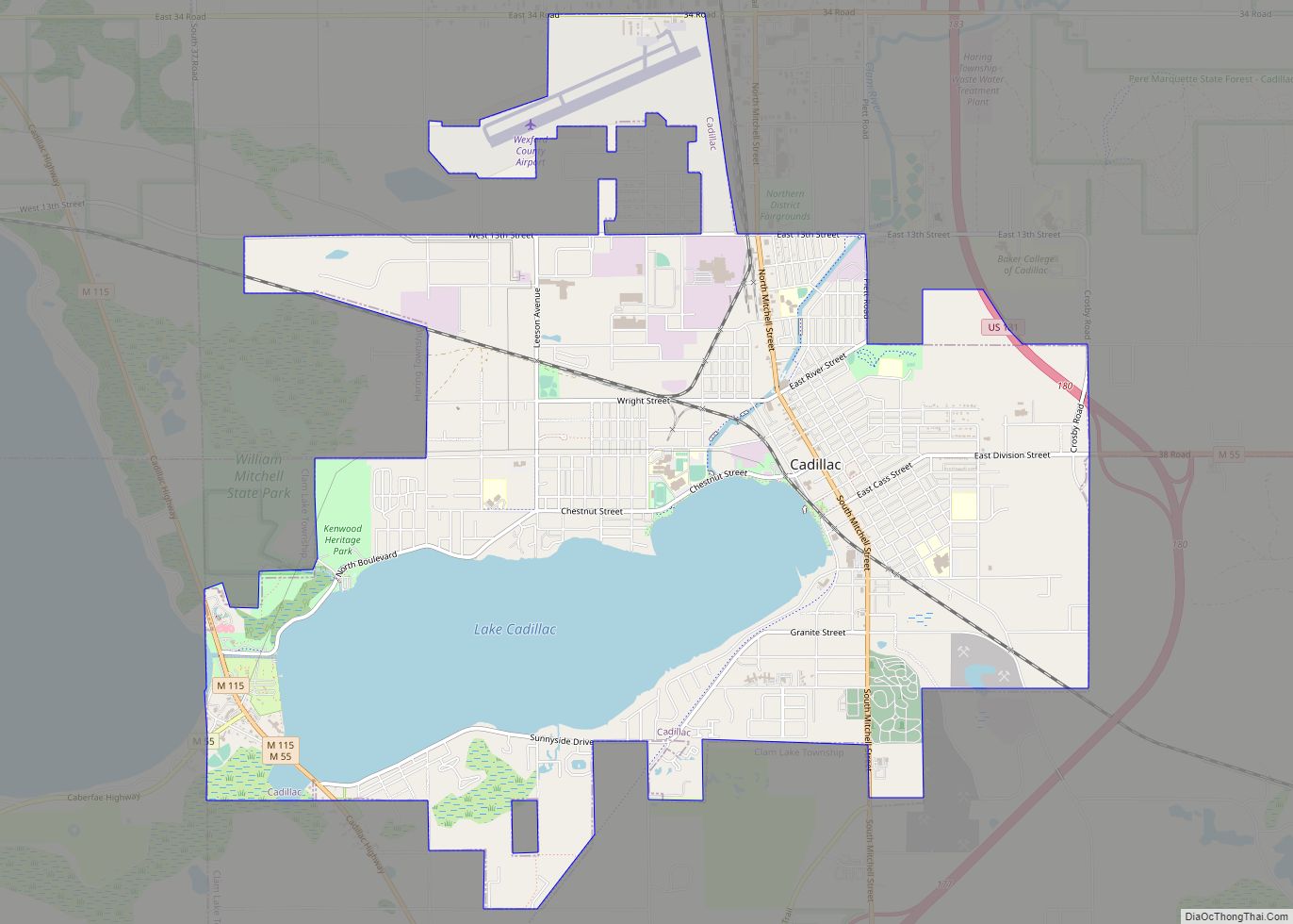
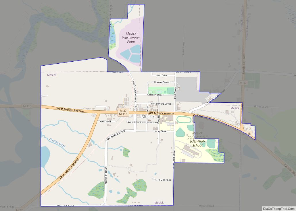
Online Interactive Map
Click on ![]() to view map in "full screen" mode.
to view map in "full screen" mode.
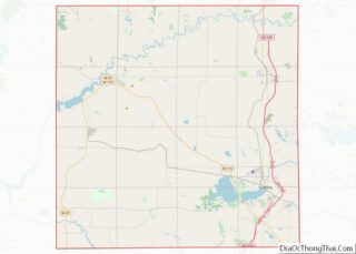
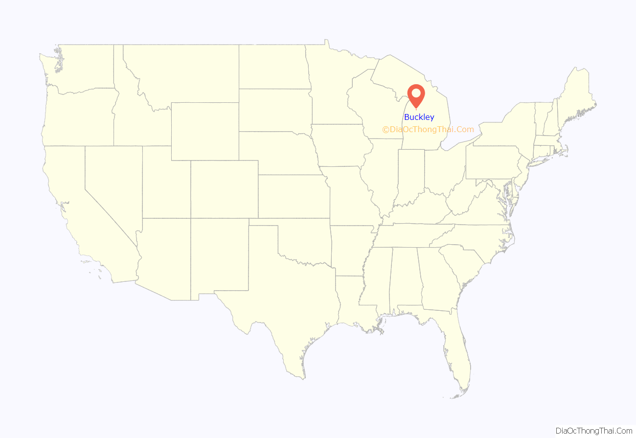
Buckley location map. Where is Buckley village?
History
Buckley was originally founded in 1905 as a railroad station operated by the Manistee and North-Eastern Railroad, and the community was named for the local Buckley & Douglas Lumber Company. The Buckley post office was established on March 31, 1906. The community incorporated as a village in 1907.
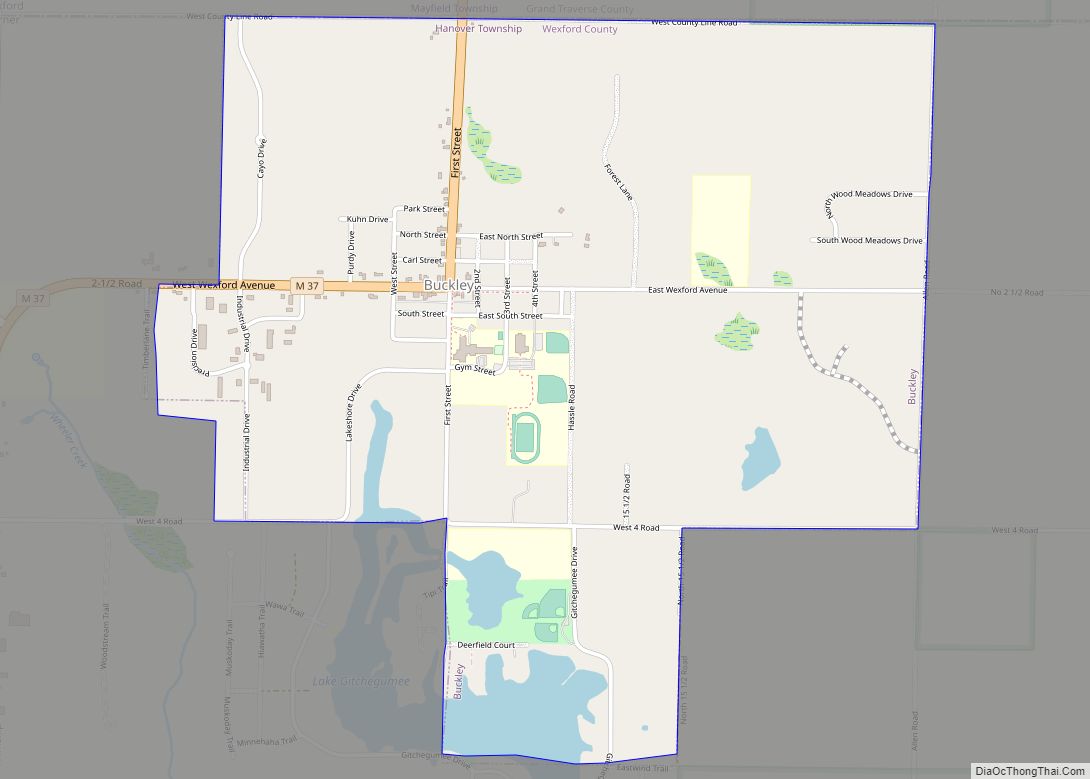
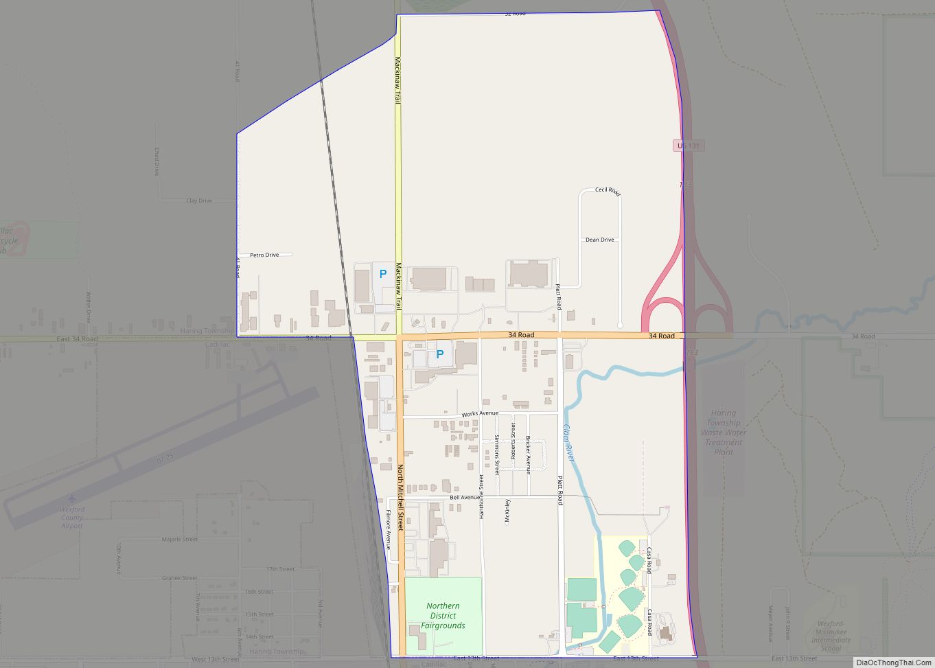
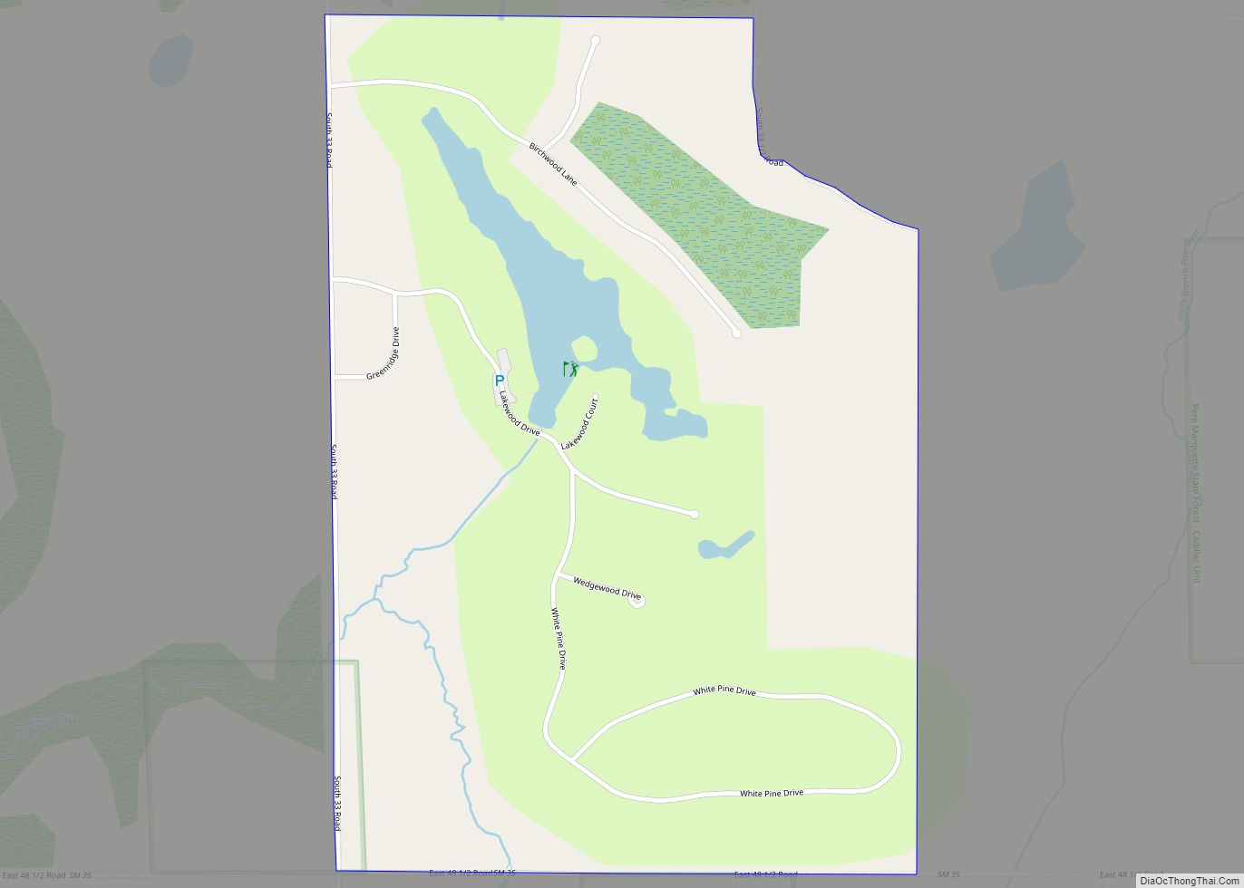
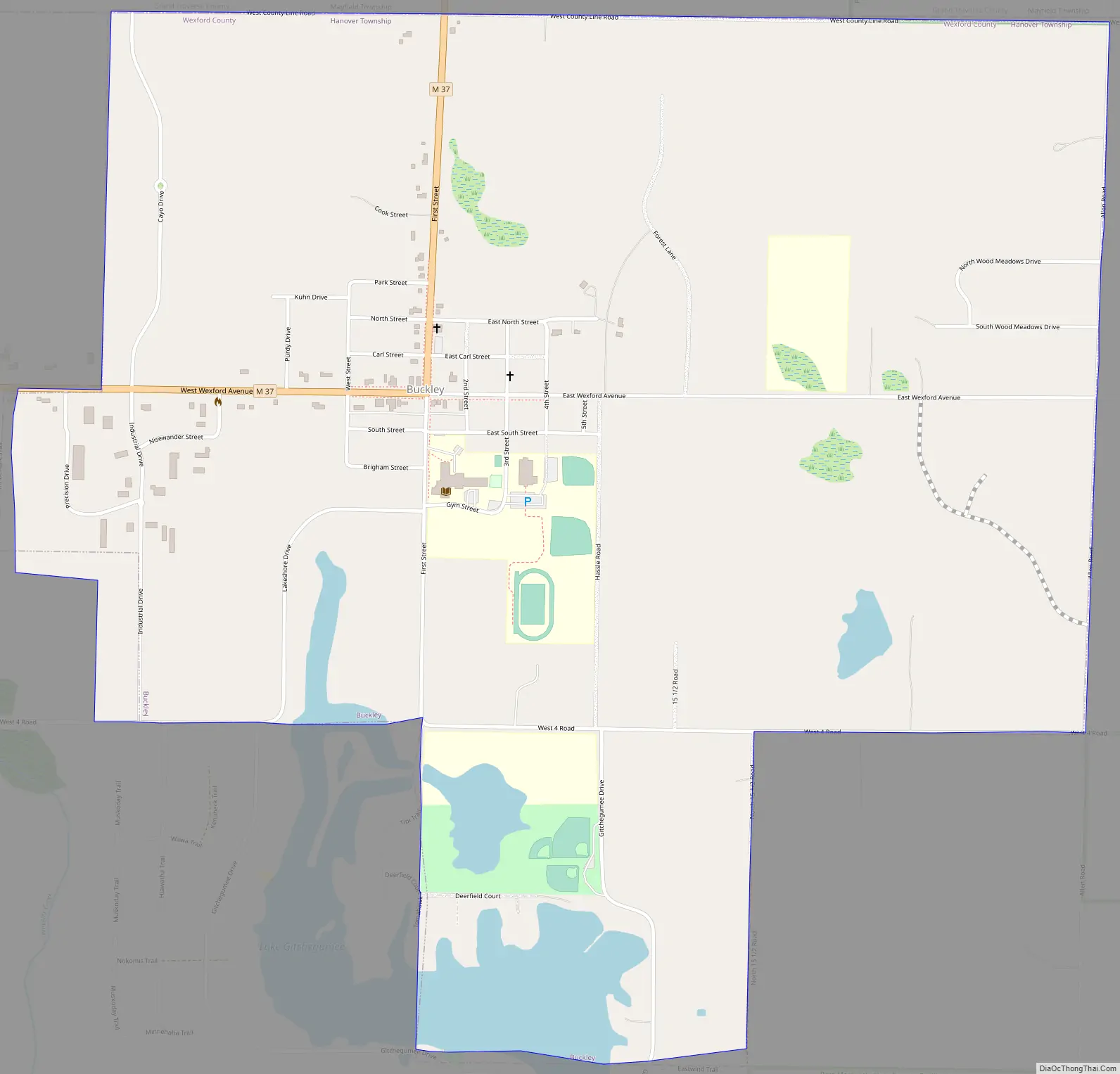
Buckley Road Map
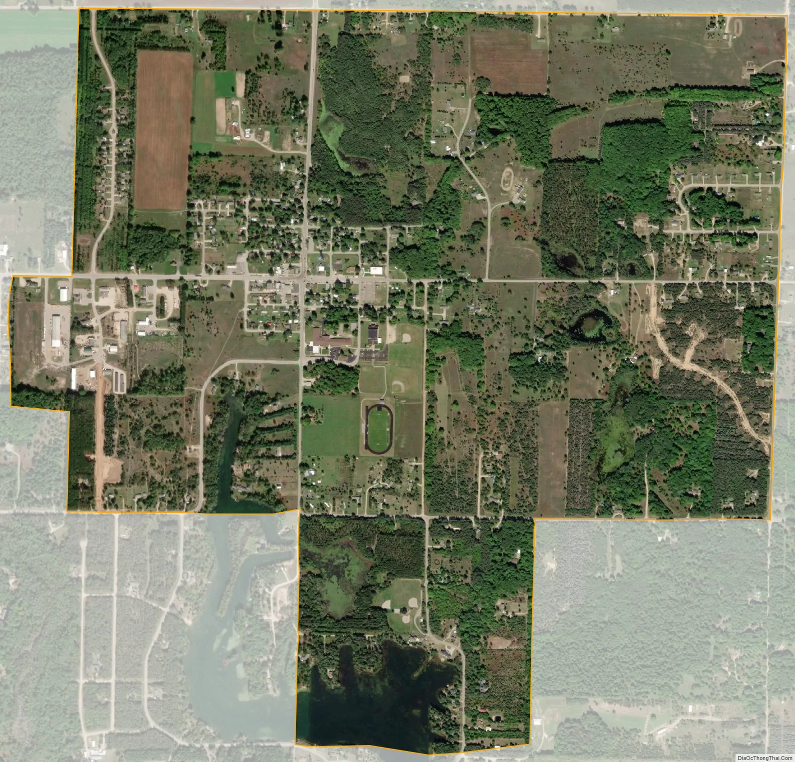
Buckley city Satellite Map
Geography
According to the U.S. Census Bureau, the village has a total area of 1.84 square miles (4.77 km), of which 1.78 square miles (4.61 km) is land and 0.06 square miles (0.16 km) (3.265) is water.
Major highways
- M-37 runs through the northwest section of the village.
See also
Map of Michigan State and its subdivision:- Alcona
- Alger
- Allegan
- Alpena
- Antrim
- Arenac
- Baraga
- Barry
- Bay
- Benzie
- Berrien
- Branch
- Calhoun
- Cass
- Charlevoix
- Cheboygan
- Chippewa
- Clare
- Clinton
- Crawford
- Delta
- Dickinson
- Eaton
- Emmet
- Genesee
- Gladwin
- Gogebic
- Grand Traverse
- Gratiot
- Hillsdale
- Houghton
- Huron
- Ingham
- Ionia
- Iosco
- Iron
- Isabella
- Jackson
- Kalamazoo
- Kalkaska
- Kent
- Keweenaw
- Lake
- Lake Hurron
- Lake Michigan
- Lake St. Clair
- Lake Superior
- Lapeer
- Leelanau
- Lenawee
- Livingston
- Luce
- Mackinac
- Macomb
- Manistee
- Marquette
- Mason
- Mecosta
- Menominee
- Midland
- Missaukee
- Monroe
- Montcalm
- Montmorency
- Muskegon
- Newaygo
- Oakland
- Oceana
- Ogemaw
- Ontonagon
- Osceola
- Oscoda
- Otsego
- Ottawa
- Presque Isle
- Roscommon
- Saginaw
- Saint Clair
- Saint Joseph
- Sanilac
- Schoolcraft
- Shiawassee
- Tuscola
- Van Buren
- Washtenaw
- Wayne
- Wexford
- Alabama
- Alaska
- Arizona
- Arkansas
- California
- Colorado
- Connecticut
- Delaware
- District of Columbia
- Florida
- Georgia
- Hawaii
- Idaho
- Illinois
- Indiana
- Iowa
- Kansas
- Kentucky
- Louisiana
- Maine
- Maryland
- Massachusetts
- Michigan
- Minnesota
- Mississippi
- Missouri
- Montana
- Nebraska
- Nevada
- New Hampshire
- New Jersey
- New Mexico
- New York
- North Carolina
- North Dakota
- Ohio
- Oklahoma
- Oregon
- Pennsylvania
- Rhode Island
- South Carolina
- South Dakota
- Tennessee
- Texas
- Utah
- Vermont
- Virginia
- Washington
- West Virginia
- Wisconsin
- Wyoming