Chelsea is a city in Washtenaw County in the U.S. state of Michigan. The population was 5,467 at the 2020 census.
| Name: | Chelsea city |
|---|---|
| LSAD Code: | 25 |
| LSAD Description: | city (suffix) |
| State: | Michigan |
| County: | Washtenaw County |
| Incorporated: | 1889 (village) 2004 (city) |
| Elevation: | 932 ft (284 m) |
| Total Area: | 3.67 sq mi (9.50 km²) |
| Land Area: | 3.62 sq mi (9.37 km²) |
| Water Area: | 0.05 sq mi (0.13 km²) |
| Total Population: | 5,467 |
| Population Density: | 1,511.89/sq mi (583.68/km²) |
| Area code: | 734 |
| FIPS code: | 2615020 |
| GNISfeature ID: | 0623143 |
Online Interactive Map
Click on ![]() to view map in "full screen" mode.
to view map in "full screen" mode.
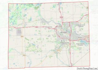
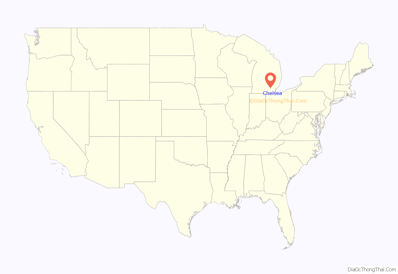
Chelsea location map. Where is Chelsea city?
History
The area was first settled as early as 1820 within the Michigan Territory by settler Cyrus Beckwith. It would be organized as Sylvan Township in 1834. The Michigan Central Railroad constructed a line through the area in 1848, and a post office was first established on January 4, 1849. It was originally named Kendon. The name was changed to Chelsea on July 19, 1850 when the train station opened and community was formally platted. The name Chelsea came from Elisha Congdon, who suggested the name after his hometown of Chelsea, Massachusetts. Chelsea incorporated as a village in 1889. The Chelsea courthouse is housed in a 120-year-old bank building in downtown.
The village of Chelsea incorporated into a city in 2004. In 2011, the downtown area of Chelsea was listed on the National Register of Historic Places as the Chelsea Commercial Historic District.
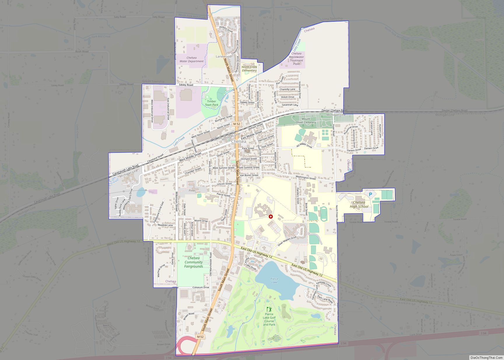
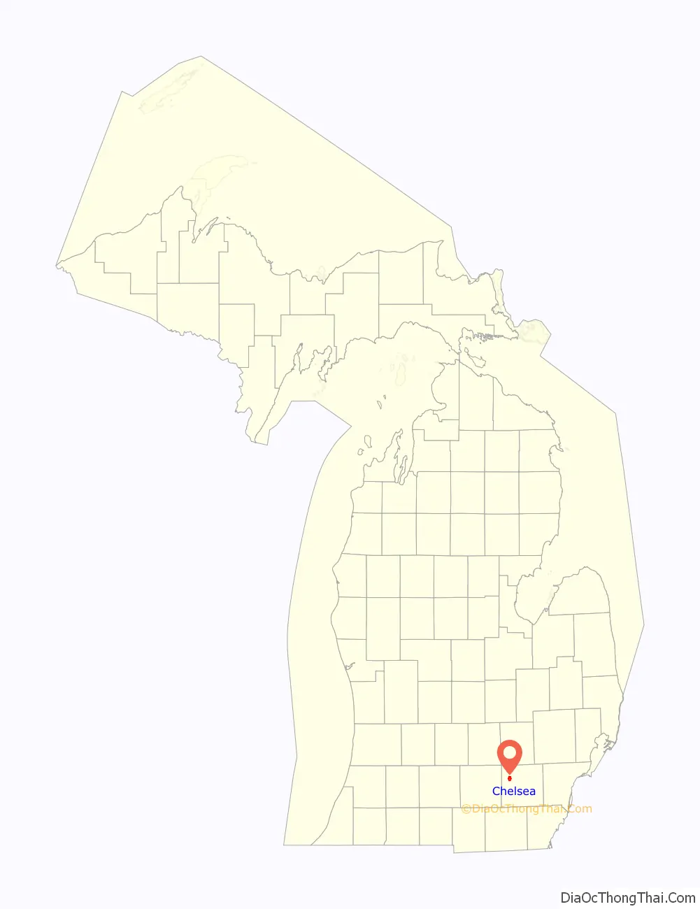
Chelsea Road Map

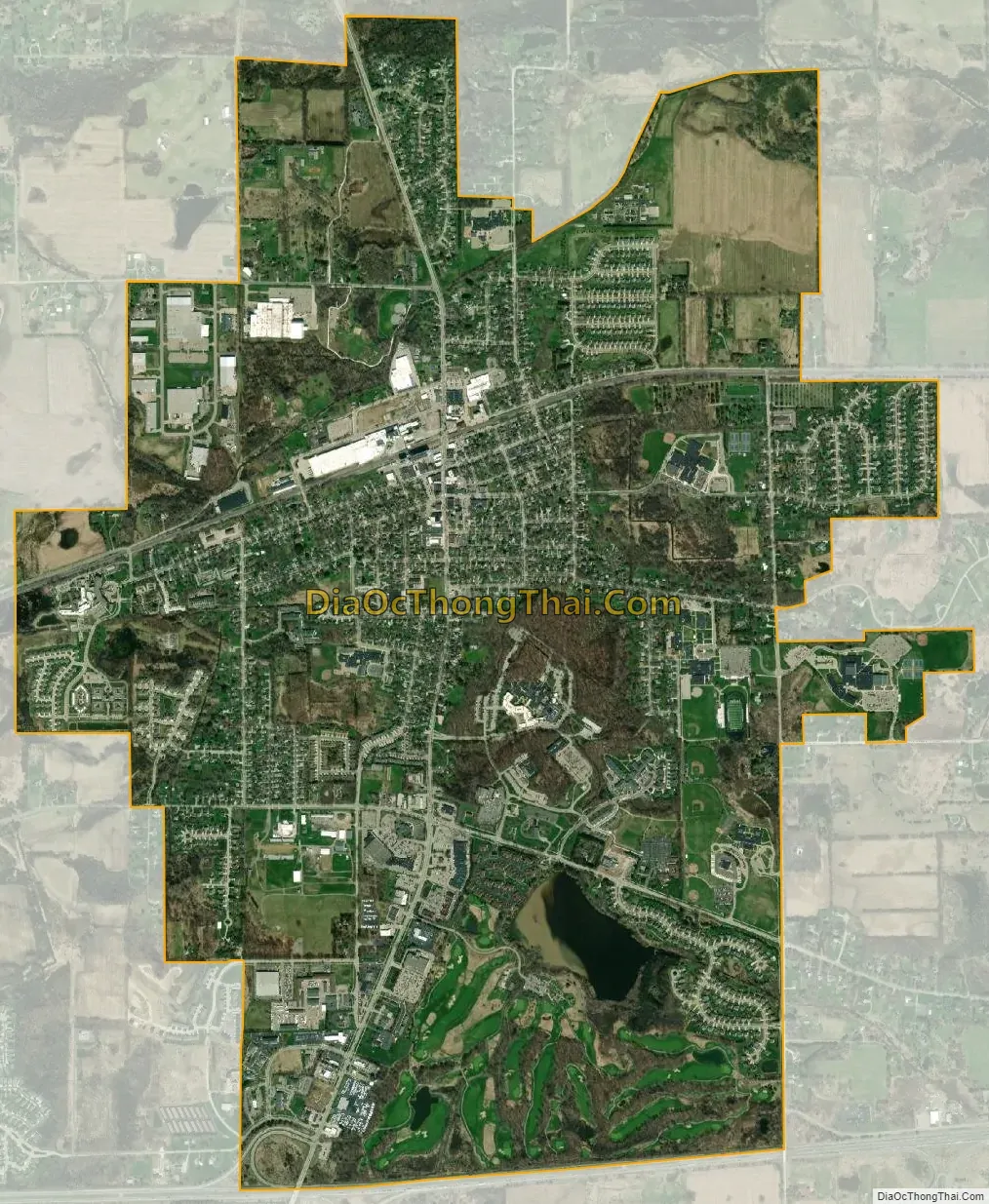
Chelsea city Satellite Map
Geography
According to the U.S. Census Bureau, the city has a total area of 3.67 square miles (9.51 km), of which 3.62 square miles (9.38 km) is land and 0.05 square miles (0.13 km) (1.36%) is water.
The Border-to-Border Trail runs through the city.
Major highways
- I-94 forms the southernmost boundary of the city
- M-52 (Main Street) runs south–north through the center of the city.
Climate
This climatic region has large, varying seasonal temperature differences, with warm to hot (and often humid) summers and cold (sometimes severely cold) winters. According to the Köppen Climate Classification system, Chelsea has a humid continental climate, abbreviated “Dfb” on climate maps.
See also
Map of Michigan State and its subdivision:- Alcona
- Alger
- Allegan
- Alpena
- Antrim
- Arenac
- Baraga
- Barry
- Bay
- Benzie
- Berrien
- Branch
- Calhoun
- Cass
- Charlevoix
- Cheboygan
- Chippewa
- Clare
- Clinton
- Crawford
- Delta
- Dickinson
- Eaton
- Emmet
- Genesee
- Gladwin
- Gogebic
- Grand Traverse
- Gratiot
- Hillsdale
- Houghton
- Huron
- Ingham
- Ionia
- Iosco
- Iron
- Isabella
- Jackson
- Kalamazoo
- Kalkaska
- Kent
- Keweenaw
- Lake
- Lake Hurron
- Lake Michigan
- Lake St. Clair
- Lake Superior
- Lapeer
- Leelanau
- Lenawee
- Livingston
- Luce
- Mackinac
- Macomb
- Manistee
- Marquette
- Mason
- Mecosta
- Menominee
- Midland
- Missaukee
- Monroe
- Montcalm
- Montmorency
- Muskegon
- Newaygo
- Oakland
- Oceana
- Ogemaw
- Ontonagon
- Osceola
- Oscoda
- Otsego
- Ottawa
- Presque Isle
- Roscommon
- Saginaw
- Saint Clair
- Saint Joseph
- Sanilac
- Schoolcraft
- Shiawassee
- Tuscola
- Van Buren
- Washtenaw
- Wayne
- Wexford
- Alabama
- Alaska
- Arizona
- Arkansas
- California
- Colorado
- Connecticut
- Delaware
- District of Columbia
- Florida
- Georgia
- Hawaii
- Idaho
- Illinois
- Indiana
- Iowa
- Kansas
- Kentucky
- Louisiana
- Maine
- Maryland
- Massachusetts
- Michigan
- Minnesota
- Mississippi
- Missouri
- Montana
- Nebraska
- Nevada
- New Hampshire
- New Jersey
- New Mexico
- New York
- North Carolina
- North Dakota
- Ohio
- Oklahoma
- Oregon
- Pennsylvania
- Rhode Island
- South Carolina
- South Dakota
- Tennessee
- Texas
- Utah
- Vermont
- Virginia
- Washington
- West Virginia
- Wisconsin
- Wyoming