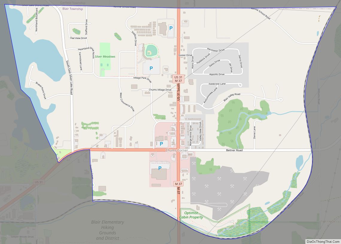
Chum’s Corners (often referred to as Chums) is an unincorporated community and census-designated place (CDP) in Grand Traverse County in the U.S. state of Michigan. At the 2020 census, the population was 1,065. The community is located within Blair Township.
| Name: | Chums Corner CDP |
|---|---|
| LSAD Code: | 57 |
| LSAD Description: | CDP (suffix) |
| State: | Michigan |
| County: | Grand Traverse County |
| Elevation: | 889 ft (271 m) |
| Total Area: | 2.79 sq mi (7.24 km²) |
| Land Area: | 2.66 sq mi (6.89 km²) |
| Water Area: | 0.14 sq mi (0.35 km²) |
| Total Population: | 1,065 |
| Population Density: | 400.38/sq mi (154.61/km²) |
| Area code: | 231 |
| FIPS code: | 2615715 |
| GNISfeature ID: | 6223278 |
Online Interactive Map
Click on ![]() to view map in "full screen" mode.
to view map in "full screen" mode.
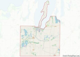
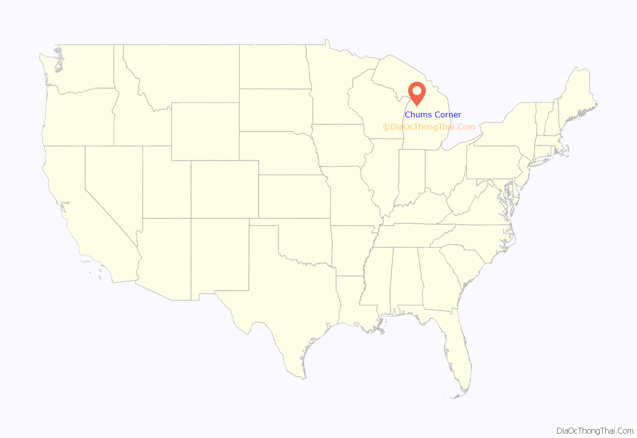
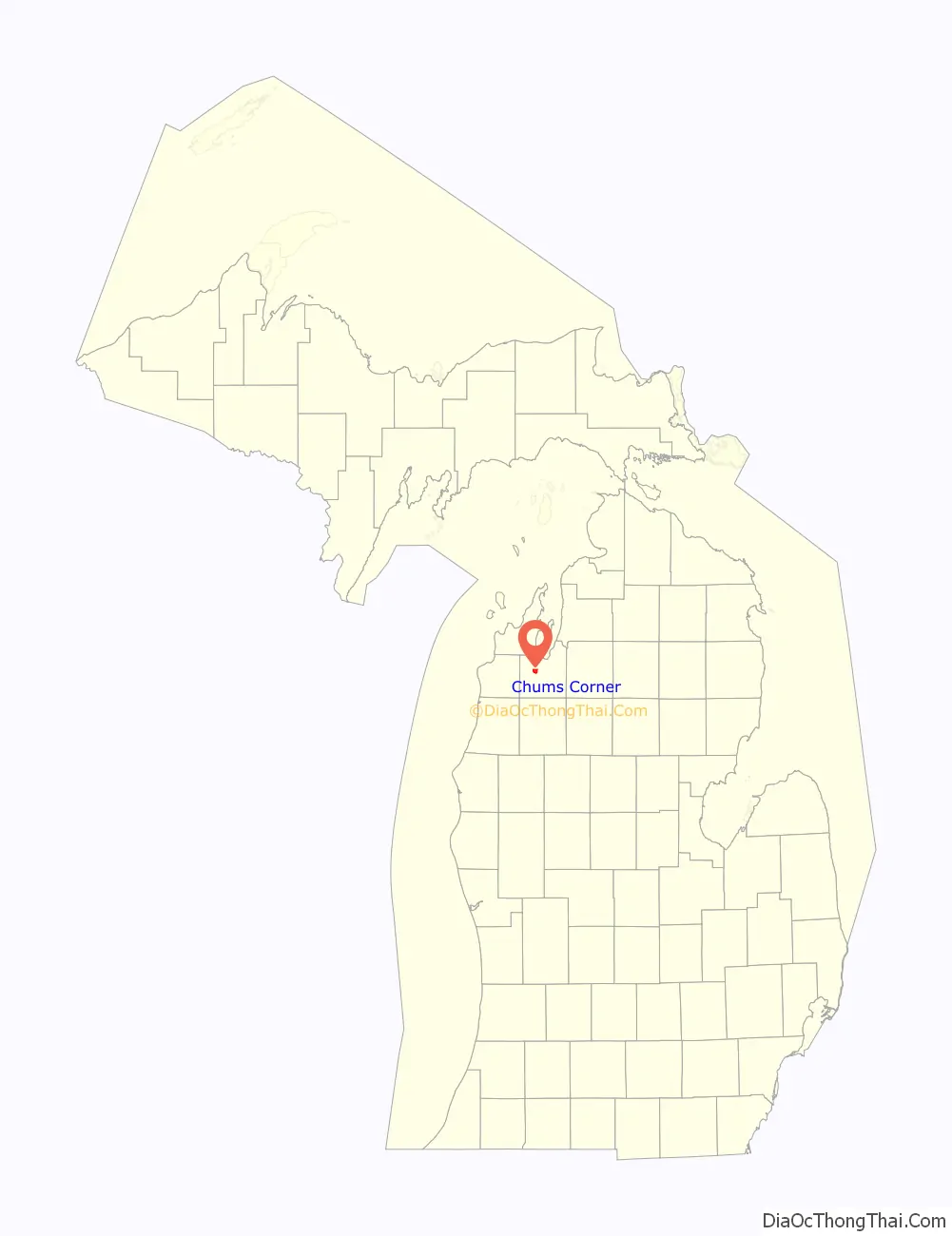
Chums Corner location map. Where is Chums Corner CDP?
History
Around 1932, Deronda “Chum” Crandall and his wife Eva began operating a gas station and a grocery store at a major highway intersection a few miles south of Traverse City. Over the years the intersection became known as “Chum’s Corners”. Chum sold the business and retired in 1953, and died in Traverse City in early 1959.
The community of Chums Corner was listed as a newly-organized census-designated place for the 2010 census, meaning it now has officially defined boundaries and population statistics for the first time.
In 2020, Chasten Buttigieg, spouse of United States Secretary of Transportation Pete Buttigieg, wrote I Have Something to Tell You. The memoir includes anecdotes about Buttigieg’s childhood growing up in a neighborhood in Chums Corner. Buttigieg noted the local stigma associated with living in Chums Corner or nearby Grawn.
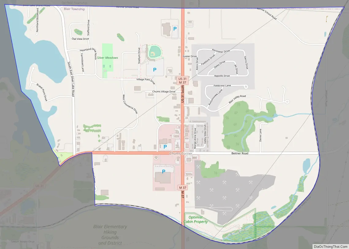
Chums Corner Road Map
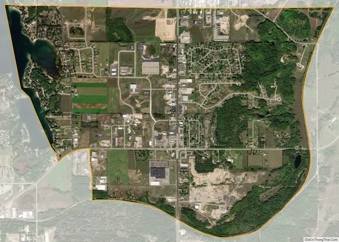
Chums Corner city Satellite Map
Geography
According to the U.S. Census Bureau, the CDP has a total area of 2.66 square miles (6.89 km), all land.
Major highways
- US 31 enters from the west and takes a 90° angle north in the center of the community.
- M-37 runs south–north through the center of the community and merges concurrent with U.S. Route 31.
See also
Map of Michigan State and its subdivision:- Alcona
- Alger
- Allegan
- Alpena
- Antrim
- Arenac
- Baraga
- Barry
- Bay
- Benzie
- Berrien
- Branch
- Calhoun
- Cass
- Charlevoix
- Cheboygan
- Chippewa
- Clare
- Clinton
- Crawford
- Delta
- Dickinson
- Eaton
- Emmet
- Genesee
- Gladwin
- Gogebic
- Grand Traverse
- Gratiot
- Hillsdale
- Houghton
- Huron
- Ingham
- Ionia
- Iosco
- Iron
- Isabella
- Jackson
- Kalamazoo
- Kalkaska
- Kent
- Keweenaw
- Lake
- Lake Hurron
- Lake Michigan
- Lake St. Clair
- Lake Superior
- Lapeer
- Leelanau
- Lenawee
- Livingston
- Luce
- Mackinac
- Macomb
- Manistee
- Marquette
- Mason
- Mecosta
- Menominee
- Midland
- Missaukee
- Monroe
- Montcalm
- Montmorency
- Muskegon
- Newaygo
- Oakland
- Oceana
- Ogemaw
- Ontonagon
- Osceola
- Oscoda
- Otsego
- Ottawa
- Presque Isle
- Roscommon
- Saginaw
- Saint Clair
- Saint Joseph
- Sanilac
- Schoolcraft
- Shiawassee
- Tuscola
- Van Buren
- Washtenaw
- Wayne
- Wexford
- Alabama
- Alaska
- Arizona
- Arkansas
- California
- Colorado
- Connecticut
- Delaware
- District of Columbia
- Florida
- Georgia
- Hawaii
- Idaho
- Illinois
- Indiana
- Iowa
- Kansas
- Kentucky
- Louisiana
- Maine
- Maryland
- Massachusetts
- Michigan
- Minnesota
- Mississippi
- Missouri
- Montana
- Nebraska
- Nevada
- New Hampshire
- New Jersey
- New Mexico
- New York
- North Carolina
- North Dakota
- Ohio
- Oklahoma
- Oregon
- Pennsylvania
- Rhode Island
- South Carolina
- South Dakota
- Tennessee
- Texas
- Utah
- Vermont
- Virginia
- Washington
- West Virginia
- Wisconsin
- Wyoming