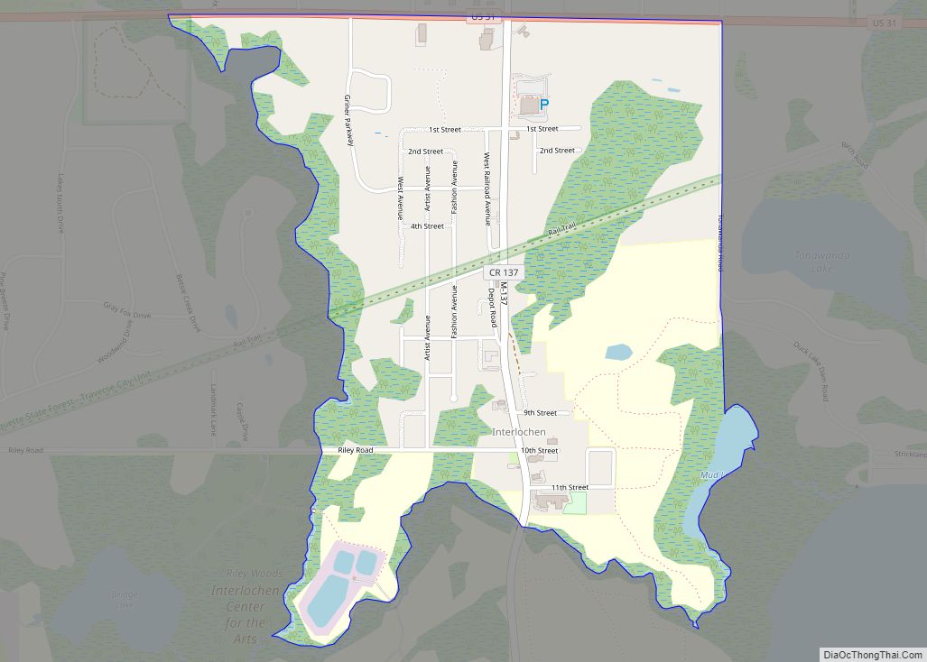
Interlochen (/ˈɪntərˈlɒkɪn/ IN-ter-lock-in) is an unincorporated community and census-designated place (CDP) in Grand Traverse County in the U.S. state of Michigan. At the 2020 census, the population was 694, up from 583 at the 2010 census. The community is located within Green Lake Township.
The community is home to the Interlochen Center for the Arts and also contains Interlochen State Park between the shores of Duck Lake and Green Lake. Interlochen is a designated Michigan State Historic Site.
| Name: | Interlochen CDP |
|---|---|
| LSAD Code: | 57 |
| LSAD Description: | CDP (suffix) |
| State: | Michigan |
| County: | Grand Traverse County |
| Elevation: | 840 ft (256 m) |
| Total Area: | 1.27 sq mi (3.29 km²) |
| Land Area: | 1.24 sq mi (3.21 km²) |
| Water Area: | 0.03 sq mi (0.08 km²) |
| Total Population: | 694 |
| Population Density: | 559.23/sq mi (216.00/km²) |
| Area code: | 231 |
| FIPS code: | 2640800 |
| GNISfeature ID: | 629053 |
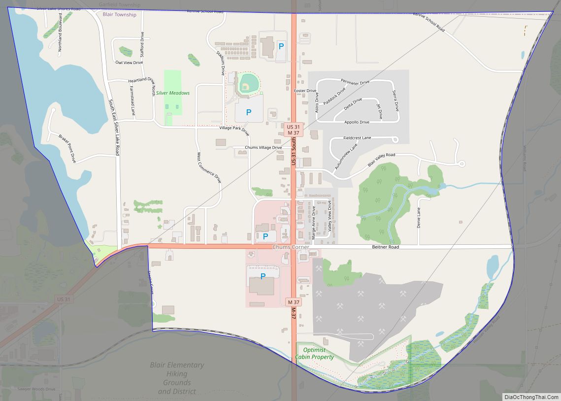
Online Interactive Map
Click on ![]() to view map in "full screen" mode.
to view map in "full screen" mode.
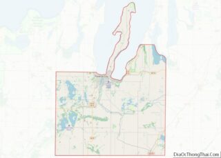
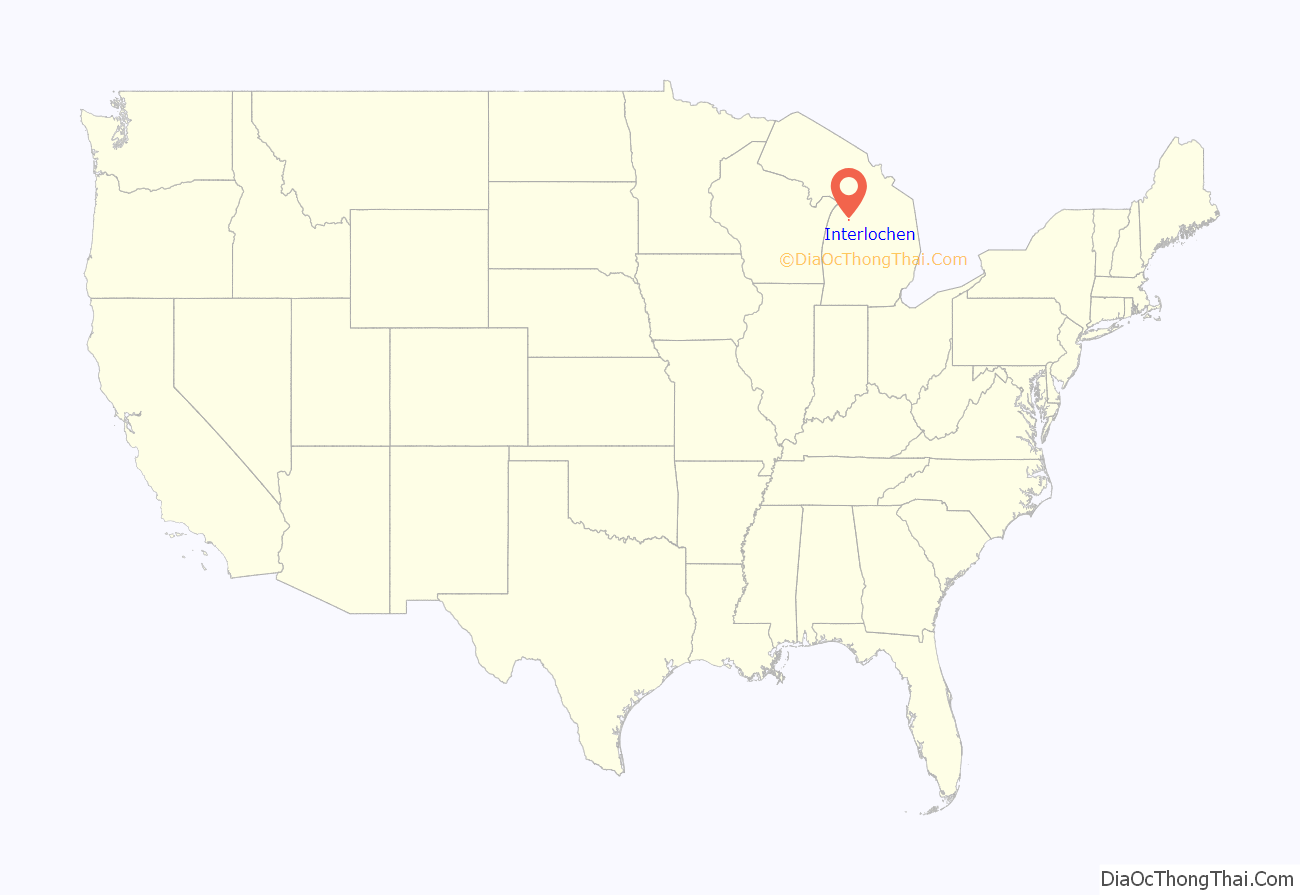
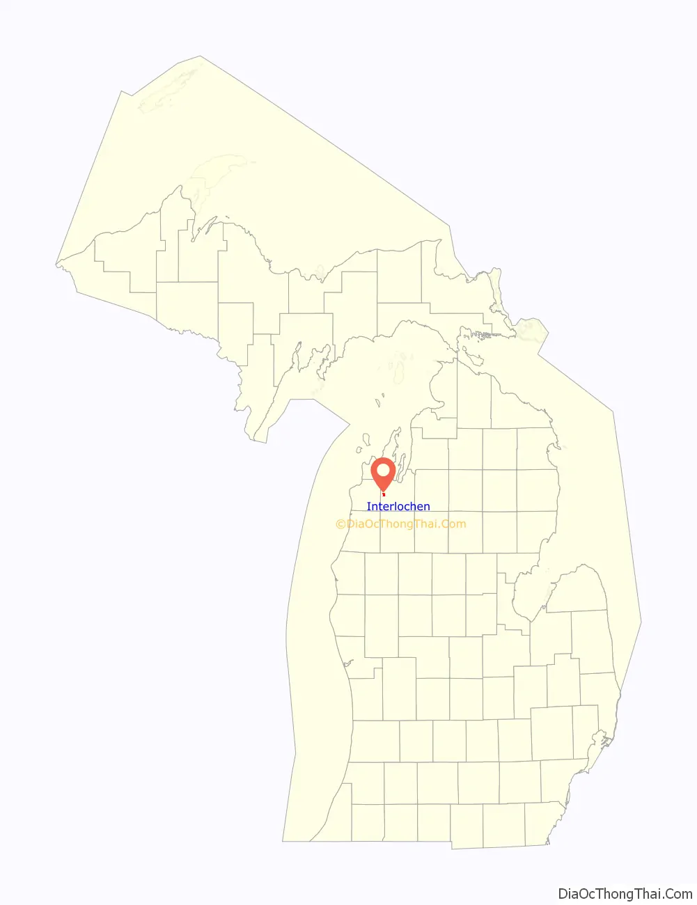
Interlochen location map. Where is Interlochen CDP?
History
Interlochen takes its name from the Latin “inter“, meaning “between”, and the Scottish Gaelic “lochen“, meaning lakes.
Before the arrival of European settlers, members of the Odawa people lived between the lakes they called Wahbekaness and Wahbekanetta (now named Duck Lake and Green Lake, respectively). Beginning in the late 19th century, European settlers began logging and fishing industries in the area, and founded the small village of Wylie, one mile south of present-day Interlochen. Because of logging, the Manistee and North-Eastern Railroad (owned by the Buckley and Douglas Lumber Company of Manistee) extended its line north from Nessen City and arrived between the lakes in the fall of 1889. Similarly, the Chicago and West Michigan Railway extended its line north from Baldwin on its way to Traverse City in 1890. The two lines crossed in current-day downtown Interlochen where a depot and interlocking tower were located. The original townsite, however, was platted just south of the depot along either side of the M&NE rail line in late 1889 or early 1890, with the business district centering on the now-former M-137 and Riley Rd/10th Street.
As the lumber industry grew, the area became more deforested. However, it was predicted from the beginning that the area would become a popular summer resort, and so Buckley and Douglas set aside 186 acres of virgin pines between Duck and Green lakes for preservation. The result was Pine Park, a public retreat boasting virgin forests and pristine lakes. A small railroad depot named Pine Park Station was built. Visitors began flocking to the region during the warmer months to camp, fish, boat, and escape the heat of the crowded cities. Piggybacking on the vacation boom, local businessman Willis Pennington purchased land adjacent to Pine Park on the banks of Green Lake and opened the Pennington Hotel in 1909.
In the mid-1910s, local representatives became worried that Pine Park would soon be logged off and so they lobbied the Michigan Legislature for help. The state ultimately allocated $60,000 in 1917 to purchase the property, and the newly acquired parkland was dedicated as The Pines, later renamed Interlochen State Park, the first state park organized by the state of Michigan (Mackinac Island was originally a national park before becoming Michigan’s first state park in 1895).
In 1928, the National High School Orchestra Camp was founded by Joseph E. Maddy just south of Interlochen, and evolved to become Interlochen Center for the Arts, which includes a summer camp as well as a fine arts boarding high school and public radio station. The camp has expanded to both sides of J. Maddy Parkway (previously designated as a highway, M-137, in 1930 but decommissioned in 2020,), and enveloped the entire village of Wylie.
By the late 20th century, the railroads that brought students, vacationers, and lumber through Interlochen, had been removed. The north-south M&NE railroad was removed in 1934, and the west-east C&WM railroad (Pere Marquette Railway after 1899) removed in 1982. The area remains a popular vacation spot, with hiking, fishing, camping, boating, swimming, cross country skiing, and snowmobiling the most popular activities.
The community of Interlochen was listed as a newly organized census-designated place for the 2010 census, meaning it now has officially defined boundaries and population statistics for the first time.
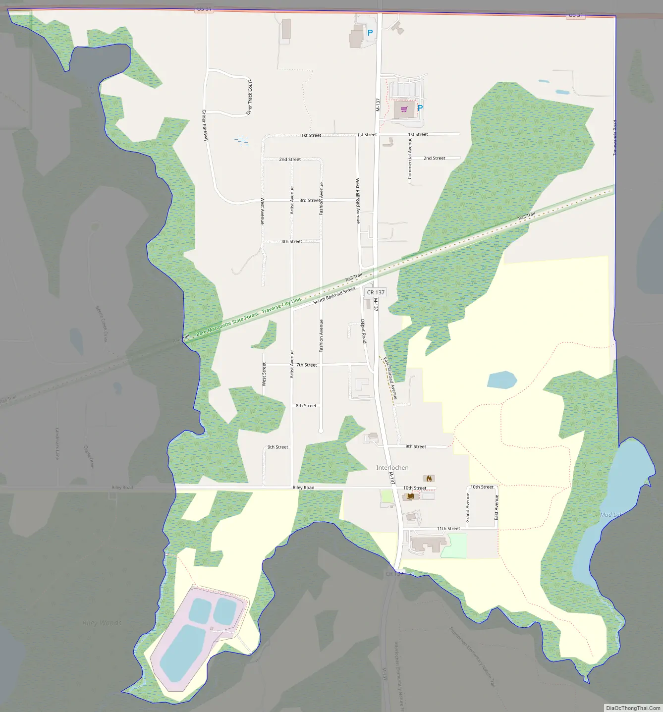
Interlochen Road Map
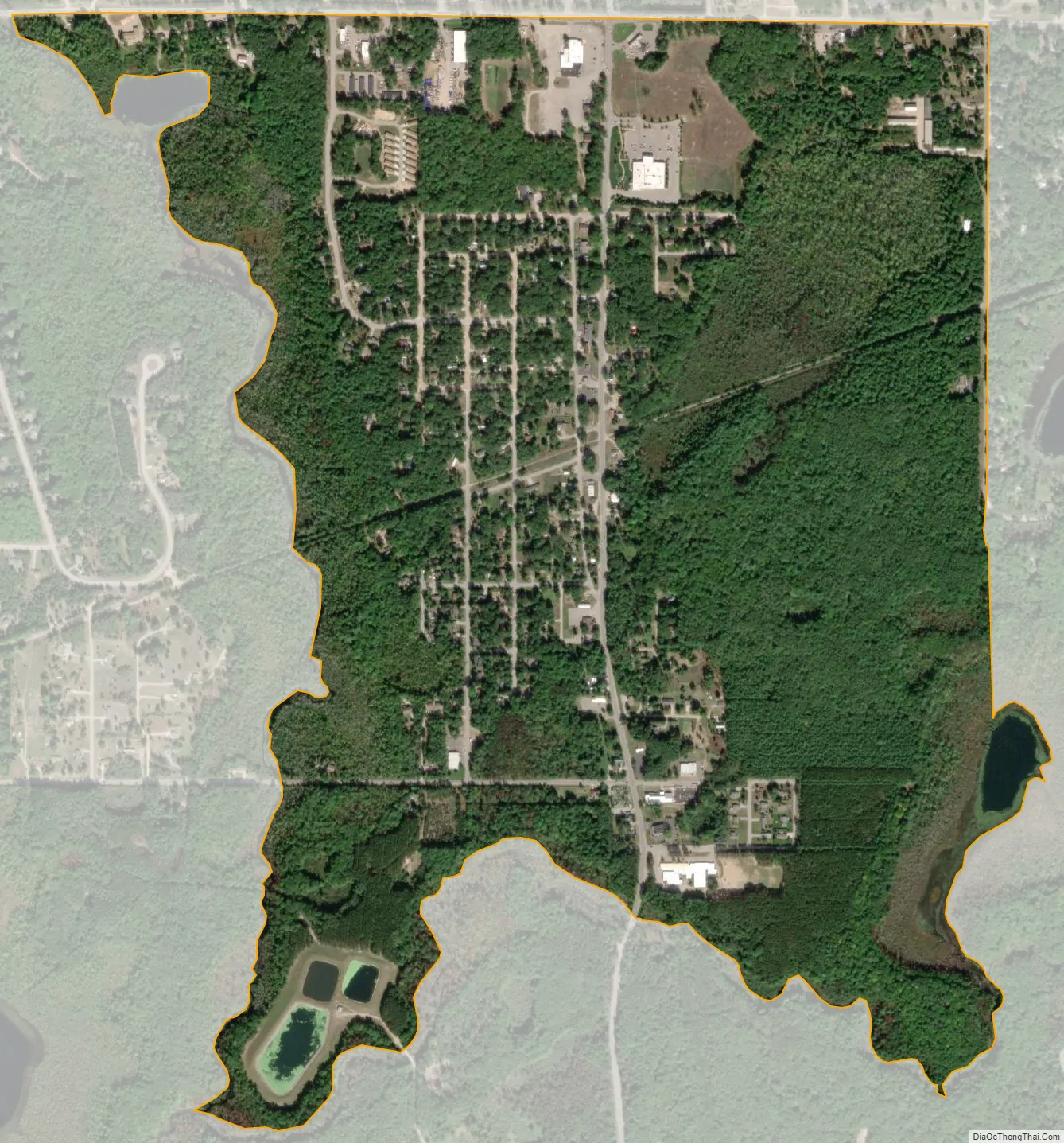
Interlochen city Satellite Map
Geography
According to the U.S. Census Bureau, the CDP has a total area of 1.27 square miles (3.29 km), of which 1.24 square miles (3.21 km) is land and 0.03 square miles (0.08 km) (2.36%) is water.
Interlochen is located within the Betsie River watershed.
See also
Map of Michigan State and its subdivision:- Alcona
- Alger
- Allegan
- Alpena
- Antrim
- Arenac
- Baraga
- Barry
- Bay
- Benzie
- Berrien
- Branch
- Calhoun
- Cass
- Charlevoix
- Cheboygan
- Chippewa
- Clare
- Clinton
- Crawford
- Delta
- Dickinson
- Eaton
- Emmet
- Genesee
- Gladwin
- Gogebic
- Grand Traverse
- Gratiot
- Hillsdale
- Houghton
- Huron
- Ingham
- Ionia
- Iosco
- Iron
- Isabella
- Jackson
- Kalamazoo
- Kalkaska
- Kent
- Keweenaw
- Lake
- Lake Hurron
- Lake Michigan
- Lake St. Clair
- Lake Superior
- Lapeer
- Leelanau
- Lenawee
- Livingston
- Luce
- Mackinac
- Macomb
- Manistee
- Marquette
- Mason
- Mecosta
- Menominee
- Midland
- Missaukee
- Monroe
- Montcalm
- Montmorency
- Muskegon
- Newaygo
- Oakland
- Oceana
- Ogemaw
- Ontonagon
- Osceola
- Oscoda
- Otsego
- Ottawa
- Presque Isle
- Roscommon
- Saginaw
- Saint Clair
- Saint Joseph
- Sanilac
- Schoolcraft
- Shiawassee
- Tuscola
- Van Buren
- Washtenaw
- Wayne
- Wexford
- Alabama
- Alaska
- Arizona
- Arkansas
- California
- Colorado
- Connecticut
- Delaware
- District of Columbia
- Florida
- Georgia
- Hawaii
- Idaho
- Illinois
- Indiana
- Iowa
- Kansas
- Kentucky
- Louisiana
- Maine
- Maryland
- Massachusetts
- Michigan
- Minnesota
- Mississippi
- Missouri
- Montana
- Nebraska
- Nevada
- New Hampshire
- New Jersey
- New Mexico
- New York
- North Carolina
- North Dakota
- Ohio
- Oklahoma
- Oregon
- Pennsylvania
- Rhode Island
- South Carolina
- South Dakota
- Tennessee
- Texas
- Utah
- Vermont
- Virginia
- Washington
- West Virginia
- Wisconsin
- Wyoming