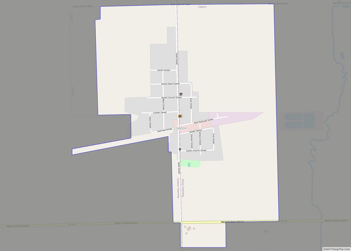
Clayton is a village in Lenawee County of the U.S. state of Michigan. The population was 311 at the 2020 census. The village is located within Hudson Township to the west and Dover Township to the east.
| Name: | Clayton village |
|---|---|
| LSAD Code: | 47 |
| LSAD Description: | village (suffix) |
| State: | Michigan |
| County: | Lenawee County |
| Incorporated: | 1870 |
| Elevation: | 896 ft (273 m) |
| Total Area: | 0.71 sq mi (1.84 km²) |
| Land Area: | 0.71 sq mi (1.84 km²) |
| Water Area: | 0.00 sq mi (0.00 km²) |
| Total Population: | 311 |
| Population Density: | 436.80/sq mi (168.77/km²) |
| Area code: | 517 |
| FIPS code: | 2616280 |
| GNISfeature ID: | 0623395 |
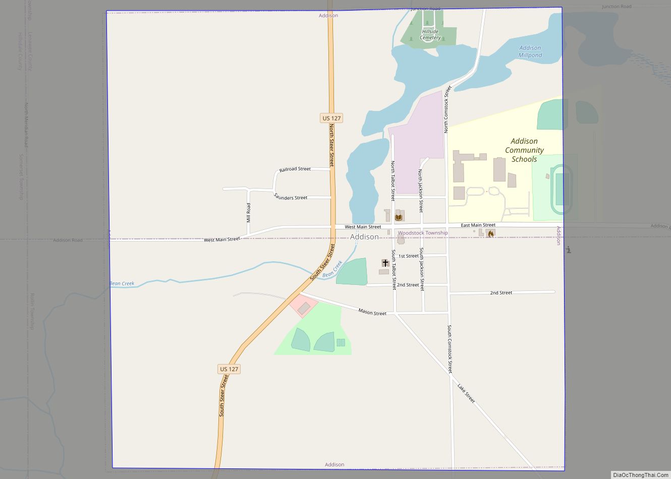
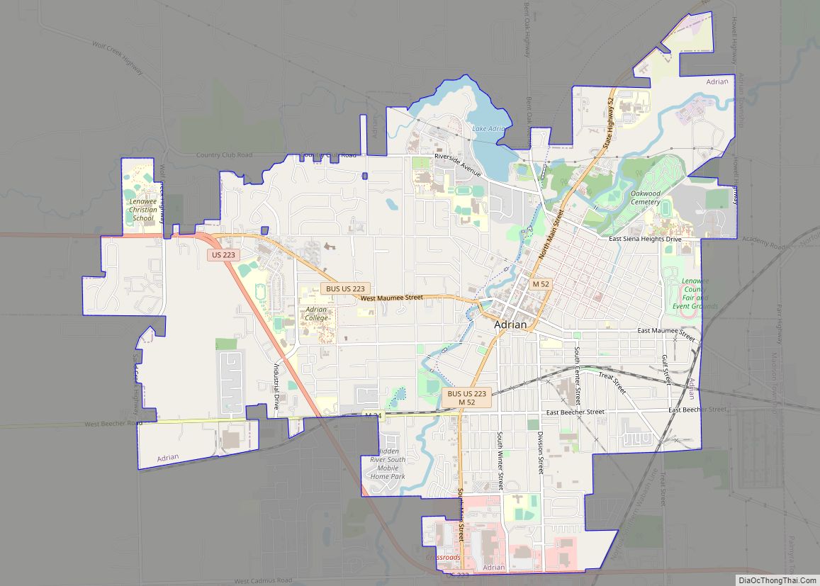
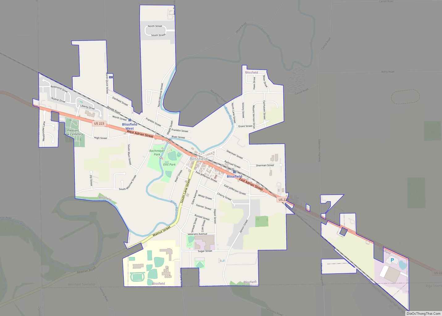
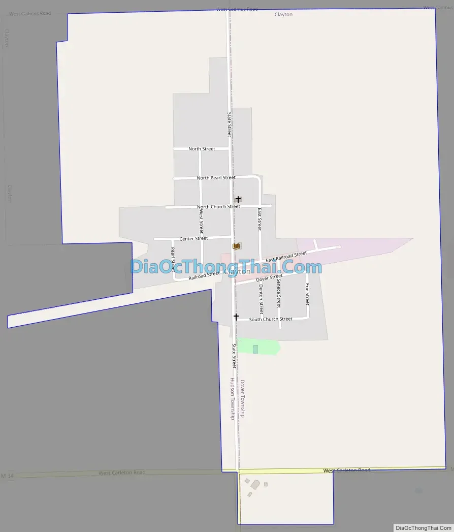
Online Interactive Map
Click on ![]() to view map in "full screen" mode.
to view map in "full screen" mode.
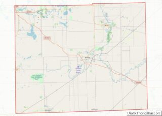
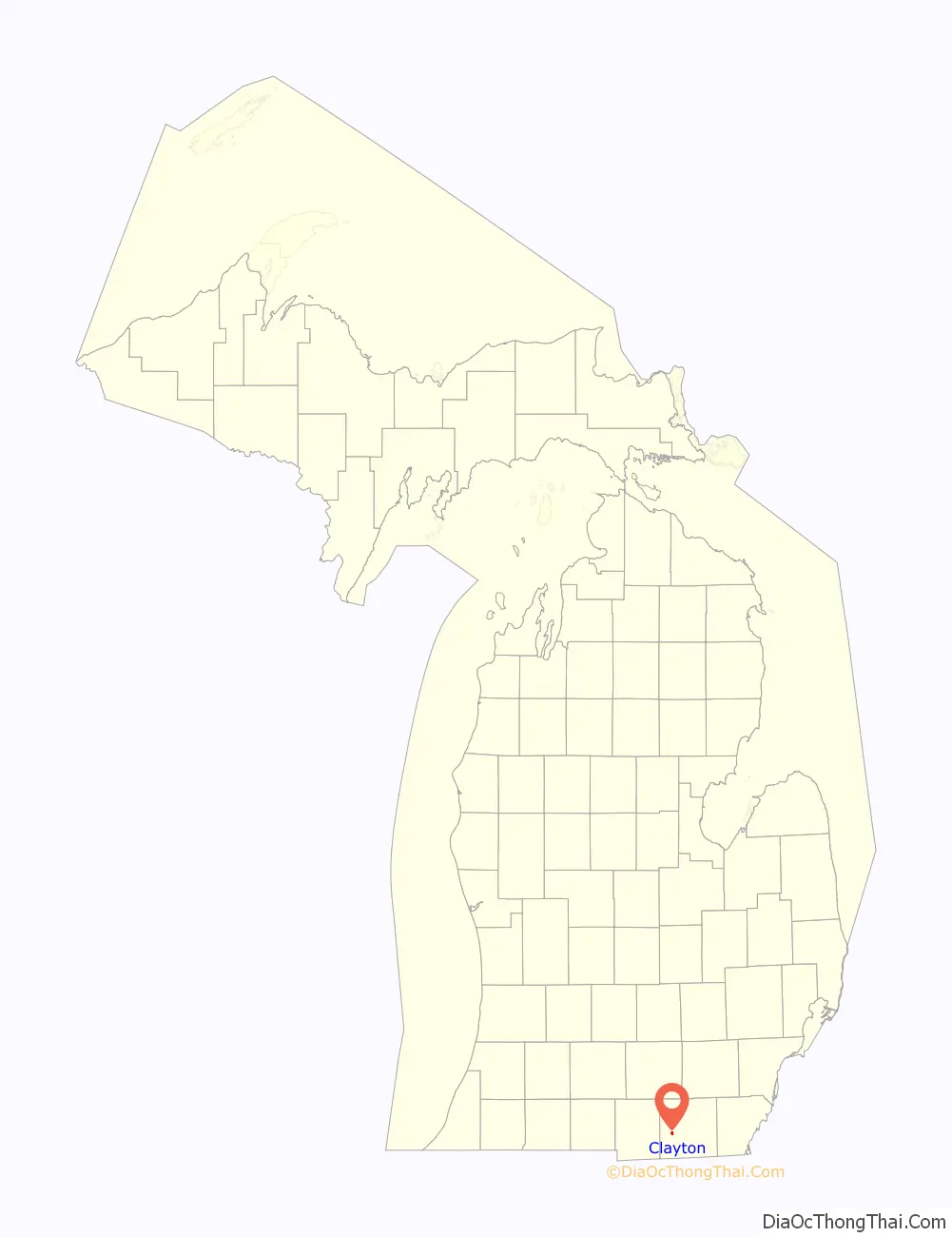
Clayton location map. Where is Clayton village?

History
The community was first settled in 1836 and named East Dover due to its location in eastern Dover Township. A post office began operating in East Dover on March 8, 1837 with Levi Soper serving as the first postmaster. Rueben Bird platted the community in 1843, and he had the post office name changed to Clayton on July 17, 1849 after his friend Reverend Clayton from New York. Clayton was incorporated as a village in 1870.
Clayton Road Map
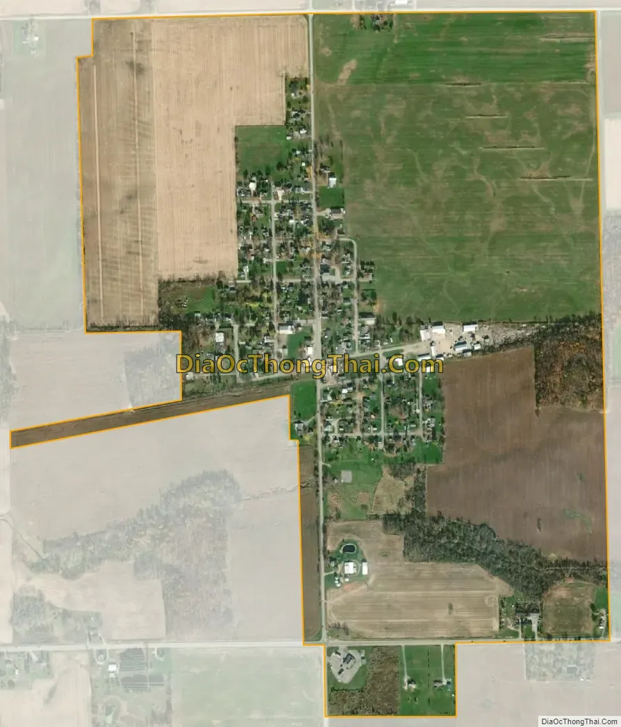
Clayton city Satellite Map
Geography
According to the U.S. Census Bureau, the village has a total area of 0.71 square miles (1.84 km), all land.
Major highways
- M-34 (West Carleton Road) runs east–west near the southern boundary of the village.
- M-156 (Morey Highway) has its northern terminus at M-34.
See also
Map of Michigan State and its subdivision:- Alcona
- Alger
- Allegan
- Alpena
- Antrim
- Arenac
- Baraga
- Barry
- Bay
- Benzie
- Berrien
- Branch
- Calhoun
- Cass
- Charlevoix
- Cheboygan
- Chippewa
- Clare
- Clinton
- Crawford
- Delta
- Dickinson
- Eaton
- Emmet
- Genesee
- Gladwin
- Gogebic
- Grand Traverse
- Gratiot
- Hillsdale
- Houghton
- Huron
- Ingham
- Ionia
- Iosco
- Iron
- Isabella
- Jackson
- Kalamazoo
- Kalkaska
- Kent
- Keweenaw
- Lake
- Lake Hurron
- Lake Michigan
- Lake St. Clair
- Lake Superior
- Lapeer
- Leelanau
- Lenawee
- Livingston
- Luce
- Mackinac
- Macomb
- Manistee
- Marquette
- Mason
- Mecosta
- Menominee
- Midland
- Missaukee
- Monroe
- Montcalm
- Montmorency
- Muskegon
- Newaygo
- Oakland
- Oceana
- Ogemaw
- Ontonagon
- Osceola
- Oscoda
- Otsego
- Ottawa
- Presque Isle
- Roscommon
- Saginaw
- Saint Clair
- Saint Joseph
- Sanilac
- Schoolcraft
- Shiawassee
- Tuscola
- Van Buren
- Washtenaw
- Wayne
- Wexford
- Alabama
- Alaska
- Arizona
- Arkansas
- California
- Colorado
- Connecticut
- Delaware
- District of Columbia
- Florida
- Georgia
- Hawaii
- Idaho
- Illinois
- Indiana
- Iowa
- Kansas
- Kentucky
- Louisiana
- Maine
- Maryland
- Massachusetts
- Michigan
- Minnesota
- Mississippi
- Missouri
- Montana
- Nebraska
- Nevada
- New Hampshire
- New Jersey
- New Mexico
- New York
- North Carolina
- North Dakota
- Ohio
- Oklahoma
- Oregon
- Pennsylvania
- Rhode Island
- South Carolina
- South Dakota
- Tennessee
- Texas
- Utah
- Vermont
- Virginia
- Washington
- West Virginia
- Wisconsin
- Wyoming