Delton is a census-designated place (CDP) in Barry Township in Barry County, Michigan, United States. The population was 872 at the 2010 census.
| Name: | Delton CDP |
|---|---|
| LSAD Code: | 57 |
| LSAD Description: | CDP (suffix) |
| State: | Michigan |
| County: | Barry County |
| Elevation: | 947 ft (289 m) |
| Total Area: | 2.55 sq mi (6.61 km²) |
| Land Area: | 2.21 sq mi (5.74 km²) |
| Water Area: | 0.34 sq mi (0.87 km²) |
| Total Population: | 854 |
| Population Density: | 385.55/sq mi (148.86/km²) |
| ZIP code: | 49046 |
| Area code: | Area code 269 |
| FIPS code: | 2621560 |
| GNISfeature ID: | 0624538 |
Online Interactive Map
Click on ![]() to view map in "full screen" mode.
to view map in "full screen" mode.
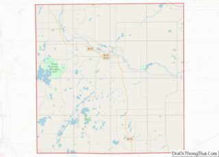
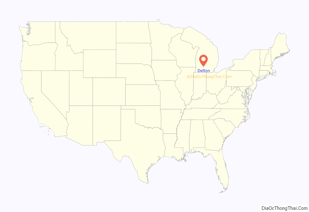
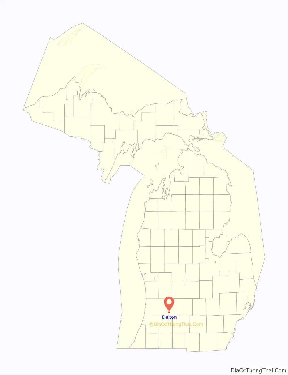
Delton location map. Where is Delton CDP?
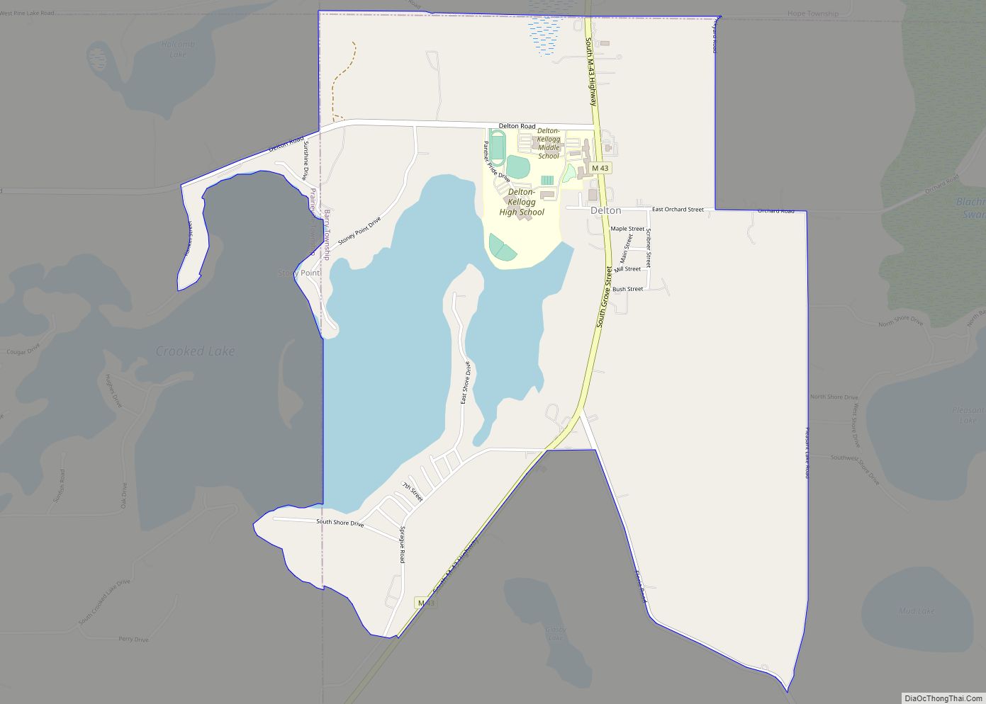
Delton Road Map
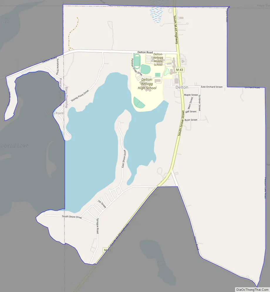
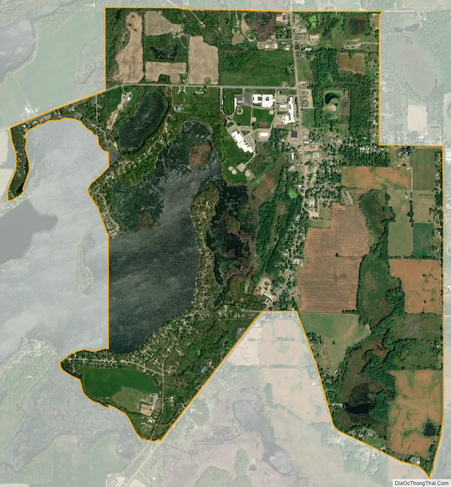
Delton city Satellite Map
Geography
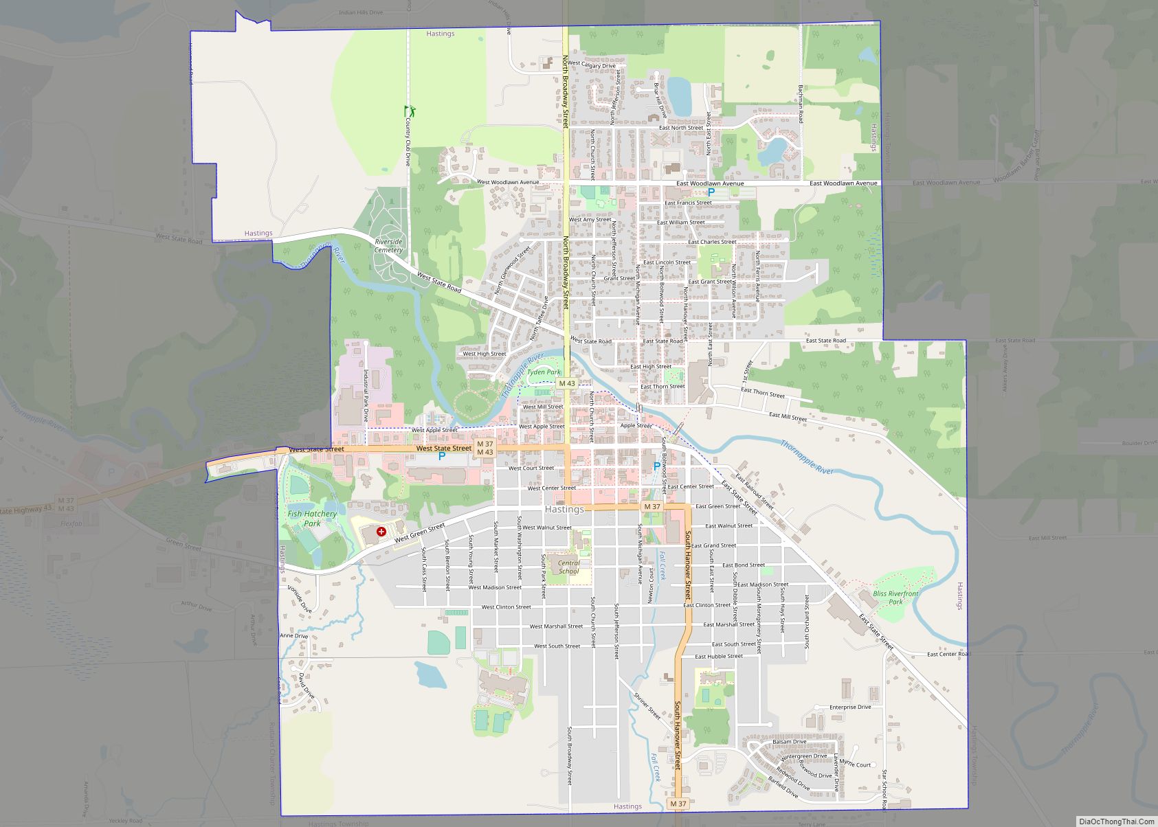
Delton is located in southwestern Barry County. It is bordered to the north by Hope Township. To the west the CDP extends slightly into Prairieville Township, Cloverdale and Cedar Creek. State highway M-43 runs through the town center, leading northeast 14 miles (23 km) to Hastings and southwest 19 miles (31 km) to downtown Kalamazoo.
According to the United States Census Bureau, the Delton CDP has a total area of 2.2 square miles (5.8 km), of which 2.2 square miles (5.6 km) is land and 0.077 square miles (0.2 km), or 2.99%, is water. The eastern end of Crooked Lake occupies the western part of the CDP.
Delton Kellogg High School, Middle School, and Elementary school are all located in the CDP, in the center of town.
See also
Map of Michigan State and its subdivision:- Alcona
- Alger
- Allegan
- Alpena
- Antrim
- Arenac
- Baraga
- Barry
- Bay
- Benzie
- Berrien
- Branch
- Calhoun
- Cass
- Charlevoix
- Cheboygan
- Chippewa
- Clare
- Clinton
- Crawford
- Delta
- Dickinson
- Eaton
- Emmet
- Genesee
- Gladwin
- Gogebic
- Grand Traverse
- Gratiot
- Hillsdale
- Houghton
- Huron
- Ingham
- Ionia
- Iosco
- Iron
- Isabella
- Jackson
- Kalamazoo
- Kalkaska
- Kent
- Keweenaw
- Lake
- Lake Hurron
- Lake Michigan
- Lake St. Clair
- Lake Superior
- Lapeer
- Leelanau
- Lenawee
- Livingston
- Luce
- Mackinac
- Macomb
- Manistee
- Marquette
- Mason
- Mecosta
- Menominee
- Midland
- Missaukee
- Monroe
- Montcalm
- Montmorency
- Muskegon
- Newaygo
- Oakland
- Oceana
- Ogemaw
- Ontonagon
- Osceola
- Oscoda
- Otsego
- Ottawa
- Presque Isle
- Roscommon
- Saginaw
- Saint Clair
- Saint Joseph
- Sanilac
- Schoolcraft
- Shiawassee
- Tuscola
- Van Buren
- Washtenaw
- Wayne
- Wexford
- Alabama
- Alaska
- Arizona
- Arkansas
- California
- Colorado
- Connecticut
- Delaware
- District of Columbia
- Florida
- Georgia
- Hawaii
- Idaho
- Illinois
- Indiana
- Iowa
- Kansas
- Kentucky
- Louisiana
- Maine
- Maryland
- Massachusetts
- Michigan
- Minnesota
- Mississippi
- Missouri
- Montana
- Nebraska
- Nevada
- New Hampshire
- New Jersey
- New Mexico
- New York
- North Carolina
- North Dakota
- Ohio
- Oklahoma
- Oregon
- Pennsylvania
- Rhode Island
- South Carolina
- South Dakota
- Tennessee
- Texas
- Utah
- Vermont
- Virginia
- Washington
- West Virginia
- Wisconsin
- Wyoming