Forest Hills is an unincorporated community and census-designated place (CDP) in Kent County in the U.S. state of Michigan. The population was 25,867 at the 2010 census.
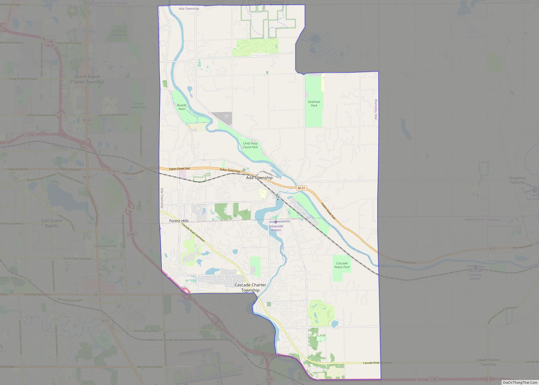
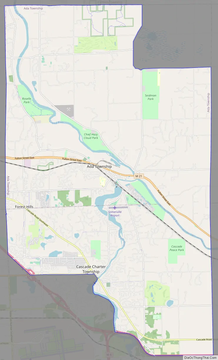
Forest Hills is the most-populated CDP and also the largest by area in the state of Michigan. The CDP encompasses nearly all of Ada Township and most of the northern half of Cascade Township. The Forest Hills Public Schools District serves most of the community.
| Name: | Forest Hills CDP |
|---|---|
| LSAD Code: | 57 |
| LSAD Description: | CDP (suffix) |
| State: | Michigan |
| County: | Kent County |
| Elevation: | 630 ft (192 m) |
| Total Area: | 50.80 sq mi (131.58 km²) |
| Land Area: | 49.30 sq mi (127.68 km²) |
| Water Area: | 1.51 sq mi (3.90 km²) |
| Total Population: | 28,573 |
| Population Density: | 579.60/sq mi (223.78/km²) |
| Area code: | 616 |
| FIPS code: | 2629580 |
| GNISfeature ID: | 1867318 |
Online Interactive Map
Click on ![]() to view map in "full screen" mode.
to view map in "full screen" mode.
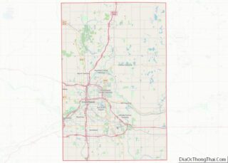
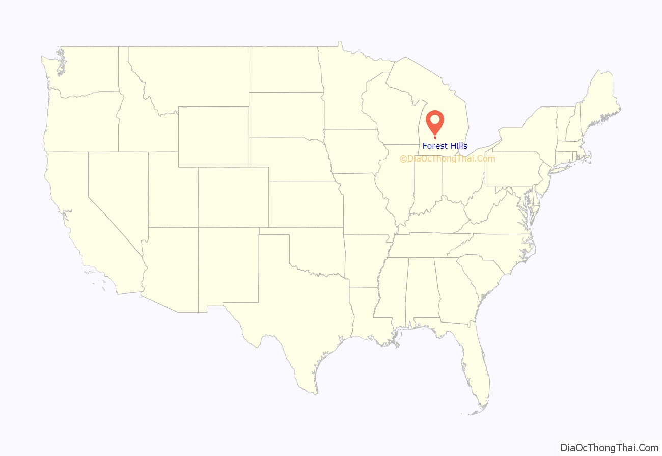
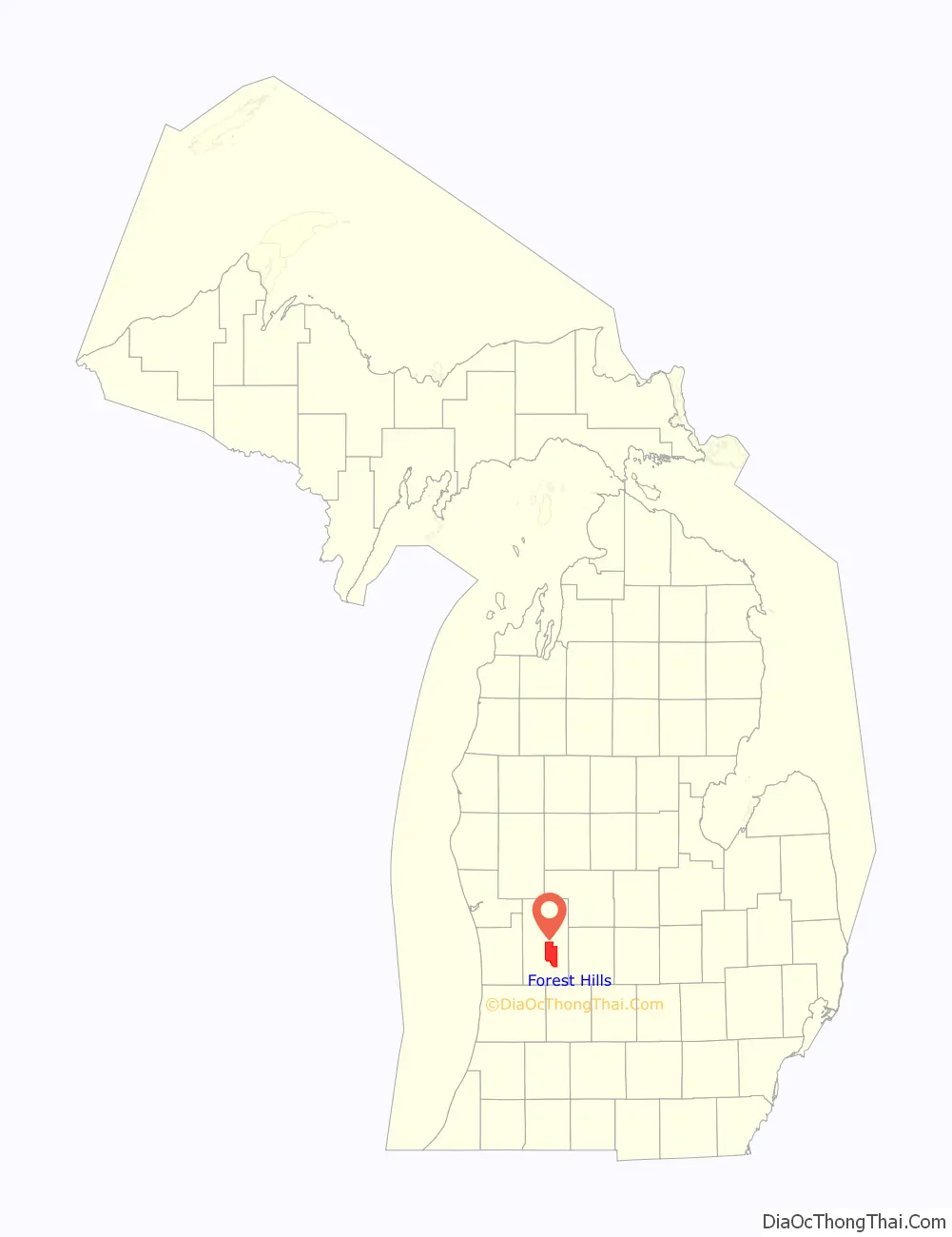
Forest Hills location map. Where is Forest Hills CDP?
Forest Hills Road Map
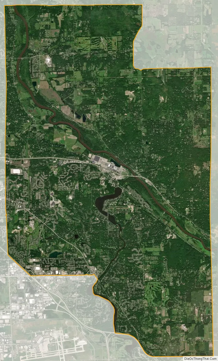
Forest Hills city Satellite Map
Geography
According to the U.S. Census Bureau, the CDP has a total area of 50.80 square miles (131.57 km), of which 49.27 square miles (127.61 km) are land and 1.53 square miles (3.96 km) (3.01%) is water.
The Grand River crosses the community from the east side to the northwest corner.
Major highways
- I-96 forms portions of the southernmost boundary of the community.
- M-11 runs west and ends at I-96 at the southwestern corner of the community but does not run through the community.
- M-21 runs east–west though the center of the community.
See also
Map of Michigan State and its subdivision:- Alcona
- Alger
- Allegan
- Alpena
- Antrim
- Arenac
- Baraga
- Barry
- Bay
- Benzie
- Berrien
- Branch
- Calhoun
- Cass
- Charlevoix
- Cheboygan
- Chippewa
- Clare
- Clinton
- Crawford
- Delta
- Dickinson
- Eaton
- Emmet
- Genesee
- Gladwin
- Gogebic
- Grand Traverse
- Gratiot
- Hillsdale
- Houghton
- Huron
- Ingham
- Ionia
- Iosco
- Iron
- Isabella
- Jackson
- Kalamazoo
- Kalkaska
- Kent
- Keweenaw
- Lake
- Lake Hurron
- Lake Michigan
- Lake St. Clair
- Lake Superior
- Lapeer
- Leelanau
- Lenawee
- Livingston
- Luce
- Mackinac
- Macomb
- Manistee
- Marquette
- Mason
- Mecosta
- Menominee
- Midland
- Missaukee
- Monroe
- Montcalm
- Montmorency
- Muskegon
- Newaygo
- Oakland
- Oceana
- Ogemaw
- Ontonagon
- Osceola
- Oscoda
- Otsego
- Ottawa
- Presque Isle
- Roscommon
- Saginaw
- Saint Clair
- Saint Joseph
- Sanilac
- Schoolcraft
- Shiawassee
- Tuscola
- Van Buren
- Washtenaw
- Wayne
- Wexford
- Alabama
- Alaska
- Arizona
- Arkansas
- California
- Colorado
- Connecticut
- Delaware
- District of Columbia
- Florida
- Georgia
- Hawaii
- Idaho
- Illinois
- Indiana
- Iowa
- Kansas
- Kentucky
- Louisiana
- Maine
- Maryland
- Massachusetts
- Michigan
- Minnesota
- Mississippi
- Missouri
- Montana
- Nebraska
- Nevada
- New Hampshire
- New Jersey
- New Mexico
- New York
- North Carolina
- North Dakota
- Ohio
- Oklahoma
- Oregon
- Pennsylvania
- Rhode Island
- South Carolina
- South Dakota
- Tennessee
- Texas
- Utah
- Vermont
- Virginia
- Washington
- West Virginia
- Wisconsin
- Wyoming