Gaylord (/ɡeɪlərd/ GAY-lərd) is a city in the U.S. state of Michigan. It is the county seat of Otsego County, and is the only city within the county. Gaylord had a population of 4,286 at the 2020 census, an increase from 3,645 at the 2010 census.
Gaylord styles itself as an “alpine village” and contains many buildings in the downtown area with Tyrolean style motifs. Receiving abundant snowfall and experiencing mild summer temperatures, the area around Gaylord has long been known for its many skiing and golf resorts, one of the largest such concentrations in the Midwestern United States.
Gaylord was struck by an EF3 tornado on May 20, 2022. The tornado killed two people and injured 44 others. It was the first recorded tornado in Gaylord since tornado records began in 1950.
| Name: | Gaylord city |
|---|---|
| LSAD Code: | 25 |
| LSAD Description: | city (suffix) |
| State: | Michigan |
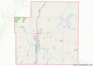
| County: | Otsego County |
| Incorporated: | 1881 (village) 1922 (city) |
| Elevation: | 1,348 ft (411 m) |
| Total Area: | 5.15 sq mi (13.33 km²) |
| Land Area: | 5.12 sq mi (13.27 km²) |
| Water Area: | 0.03 sq mi (0.06 km²) |
| Total Population: | 4,286 |
| Population Density: | 836.46/sq mi (322.98/km²) |
| Area code: | 989 |
| FIPS code: | 2631720 |
| GNISfeature ID: | 0626696 |
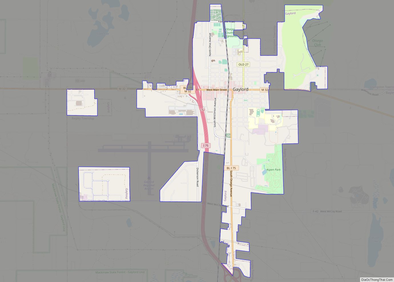
Online Interactive Map
Click on ![]() to view map in "full screen" mode.
to view map in "full screen" mode.
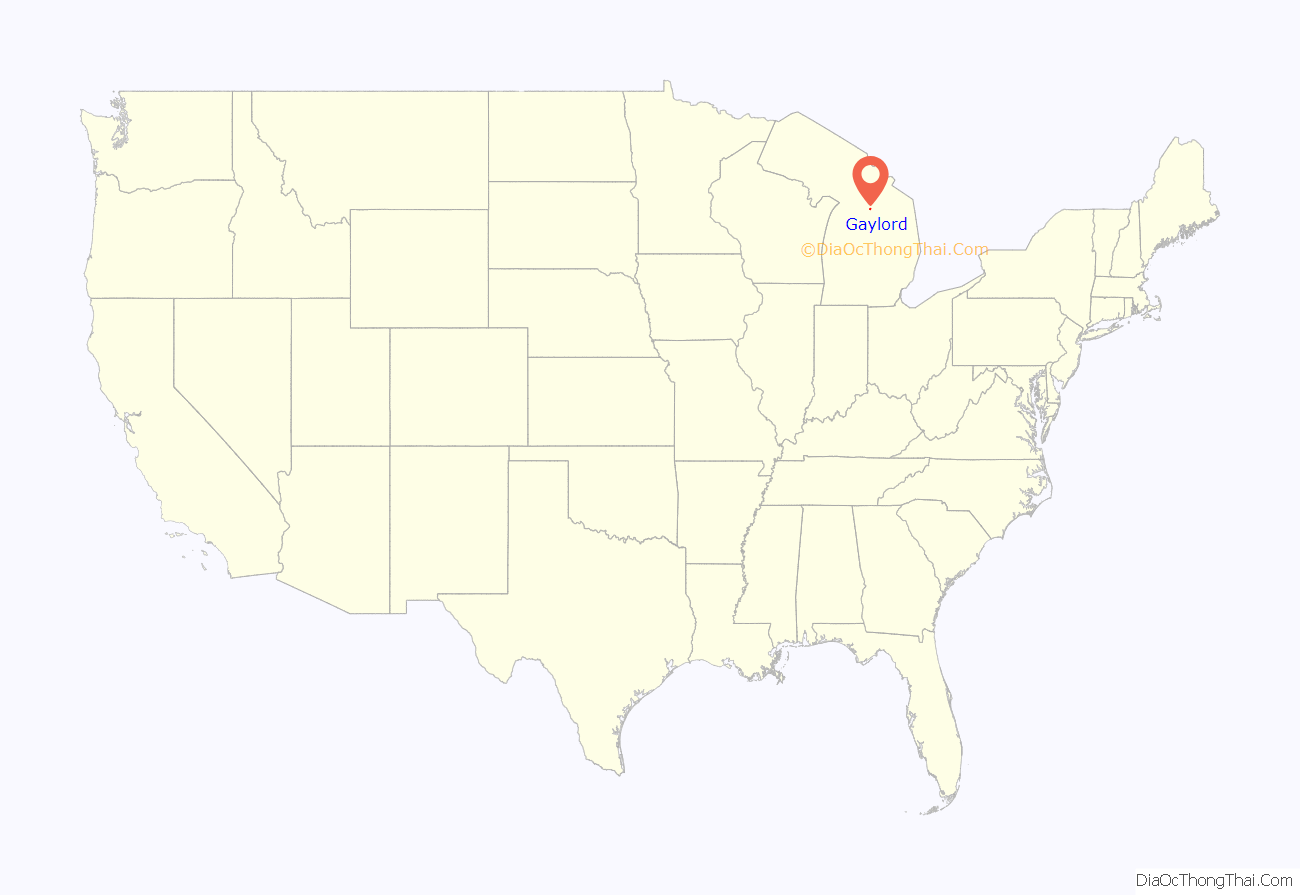
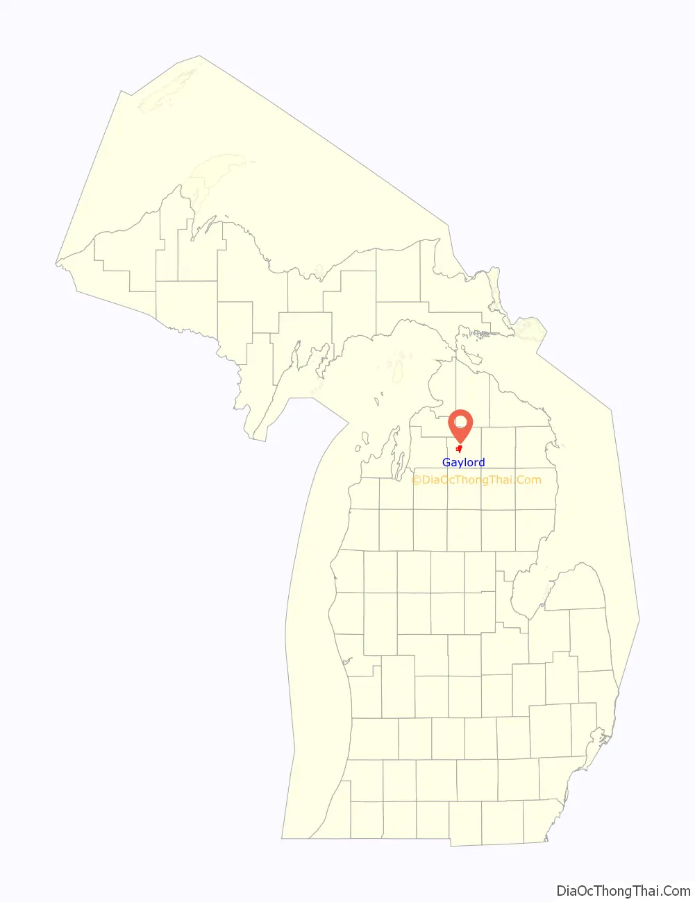
Gaylord location map. Where is Gaylord city?
History
Originally called Barnes, Gaylord was named for an attorney employed with the Michigan Central Railroad. The town of Gaylord was established when the Jackson, Lansing, and Saginaw Railroads pushed north from Otsego Lake Village in 1873. All property north of Main Street was owned by the railroad. Orlando M. Barnes owned all of the property to the south. Interestingly, Main Street was the borderline for two townships. This put the northern half of the new community in Livingston Township and the southern portion in Bagley Township.
The year the “Village of Gaylord” was officially platted (1874), it also was granted a post office of the same name. So, if the community was truly ever named Barnes, the name change would have occurred between November 1873 and October 1874. Note: Today the term “village” has a legal definition for a specific form of local government. Technically, Gaylord didn’t become a village until March 4, 1881, when incorporated by act of the State of Michigan Legislature. The person for whom the town was re-named, Augustine Smith Gaylord, was an attorney associated with the Michigan Central Railroad. His law firm was located in Saginaw. Mr. Gaylord never lived in his namesake town, but he did own property in Hayes Township. His distinguished career included serving as a school teacher, church choir director, county clerk, and member of the State Legislature. In 1875, Mr. Gaylord was appointed to serve as an attorney for the United States Department of the Interior. At the request of President Grant, Mr. Gaylord was assigned to negotiate a treaty with Native Americans in Montana and the Dakotas. It is believed this trip may have been too strenuous for Mr. Gaylord’s pre-existing health conditions. Declining health prevented him from returning to Washington, D.C. Mr. Gaylord died at his home in Saginaw in 1877 at the age of 46. That same year, Gaylord became the county seat – the location of government and judicial transactions. Prior to 1877, Otsego Lake Village had been designated the temporary county seat. Gaylord’s central location in the county, along with its growing business community, prompted the change.
In 1879, the state legislature appropriated state-owned lands to be exchanged for construction of a state road from Petoskey through Berryville to Gaylord. These lands were originally conveyed to the State of Michigan by the Federal government in 1850 by the Swamp Land Act of 1850.
In 1905, a marketing campaign was undertaken to attract outside business investors and new residents to locate in Gaylord. A 38-page photo booklet entitled “Gaylord Illustrated” was published to showcase the many benefits of living in the town located on the 45th parallel in Michigan’s Lower Peninsula. Among the many photographs featured in the booklet were the Otsego County Courthouse and the Dayton Last Block Works. The Dayton Last Block Works was located south and west of downtown Gaylord between the Michigan Central Railroad and U.S. 27. It was bordered on the south by Wisconsin Avenue, and to the north by Third Street. The 14-acre industrial site included 27 buildings, and the owners claimed it to be the largest factory of its kind in world. The company, headquartered in Dayton Ohio, operated its Gaylord branch from 1895 to 1931. Otsego County hardwoods were used to produce wooden shoe forms, bowling pins, and golf club heads. One of the original brick buildings stands still today on South Otsego Avenue as the Bavarian Office complex.
A second railroad, the Boyne City, Gaylord and Alpena (BC,G&A), reached Gaylord in 1906. This provided east-west rail travel and transportation. The tracks entered Gaylord from Hallock from the northeast. The BC,G&A shared the Michigan Central Railroad depot on Michigan Avenue. Heading east, the tracks paralleled Fourth Street and headed toward the town of Sparr.
Another important manufacturing venture in Gaylord’s past was the Gaylord Motor Car Company. Formed in 1910 by local investors who had dreams of becoming the next Detroit, the company offered four innovative styles designed to compete with other automakers. Approximately 350 cars were produced before the company went bankrupt in 1913. Only one Gaylord car exists today: It is on display at the Visitors Center in downtown Gaylord.
Gaylord became a city in 1922. The change from village to city required a vote by town residents. For reasons that are unclear, the margin of passage was a very close 21 votes — 114 people in favor to 93 against. John Hamilton was elected the first mayor of Gaylord. Over the years, the community continued to grow, in part, because of its location. Gaylord’s Main Street was the intersection of U.S. 27 and M-32. These major roads brought both through-traffic and travelers to Gaylord. Gas stations, restaurants, and lodging establishments sprung up to accommodate local shoppers as well as visitors enjoying the area’s attractions. Long before Gaylord was the Alpine Village or the Golf Mecca, it promoted itself as the Top of Michigan and, later, the ski capital of Michigan. Both of these marketing endeavors were based on the area’s natural features and reflected the importance of tourism as an economic development strategy. With an altitude of 1,394 feet above sea level, Gaylord held the distinction of being the city of highest elevation in Michigan’s Lower Peninsula. The abundant winter snowfall and steep hills nearby made downhill skiing a logical focus for efforts to attract recreational visitors to the area.
2022 tornado
On May 20, 2022, an EF3 tornado with winds of 150 miles per hour (240 km/h) struck the city killing two people and injuring 44. There was major damage to several businesses and a mobile home park. Incumbent Michigan governor Gretchen Whitmer declared a state of emergency for the Gaylord area and stated that Lansing will provide reconstruction to Gaylord. This tornado was the first to hit the city since records began in 1950.
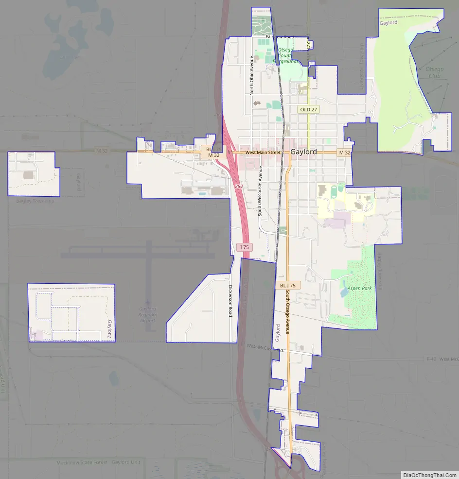
Gaylord Road Map
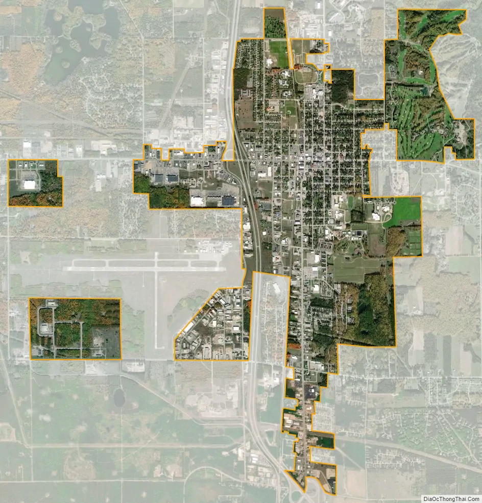
Gaylord city Satellite Map
Geography
- According to the United States Census Bureau, the city has a total area of 4.83 square miles (12.51 km), of which, 4.80 square miles (12.43 km) is land and 0.03 square miles (0.08 km) is water.
- Gaylord experiences heavy lake effect snow during the winter and is in the middle of the Northern Michigan snowbelt.
- Highway signs denote that Gaylord rests on the 45th parallel line – halfway between the equator and the North Pole. This is one of 29 places (six are in Michigan) in the U.S. where such signs are known to exist.
- It is considered to be part of Northern Michigan.
- Hartwick Pines State Park is just 28 miles (45 km) to the south, and is one of the last remaining stands of old growth virgin Eastern white pine forest.
- The Huron-Manistee National Forests is nearby.
Climate
This climatic region has large seasonal temperature differences, with warm to hot (and often humid) summers and cold (sometimes severely cold) winters. According to the Köppen Climate Classification system, Gaylord has a humid continental climate, abbreviated “Dfb” on climate maps.
See also
Map of Michigan State and its subdivision:- Alcona
- Alger
- Allegan
- Alpena
- Antrim
- Arenac
- Baraga
- Barry
- Bay
- Benzie
- Berrien
- Branch
- Calhoun
- Cass
- Charlevoix
- Cheboygan
- Chippewa
- Clare
- Clinton
- Crawford
- Delta
- Dickinson
- Eaton
- Emmet
- Genesee
- Gladwin
- Gogebic
- Grand Traverse
- Gratiot
- Hillsdale
- Houghton
- Huron
- Ingham
- Ionia
- Iosco
- Iron
- Isabella
- Jackson
- Kalamazoo
- Kalkaska
- Kent
- Keweenaw
- Lake
- Lake Hurron
- Lake Michigan
- Lake St. Clair
- Lake Superior
- Lapeer
- Leelanau
- Lenawee
- Livingston
- Luce
- Mackinac
- Macomb
- Manistee
- Marquette
- Mason
- Mecosta
- Menominee
- Midland
- Missaukee
- Monroe
- Montcalm
- Montmorency
- Muskegon
- Newaygo
- Oakland
- Oceana
- Ogemaw
- Ontonagon
- Osceola
- Oscoda
- Otsego
- Ottawa
- Presque Isle
- Roscommon
- Saginaw
- Saint Clair
- Saint Joseph
- Sanilac
- Schoolcraft
- Shiawassee
- Tuscola
- Van Buren
- Washtenaw
- Wayne
- Wexford
- Alabama
- Alaska
- Arizona
- Arkansas
- California
- Colorado
- Connecticut
- Delaware
- District of Columbia
- Florida
- Georgia
- Hawaii
- Idaho
- Illinois
- Indiana
- Iowa
- Kansas
- Kentucky
- Louisiana
- Maine
- Maryland
- Massachusetts
- Michigan
- Minnesota
- Mississippi
- Missouri
- Montana
- Nebraska
- Nevada
- New Hampshire
- New Jersey
- New Mexico
- New York
- North Carolina
- North Dakota
- Ohio
- Oklahoma
- Oregon
- Pennsylvania
- Rhode Island
- South Carolina
- South Dakota
- Tennessee
- Texas
- Utah
- Vermont
- Virginia
- Washington
- West Virginia
- Wisconsin
- Wyoming