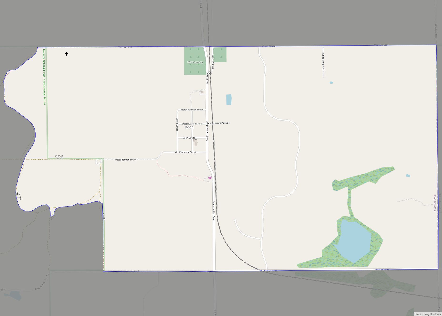
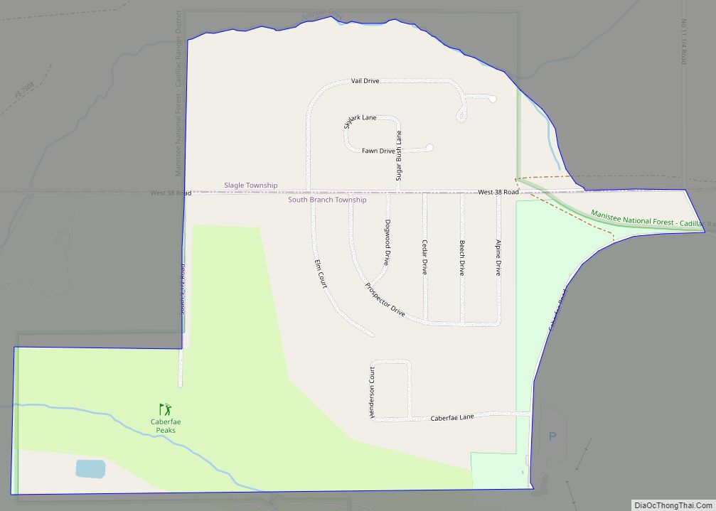
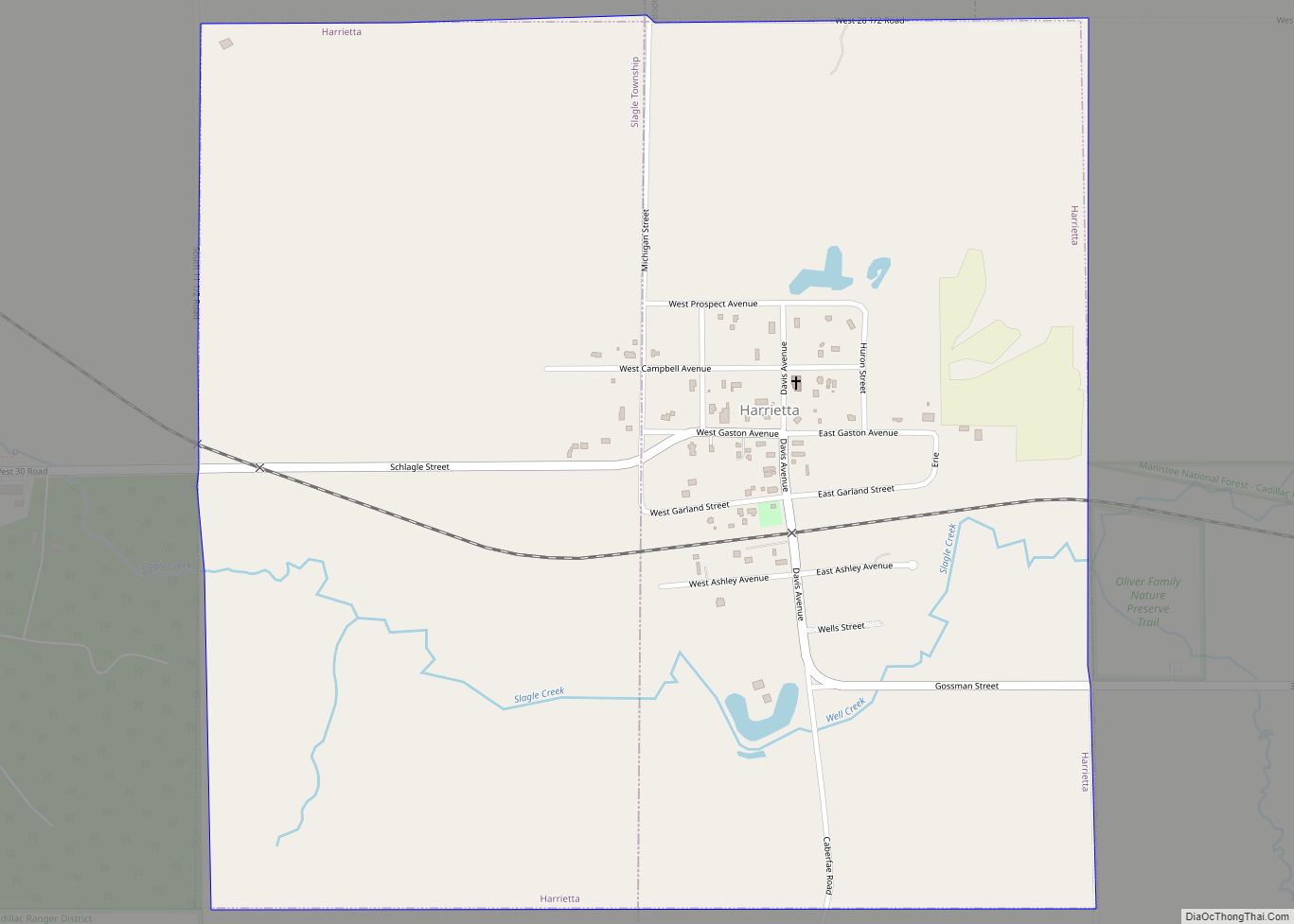
Harrietta is a village in Wexford County of the U.S. state of Michigan. The population was 151 at the 2020 census, which ranked it as the fourth least-populated village in the state. The village is split almost evenly between Slagle Township on the west and Boon Township on the east.
| Name: | Harrietta village |
|---|---|
| LSAD Code: | 47 |
| LSAD Description: | village (suffix) |
| State: | Michigan |
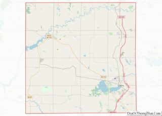
| County: | Wexford County |
| Incorporated: | 1891 |
| Elevation: | 1,145 ft (349 m) |
| Total Area: | 0.99 sq mi (2.57 km²) |
| Land Area: | 0.99 sq mi (2.57 km²) |
| Water Area: | 0.00 sq mi (0.00 km²) |
| Total Population: | 151 |
| Population Density: | 152.06/sq mi (58.72/km²) |
| Area code: | 231 |
| FIPS code: | 2636720 |
| GNISfeature ID: | 1620134 |
Online Interactive Map
Click on ![]() to view map in "full screen" mode.
to view map in "full screen" mode.
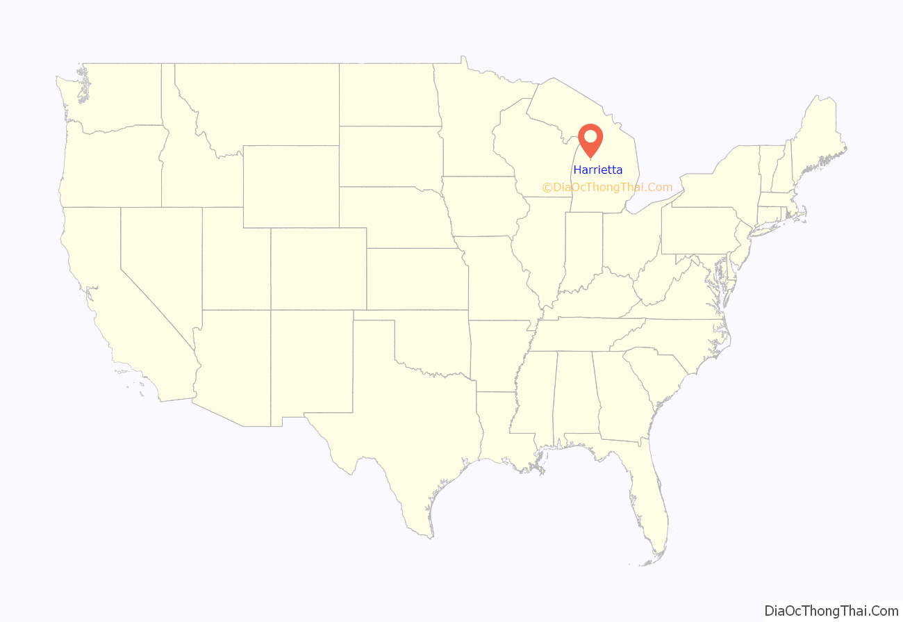
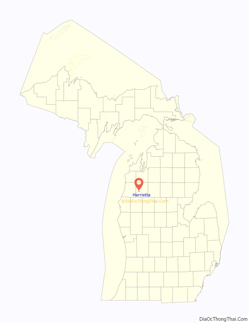
Harrietta location map. Where is Harrietta village?
History
The community first platted in 1889 along the Toledo, Ann Arbor and North Michigan Railway. It was recorded with the spelling Harriette, which early founder James Ashley chose from combining his father’s name of Harry and his fiancé Henriette Burt. The Springdale post office, which was established earlier to the north in 1874, moved to Harriette in 1890 but retained is original name. The community incorporated as a village in 1891 under the name Gaston, but railway executives insisted on returning the community to its original name of Harriette in 1892. The community and post office name was again changed to its current name of Harrietta in 1925.
Harrietta Road Map

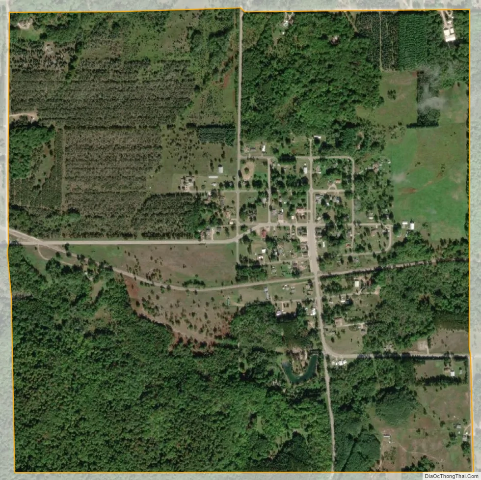
Harrietta city Satellite Map
Geography
According to the U.S. Census Bureau, the village has a total area of 0.99 square miles (2.56 km), all land.
See also
Map of Michigan State and its subdivision:- Alcona
- Alger
- Allegan
- Alpena
- Antrim
- Arenac
- Baraga
- Barry
- Bay
- Benzie
- Berrien
- Branch
- Calhoun
- Cass
- Charlevoix
- Cheboygan
- Chippewa
- Clare
- Clinton
- Crawford
- Delta
- Dickinson
- Eaton
- Emmet
- Genesee
- Gladwin
- Gogebic
- Grand Traverse
- Gratiot
- Hillsdale
- Houghton
- Huron
- Ingham
- Ionia
- Iosco
- Iron
- Isabella
- Jackson
- Kalamazoo
- Kalkaska
- Kent
- Keweenaw
- Lake
- Lake Hurron
- Lake Michigan
- Lake St. Clair
- Lake Superior
- Lapeer
- Leelanau
- Lenawee
- Livingston
- Luce
- Mackinac
- Macomb
- Manistee
- Marquette
- Mason
- Mecosta
- Menominee
- Midland
- Missaukee
- Monroe
- Montcalm
- Montmorency
- Muskegon
- Newaygo
- Oakland
- Oceana
- Ogemaw
- Ontonagon
- Osceola
- Oscoda
- Otsego
- Ottawa
- Presque Isle
- Roscommon
- Saginaw
- Saint Clair
- Saint Joseph
- Sanilac
- Schoolcraft
- Shiawassee
- Tuscola
- Van Buren
- Washtenaw
- Wayne
- Wexford
- Alabama
- Alaska
- Arizona
- Arkansas
- California
- Colorado
- Connecticut
- Delaware
- District of Columbia
- Florida
- Georgia
- Hawaii
- Idaho
- Illinois
- Indiana
- Iowa
- Kansas
- Kentucky
- Louisiana
- Maine
- Maryland
- Massachusetts
- Michigan
- Minnesota
- Mississippi
- Missouri
- Montana
- Nebraska
- Nevada
- New Hampshire
- New Jersey
- New Mexico
- New York
- North Carolina
- North Dakota
- Ohio
- Oklahoma
- Oregon
- Pennsylvania
- Rhode Island
- South Carolina
- South Dakota
- Tennessee
- Texas
- Utah
- Vermont
- Virginia
- Washington
- West Virginia
- Wisconsin
- Wyoming