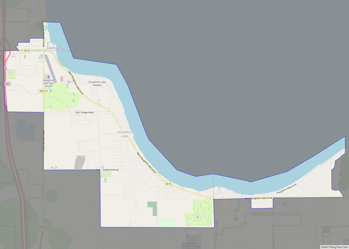
Houghton Lake is an unincorporated community and census-designated place (CDP) in Roscommon County in the U.S. state of Michigan. The population was 5,294 at the time of the 2020 census, making it the largest unincorporated community in Northern Michigan. The CDP is located within Denton, Lake, and Roscommon townships.
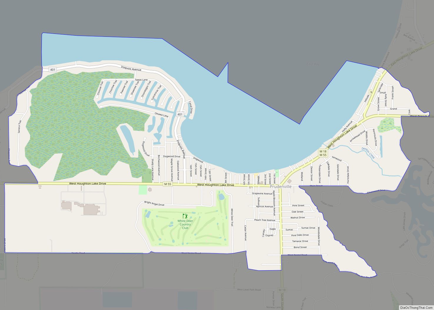
The community of Houghton Lake is named after and situated upon Houghton Lake, the largest inland lake in Michigan. The CDP includes the unincorporated community of Houghton Lake Heights. The CDP of Prudenville is immediately east of Houghton Lake. M-55 is the primary thoroughfare serving the community, running east–west.
| Name: | Houghton Lake CDP |
|---|---|
| LSAD Code: | 57 |
| LSAD Description: | CDP (suffix) |
| State: | Michigan |
| County: | Roscommon County |
| Elevation: | 1,145 ft (349 m) |
| Total Area: | 12.38 sq mi (32.07 km²) |
| Land Area: | 10.75 sq mi (27.84 km²) |
| Water Area: | 1.63 sq mi (4.22 km²) |
| Total Population: | 5,294 |
| Population Density: | 492.47/sq mi (190.14/km²) |
| Area code: | 989 |
| FIPS code: | 2639400 |
| GNISfeature ID: | 0628665 |
Online Interactive Map
Click on ![]() to view map in "full screen" mode.
to view map in "full screen" mode.
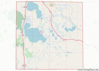
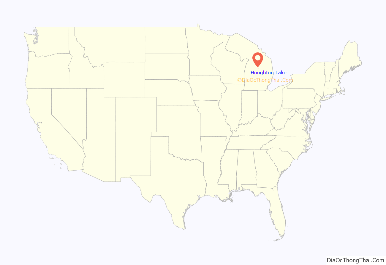
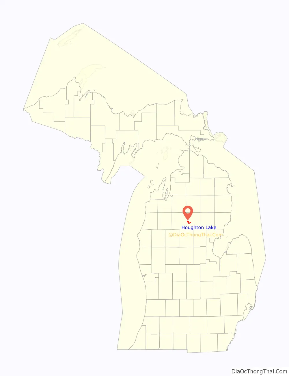
Houghton Lake location map. Where is Houghton Lake CDP?
History
The Houghton Lake area’s first white settlers were said to be the Emery family in 1873. Augustus Emery, his wife, and their 7 children left their home in Chesaning, Michigan, and made their way on foot to an area three miles south of the lake via the well-known Saginaw Trail. It was here that Mr. Emery and his three sons, Augustus Jr., 21, William, 19, and Harvey, 17, would construct the family home on 160 acres of homesteaded property.
Lumbering had a profound impact on the early development of Houghton Lake. In the mid-1800s, lumber camps in the area were abundant, and roads, towns, and railways were established to support the lumber trade. Logs were floated from Houghton Lake down the Muskegon River to sawmills and shipping facilities in Muskegon. It has been estimated that in 1860 alone, mills on the Muskegon River produced 75,000,000 board-feet of lumber.
By the late 1800s, lumbering became the primary industry in the area. As lumber camps sprung up around sawmills, more settlers arrived. Around 1883, a community at Houghton Lake had been created.
Houghton Lake was originally called “Roscommon Lake”. However, in 1879, after the untimely death of famous physician, explorer, and Michigan’s first state geologist, Douglass Houghton, Roscommon Lake was honorably renamed Houghton Lake.
With the decline of the lumber industry in the early 1900s, railways that had been used to transport lumber were repurposed as passenger lines to bring outdoorsmen to fish, hunt, and experience the beauty of the “north country.” The Houghton Lake fishery became legendary and attracted visitors from far and wide.
By the mid-1900s Houghton Lake had developed a reputation as a desirable resort area. Today, thousands of seasonal cottages, year-round homes, and businesses border the lake. Houghton Lake remains one of Michigan’s top resort and vacation destinations and attracts thousands of visitors to its shores each year.
In 1927, the “Johnson Dance Hall,” presently known as “The Playhouse,” was erected and served for many years as the entertainment center for the area. The Playhouse and the surrounding property are now home to The Houghton Lake Historical Society, as well as the yearly event “Historic Village Days”
The town was struck by a windstorm on June 11, 1932, which killed four people. During a snowstorm that caused reduced visibility, two married couples died when they drove their cars into the frozen lake on New Year’s Day, 1957. The Limberlost Hotel, situated on the shore of Houghton Lake, was destroyed by a fire in 1968 causing one injury but no deaths. Two men drowned in a snowmobile accident during a carnival on the frozen lake in 1980.
Houghton Lake Road Map
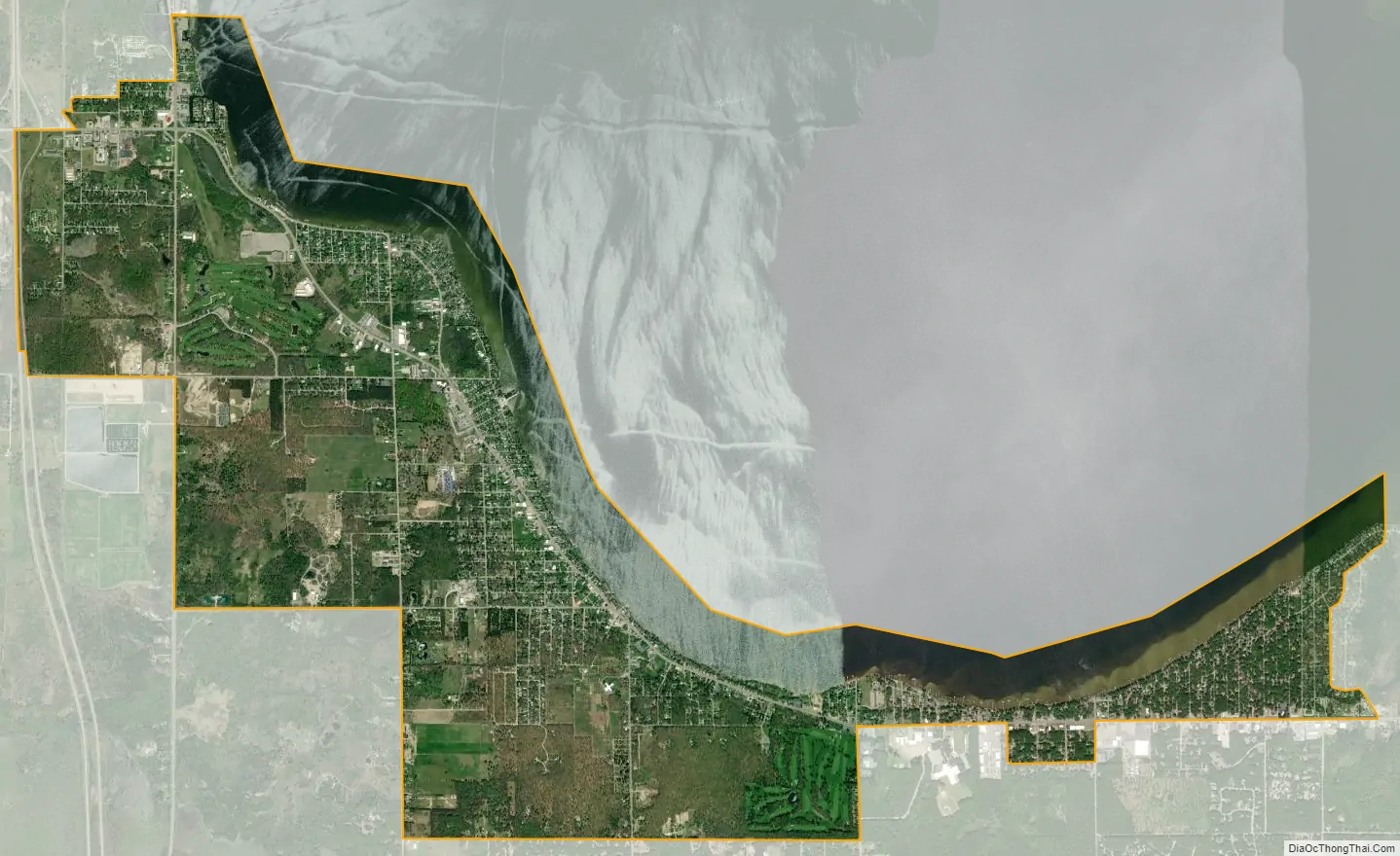
Houghton Lake city Satellite Map
Geography
According to the U.S. Census Bureau, the CDP has a total area of 12.38 square miles (32.06 km), of which 10.75 square miles (27.84 km) is land and 1.63 square miles (4.22 km) (13.17%) is water.
Climate
See also
Map of Michigan State and its subdivision:- Alcona
- Alger
- Allegan
- Alpena
- Antrim
- Arenac
- Baraga
- Barry
- Bay
- Benzie
- Berrien
- Branch
- Calhoun
- Cass
- Charlevoix
- Cheboygan
- Chippewa
- Clare
- Clinton
- Crawford
- Delta
- Dickinson
- Eaton
- Emmet
- Genesee
- Gladwin
- Gogebic
- Grand Traverse
- Gratiot
- Hillsdale
- Houghton
- Huron
- Ingham
- Ionia
- Iosco
- Iron
- Isabella
- Jackson
- Kalamazoo
- Kalkaska
- Kent
- Keweenaw
- Lake
- Lake Hurron
- Lake Michigan
- Lake St. Clair
- Lake Superior
- Lapeer
- Leelanau
- Lenawee
- Livingston
- Luce
- Mackinac
- Macomb
- Manistee
- Marquette
- Mason
- Mecosta
- Menominee
- Midland
- Missaukee
- Monroe
- Montcalm
- Montmorency
- Muskegon
- Newaygo
- Oakland
- Oceana
- Ogemaw
- Ontonagon
- Osceola
- Oscoda
- Otsego
- Ottawa
- Presque Isle
- Roscommon
- Saginaw
- Saint Clair
- Saint Joseph
- Sanilac
- Schoolcraft
- Shiawassee
- Tuscola
- Van Buren
- Washtenaw
- Wayne
- Wexford
- Alabama
- Alaska
- Arizona
- Arkansas
- California
- Colorado
- Connecticut
- Delaware
- District of Columbia
- Florida
- Georgia
- Hawaii
- Idaho
- Illinois
- Indiana
- Iowa
- Kansas
- Kentucky
- Louisiana
- Maine
- Maryland
- Massachusetts
- Michigan
- Minnesota
- Mississippi
- Missouri
- Montana
- Nebraska
- Nevada
- New Hampshire
- New Jersey
- New Mexico
- New York
- North Carolina
- North Dakota
- Ohio
- Oklahoma
- Oregon
- Pennsylvania
- Rhode Island
- South Carolina
- South Dakota
- Tennessee
- Texas
- Utah
- Vermont
- Virginia
- Washington
- West Virginia
- Wisconsin
- Wyoming