St. Helen is an unincorporated community and census-designated place (CDP) in Roscommon County in the U.S. state of Michigan. The population was 2,735 at the 2020 census. St. Helen is located within Richfield Township.
| Name: | St. Helen CDP |
|---|---|
| LSAD Code: | 57 |
| LSAD Description: | CDP (suffix) |
| State: | Michigan |
| County: | Roscommon County |
| Elevation: | 1,191 ft (363 m) |
| Total Area: | 6.62 sq mi (17.15 km²) |
| Land Area: | 5.73 sq mi (14.84 km²) |
| Water Area: | 0.89 sq mi (2.31 km²) |
| Total Population: | 2,735 |
| Population Density: | 477.48/sq mi (184.34/km²) |
| Area code: | 989 |
| FIPS code: | 2670800 |
| GNISfeature ID: | 0636665 |
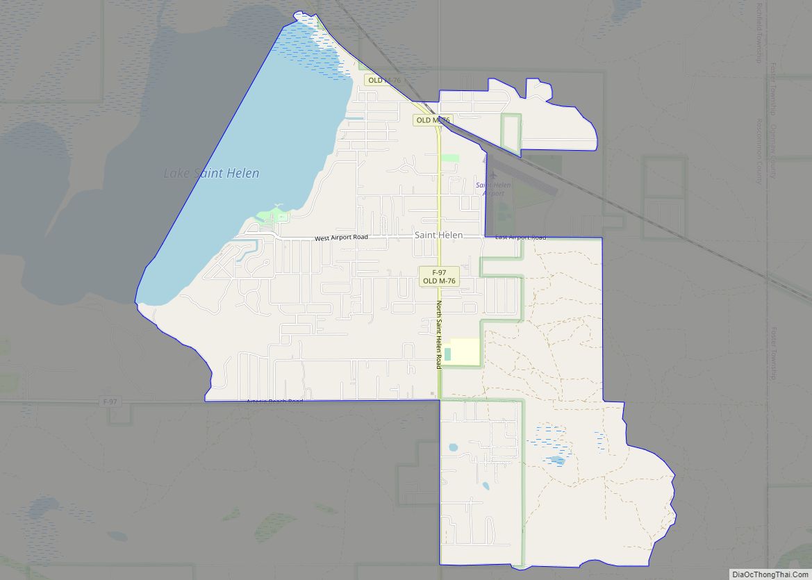
Online Interactive Map
Click on ![]() to view map in "full screen" mode.
to view map in "full screen" mode.
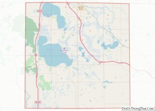
St. Helen location map. Where is St. Helen CDP?


History
In the 1870s, lumber baron Henry Stephens established a large lumber operation at St. Helen, considered at the time to be among the largest and best equipped in the state. The mills were estimated to have produced more than 1 billion board feet (2,000,000 m) of lumber within a period of fourteen years. Most of the logs were moved by river, but lumber was also moved by rail.
The St. Helen Development Company was organized to sell land and promote development of the area, and over seven years sold 80,000 acres (320 km) of land and helped to build more than 30 miles (48 km) of roads and over 80 miles (130 km) of fencing.
St. Helen was named after the lake. It is believed that French voyageurs named it after Saint Helena of Constantinople, mother of Emperor Constantine.
The Detroit, Bay City and Alpena Railroad (later the Michigan Central, then the Detroit and Mackinac Railway and presently the Lake State Railway Company) built a line through the area with a station at St. Helen. M-76 passes through St. Helen and portions are still signed as “Old 76”.
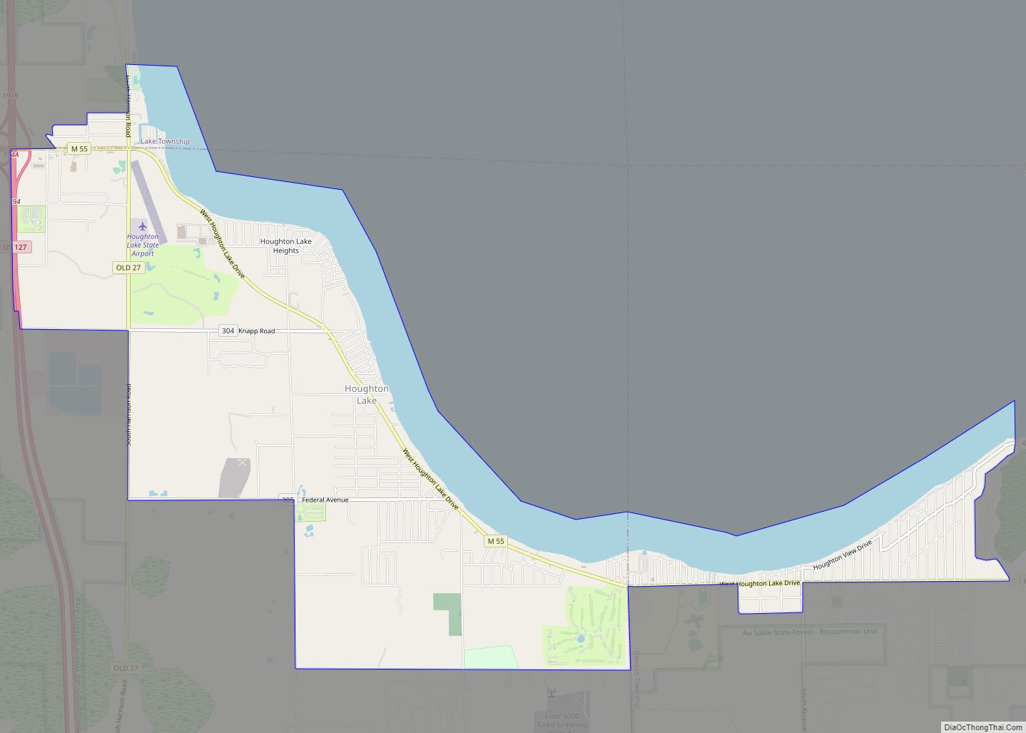
St. Helen Road Map

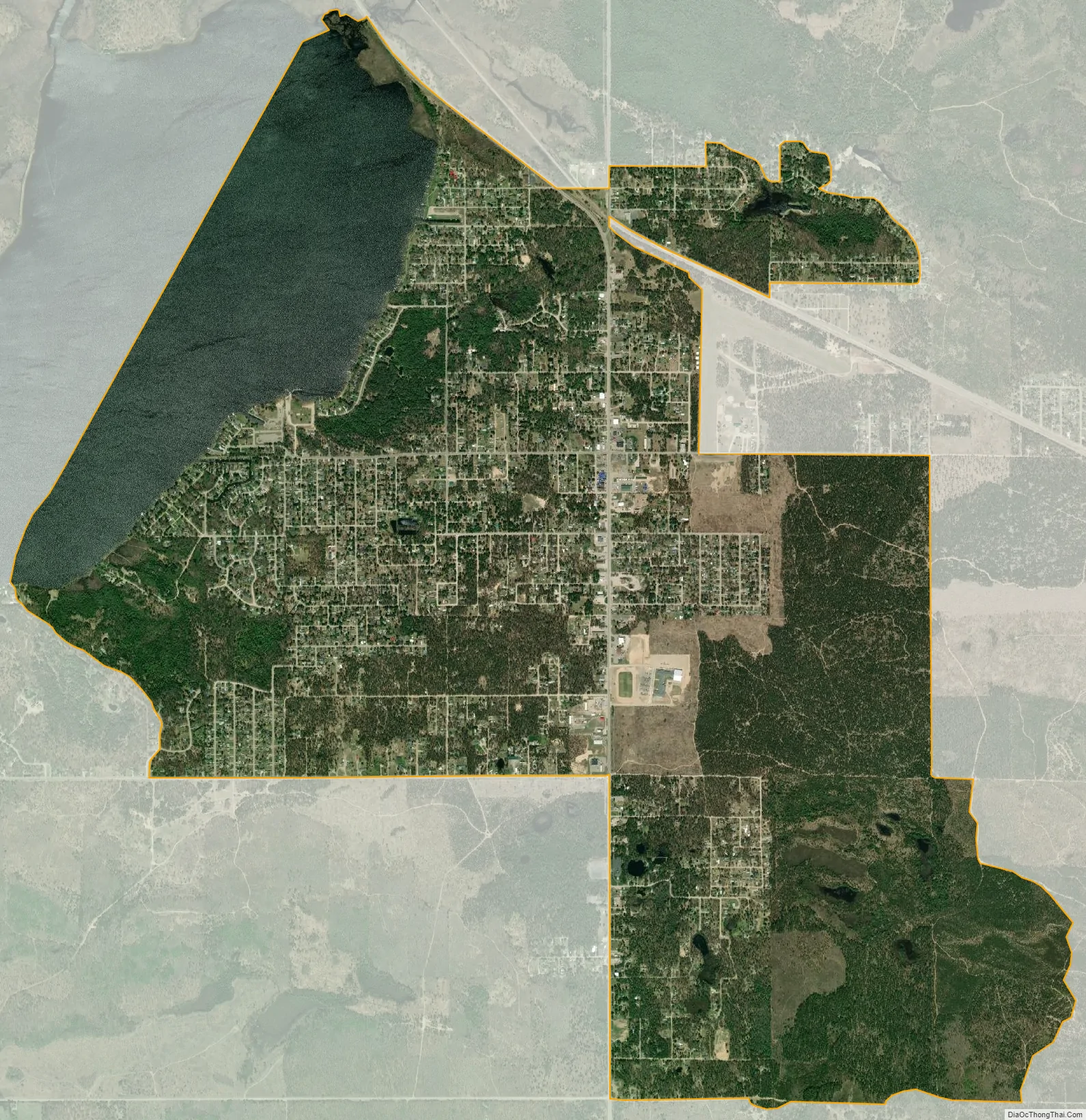
St. Helen city Satellite Map
Geography
According to the U.S. Census Bureau, the CDP has a total area of 6.62 square miles (17.15 km), of which 5.73 square miles (14.84 km) is land and 0.89 square miles (2.31 km) (13.44%) is water.
See also
Map of Michigan State and its subdivision:- Alcona
- Alger
- Allegan
- Alpena
- Antrim
- Arenac
- Baraga
- Barry
- Bay
- Benzie
- Berrien
- Branch
- Calhoun
- Cass
- Charlevoix
- Cheboygan
- Chippewa
- Clare
- Clinton
- Crawford
- Delta
- Dickinson
- Eaton
- Emmet
- Genesee
- Gladwin
- Gogebic
- Grand Traverse
- Gratiot
- Hillsdale
- Houghton
- Huron
- Ingham
- Ionia
- Iosco
- Iron
- Isabella
- Jackson
- Kalamazoo
- Kalkaska
- Kent
- Keweenaw
- Lake
- Lake Hurron
- Lake Michigan
- Lake St. Clair
- Lake Superior
- Lapeer
- Leelanau
- Lenawee
- Livingston
- Luce
- Mackinac
- Macomb
- Manistee
- Marquette
- Mason
- Mecosta
- Menominee
- Midland
- Missaukee
- Monroe
- Montcalm
- Montmorency
- Muskegon
- Newaygo
- Oakland
- Oceana
- Ogemaw
- Ontonagon
- Osceola
- Oscoda
- Otsego
- Ottawa
- Presque Isle
- Roscommon
- Saginaw
- Saint Clair
- Saint Joseph
- Sanilac
- Schoolcraft
- Shiawassee
- Tuscola
- Van Buren
- Washtenaw
- Wayne
- Wexford
- Alabama
- Alaska
- Arizona
- Arkansas
- California
- Colorado
- Connecticut
- Delaware
- District of Columbia
- Florida
- Georgia
- Hawaii
- Idaho
- Illinois
- Indiana
- Iowa
- Kansas
- Kentucky
- Louisiana
- Maine
- Maryland
- Massachusetts
- Michigan
- Minnesota
- Mississippi
- Missouri
- Montana
- Nebraska
- Nevada
- New Hampshire
- New Jersey
- New Mexico
- New York
- North Carolina
- North Dakota
- Ohio
- Oklahoma
- Oregon
- Pennsylvania
- Rhode Island
- South Carolina
- South Dakota
- Tennessee
- Texas
- Utah
- Vermont
- Virginia
- Washington
- West Virginia
- Wisconsin
- Wyoming