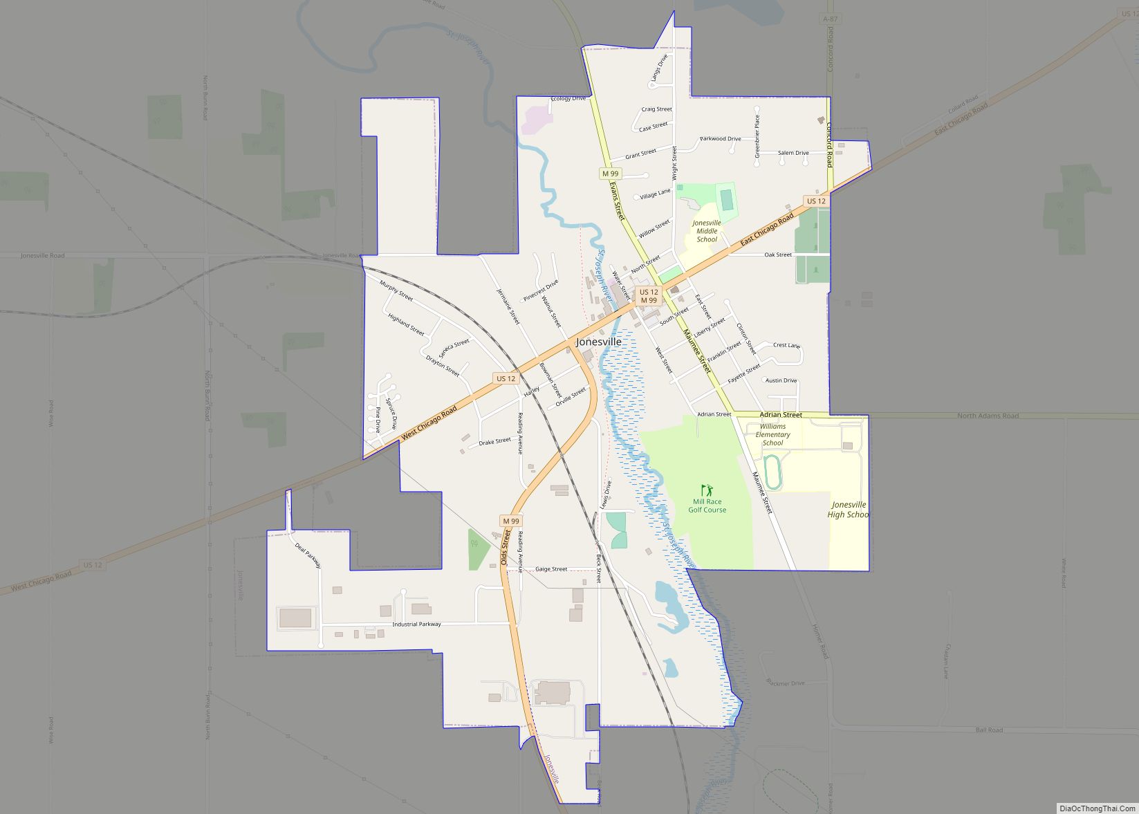
Jonesville is a city in Hillsdale County in the U.S. state of Michigan. The population was 2,176 at the 2020 census.
| Name: | Jonesville city |
|---|---|
| LSAD Code: | 25 |
| LSAD Description: | city (suffix) |
| State: | Michigan |
| County: | Hillsdale County |
| Founded: | 1828 |
| Incorporated: | 1855 (village) 2014 (city) |
| Elevation: | 1,076 ft (328 m) |
| Total Area: | 2.83 sq mi (7.33 km²) |
| Land Area: | 2.79 sq mi (7.23 km²) |
| Water Area: | 0.03 sq mi (0.10 km²) |
| Total Population: | 2,176 |
| Population Density: | 887.46/sq mi (342.65/km²) |
| Area code: | 517 |
| FIPS code: | 2641920 |
| GNISfeature ID: | 0629385 |
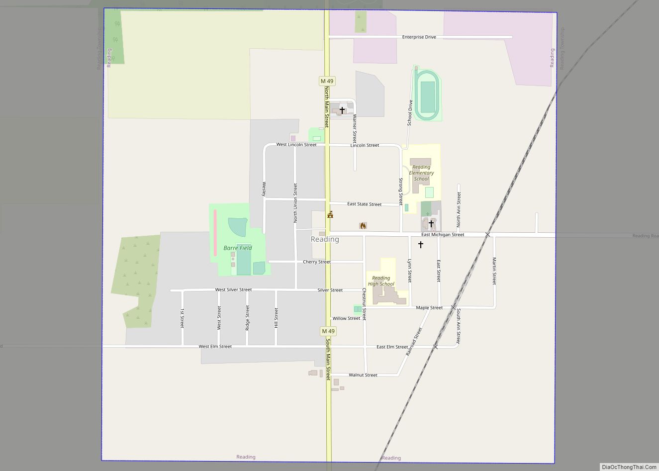
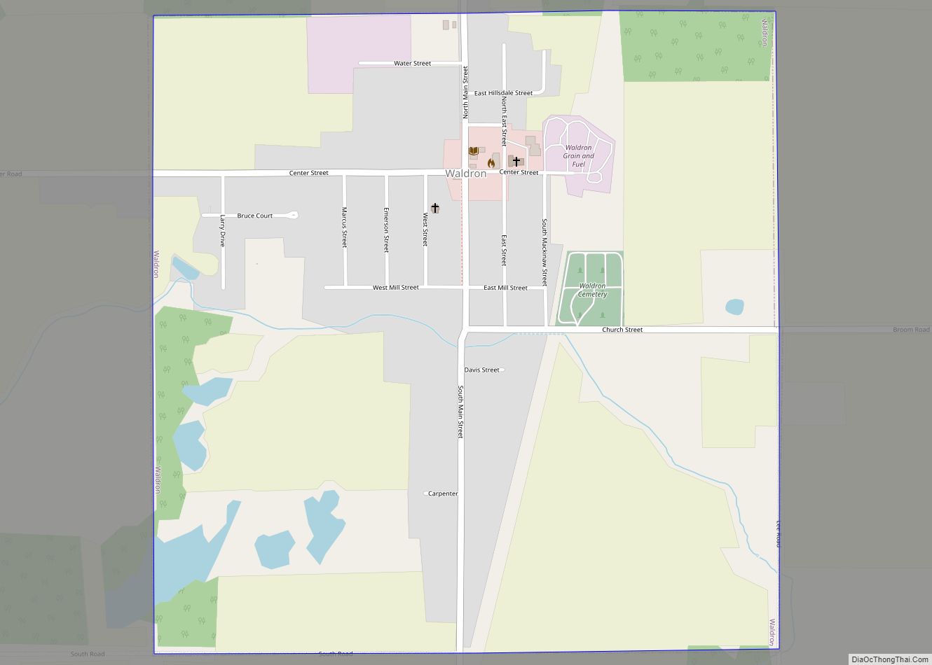
Online Interactive Map
Click on ![]() to view map in "full screen" mode.
to view map in "full screen" mode.
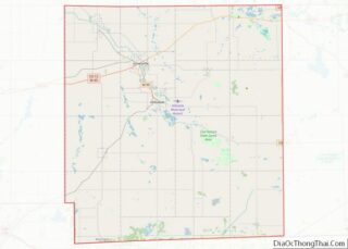
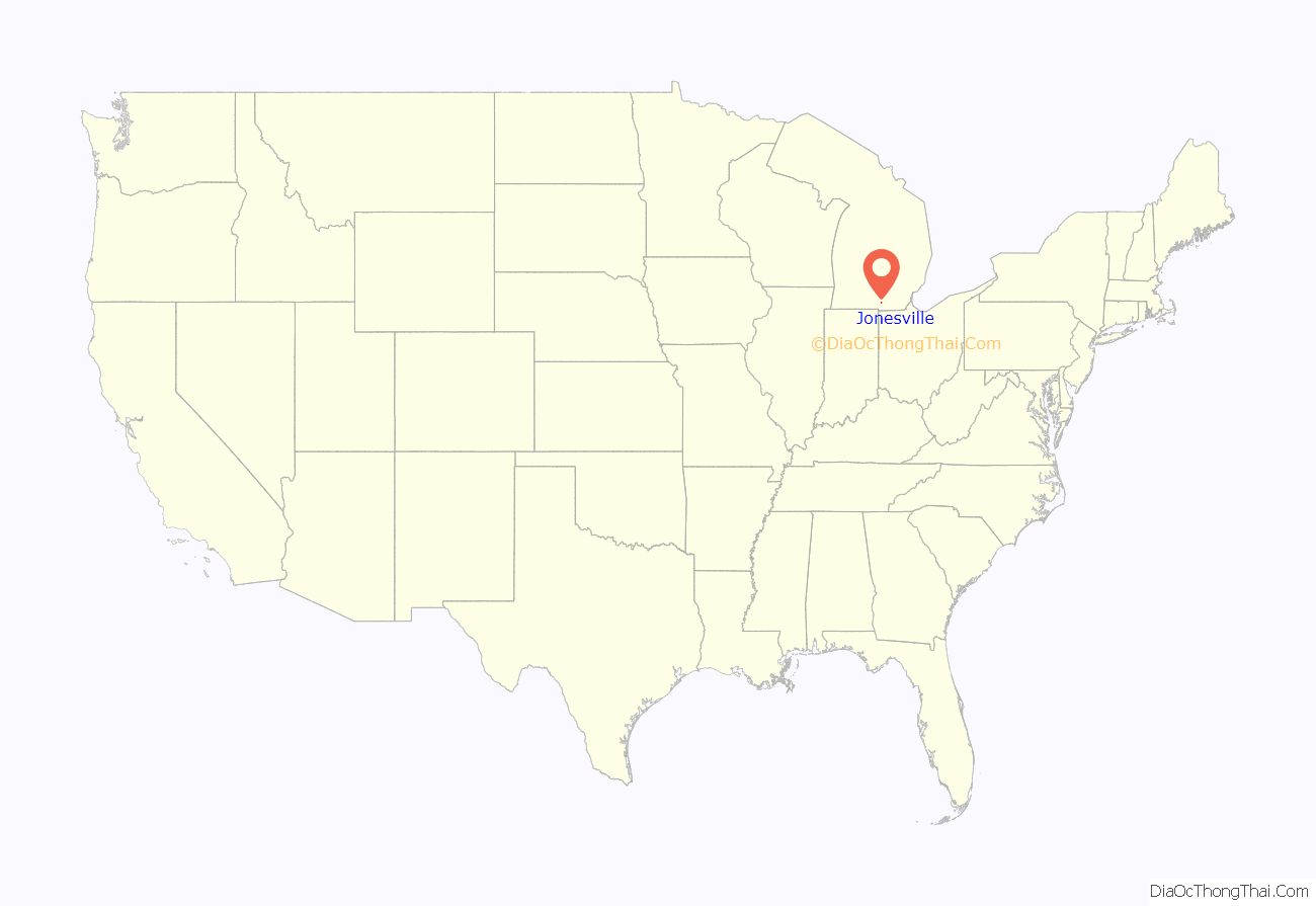
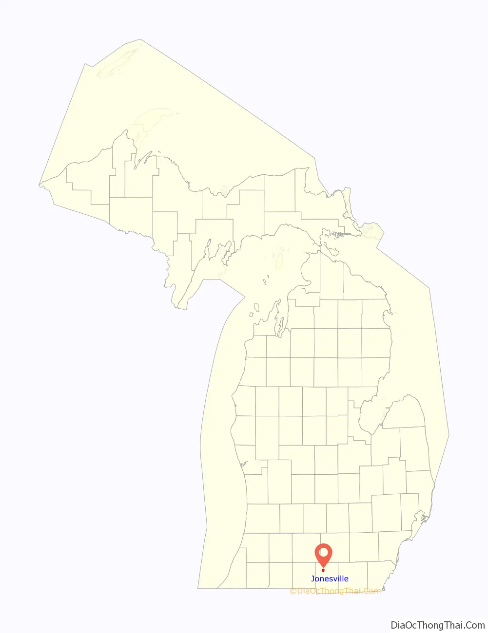
Jonesville location map. Where is Jonesville city?
History
The area was first settled by brothers Benaiah and Edmund Jones, who came here from Painesville, Ohio in 1828 and purchased land the next year. They surveyed and platted the community by 1831. It served as the first county seat of Hillsdale County, which was formally organized in 1835. The Jonesville post office opened on January 21, 1841. The community incorporated as a village in 1855. Jonesville once contained a railway station along the Lake Shore and Michigan Southern Railway.
In August 2014, the village voted to adopt a charter and incorporated as a city.
The city contains three listings on the National Register of Historic Places: J.J. Deal and Son Carriage Factory, Grace Episcopal Church, and the E.O. Grosvenor House. All three of these are also Michigan State Historic Sites, and the city also includes the state historic sites the Delevan (Munro) House and Kiddie Brush and Toy Company. The toy company occupied the same building as the Carriage Factory, which is now renovated as an apartment complex.
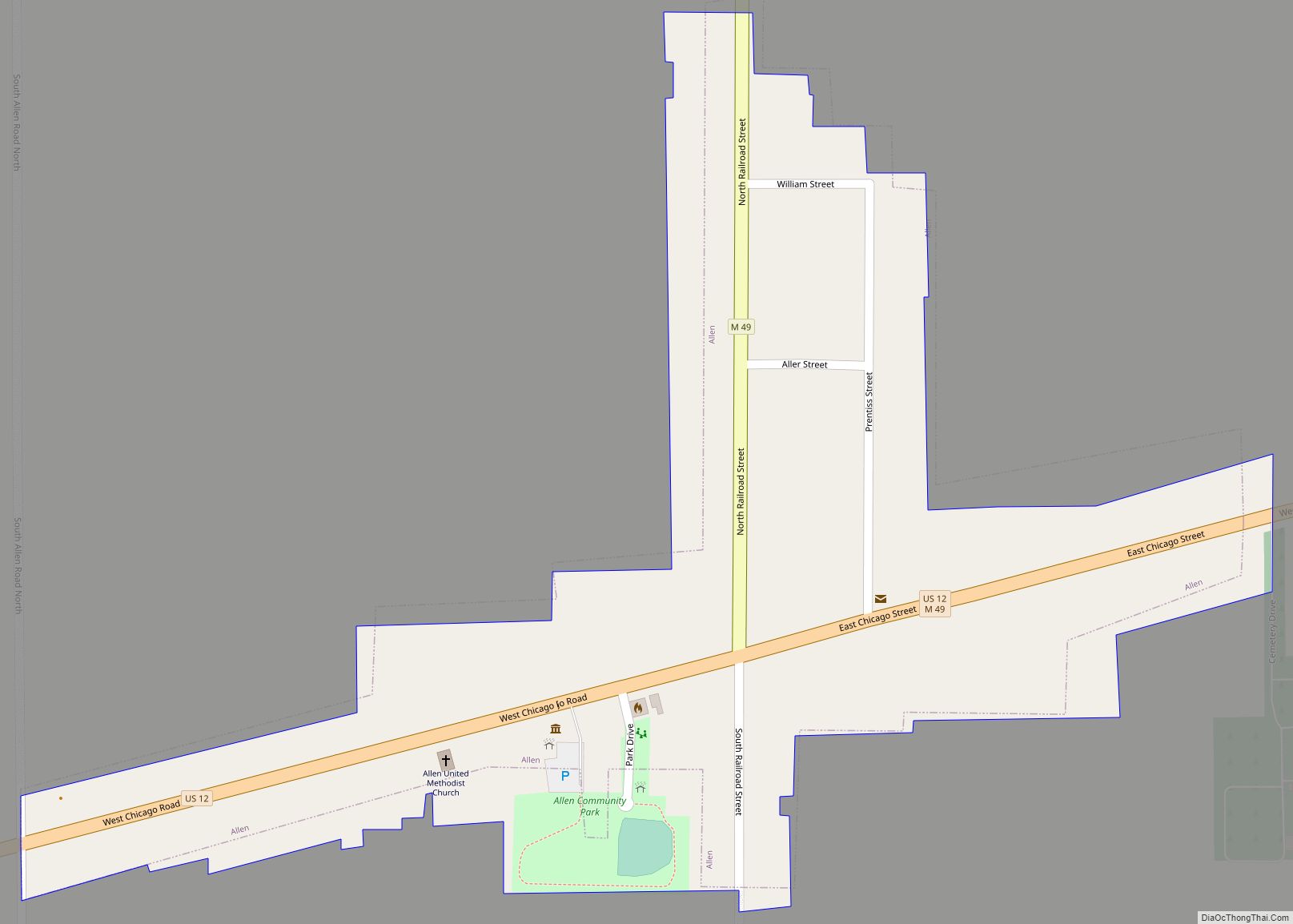
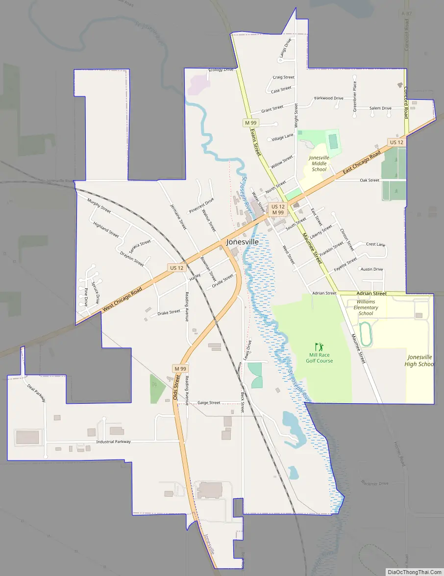
Jonesville Road Map
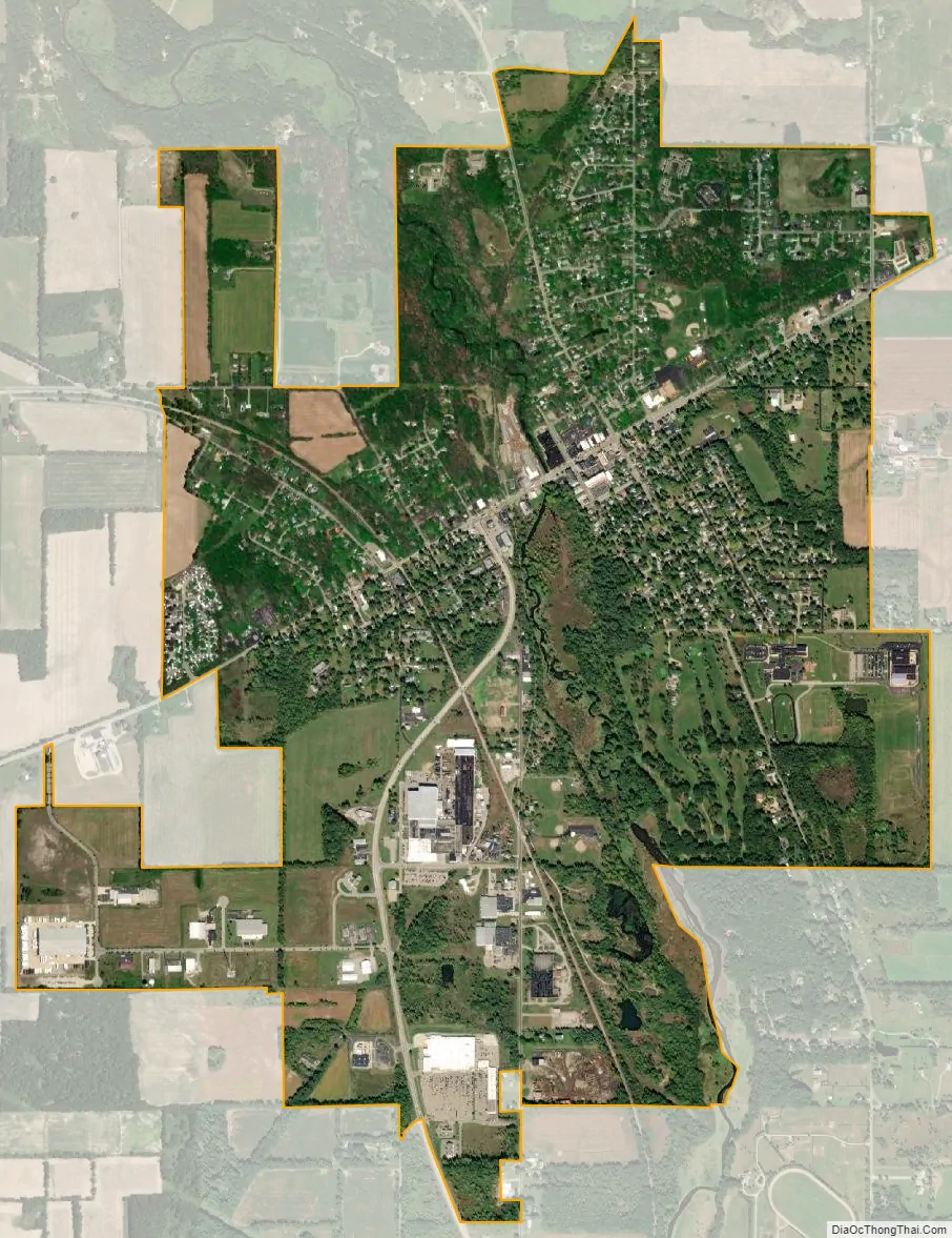
Jonesville city Satellite Map
Geography
According to the U.S. Census Bureau, the village has a total area of 2.83 square miles (7.33 km), of which 2.79 square miles (7.23 km) is land and 0.04 square miles (0.10 km) (0.99%) is water.
The St. Joseph River flows through the city.
Major highways
- US 12 (W. Chicago Street) runs southwest through the center of the city.
- M-99 runs south–north through the city and also runs concurrently with US 12 for a short distance.
See also
Map of Michigan State and its subdivision:- Alcona
- Alger
- Allegan
- Alpena
- Antrim
- Arenac
- Baraga
- Barry
- Bay
- Benzie
- Berrien
- Branch
- Calhoun
- Cass
- Charlevoix
- Cheboygan
- Chippewa
- Clare
- Clinton
- Crawford
- Delta
- Dickinson
- Eaton
- Emmet
- Genesee
- Gladwin
- Gogebic
- Grand Traverse
- Gratiot
- Hillsdale
- Houghton
- Huron
- Ingham
- Ionia
- Iosco
- Iron
- Isabella
- Jackson
- Kalamazoo
- Kalkaska
- Kent
- Keweenaw
- Lake
- Lake Hurron
- Lake Michigan
- Lake St. Clair
- Lake Superior
- Lapeer
- Leelanau
- Lenawee
- Livingston
- Luce
- Mackinac
- Macomb
- Manistee
- Marquette
- Mason
- Mecosta
- Menominee
- Midland
- Missaukee
- Monroe
- Montcalm
- Montmorency
- Muskegon
- Newaygo
- Oakland
- Oceana
- Ogemaw
- Ontonagon
- Osceola
- Oscoda
- Otsego
- Ottawa
- Presque Isle
- Roscommon
- Saginaw
- Saint Clair
- Saint Joseph
- Sanilac
- Schoolcraft
- Shiawassee
- Tuscola
- Van Buren
- Washtenaw
- Wayne
- Wexford
- Alabama
- Alaska
- Arizona
- Arkansas
- California
- Colorado
- Connecticut
- Delaware
- District of Columbia
- Florida
- Georgia
- Hawaii
- Idaho
- Illinois
- Indiana
- Iowa
- Kansas
- Kentucky
- Louisiana
- Maine
- Maryland
- Massachusetts
- Michigan
- Minnesota
- Mississippi
- Missouri
- Montana
- Nebraska
- Nevada
- New Hampshire
- New Jersey
- New Mexico
- New York
- North Carolina
- North Dakota
- Ohio
- Oklahoma
- Oregon
- Pennsylvania
- Rhode Island
- South Carolina
- South Dakota
- Tennessee
- Texas
- Utah
- Vermont
- Virginia
- Washington
- West Virginia
- Wisconsin
- Wyoming