Lake Isabella is a village split between Sherman Township and Broomfield Township within Isabella County in the U.S. state of Michigan. The population grew to 1,681 people as of the 2010 Census, making the community one of the state’s ten fastest growing communities in terms of percentage, with an increase of 35% from the 2000 Census, and an increase of 160% from 1990. The village shares the 48893 ZIP Code with several neighboring municipalities.
| Name: | Lake Isabella village |
|---|---|
| LSAD Code: | 47 |
| LSAD Description: | village (suffix) |
| State: | Michigan |
| County: | Isabella County |
| Incorporated: | 1998 (village) |
| Elevation: | 781 ft (238 m) |
| Total Area: | 4.62 sq mi (11.95 km²) |
| Land Area: | 3.48 sq mi (9.01 km²) |
| Water Area: | 1.14 sq mi (2.94 km²) |
| Total Population: | 1,829 |
| Population Density: | 525.73/sq mi (202.96/km²) |
| Area code: | 989 |
| FIPS code: | 2644715 |
| GNISfeature ID: | 0636218 |
Online Interactive Map
Click on ![]() to view map in "full screen" mode.
to view map in "full screen" mode.
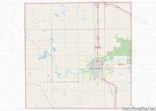
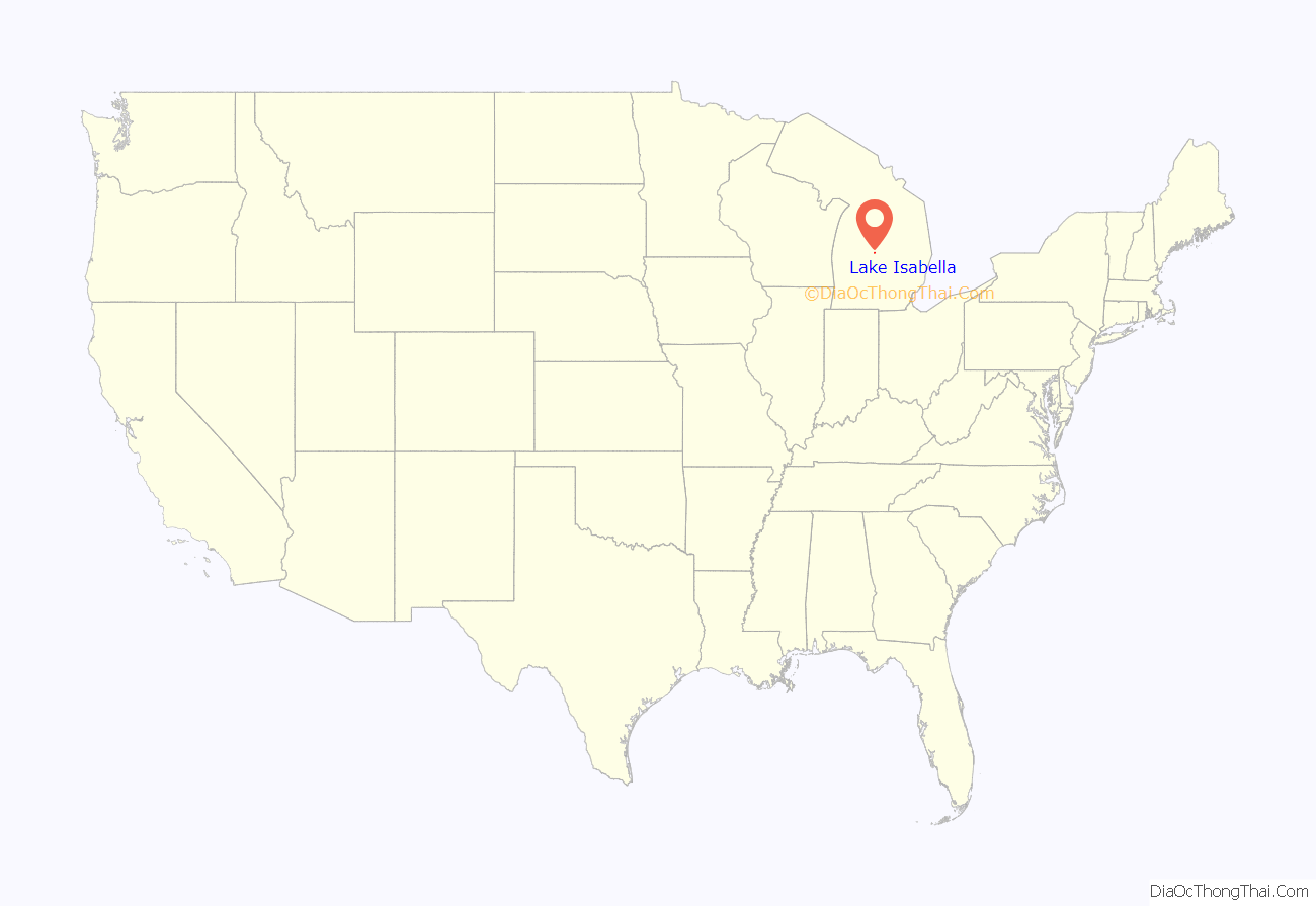
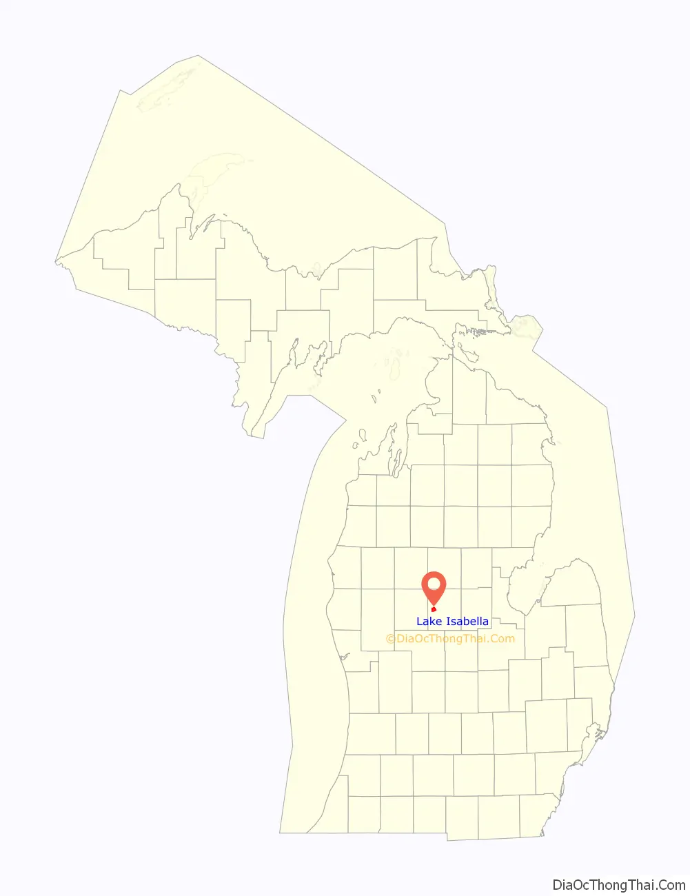
Lake Isabella location map. Where is Lake Isabella village?
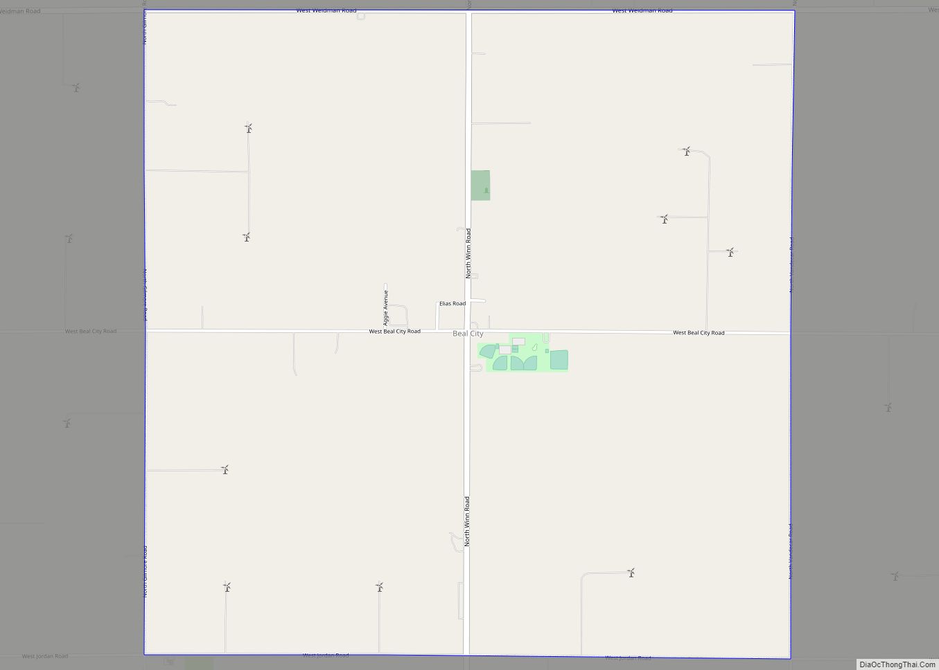
Lake Isabella Road Map
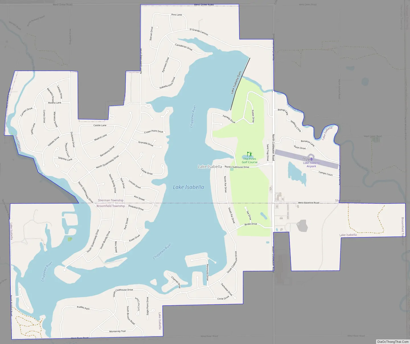
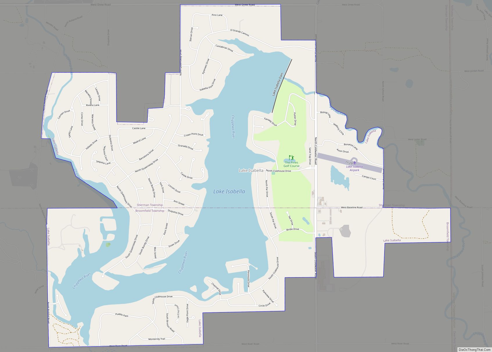
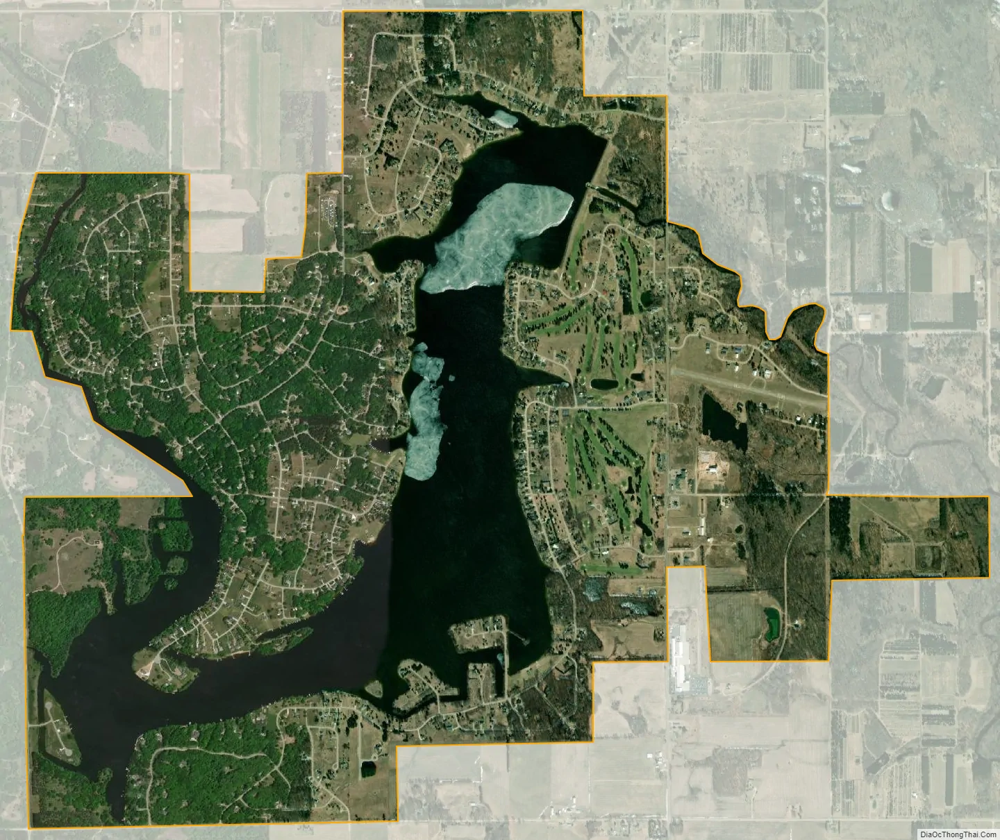
Lake Isabella city Satellite Map
Geography
According to the United States Census Bureau, the village has a total area of 4.65 square miles (12.04 km), of which 3.51 square miles (9.09 km) is land and 1.14 square miles (2.95 km) is water.
See also
Map of Michigan State and its subdivision:- Alcona
- Alger
- Allegan
- Alpena
- Antrim
- Arenac
- Baraga
- Barry
- Bay
- Benzie
- Berrien
- Branch
- Calhoun
- Cass
- Charlevoix
- Cheboygan
- Chippewa
- Clare
- Clinton
- Crawford
- Delta
- Dickinson
- Eaton
- Emmet
- Genesee
- Gladwin
- Gogebic
- Grand Traverse
- Gratiot
- Hillsdale
- Houghton
- Huron
- Ingham
- Ionia
- Iosco
- Iron
- Isabella
- Jackson
- Kalamazoo
- Kalkaska
- Kent
- Keweenaw
- Lake
- Lake Hurron
- Lake Michigan
- Lake St. Clair
- Lake Superior
- Lapeer
- Leelanau
- Lenawee
- Livingston
- Luce
- Mackinac
- Macomb
- Manistee
- Marquette
- Mason
- Mecosta
- Menominee
- Midland
- Missaukee
- Monroe
- Montcalm
- Montmorency
- Muskegon
- Newaygo
- Oakland
- Oceana
- Ogemaw
- Ontonagon
- Osceola
- Oscoda
- Otsego
- Ottawa
- Presque Isle
- Roscommon
- Saginaw
- Saint Clair
- Saint Joseph
- Sanilac
- Schoolcraft
- Shiawassee
- Tuscola
- Van Buren
- Washtenaw
- Wayne
- Wexford
- Alabama
- Alaska
- Arizona
- Arkansas
- California
- Colorado
- Connecticut
- Delaware
- District of Columbia
- Florida
- Georgia
- Hawaii
- Idaho
- Illinois
- Indiana
- Iowa
- Kansas
- Kentucky
- Louisiana
- Maine
- Maryland
- Massachusetts
- Michigan
- Minnesota
- Mississippi
- Missouri
- Montana
- Nebraska
- Nevada
- New Hampshire
- New Jersey
- New Mexico
- New York
- North Carolina
- North Dakota
- Ohio
- Oklahoma
- Oregon
- Pennsylvania
- Rhode Island
- South Carolina
- South Dakota
- Tennessee
- Texas
- Utah
- Vermont
- Virginia
- Washington
- West Virginia
- Wisconsin
- Wyoming