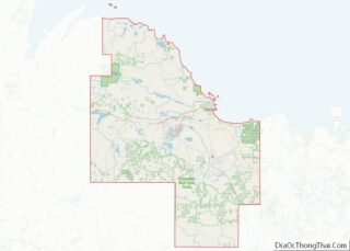
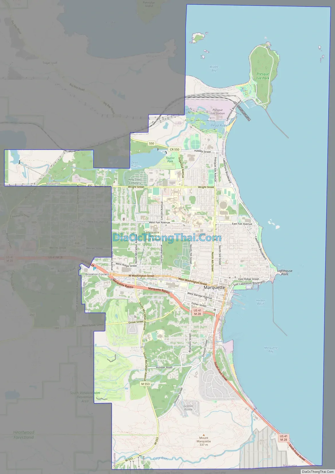
Marquette (/mɑːrˈkɛt/ mar-KEHT) is the largest city in the Upper Peninsula of the U.S. state of Michigan. Marquette is the county seat of Marquette County. Located on the shores of Lake Superior, Marquette is a major port, known primarily for shipping iron ore from the Marquette Iron Range. The city is partially surrounded by Marquette Township, but the two are administered autonomously.
Marquette is named after Jacques Marquette, a French Jesuit missionary who had explored the Great Lakes region. Marquette had a population of 20,629 at the 2020 census, making it the largest city in Michigan north of the Tri-Cities. Marquette is also the third-largest American city on Lake Superior, behind Duluth, Minnesota, and Superior, Wisconsin. Marquette’s urban area extends south toward the community of Harvey, and west toward Negaunee and Ishpeming, at the base of the Huron Mountains.
Marquette is the home of Northern Michigan University (NMU), a four-year public university. NMU’s athletic teams are nicknamed the Wildcats, and compete primarily in the NCAA Division II Great Lakes Intercollegiate Athletic Conference (GLIAC). The men’s ice hockey team, which competes in the NCAA Division I Central Collegiate Hockey Association (CCHA), won the Division I national championship in 1991.
| Name: | Marquette city |
|---|---|
| LSAD Code: | 25 |
| LSAD Description: | city (suffix) |
| State: | Michigan |
| County: | Marquette County |
| Incorporated: | 1849 (village) 1871 (city) |
| Elevation: | 633 ft (203 m) |
| Land Area: | 11.34 sq mi (29.36 km²) |
| Water Area: | 8.06 sq mi (20.87 km²) |
| Population Density: | 1,819.62/sq mi (702.55/km²) |
| Area code: | 906 |
| FIPS code: | 2651900 |
| GNISfeature ID: | 0631600 |
Online Interactive Map
Click on ![]() to view map in "full screen" mode.
to view map in "full screen" mode.
Marquette location map. Where is Marquette city?


History
The land around Marquette was known to French missionaries of the early 17th century and the trappers of the early 19th century. The area was originally inhabited by the Anishinaabe Council of Three Fires, who referred to the area as Gichi-namebini Ziibing. Development of the area did not begin until 1844, when William Burt and Jacob Houghton (the brother of geologist Douglass Houghton) discovered iron deposits near Teal Lake west of Marquette. In 1845, Jackson Mining Company, the first organized mining company in the region, was formed.
The village of Marquette began on September 14, 1849, with the formation of a second iron concern, the Marquette Iron Company. Three men participated in organizing the firm: Robert J. Graveraet, who had prospected the region for ore; Edward Clark, agent for Waterman A. Fisher of Worcester, Massachusetts, who financed the company, and Amos Rogers Harlow. The village was at first called New Worcester, with Harlow as the first postmaster. On August 21, 1850, the name was changed to honor Jacques Marquette, the French Jesuit missionary who had explored the region. A second post office, named Carp River, was opened on October 13, 1851, by Peter White, who had gone there with Graveraet at age 18. Harlow closed his post office in August 1852. The Marquette Iron Company failed, while its successor, the Cleveland Iron Mining Company, flourished and had the village platted in 1854. The plat was recorded by Peter White. White’s office was renamed as Marquette in April 1856, and the village was incorporated in 1859. It was incorporated as a city in 1871.
During the 1850s, Marquette was linked by rail to numerous mines and became the leading shipping center of the Upper Peninsula. The first ore pocket dock, designed by an early town leader, John Burt, was built by the Cleveland Iron Mining Company in 1859. By 1862, the city had a population of over 1,600 and a soaring economy.
In the late 19th century, during the height of iron mining, Marquette became nationally known as a summer haven. Visitors brought in by Great Lakes passenger steamships filled the city’s hotels and resorts.
South of the city, K. I. Sawyer Air Force Base was an important Air Force installation during the Cold War, host to B-52H bombers and KC-135 tankers of the Strategic Air Command, as well as a fighter interceptor squadron. The base closed in September 1995, and is now the county’s Sawyer International Airport.
Marquette continues to be a shipping port for hematite ores and, today, enriched iron ore pellets, from nearby mines and pelletizing plants. About 7.9 million gross tons of pelletized iron ore passed through Marquette’s Presque Isle Harbor in 2005.
The Roman Catholic Bishop Frederic Baraga is buried at St. Peter Cathedral, which is the center for the Diocese of Marquette.
Lakeview Arena, an ice hockey rink in Marquette, won the Kraft Hockeyville USA contest on April 30, 2016. The arena received $150,000 in upgrades, and hosted the Buffalo Sabres and Carolina Hurricanes on October 4, 2016, in a preseason NHL contest. Buffalo won the game 2–0.
Postal and philatelic history
In addition to the Marquette #1 Post Office there is the “Northern Michigan University Bookstore Contract Station #384”.
The first day of issue of a postal card showing Bishop Frederic Baraga took place in Marquette on June 29, 1984, and that of the Wonders of America Lake Superior stamp on May 27, 2006.
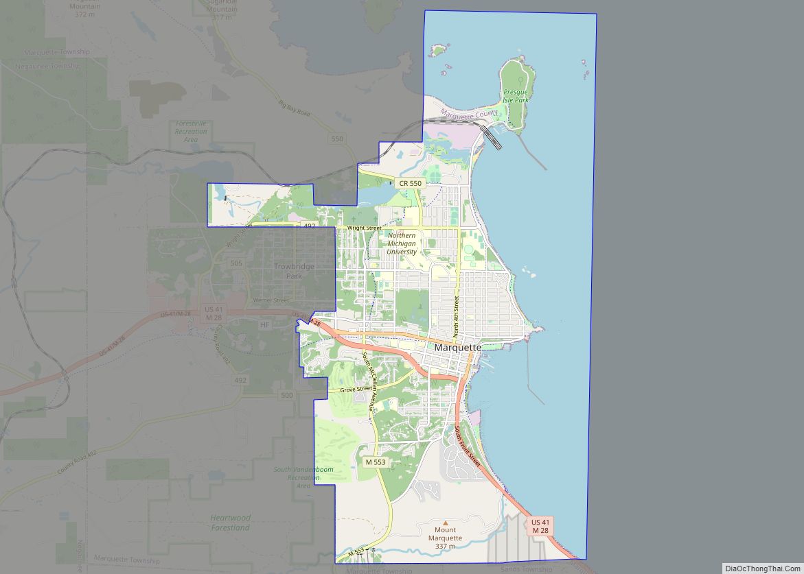
Marquette Road Map
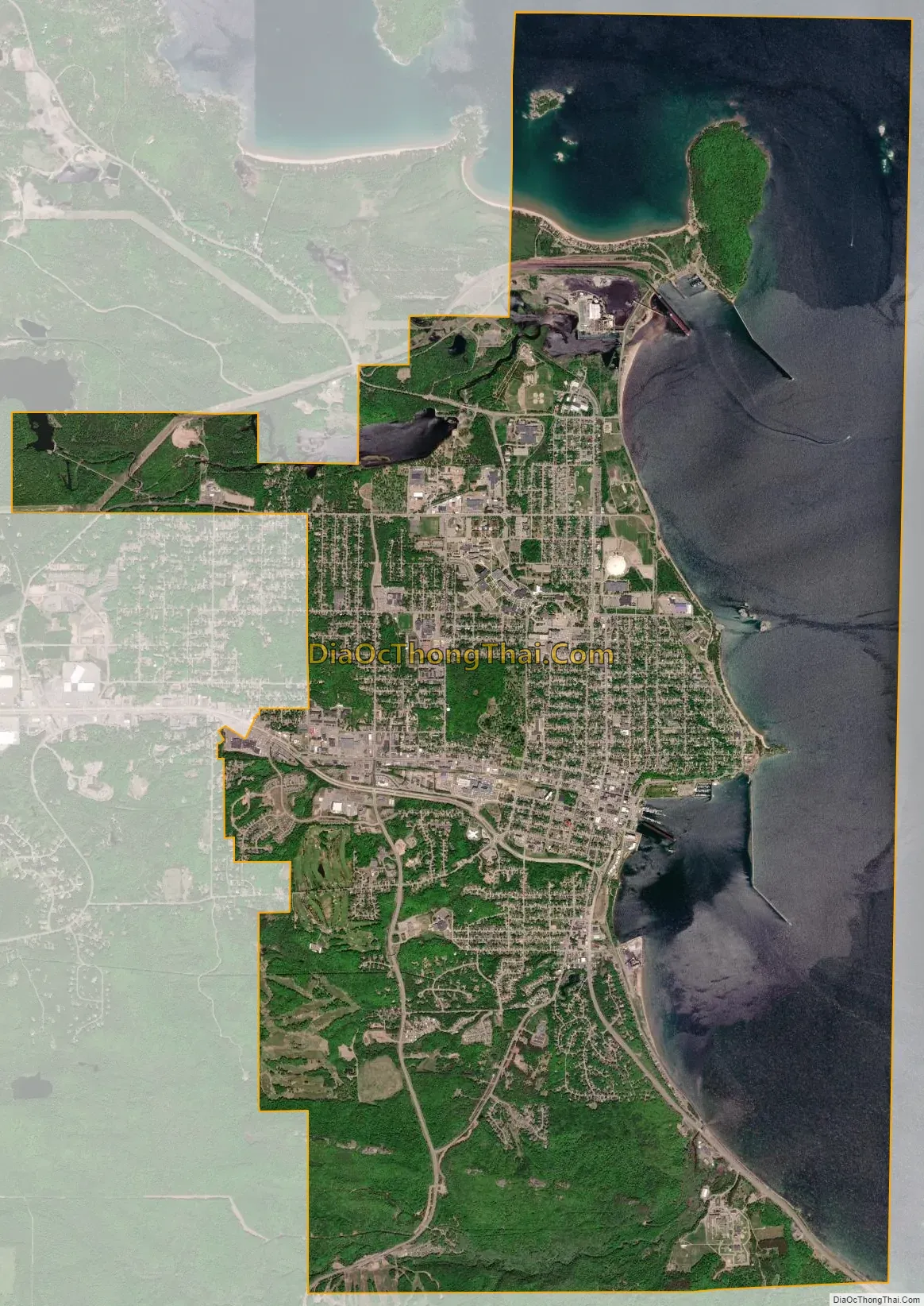
Marquette city Satellite Map
Geography
Geography
According to the United States Census Bureau, the city has a total area of 19.45 square miles (50.38 km), of which 11.39 square miles (29.50 km) is land and 8.06 square miles (20.88 km) is water.
The city includes several small islands (principally Middle Island, Gull Island, Lover’s Island, Presque Isle Pt. Rocks, White Rocks, Ripley Rock, and Picnic Rocks) in Lake Superior. The Marquette Underwater Preserve lies immediately offshore.
Marquette Mountain, used for skiing, is located in the city, as is most of the land of Marquette Branch Prison of the Michigan Department of Corrections. The town of Trowbridge Park (under Marquette Township), is located to the west, Sands Township to the south, and Marquette Township to the northwest of the city.
Climate
The climate is a hemiboreal humid continental (Köppen: Dfb) with four distinct seasons that are strongly moderated by Lake Superior and is located in Plant Hardiness zone 5b. Narrative below is based on chart below, reflecting 1991-2020 climate normals. Winters are long and cold with a January average of 18.5 °F (−7.5 °C). Winter temperatures are slightly warmer than inland locations at a similar latitude due to the release of the heat stored by the lake, which moderates the climate. On average, there are 11.6 days annually where the minimum temperature reaches 0 °F (−18 °C) and 73 days with a maximum at or below freezing, including a majority of days during meteorological winter (December thru February).
Being located in the snowbelt region, Marquette receives a significant amount of snowfall during the winter months, mostly from lake-effect snow. Because Lake Superior rarely freezes over completely, this enables lake effect snow to persist throughout winter, making Marquette the third snowiest location in the contiguous United States as reported by the National Oceanic and Atmospheric Administration with an average annual snowfall of 149.1 inches or 3.79 metres. The snow depth in winter usually exceeds 10 inches or 0.25 metres. Marquette is the city with the deepest snow depths with a population of more than 20,000 in the US (and one of the largest in North America outside the western Cordillera or eastern Canada), as temperatures remain low throughout the winter and cold, dry air is intercepted by the Great Lakes.
The warmest months, July and August, each average 66.2 °F (19.0 °C), showing somewhat of a seasonal lag. The surrounding lake cools summertime temperatures and as a result, temperatures above 90 °F (32.2 °C) are rare, with only 3.4 days per year. Spring and fall are transitional seasons that are generally mild though highly variable due to the alternation of air masses moving quickly. Spring is usually cooler than fall because the surrounding lake is slower to warm than the land, while in fall the lake releases heat, warming the area.
Marquette receives 30.2 in (767 mm) of precipitation per year, which is fairly evenly distributed throughout the year, though September and October are the wettest months with February and March being the driest. The average window for morning freezes is October 15 thru May 7. The highest temperature ever recorded in Marquette was 108 °F (42 °C) on July 15, 1901, and the lowest was −33 °F (−36 °C) on February 8, 1861. Marquette receives an average of 2,294 hours of sunshine per year or 51 percent of possible sunshine, ranging from a low of 29 percent in December to a high of 68 percent in July.
The City of Marquette has received national attention for its measures to adapt to climate change, such as coastline restoration and moving portions of Lakeshore Boulevard which are flooded by Lake Superior 100 yards inland. Property owners are required to maintain “riparian buffers” of native plants along waterways. A county task force has created a guidebook in cooperation with the University of Michigan for landscaping which can reduce the habitat for disease-bearing ticks. A federally funded stormwater drain project will route runoff which flows into Lake Superior into restored wetlands. At the time of a 2014 NOAA climate study, climate change was expected to lead to rising temperatures, a longer growing season, and greater precipitation in Marquette.
See also
Map of Michigan State and its subdivision:- Alcona
- Alger
- Allegan
- Alpena
- Antrim
- Arenac
- Baraga
- Barry
- Bay
- Benzie
- Berrien
- Branch
- Calhoun
- Cass
- Charlevoix
- Cheboygan
- Chippewa
- Clare
- Clinton
- Crawford
- Delta
- Dickinson
- Eaton
- Emmet
- Genesee
- Gladwin
- Gogebic
- Grand Traverse
- Gratiot
- Hillsdale
- Houghton
- Huron
- Ingham
- Ionia
- Iosco
- Iron
- Isabella
- Jackson
- Kalamazoo
- Kalkaska
- Kent
- Keweenaw
- Lake
- Lake Hurron
- Lake Michigan
- Lake St. Clair
- Lake Superior
- Lapeer
- Leelanau
- Lenawee
- Livingston
- Luce
- Mackinac
- Macomb
- Manistee
- Marquette
- Mason
- Mecosta
- Menominee
- Midland
- Missaukee
- Monroe
- Montcalm
- Montmorency
- Muskegon
- Newaygo
- Oakland
- Oceana
- Ogemaw
- Ontonagon
- Osceola
- Oscoda
- Otsego
- Ottawa
- Presque Isle
- Roscommon
- Saginaw
- Saint Clair
- Saint Joseph
- Sanilac
- Schoolcraft
- Shiawassee
- Tuscola
- Van Buren
- Washtenaw
- Wayne
- Wexford
- Alabama
- Alaska
- Arizona
- Arkansas
- California
- Colorado
- Connecticut
- Delaware
- District of Columbia
- Florida
- Georgia
- Hawaii
- Idaho
- Illinois
- Indiana
- Iowa
- Kansas
- Kentucky
- Louisiana
- Maine
- Maryland
- Massachusetts
- Michigan
- Minnesota
- Mississippi
- Missouri
- Montana
- Nebraska
- Nevada
- New Hampshire
- New Jersey
- New Mexico
- New York
- North Carolina
- North Dakota
- Ohio
- Oklahoma
- Oregon
- Pennsylvania
- Rhode Island
- South Carolina
- South Dakota
- Tennessee
- Texas
- Utah
- Vermont
- Virginia
- Washington
- West Virginia
- Wisconsin
- Wyoming