Marysville is a city in St. Clair County of the U.S. state of Michigan. The population was 9,959 at the 2010 census. The municipality was founded in 1919, first as a village, then became a city in 1924.
Marysville is located on the western shore of the St. Clair River, across from Corunna, Ontario. The city is marked by winding streets, subdivisions, a riverfront boardwalk, Bridge-to-Bay Bike Trail and an industrial park. The city was home to the former Wills Sainte Claire Automotive company, a Morton Salt plant, and the Detroit Edison Marysville Power Plant which was decommissioned in 2001 and razed in 2015.
| Name: | Marysville city |
|---|---|
| LSAD Code: | 25 |
| LSAD Description: | city (suffix) |
| State: | Michigan |
| County: | St. Clair County |
| Incorporated: | 1919 (village) 1924 (city) |
| Elevation: | 610 ft (186 m) |
| Total Area: | 8.32 sq mi (21.54 km²) |
| Land Area: | 7.33 sq mi (18.98 km²) |
| Water Area: | 0.99 sq mi (2.56 km²) |
| Total Population: | 9,997 |
| Population Density: | 1,364.22/sq mi (526.74/km²) |
| Area code: | 810 |
| FIPS code: | 2652080 |
| GNISfeature ID: | 1624715 |
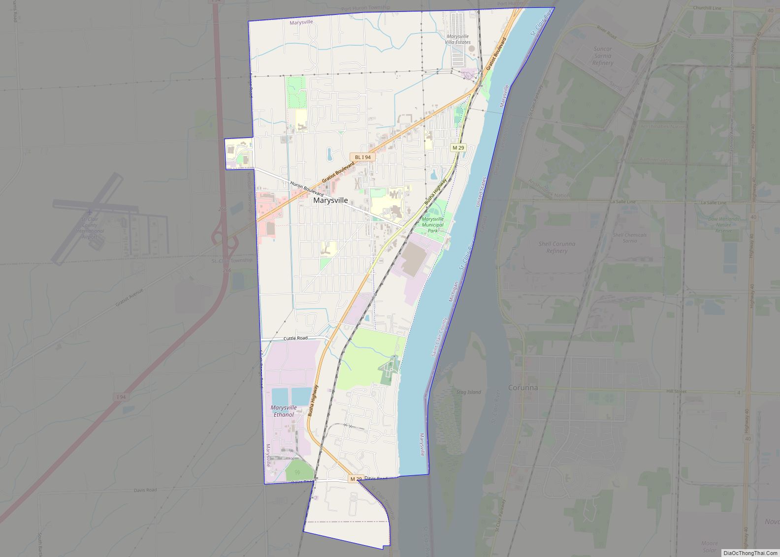
Online Interactive Map
Click on ![]() to view map in "full screen" mode.
to view map in "full screen" mode.
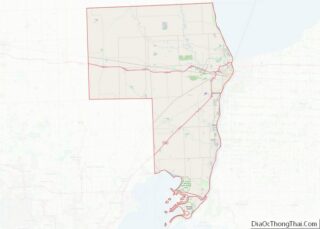
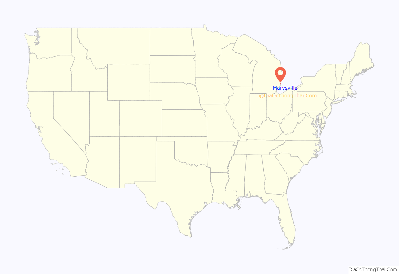
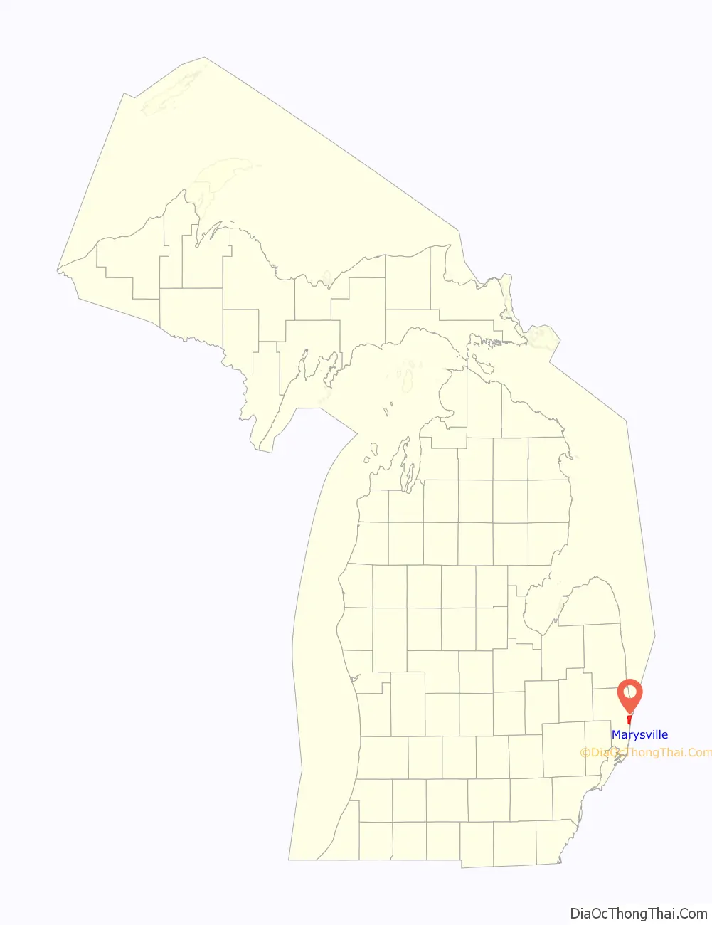
Marysville location map. Where is Marysville city?
History
Marysville traces its history back to 1786 when Antoin Morass built a sawmill at Bunce Creek. Later, in 1817, Zephaniah W. Bunce sailed up the St. Clair River and settled at the place of the mill, naming it Bunce Creek. This would later become the property of the Detroit Edison Marysville Power Plant. He later became postmaster and a member of the Michigan Territorial Council.
Meanwhile, two businessmen, Meldrum & Park, founded a sawmill in 1792 at the location now known as Cuttle Creek. This settlement was located in the southern part of current day Marysville, two streets are named after them.
Also having a street named for him was Colonel Andrew Mack, a native and the 11th mayor of Detroit. He bought Meldrum and Park’s mill and built his home and a general store along the St. Clair River. The small settlement with Mack’s general store and mill was called “Mack’s Place” and was awarded a post office. Mack was a state representative, Colonel in the War of 1812, and a co-founder of the Detroit Free Press. Colonel Mack and his wife, Amelia, are buried on the north bank of Cuttle Creek in the Riverview Golf Course.
Later, Edward P. Vickery settled at the present day foot of Huron Boulevard in Marysville. He named the operation Vickery’s Landing and the settlement surrounding it eventually became known as Vicksburg. In 1854, the Mack’s Place post office was transferred to Vicksburg. However, there was already another Vicksburg, Michigan, so in 1859 the name was changed to Marysville, after Nelson Mill’s wife Mary.
These small settlements were brought together by inventor and engineer, C. Harold Wills. He worked at the Ford Motor Company, and was considered the “right-hand man” of Henry Ford. His contributions to the Ford company included designing Models A through T of the early Ford Motor Company. He was the inventor of many auto improvements including the planetary transmission used in the Models S and T. He was a pioneer in the use of vanadium steel and designed the “Blue Oval” logo, still used on Ford Products today. He resigned in 1919 and moved to Marysville to establish the C. H. Wills & Company on the banks of the St. Clair River. Two years later in 1921, the first Wills Ste. Clair automobile was produced (named for the factory’s location on the St. Clair River). The factory closed in 1926 after 14,000 vehicles were made by the Wills factory.
Wills’ and his partner John Lee provided much of the early infrastructure of Marysville, including electricity, sidewalks, roads, etc. so that Wills is credited with the street design and city planning of Marysville. He nicknamed Marysville the “Dream City”. The main area of the city to be developed before his company folded was the area surrounding Washington Elementary School. The community was deeply affected by the Great Depression, and the vision for the city was never fully realized. Subdivision development in the later half of the 20th century has further offset the strategic plan for the City of Marysville. Wills did succeed to the extent that the Marysville area is nowadays a vibrant community. Wills’ former factory currently houses the Chrysler Corporation MOPAR parts distribution facility.
Marysville was incorporated as a village in 1919. It became an incorporated city in 1924.
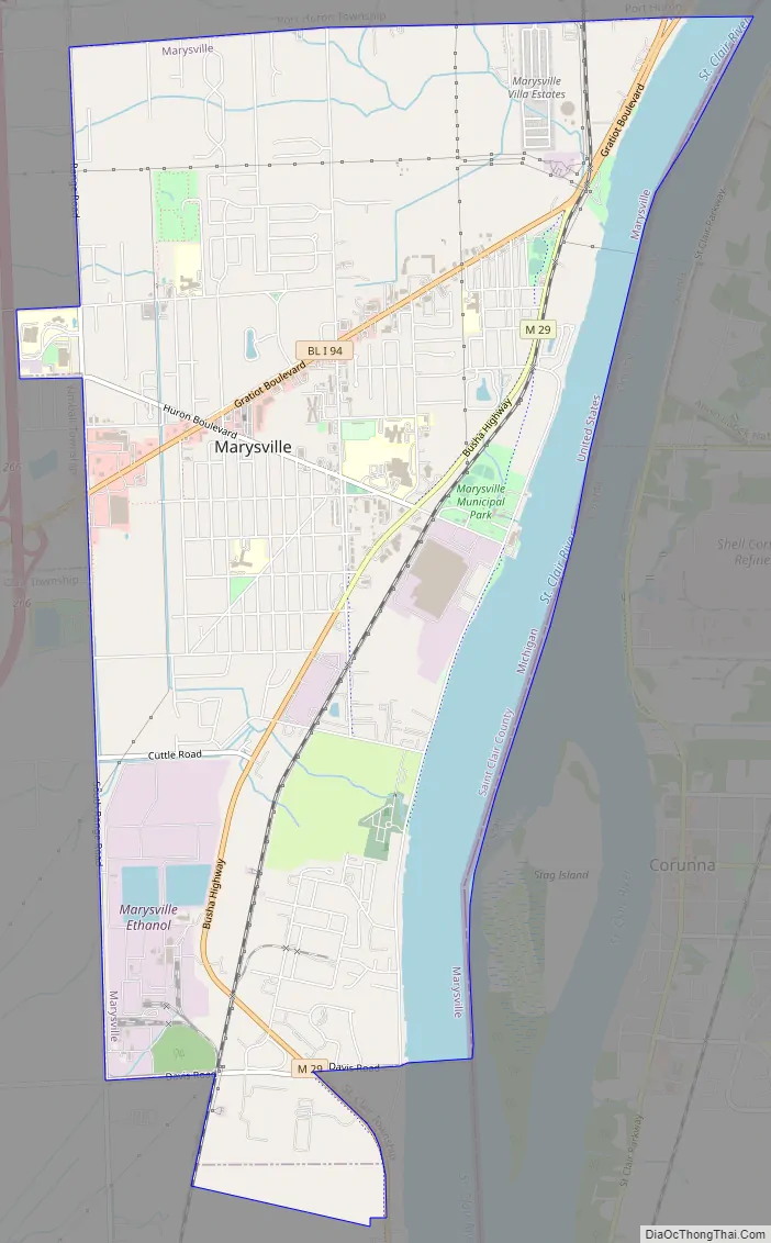
Marysville Road Map
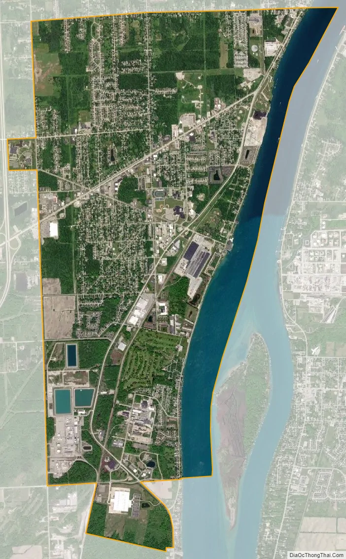
Marysville city Satellite Map
Geography
- According to the United States Census Bureau, the city has a total area of 8.30 square miles (21.50 km), of which 7.31 square miles (18.93 km) is land and 0.99 square miles (2.56 km) is water.
- It is considered to be part of the Thumb of Michigan.
- Marysville can also be considered as in the Blue Water Area.
- The city lies on the border between Michigan and Ontario formed by the St. Clair River
- Marysville is neighbored by Port Huron, Michigan to the north, St. Clair, Michigan to the south, Kimball Township, Michigan to the west, and Corunna, Ontario to the east.
See also
Map of Michigan State and its subdivision:- Alcona
- Alger
- Allegan
- Alpena
- Antrim
- Arenac
- Baraga
- Barry
- Bay
- Benzie
- Berrien
- Branch
- Calhoun
- Cass
- Charlevoix
- Cheboygan
- Chippewa
- Clare
- Clinton
- Crawford
- Delta
- Dickinson
- Eaton
- Emmet
- Genesee
- Gladwin
- Gogebic
- Grand Traverse
- Gratiot
- Hillsdale
- Houghton
- Huron
- Ingham
- Ionia
- Iosco
- Iron
- Isabella
- Jackson
- Kalamazoo
- Kalkaska
- Kent
- Keweenaw
- Lake
- Lake Hurron
- Lake Michigan
- Lake St. Clair
- Lake Superior
- Lapeer
- Leelanau
- Lenawee
- Livingston
- Luce
- Mackinac
- Macomb
- Manistee
- Marquette
- Mason
- Mecosta
- Menominee
- Midland
- Missaukee
- Monroe
- Montcalm
- Montmorency
- Muskegon
- Newaygo
- Oakland
- Oceana
- Ogemaw
- Ontonagon
- Osceola
- Oscoda
- Otsego
- Ottawa
- Presque Isle
- Roscommon
- Saginaw
- Saint Clair
- Saint Joseph
- Sanilac
- Schoolcraft
- Shiawassee
- Tuscola
- Van Buren
- Washtenaw
- Wayne
- Wexford
- Alabama
- Alaska
- Arizona
- Arkansas
- California
- Colorado
- Connecticut
- Delaware
- District of Columbia
- Florida
- Georgia
- Hawaii
- Idaho
- Illinois
- Indiana
- Iowa
- Kansas
- Kentucky
- Louisiana
- Maine
- Maryland
- Massachusetts
- Michigan
- Minnesota
- Mississippi
- Missouri
- Montana
- Nebraska
- Nevada
- New Hampshire
- New Jersey
- New Mexico
- New York
- North Carolina
- North Dakota
- Ohio
- Oklahoma
- Oregon
- Pennsylvania
- Rhode Island
- South Carolina
- South Dakota
- Tennessee
- Texas
- Utah
- Vermont
- Virginia
- Washington
- West Virginia
- Wisconsin
- Wyoming