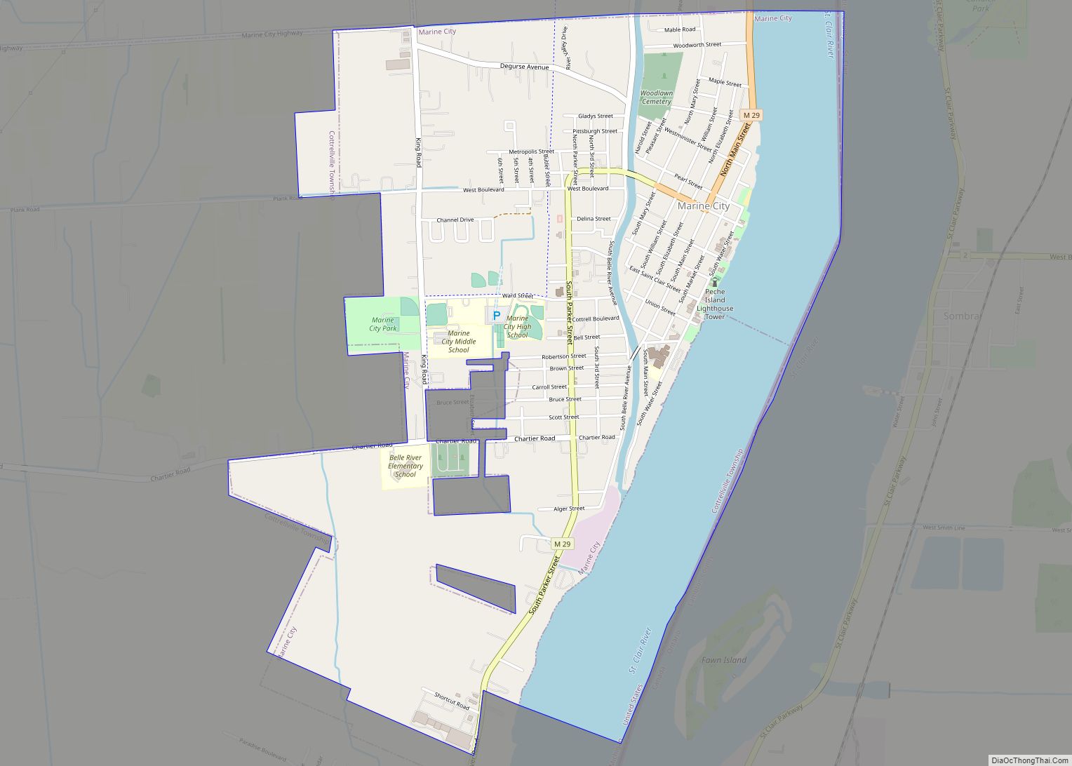
Marine City is a city in St. Clair County in the U.S. state of Michigan. Located on the west bank of the St. Clair River, it is one of the cities in the River District north of Detroit and south of Lake Huron. In the late 19th century, it was a major center of wooden shipbuilding and lumber processing.
The population was 4,248 at the 2010 census. The city formerly featured an international auto ferry service, The Bluewater Ferry to Sombra, Ontario, Canada across the river.
| Name: | Marine City city |
|---|---|
| LSAD Code: | 25 |
| LSAD Description: | city (suffix) |
| State: | Michigan |
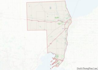
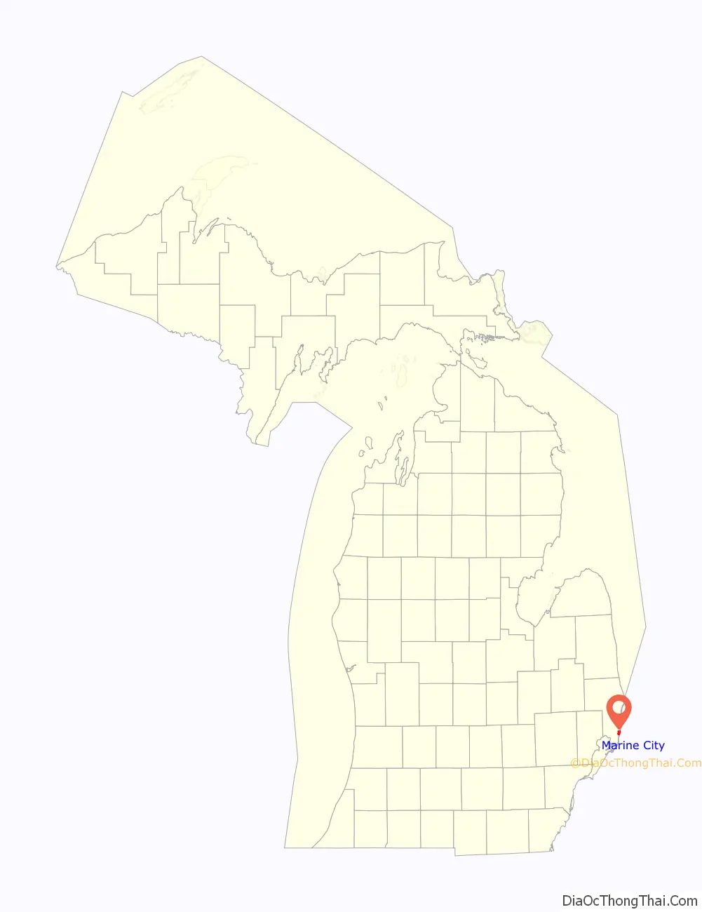
| County: | St. Clair County |
| Elevation: | 584 ft (178 m) |
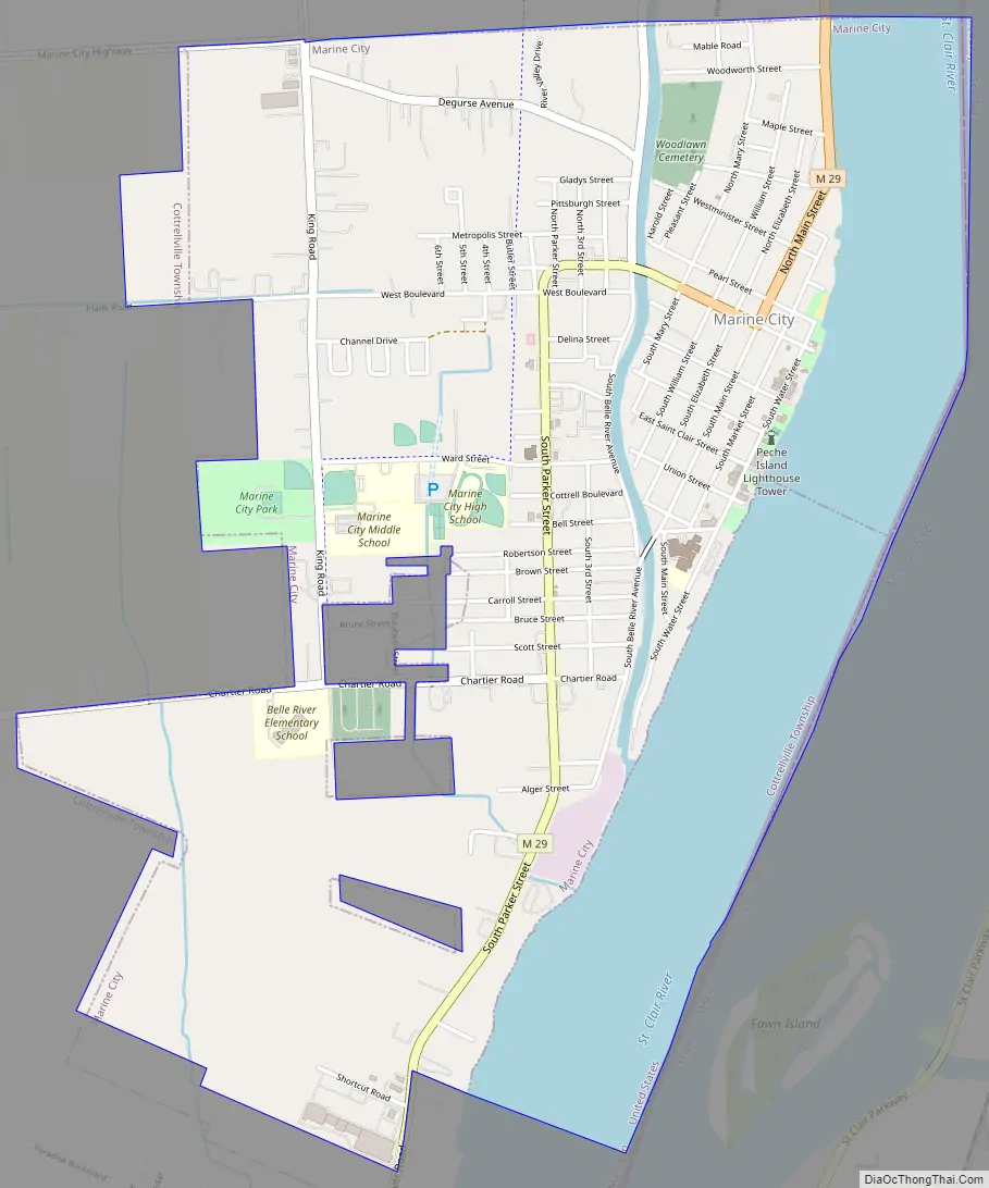
| Total Area: | 2.90 sq mi (7.50 km²) |
| Land Area: | 2.16 sq mi (5.58 km²) |
| Water Area: | 0.74 sq mi (1.91 km²) |
| Total Population: | 4,079 |
| Population Density: | 1,891.93/sq mi (730.45/km²) |
| Area code: | 810 |
| FIPS code: | 2651600 |
| GNISfeature ID: | 1624706 |
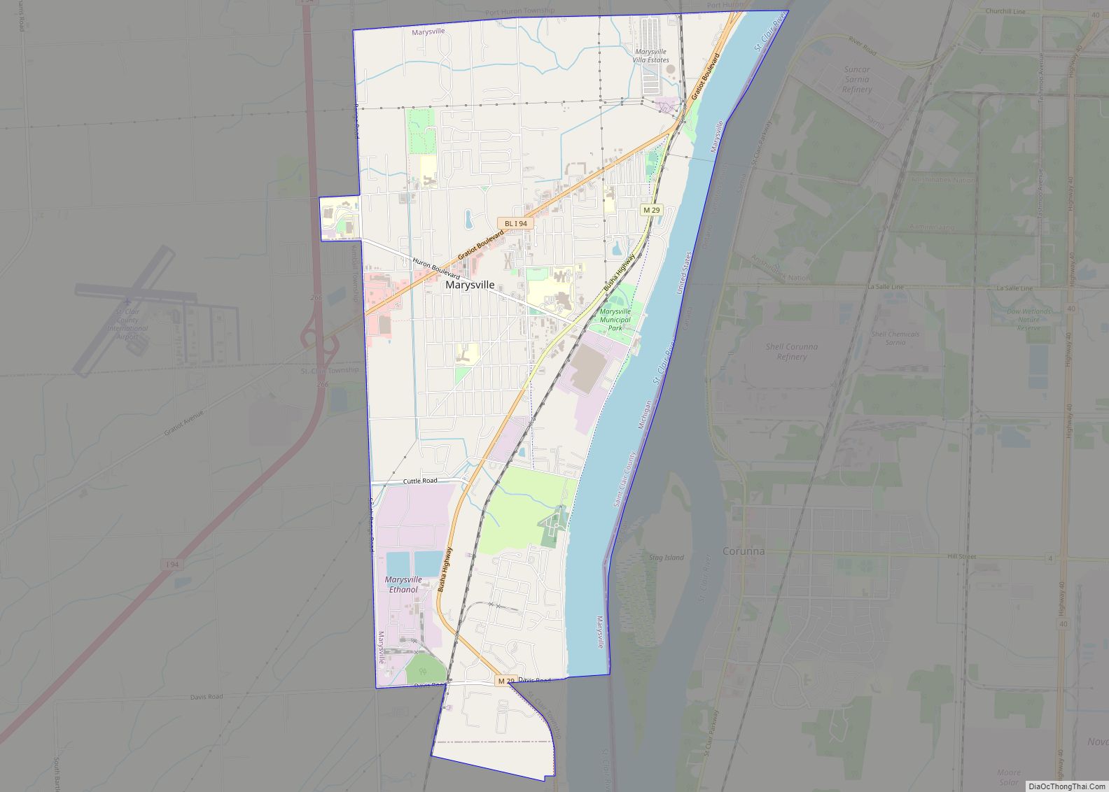
Online Interactive Map
Click on ![]() to view map in "full screen" mode.
to view map in "full screen" mode.
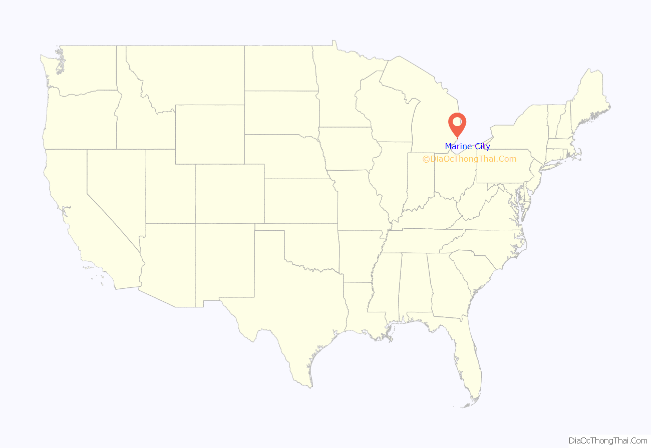
Marine City location map. Where is Marine City city?
History
The area of Marine City had been Ojibwa territory for centuries before the first European contact. Beginning in the 17th century, French trappers and missionaries entered the territory, followed by settlers in the colonial period on both sides of the Detroit and St. Clair rivers. Farmers developed long, narrow plots that were laid out in the typical rectangular shape of colonial French, with the narrow end along the riverfront. The first Catholic Church was built by French Catholics at Catholic Point, where they had bought land before the United States was formed. French Canadians also lived on the other side of the river in a small farming community known as Petite Côte.
It was not until after the American Revolution that European-American settlers arrived in any number. In the 1780s they obtained a deed for land from the Chippewa Indians. The Americans began to call the community “Yankee Point”, because so many settlers came from the Northern Tier of states, with late 18th and 19th-century westward migration originating from New England and New York. They also called the settlement “Belle River” (Belle Riviere in French), as the French had; this later was applied as the name of a neighborhood.
The village was platted by Americans as Newport in 1835–37. Although never incorporated by that name, it was known as “Newport” for 31 years. In 1865, it was incorporated as the Village of Marine City. Thriving on lumber trade and shipbuilding, the village re-incorporated as a city in June 1887.
The second half of the 19th century was the period of great growth in the village, with many workers employed in the lumber and shipping industries. Rafts of lumber were moved down the St. Clair River in the spring to be worked at Marine City or Detroit. Shipyards built some of the many wooden ships that crossed the Great Lakes. Lake steamers linked passengers with small towns around the lakes. Their decks were full and their flags were flying. Marine City was centered on a park by the St. Clair River, where bands played in the bandstand at City Hall during the summer.
As the lumber business ran down with the exploitation of forests, the area became linked to other resource extraction. Freighters carried iron from Duluth, Minnesota, which had been mined in the Mesabi Range, to Ashtabula, Ohio for steel processing. They passed from Lake Superior through Lake Huron and to Lake Erie. Marine City was known as the town on the St. Clair River where the captains of lake freighters lived. Many of these men and their crews worked for the Pittsburgh Steamship Company. Formed in 1901 by US Steel Corporation, it became the largest commercial fleet on the Great Lakes.
In the 21st century, Marine City has become the home of ten antique stores, including the “Water Street Antique Mall” located at 412 S Water Street. The Snug Theater is a 98-seat theater featuring live performances. It will be joined in 2014/15 by a sister theater, The Riverbank Theater, in a former bank building (originally Marine Bank & Trust) down the street. Also joining the two acting theaters is the old Mariner Theatre, which serves as a special event center, movie theater, gallery for fine art Models, and site of the builders model for the ocean-going Titanic. Restaurants and retail in downtown also cater to visitors and residents.
The Heather House, now operated as a bed and breakfast, was built in the Queen Anne Victorian-style. It was completed in 1885 after 2 years of construction for its owner, William Sauber. He was chief engineer for the Mitchell fleet of Great Lake steamers.
Marine City Road Map
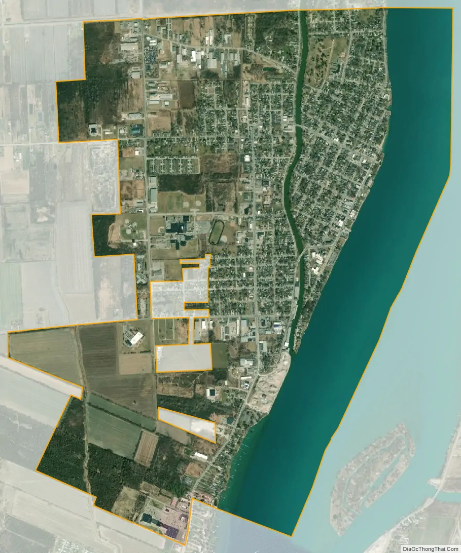
Marine City city Satellite Map
Geography
- According to the United States Census Bureau, the city has a total area of 2.46 square miles (6.37 km), of which 2.15 square miles (5.57 km) is land and 0.31 square miles (0.80 km) is water.
- It is considered to be part of the Thumb of Michigan, which in turn is a subregion of the Flint/Tri-Cities.
- Marine City can also be considered as in the Blue Water Area, a subregion of the Thumb.
- It is part of the Detroit-Warren-Livonia Metropolitan Statistical Area (MSA) and the Detroit-Ann Arbor-Flint Combined Statistical Area (CSA).
See also
Map of Michigan State and its subdivision:- Alcona
- Alger
- Allegan
- Alpena
- Antrim
- Arenac
- Baraga
- Barry
- Bay
- Benzie
- Berrien
- Branch
- Calhoun
- Cass
- Charlevoix
- Cheboygan
- Chippewa
- Clare
- Clinton
- Crawford
- Delta
- Dickinson
- Eaton
- Emmet
- Genesee
- Gladwin
- Gogebic
- Grand Traverse
- Gratiot
- Hillsdale
- Houghton
- Huron
- Ingham
- Ionia
- Iosco
- Iron
- Isabella
- Jackson
- Kalamazoo
- Kalkaska
- Kent
- Keweenaw
- Lake
- Lake Hurron
- Lake Michigan
- Lake St. Clair
- Lake Superior
- Lapeer
- Leelanau
- Lenawee
- Livingston
- Luce
- Mackinac
- Macomb
- Manistee
- Marquette
- Mason
- Mecosta
- Menominee
- Midland
- Missaukee
- Monroe
- Montcalm
- Montmorency
- Muskegon
- Newaygo
- Oakland
- Oceana
- Ogemaw
- Ontonagon
- Osceola
- Oscoda
- Otsego
- Ottawa
- Presque Isle
- Roscommon
- Saginaw
- Saint Clair
- Saint Joseph
- Sanilac
- Schoolcraft
- Shiawassee
- Tuscola
- Van Buren
- Washtenaw
- Wayne
- Wexford
- Alabama
- Alaska
- Arizona
- Arkansas
- California
- Colorado
- Connecticut
- Delaware
- District of Columbia
- Florida
- Georgia
- Hawaii
- Idaho
- Illinois
- Indiana
- Iowa
- Kansas
- Kentucky
- Louisiana
- Maine
- Maryland
- Massachusetts
- Michigan
- Minnesota
- Mississippi
- Missouri
- Montana
- Nebraska
- Nevada
- New Hampshire
- New Jersey
- New Mexico
- New York
- North Carolina
- North Dakota
- Ohio
- Oklahoma
- Oregon
- Pennsylvania
- Rhode Island
- South Carolina
- South Dakota
- Tennessee
- Texas
- Utah
- Vermont
- Virginia
- Washington
- West Virginia
- Wisconsin
- Wyoming