Newaygo (/nəweɪɡoʊ/ nə-WAY-goh) is a rural city in Newaygo County in the U.S. state of Michigan. The population was 2,471 at the 2020 census.
| Name: | Newaygo city |
|---|---|
| LSAD Code: | 25 |
| LSAD Description: | city (suffix) |
| State: | Michigan |
| County: | Newaygo County |
| Elevation: | 692 ft (211 m) |
| Total Area: | 3.92 sq mi (10.16 km²) |
| Land Area: | 3.77 sq mi (9.75 km²) |
| Water Area: | 0.15 sq mi (0.40 km²) |
| Total Population: | 2,471 |
| Population Density: | 656.13/sq mi (253.35/km²) |
| ZIP code: | 49337 |
| Area code: | 231 |
| FIPS code: | 2657080 |
| GNISfeature ID: | 1621003 |
| Website: | www.newaygocity.org |
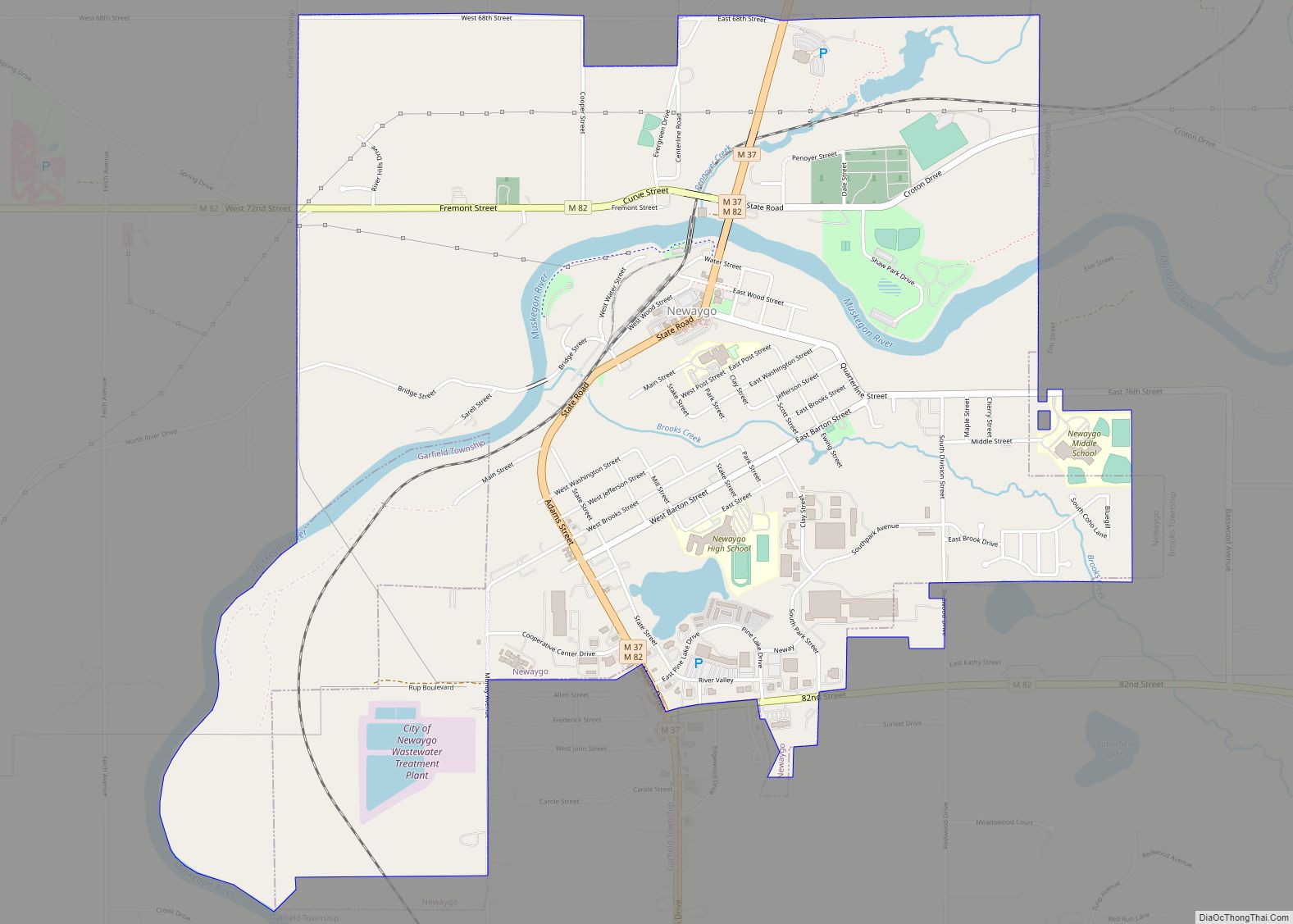
Online Interactive Map
Click on ![]() to view map in "full screen" mode.
to view map in "full screen" mode.
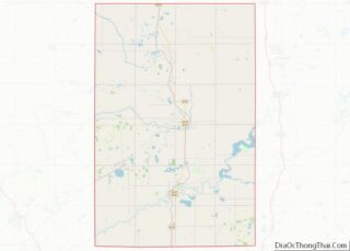
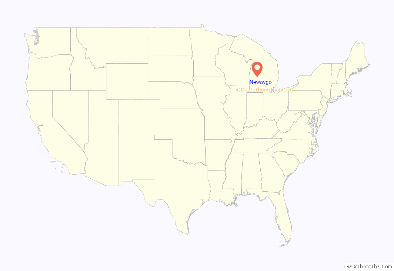
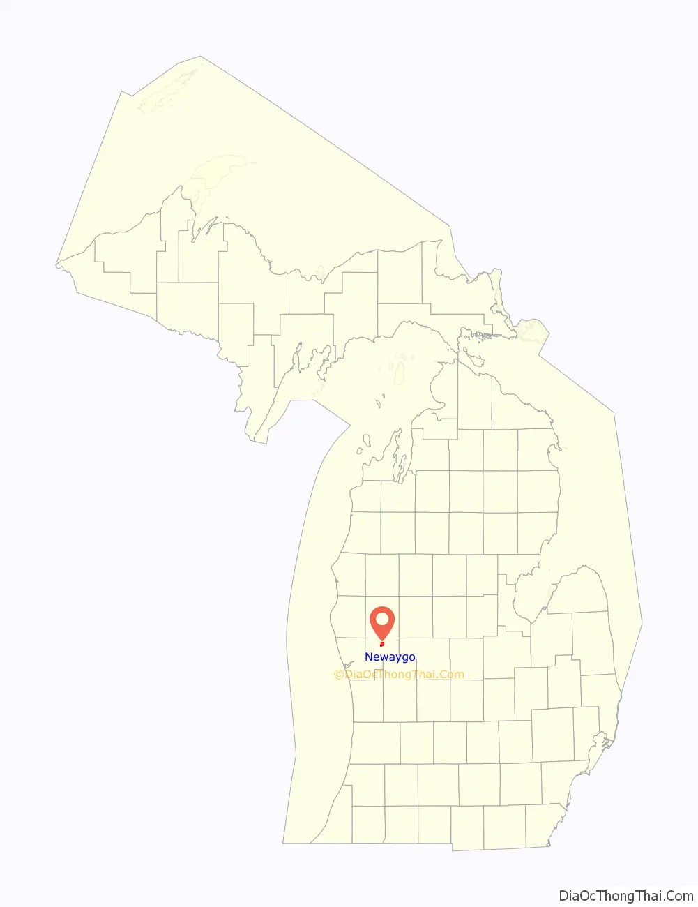
Newaygo location map. Where is Newaygo city?
History
Newaygo’s recorded history goes back to the 1600s and the French coureur des bois (independent trappers) and, later, fur company voyageurs that travelled by canoe via the Muskegon River. It was ostensibly named after Chief Nuwagon, an Ojibwe leader who signed the Treaty of Saginaw in 1819, or for an Algonquian word meaning “much water”. John Brooks came to harvest lumber in 1836, and was the town’s first postmaster in 1847. Proximity to the river made it a center for floating logs to the mills in Muskegon during the lumber boom of the late 1800s.
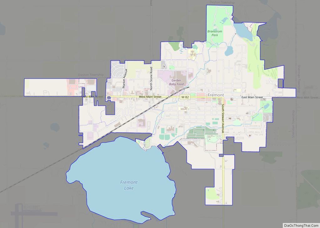
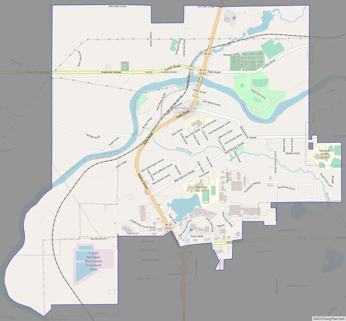
Newaygo Road Map
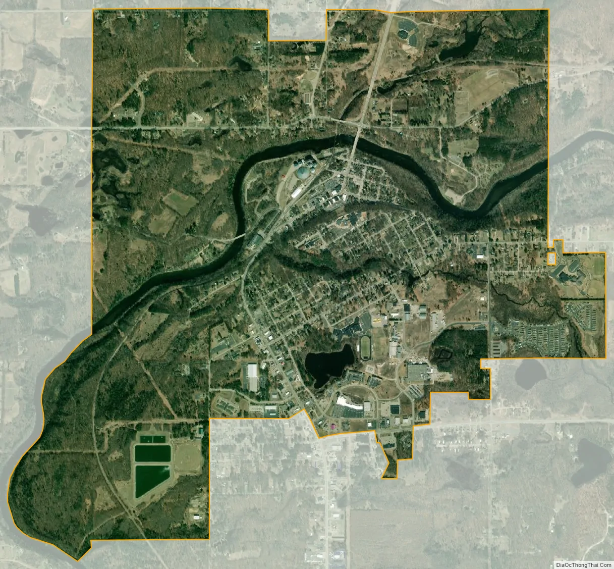
Newaygo city Satellite Map
Geography
According to the United States Census Bureau, the city has a total area of 3.90 square miles (10.10 km), of which 3.74 square miles (9.69 km) is land and 0.16 square miles (0.41 km) is water. including the Muskegon River, which runs through the town and is often used for canoe trips, tubing, and fishing. The county is considered part of West Michigan. Newaygo is part of the Roman Catholic Diocese of Grand Rapids.
Geographic features
The Muskegon River flows through the north side of the town.
Major highways
- M-37
- M-82
See also
Map of Michigan State and its subdivision:- Alcona
- Alger
- Allegan
- Alpena
- Antrim
- Arenac
- Baraga
- Barry
- Bay
- Benzie
- Berrien
- Branch
- Calhoun
- Cass
- Charlevoix
- Cheboygan
- Chippewa
- Clare
- Clinton
- Crawford
- Delta
- Dickinson
- Eaton
- Emmet
- Genesee
- Gladwin
- Gogebic
- Grand Traverse
- Gratiot
- Hillsdale
- Houghton
- Huron
- Ingham
- Ionia
- Iosco
- Iron
- Isabella
- Jackson
- Kalamazoo
- Kalkaska
- Kent
- Keweenaw
- Lake
- Lake Hurron
- Lake Michigan
- Lake St. Clair
- Lake Superior
- Lapeer
- Leelanau
- Lenawee
- Livingston
- Luce
- Mackinac
- Macomb
- Manistee
- Marquette
- Mason
- Mecosta
- Menominee
- Midland
- Missaukee
- Monroe
- Montcalm
- Montmorency
- Muskegon
- Newaygo
- Oakland
- Oceana
- Ogemaw
- Ontonagon
- Osceola
- Oscoda
- Otsego
- Ottawa
- Presque Isle
- Roscommon
- Saginaw
- Saint Clair
- Saint Joseph
- Sanilac
- Schoolcraft
- Shiawassee
- Tuscola
- Van Buren
- Washtenaw
- Wayne
- Wexford
- Alabama
- Alaska
- Arizona
- Arkansas
- California
- Colorado
- Connecticut
- Delaware
- District of Columbia
- Florida
- Georgia
- Hawaii
- Idaho
- Illinois
- Indiana
- Iowa
- Kansas
- Kentucky
- Louisiana
- Maine
- Maryland
- Massachusetts
- Michigan
- Minnesota
- Mississippi
- Missouri
- Montana
- Nebraska
- Nevada
- New Hampshire
- New Jersey
- New Mexico
- New York
- North Carolina
- North Dakota
- Ohio
- Oklahoma
- Oregon
- Pennsylvania
- Rhode Island
- South Carolina
- South Dakota
- Tennessee
- Texas
- Utah
- Vermont
- Virginia
- Washington
- West Virginia
- Wisconsin
- Wyoming