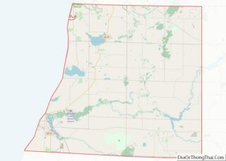
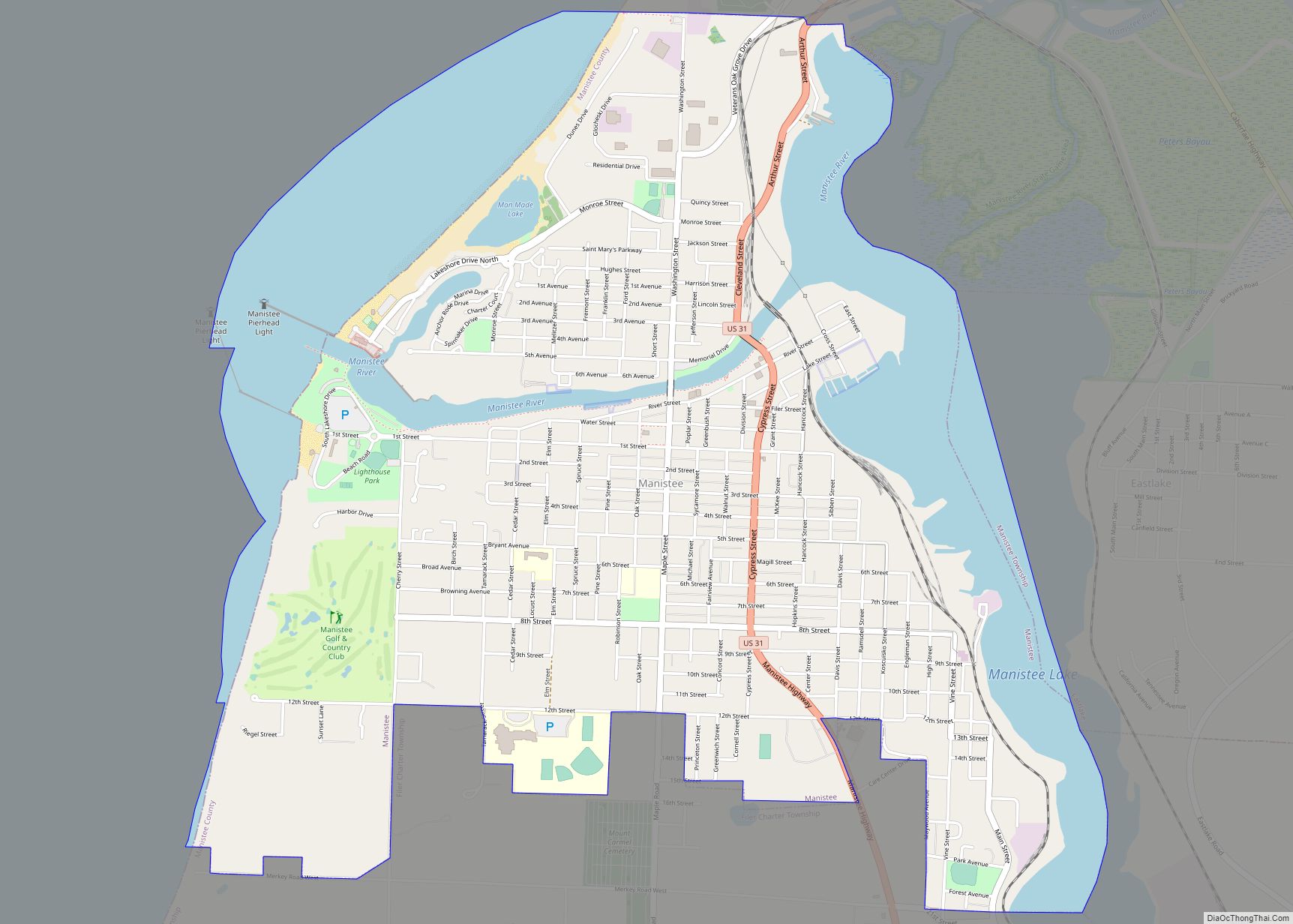
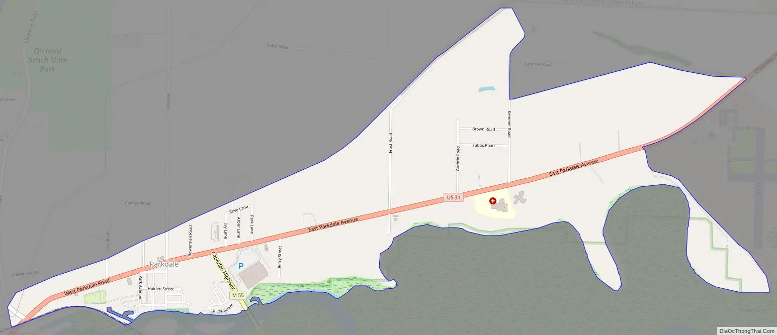
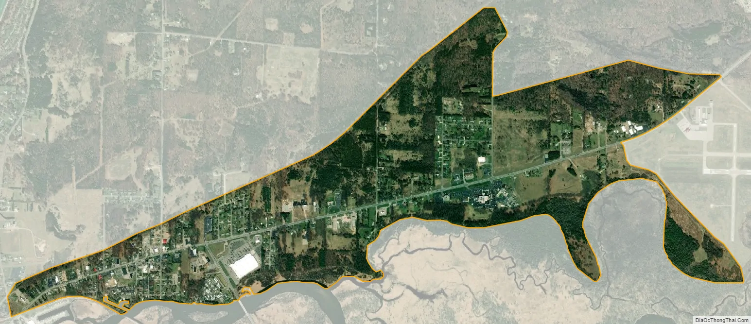
Parkdale is an unincorporated community and census-designated place located within Manistee Township, Manistee County, Michigan, United States. Its population was 704 as of the 2010 census. The community is in the southwest corner of the township, on the northern edge of Manistee Lake where the Manistee River enters the lake. It is on US 31 near the junction with M-55 on the northern boundary of the Manistee city limits.
| Name: | Parkdale CDP |
|---|---|
| LSAD Code: | 57 |
| LSAD Description: | CDP (suffix) |
| State: | Michigan |
| County: | Manistee County |
| Elevation: | 600 ft (200 m) |
| Total Area: | 1.55 sq mi (4.01 km²) |
| Land Area: | 1.55 sq mi (4.01 km²) |
| Water Area: | 0.00 sq mi (0.00 km²) |
| Total Population: | 607 |
| Population Density: | 392.12/sq mi (151.42/km²) |
| Area code: | 231 |
| FIPS code: | 2662500 |
| GNISfeature ID: | 634378 |
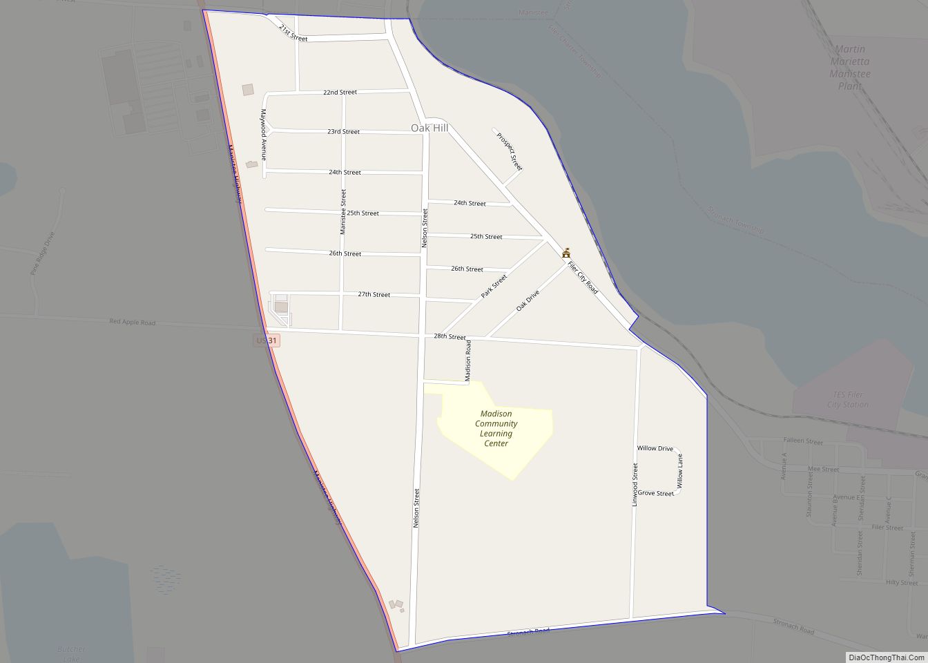
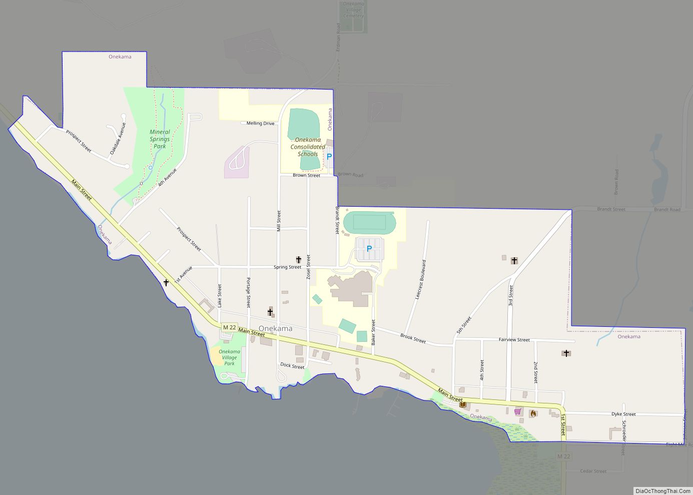
Online Interactive Map
Click on ![]() to view map in "full screen" mode.
to view map in "full screen" mode.
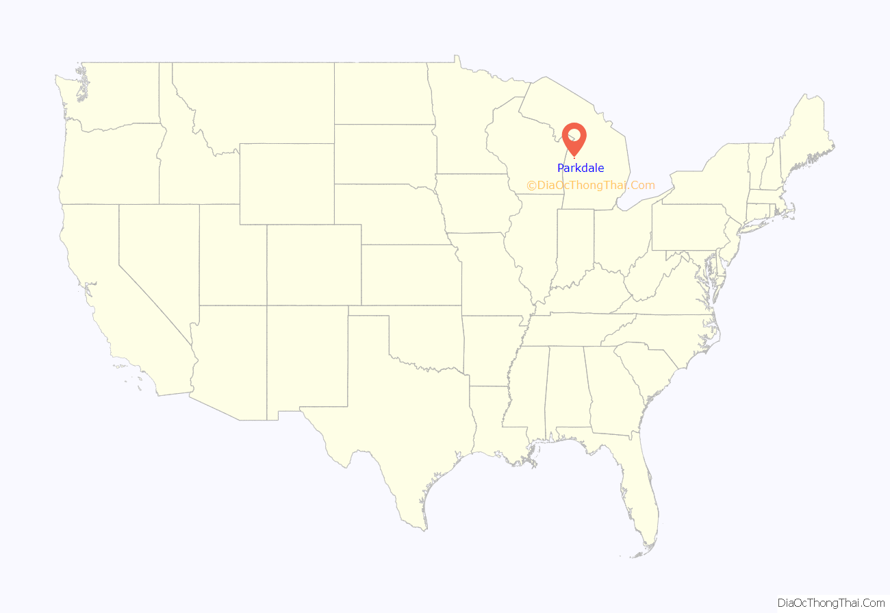
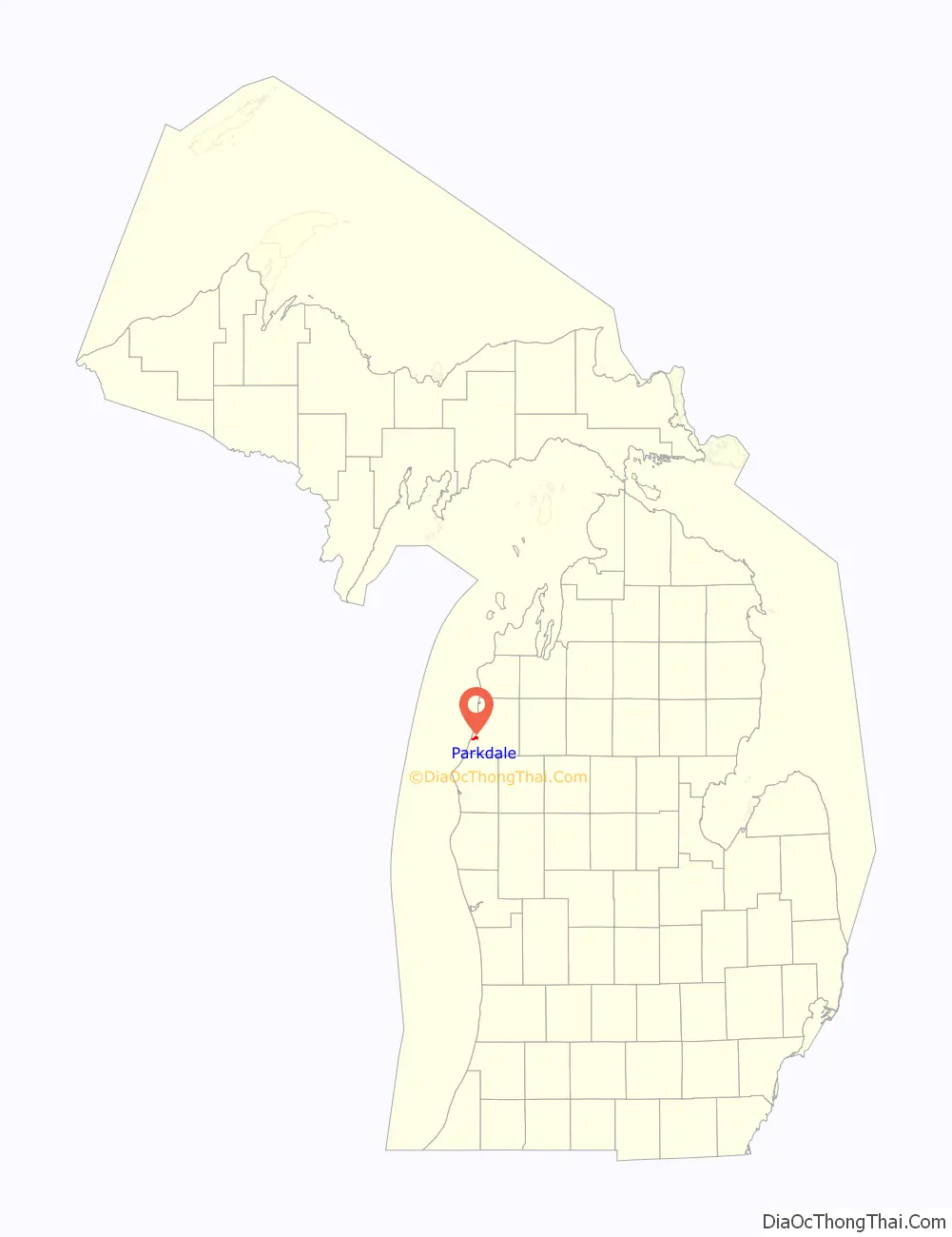
Parkdale location map. Where is Parkdale CDP?
History
The community had a rural post office from April 1897 to September 1898 and again from October 1898 to April 1900. From 1927 until 2003, Parkdale was the southern terminus of M-110.
Parkdale Road Map
Parkdale city Satellite Map
Geography
According to the U.S. Census Bureau, the community has an area of 1.548 square miles (4.01 km), all of it land.
See also
Map of Michigan State and its subdivision:- Alcona
- Alger
- Allegan
- Alpena
- Antrim
- Arenac
- Baraga
- Barry
- Bay
- Benzie
- Berrien
- Branch
- Calhoun
- Cass
- Charlevoix
- Cheboygan
- Chippewa
- Clare
- Clinton
- Crawford
- Delta
- Dickinson
- Eaton
- Emmet
- Genesee
- Gladwin
- Gogebic
- Grand Traverse
- Gratiot
- Hillsdale
- Houghton
- Huron
- Ingham
- Ionia
- Iosco
- Iron
- Isabella
- Jackson
- Kalamazoo
- Kalkaska
- Kent
- Keweenaw
- Lake
- Lake Hurron
- Lake Michigan
- Lake St. Clair
- Lake Superior
- Lapeer
- Leelanau
- Lenawee
- Livingston
- Luce
- Mackinac
- Macomb
- Manistee
- Marquette
- Mason
- Mecosta
- Menominee
- Midland
- Missaukee
- Monroe
- Montcalm
- Montmorency
- Muskegon
- Newaygo
- Oakland
- Oceana
- Ogemaw
- Ontonagon
- Osceola
- Oscoda
- Otsego
- Ottawa
- Presque Isle
- Roscommon
- Saginaw
- Saint Clair
- Saint Joseph
- Sanilac
- Schoolcraft
- Shiawassee
- Tuscola
- Van Buren
- Washtenaw
- Wayne
- Wexford
- Alabama
- Alaska
- Arizona
- Arkansas
- California
- Colorado
- Connecticut
- Delaware
- District of Columbia
- Florida
- Georgia
- Hawaii
- Idaho
- Illinois
- Indiana
- Iowa
- Kansas
- Kentucky
- Louisiana
- Maine
- Maryland
- Massachusetts
- Michigan
- Minnesota
- Mississippi
- Missouri
- Montana
- Nebraska
- Nevada
- New Hampshire
- New Jersey
- New Mexico
- New York
- North Carolina
- North Dakota
- Ohio
- Oklahoma
- Oregon
- Pennsylvania
- Rhode Island
- South Carolina
- South Dakota
- Tennessee
- Texas
- Utah
- Vermont
- Virginia
- Washington
- West Virginia
- Wisconsin
- Wyoming