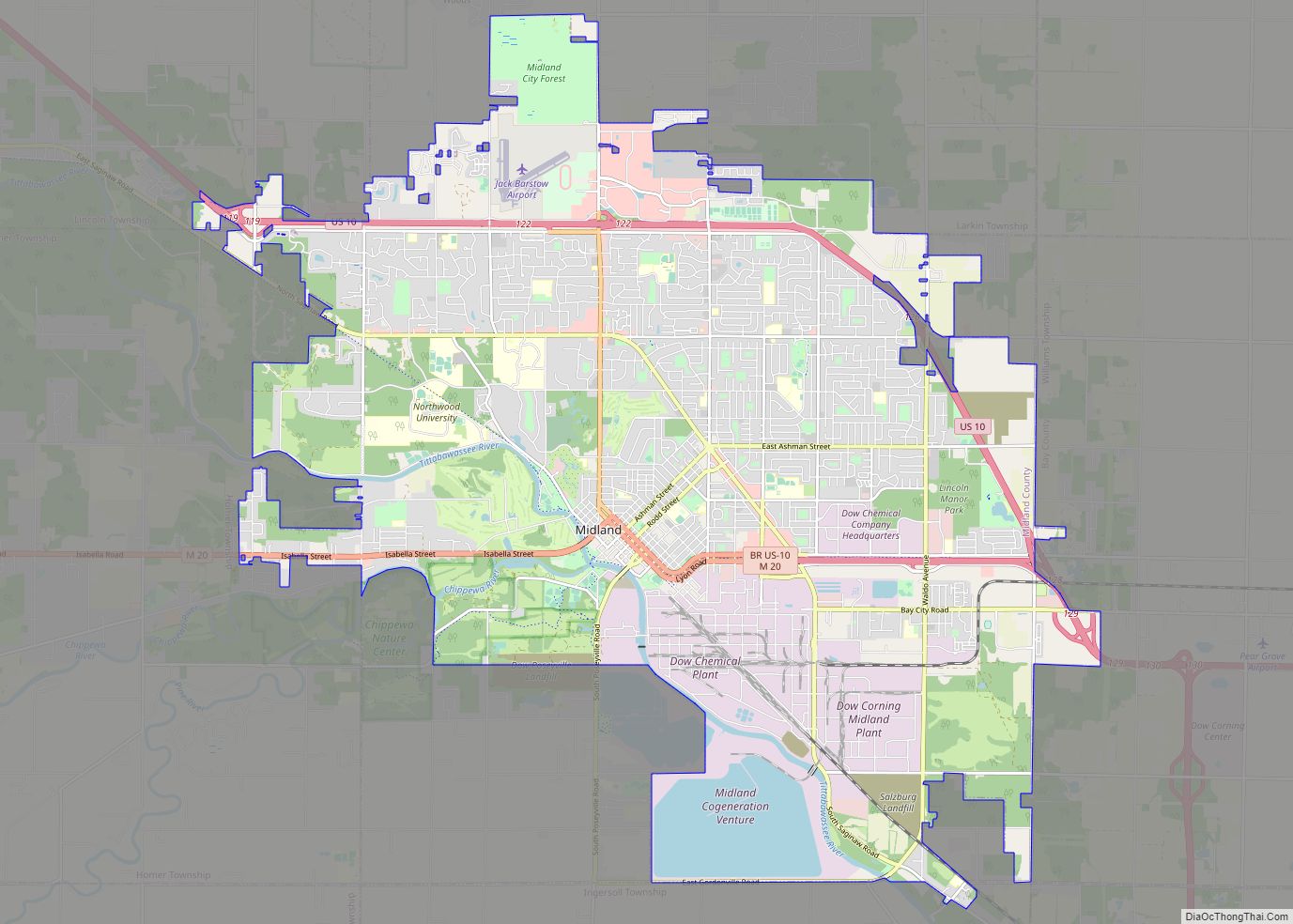
Sanford is a village in Midland County in the U.S. state of Michigan. The population was 859 at the 2010 census. The village is located within Jerome Township.
| Name: | Sanford village |
|---|---|
| LSAD Code: | 47 |
| LSAD Description: | village (suffix) |
| State: | Michigan |
| County: | Midland County |
| Elevation: | 630 ft (192 m) |
| Total Area: | 1.55 sq mi (4.01 km²) |
| Land Area: | 1.27 sq mi (3.29 km²) |
| Water Area: | 0.28 sq mi (0.71 km²) |
| Total Population: | 813 |
| Population Density: | 639.15/sq mi (246.78/km²) |
| Area code: | 989 |
| FIPS code: | 2671560 |
| GNISfeature ID: | 0637235 |
Online Interactive Map
Click on ![]() to view map in "full screen" mode.
to view map in "full screen" mode.
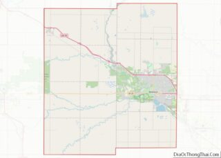
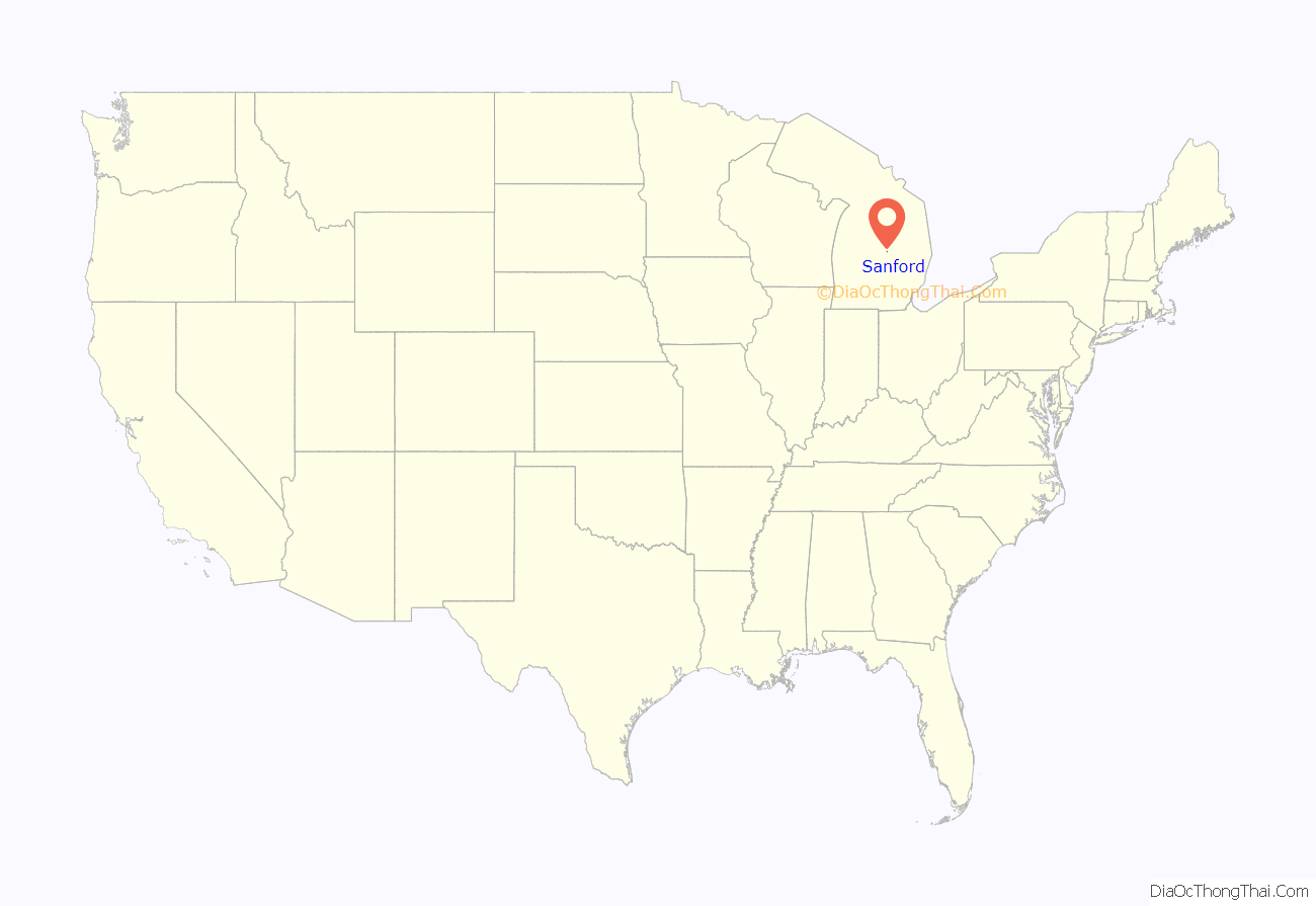
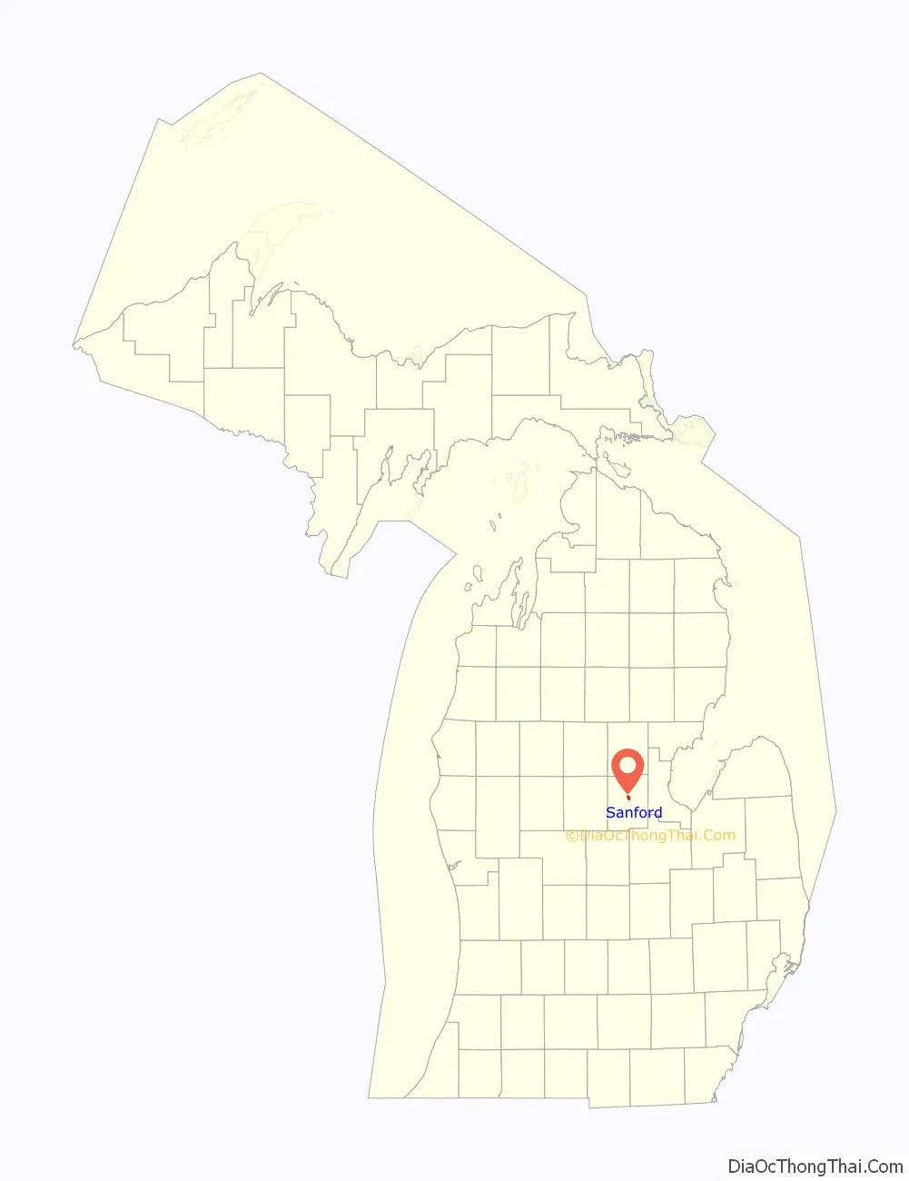
Sanford location map. Where is Sanford village?
History
In 1864, Charles Sanford, of Madison County, New York, purchased 213 acres (0.86 km) of land where the village is now located, along with 1,000 acres (4.0 km) of pine land. The site was first known as the “Salt-Spring Reserve”, and was the location of the first salt well in the state. Douglass Houghton, the state surveyor and geologist, supervised sinking the shaft of the well. Charles Sanford moved there in May 1864. He platted the village in 1870. Romig identifies Jay F. Hamilton as the first postmaster of Sanfordville on June 23, 1871, while the Portrait and biographical album of Midland county, Mich. lists Phineas Hamilton as the first postmaster. The name was shortened to “Sanford” on July 13, 1871. Also in 1871, the Pere Marquette Railroad built a station in Sanford.
In 1982, Sanford voters approved the repeal of its 1963 village charter and became part of Jerome Township, but a Michigan court overturned the election results on the grounds that it should have been presented as one proposal instead of two.
The founder’s day parade is an important annual event in this old logging village along the Tittabawassee River.
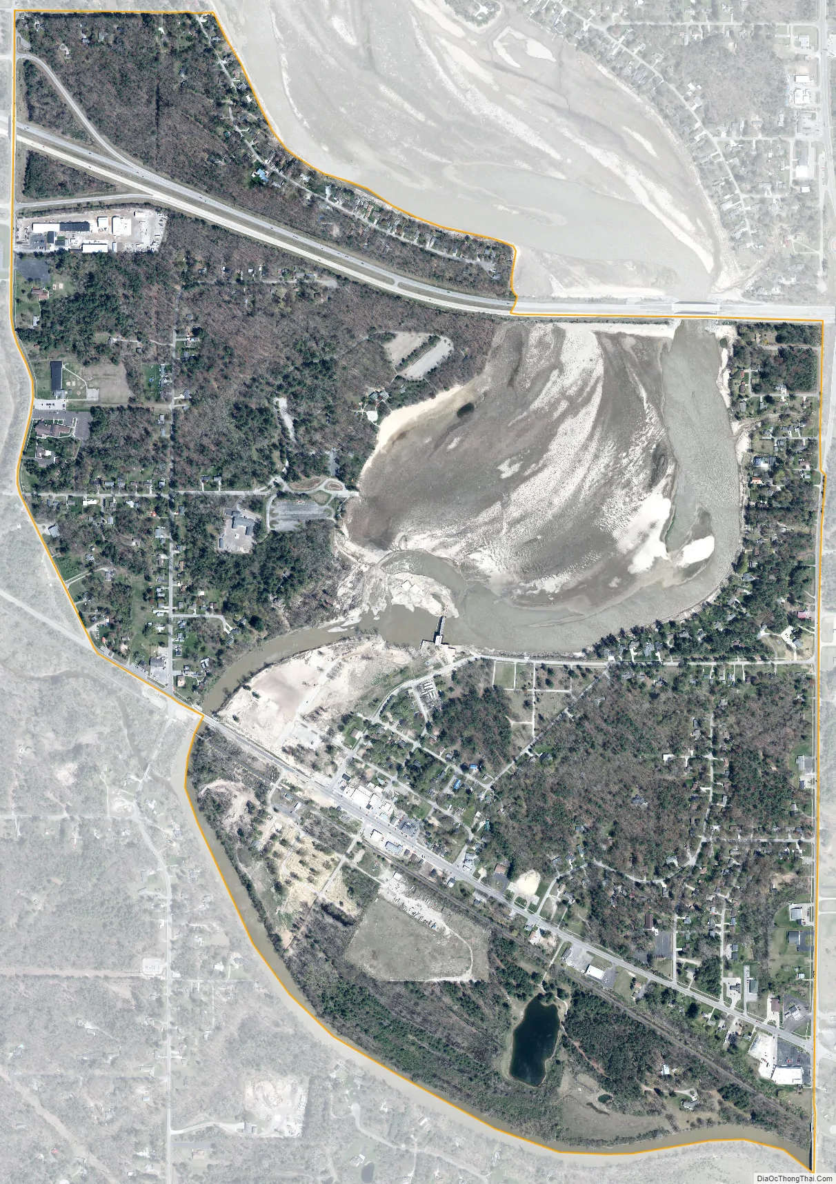
On May 19, 2020, the Sanford Dam and Edenville Dam on the Tittabawassee River collapsed, forcing the evacuation of the village and largely destroying its downtown.
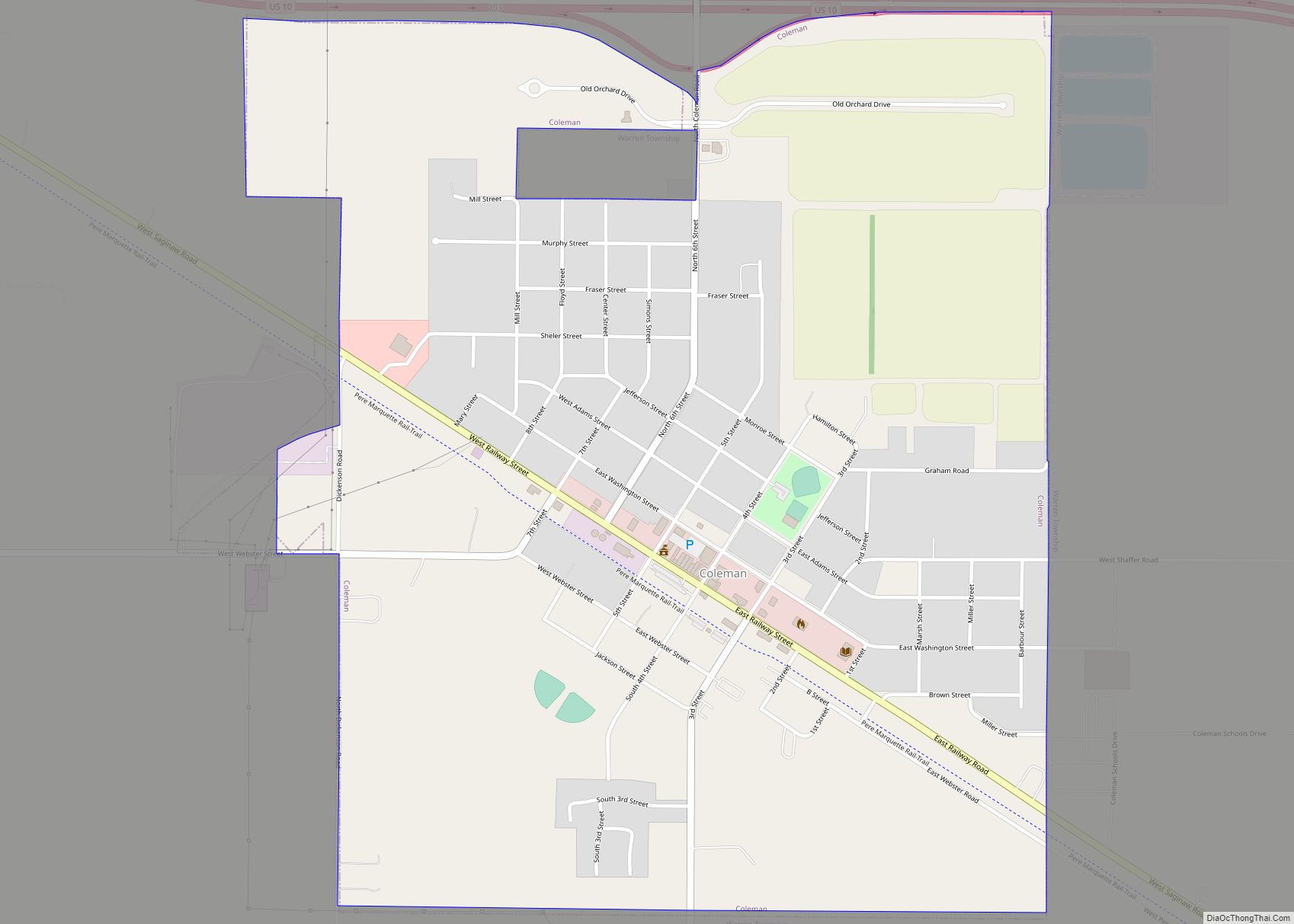
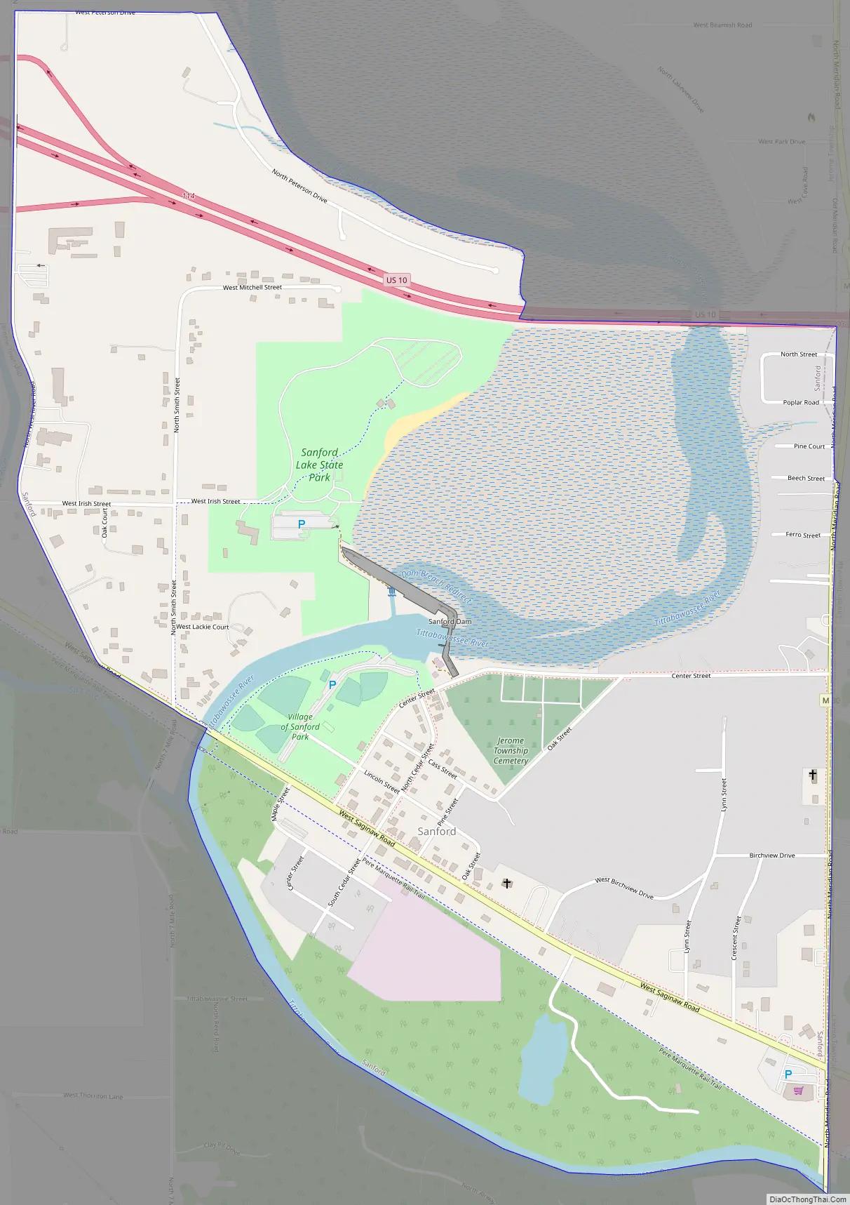
Sanford Road Map
Sanford city Satellite Map
Geography
According to the United States Census Bureau, the village has a total area of 1.55 square miles (4.01 km), of which 1.27 square miles (3.29 km) is land and 0.28 square miles (0.73 km) is water.
The village sits on Sanford Lake and the Tittabawassee River.
See also
Map of Michigan State and its subdivision:- Alcona
- Alger
- Allegan
- Alpena
- Antrim
- Arenac
- Baraga
- Barry
- Bay
- Benzie
- Berrien
- Branch
- Calhoun
- Cass
- Charlevoix
- Cheboygan
- Chippewa
- Clare
- Clinton
- Crawford
- Delta
- Dickinson
- Eaton
- Emmet
- Genesee
- Gladwin
- Gogebic
- Grand Traverse
- Gratiot
- Hillsdale
- Houghton
- Huron
- Ingham
- Ionia
- Iosco
- Iron
- Isabella
- Jackson
- Kalamazoo
- Kalkaska
- Kent
- Keweenaw
- Lake
- Lake Hurron
- Lake Michigan
- Lake St. Clair
- Lake Superior
- Lapeer
- Leelanau
- Lenawee
- Livingston
- Luce
- Mackinac
- Macomb
- Manistee
- Marquette
- Mason
- Mecosta
- Menominee
- Midland
- Missaukee
- Monroe
- Montcalm
- Montmorency
- Muskegon
- Newaygo
- Oakland
- Oceana
- Ogemaw
- Ontonagon
- Osceola
- Oscoda
- Otsego
- Ottawa
- Presque Isle
- Roscommon
- Saginaw
- Saint Clair
- Saint Joseph
- Sanilac
- Schoolcraft
- Shiawassee
- Tuscola
- Van Buren
- Washtenaw
- Wayne
- Wexford
- Alabama
- Alaska
- Arizona
- Arkansas
- California
- Colorado
- Connecticut
- Delaware
- District of Columbia
- Florida
- Georgia
- Hawaii
- Idaho
- Illinois
- Indiana
- Iowa
- Kansas
- Kentucky
- Louisiana
- Maine
- Maryland
- Massachusetts
- Michigan
- Minnesota
- Mississippi
- Missouri
- Montana
- Nebraska
- Nevada
- New Hampshire
- New Jersey
- New Mexico
- New York
- North Carolina
- North Dakota
- Ohio
- Oklahoma
- Oregon
- Pennsylvania
- Rhode Island
- South Carolina
- South Dakota
- Tennessee
- Texas
- Utah
- Vermont
- Virginia
- Washington
- West Virginia
- Wisconsin
- Wyoming