Sparta is a village in Kent County in the U.S. state of Michigan. The population was 4,244 at the 2020 census. The village is located within Sparta Township.
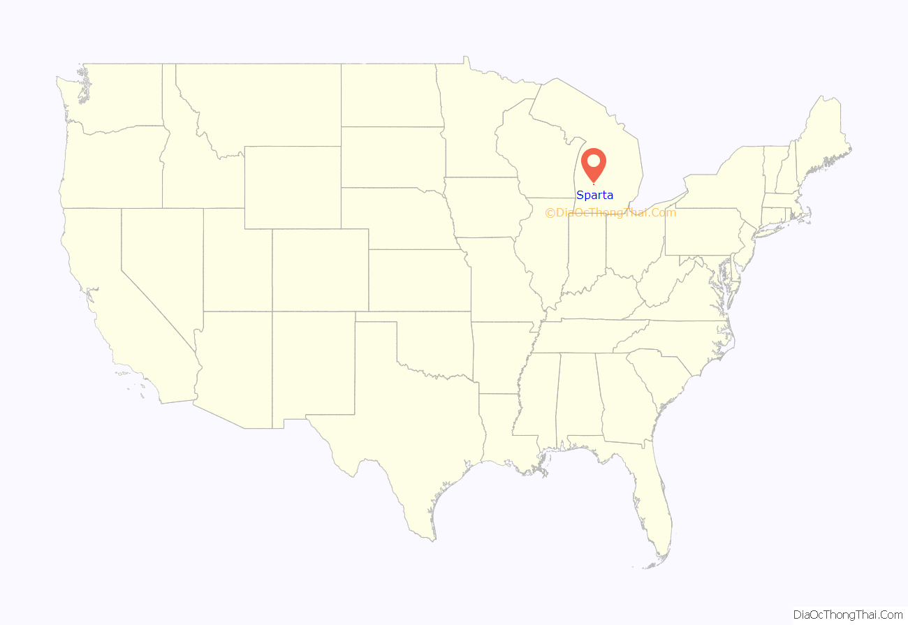
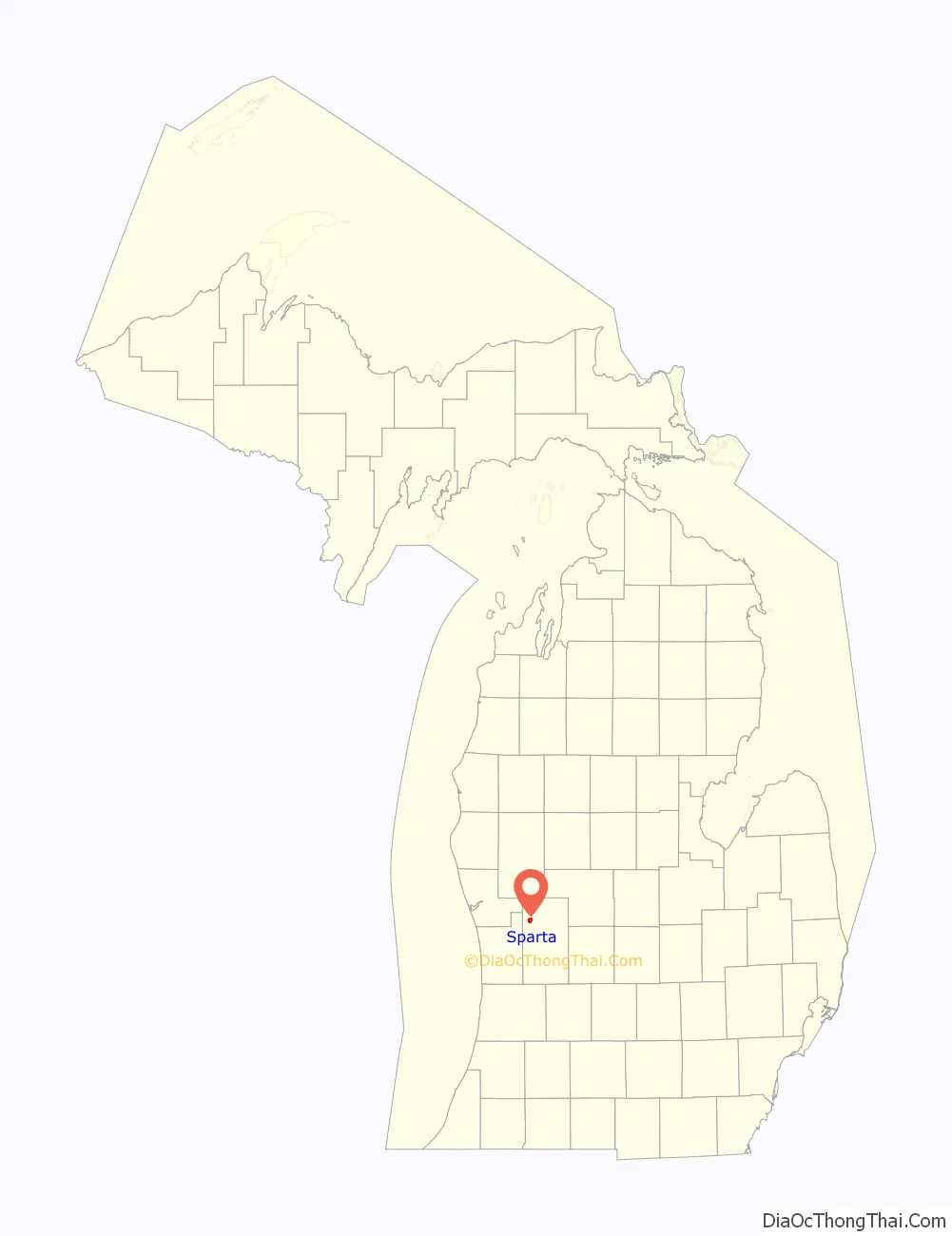
Sparta is part of the Grand Rapids metropolitan area and is located about 10 miles (16 km) north of the city of Grand Rapids.
| Name: | Sparta village |
|---|---|
| LSAD Code: | 47 |
| LSAD Description: | village (suffix) |
| State: | Michigan |
| County: | Kent County |
| Incorporated: | 1883 |
| Elevation: | 800 ft (243 m) |
| Total Area: | 2.56 sq mi (6.63 km²) |
| Land Area: | 2.55 sq mi (6.60 km²) |
| Water Area: | 0.01 sq mi (0.03 km²) |
| Total Population: | 4,244 |
| Population Density: | 1,663.01/sq mi (642.17/km²) |
| ZIP code: | 49345 |
| Area code: | 616 |
| FIPS code: | 2675420 |
| GNISfeature ID: | 0638470 |
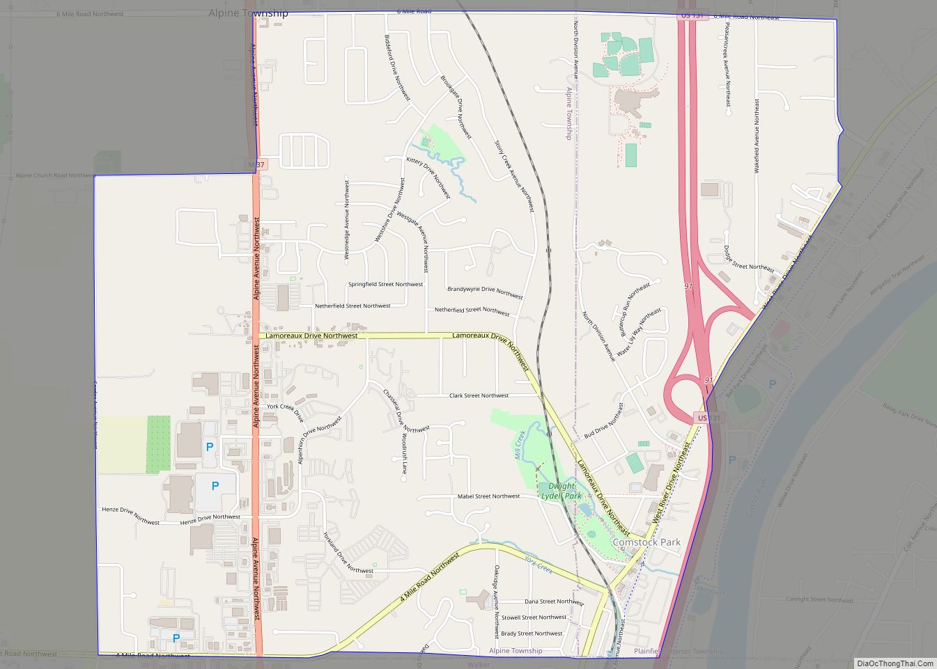
Online Interactive Map
Click on ![]() to view map in "full screen" mode.
to view map in "full screen" mode.
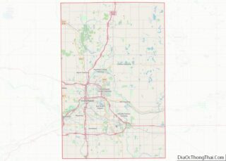
Sparta location map. Where is Sparta village?
History
The Sparta area was first settled in 1844, with the township formally organized in 1846. The first settler in what is now the village was Jonathan Nash in 1846. Calling the place Nashville, he built a sawmill on Lick Creek. Subsequently, he changed the name of the creek to Nash Creek. Seeing as there was already a Nashville in Michigan, the state legislature suggested Sparta, meaning land of the fair women. The village was platted in 1867 and incorporated in 1883.
During World War II, Sparta was host to a German prisoner of war camp. The POWs were put to work as farmhands because many of the farmhands from the town had left to go fight in the war. The prisoners were treated relatively well, and later even wrote letters to the owner of the farm they worked on saying such things as, “I like to think back on the nice time we could spend on your farm.”
Music
In the early to late 1960s, Sparta was home to Fenton Records, an independent record company and recording studio. The label recorded many local bands, as well as other Michigan garage bands. Due to the limited runs of the records, Fenton vinyl 45rpms are highly collectable, often selling for hundreds of dollars each. Many of the records were compiled on a CD called Scream Loud!!!: The Fenton Records Story (Way Back Records).
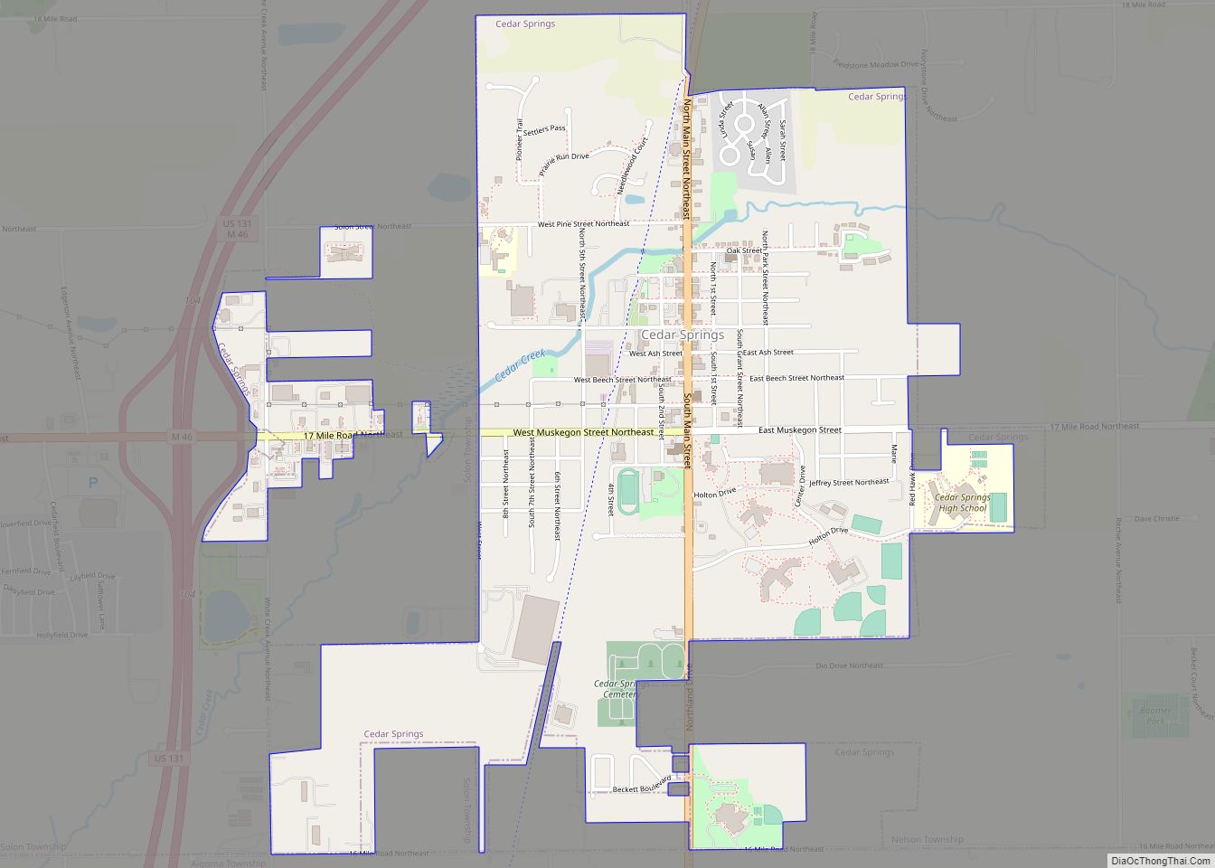
Sparta Road Map
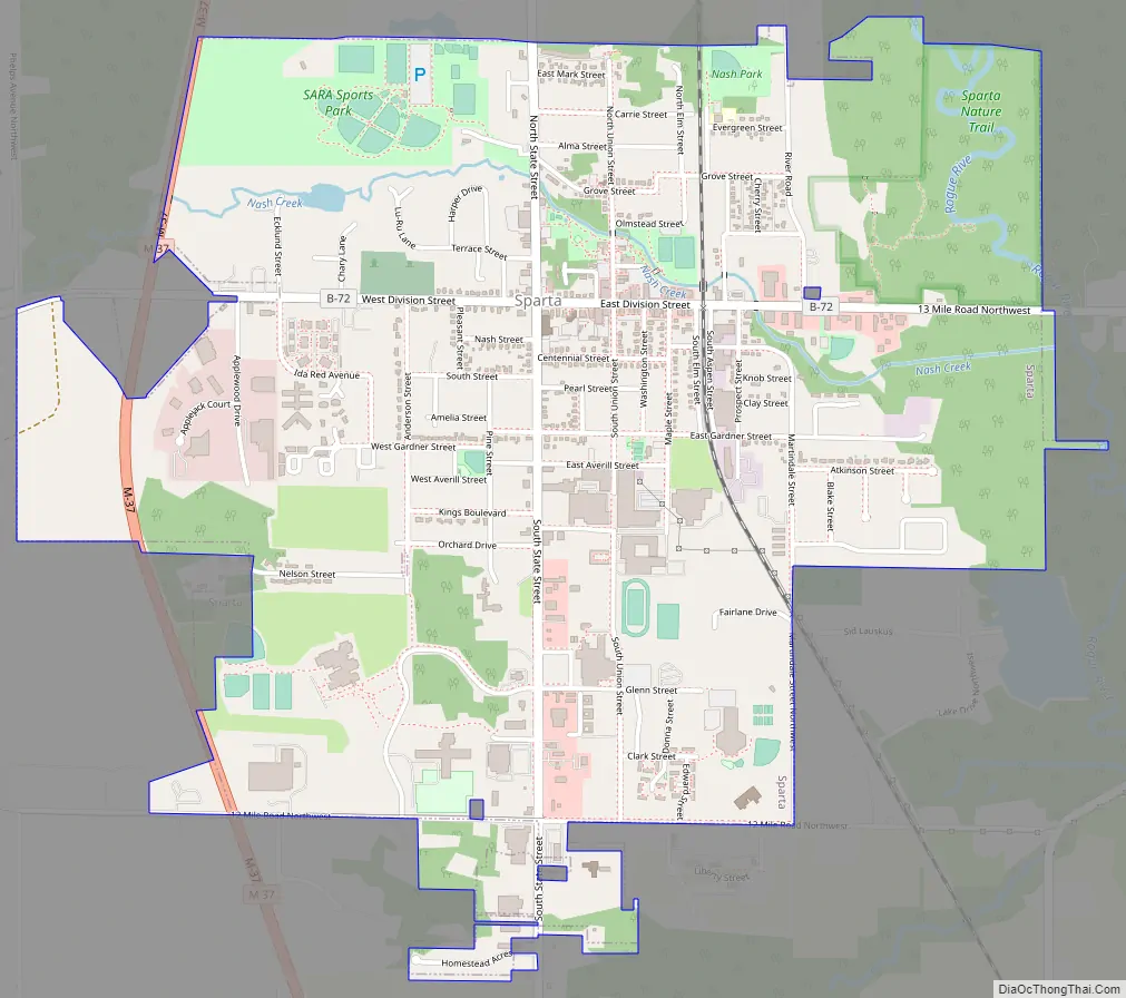
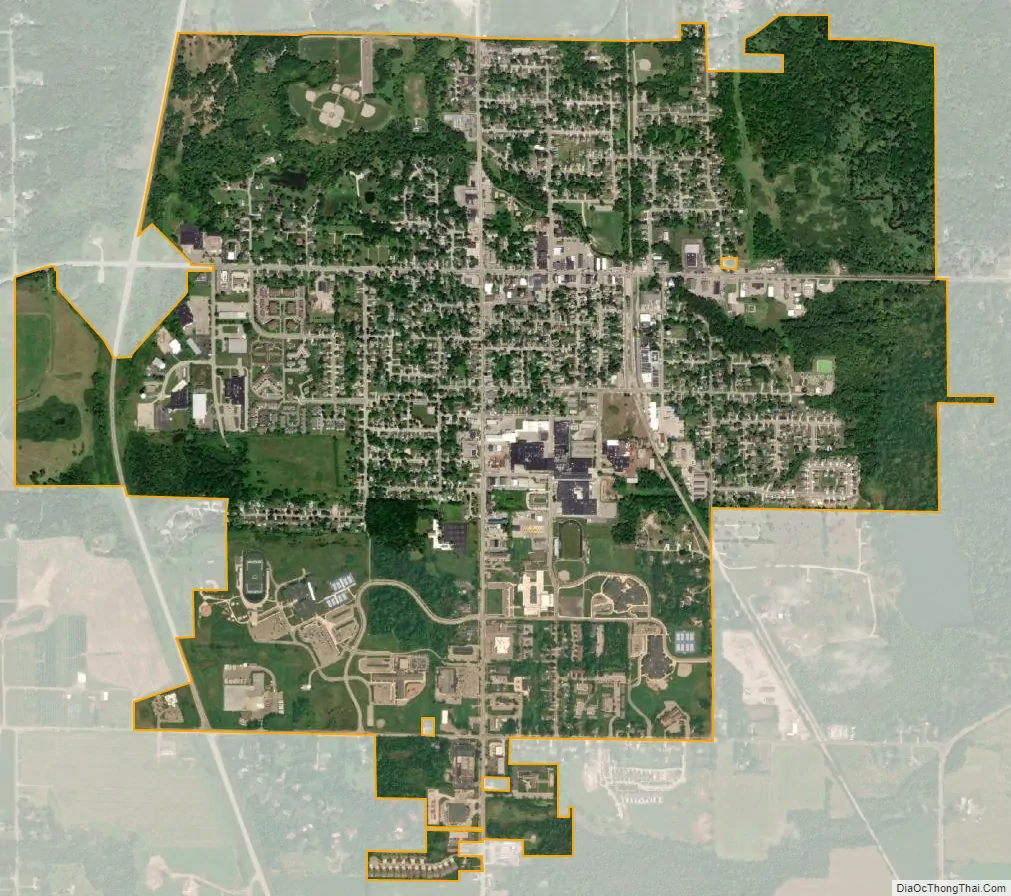
Sparta city Satellite Map
Geography
According to the U.S. Census Bureau, the village has a total area of 2.56 square miles (6.63 km), of which 2.55 square miles (6.60 km) is land and 0.01 square miles (0.03 km) (0.40%) is water.
The Rogue River flows through the western portion of the village.
Major highways
- M-37 runs north–south through the westernmost portion of the village.
See also
Map of Michigan State and its subdivision:- Alcona
- Alger
- Allegan
- Alpena
- Antrim
- Arenac
- Baraga
- Barry
- Bay
- Benzie
- Berrien
- Branch
- Calhoun
- Cass
- Charlevoix
- Cheboygan
- Chippewa
- Clare
- Clinton
- Crawford
- Delta
- Dickinson
- Eaton
- Emmet
- Genesee
- Gladwin
- Gogebic
- Grand Traverse
- Gratiot
- Hillsdale
- Houghton
- Huron
- Ingham
- Ionia
- Iosco
- Iron
- Isabella
- Jackson
- Kalamazoo
- Kalkaska
- Kent
- Keweenaw
- Lake
- Lake Hurron
- Lake Michigan
- Lake St. Clair
- Lake Superior
- Lapeer
- Leelanau
- Lenawee
- Livingston
- Luce
- Mackinac
- Macomb
- Manistee
- Marquette
- Mason
- Mecosta
- Menominee
- Midland
- Missaukee
- Monroe
- Montcalm
- Montmorency
- Muskegon
- Newaygo
- Oakland
- Oceana
- Ogemaw
- Ontonagon
- Osceola
- Oscoda
- Otsego
- Ottawa
- Presque Isle
- Roscommon
- Saginaw
- Saint Clair
- Saint Joseph
- Sanilac
- Schoolcraft
- Shiawassee
- Tuscola
- Van Buren
- Washtenaw
- Wayne
- Wexford
- Alabama
- Alaska
- Arizona
- Arkansas
- California
- Colorado
- Connecticut
- Delaware
- District of Columbia
- Florida
- Georgia
- Hawaii
- Idaho
- Illinois
- Indiana
- Iowa
- Kansas
- Kentucky
- Louisiana
- Maine
- Maryland
- Massachusetts
- Michigan
- Minnesota
- Mississippi
- Missouri
- Montana
- Nebraska
- Nevada
- New Hampshire
- New Jersey
- New Mexico
- New York
- North Carolina
- North Dakota
- Ohio
- Oklahoma
- Oregon
- Pennsylvania
- Rhode Island
- South Carolina
- South Dakota
- Tennessee
- Texas
- Utah
- Vermont
- Virginia
- Washington
- West Virginia
- Wisconsin
- Wyoming