Stephenson is a city in Menominee County in the U.S. state of Michigan. The population was 862 at the 2010 census. The city is surrounded by Stephenson Township but is administered autonomously. It is part of the Marinette, WI–MI Micropolitan Statistical Area.
| Name: | Stephenson city |
|---|---|
| LSAD Code: | 25 |
| LSAD Description: | city (suffix) |
| State: | Michigan |
| County: | Menominee County |
| Incorporated: | 1898 (village) 1969 (city) |
| Elevation: | 676 ft (206 m) |
| Total Area: | 1.08 sq mi (2.81 km²) |
| Land Area: | 1.08 sq mi (2.81 km²) |
| Water Area: | 0.00 sq mi (0.00 km²) |
| Total Population: | 816 |
| Population Density: | 752.07/sq mi (290.36/km²) |
| Area code: | 906 |
| FIPS code: | 2676380 |
| GNISfeature ID: | 0638791 |
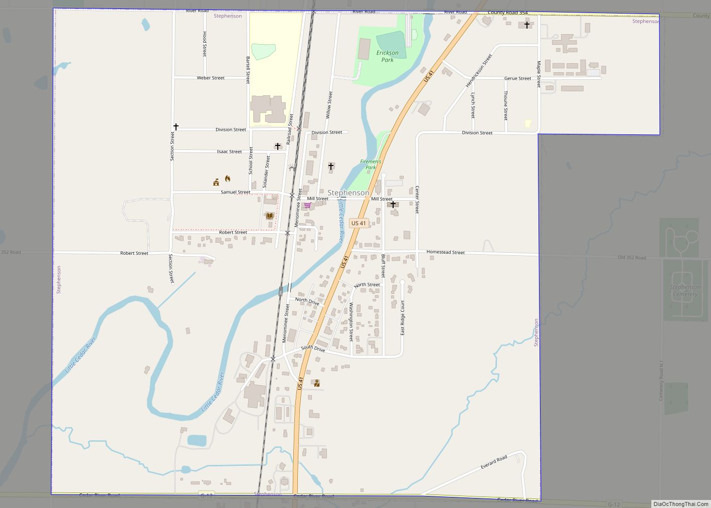
Online Interactive Map
Click on ![]() to view map in "full screen" mode.
to view map in "full screen" mode.
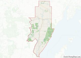
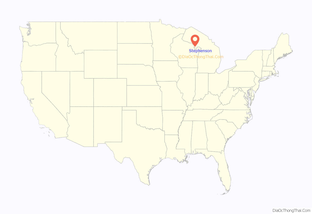
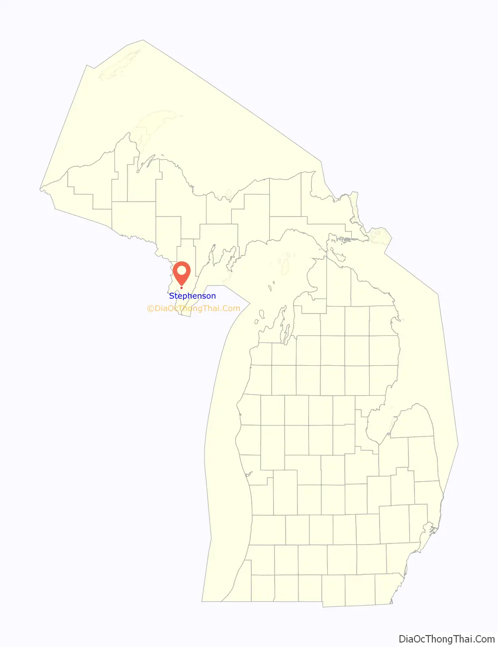
Stephenson location map. Where is Stephenson city?
History
This Menominee River settlement had a Chicago and Northwestern Railroad station setup in 1872. On July 13, 1874, a post office was opened here under the name of Wacedah with Alva F. Burnham as its postmaster. The post office was renamed after local leader Samuel Stephenson on January 10, 1876. Stephenson would serve as Congressmen for the community’s district from 1889 to 1896. Stephenson incorporated as a village in 1898.
Stephenson village incorporated as a city in 1968.
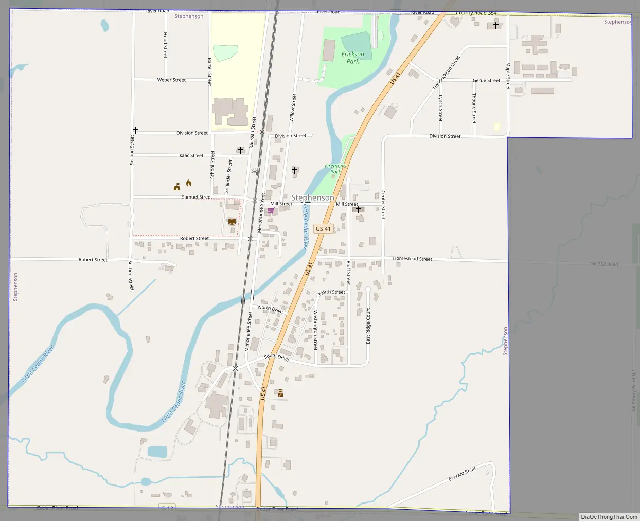
Stephenson Road Map
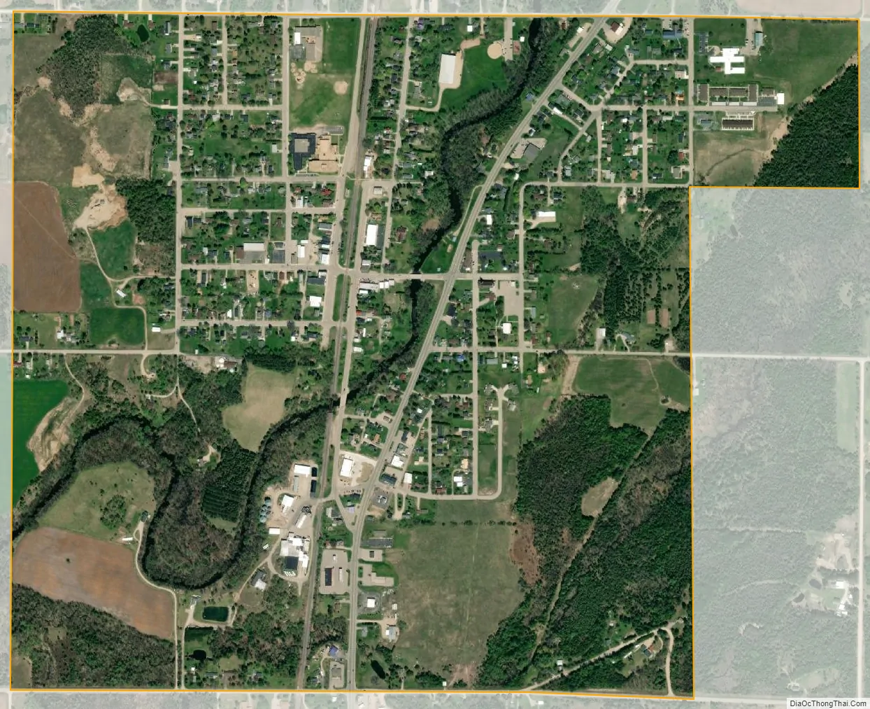
Stephenson city Satellite Map
Geography
According to the United States Census Bureau, the city has a total area of 1.09 square miles (2.82 km), all land.
See also
Map of Michigan State and its subdivision:- Alcona
- Alger
- Allegan
- Alpena
- Antrim
- Arenac
- Baraga
- Barry
- Bay
- Benzie
- Berrien
- Branch
- Calhoun
- Cass
- Charlevoix
- Cheboygan
- Chippewa
- Clare
- Clinton
- Crawford
- Delta
- Dickinson
- Eaton
- Emmet
- Genesee
- Gladwin
- Gogebic
- Grand Traverse
- Gratiot
- Hillsdale
- Houghton
- Huron
- Ingham
- Ionia
- Iosco
- Iron
- Isabella
- Jackson
- Kalamazoo
- Kalkaska
- Kent
- Keweenaw
- Lake
- Lake Hurron
- Lake Michigan
- Lake St. Clair
- Lake Superior
- Lapeer
- Leelanau
- Lenawee
- Livingston
- Luce
- Mackinac
- Macomb
- Manistee
- Marquette
- Mason
- Mecosta
- Menominee
- Midland
- Missaukee
- Monroe
- Montcalm
- Montmorency
- Muskegon
- Newaygo
- Oakland
- Oceana
- Ogemaw
- Ontonagon
- Osceola
- Oscoda
- Otsego
- Ottawa
- Presque Isle
- Roscommon
- Saginaw
- Saint Clair
- Saint Joseph
- Sanilac
- Schoolcraft
- Shiawassee
- Tuscola
- Van Buren
- Washtenaw
- Wayne
- Wexford
- Alabama
- Alaska
- Arizona
- Arkansas
- California
- Colorado
- Connecticut
- Delaware
- District of Columbia
- Florida
- Georgia
- Hawaii
- Idaho
- Illinois
- Indiana
- Iowa
- Kansas
- Kentucky
- Louisiana
- Maine
- Maryland
- Massachusetts
- Michigan
- Minnesota
- Mississippi
- Missouri
- Montana
- Nebraska
- Nevada
- New Hampshire
- New Jersey
- New Mexico
- New York
- North Carolina
- North Dakota
- Ohio
- Oklahoma
- Oregon
- Pennsylvania
- Rhode Island
- South Carolina
- South Dakota
- Tennessee
- Texas
- Utah
- Vermont
- Virginia
- Washington
- West Virginia
- Wisconsin
- Wyoming