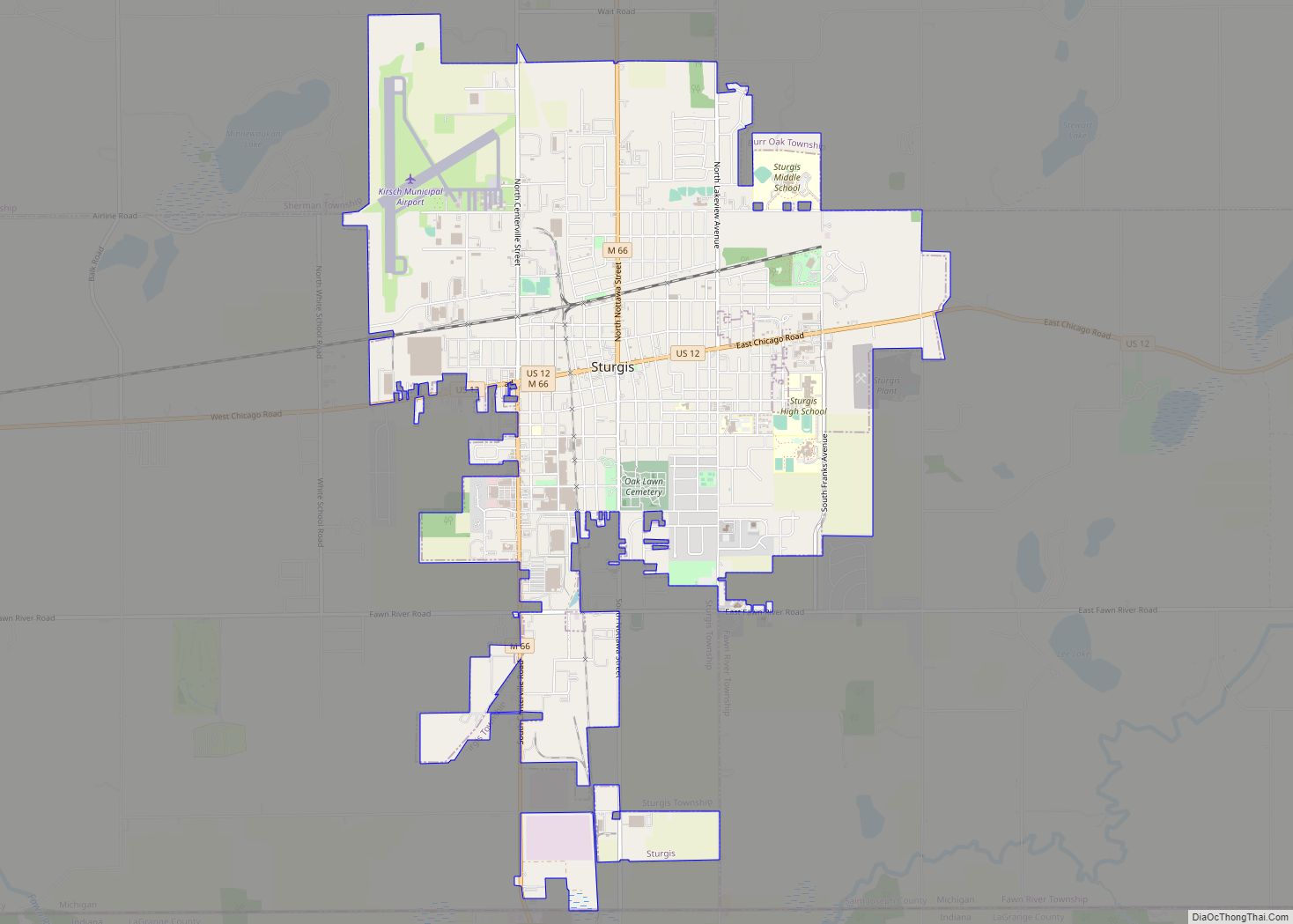
Sturgis is a city in St. Joseph County in the U.S. state of Michigan. The population was 10,994 at the 2010 census. The city is located at the northeast corner of Sturgis Township and at the intersection of US 12 and M-66. Sturgis is just north of the Michigan–Indiana border and the I-80/90 Indiana Toll Road.
Sturgis has been assigned a ZIP code of 49091.
| Name: | Sturgis city |
|---|---|
| LSAD Code: | 25 |
| LSAD Description: | city (suffix) |
| State: | Michigan |
| County: | St. Joseph County |
| Elevation: | 915 ft (279 m) |
| Total Area: | 6.78 sq mi (17.57 km²) |
| Land Area: | 6.78 sq mi (17.57 km²) |
| Water Area: | 0.00 sq mi (0.00 km²) |
| Total Population: | 11,082 |
| Population Density: | 1,633.79/sq mi (630.84/km²) |
| FIPS code: | 2676960 |
| GNISfeature ID: | 1624965 |
| Website: | http://www.sturgismi.gov/ |
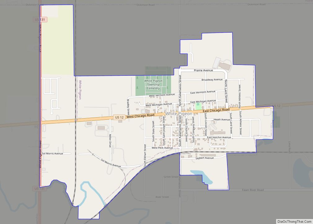
Online Interactive Map
Click on ![]() to view map in "full screen" mode.
to view map in "full screen" mode.
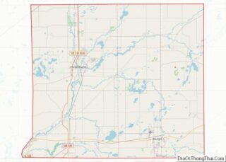
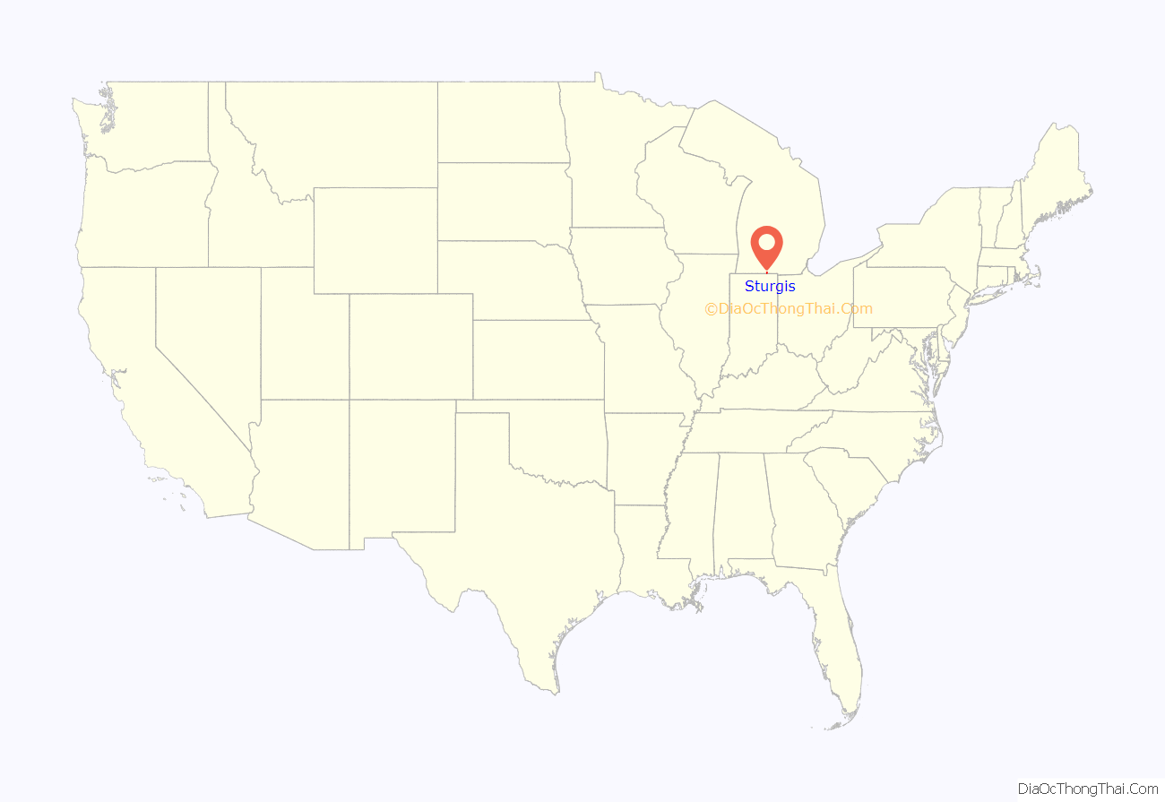
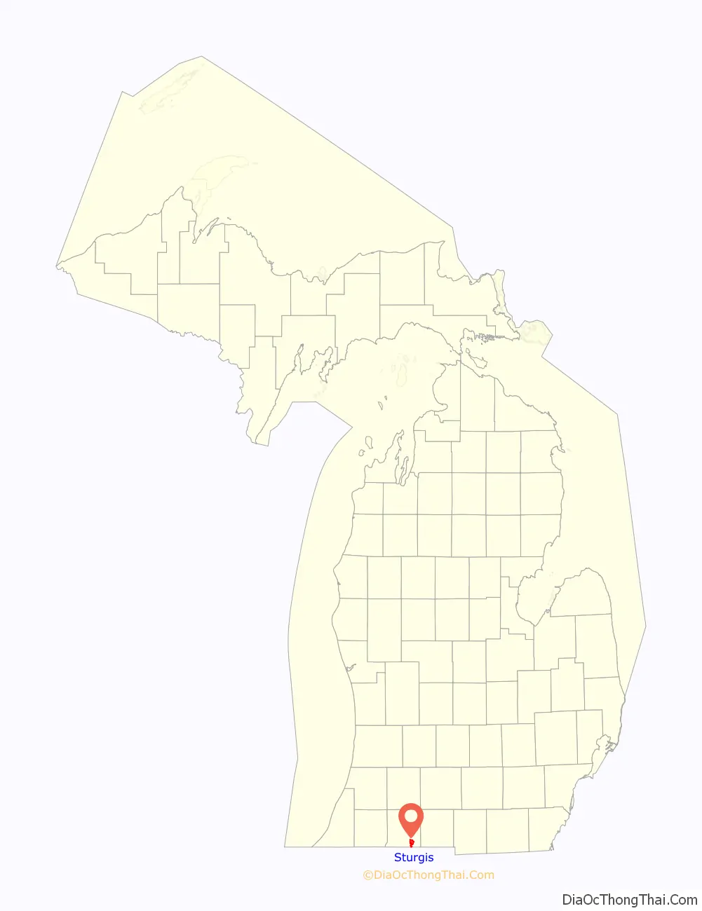
Sturgis location map. Where is Sturgis city?
History
Founding of the community
In 1827, Judge John Sturgis came to the St. Joseph Valley area in southern Michigan territory and settled in what is now Sturgis. The original site of his home can be seen at Pioneer Park, maintained by the City of Sturgis. Legend has it that Sturgis was chosen as the town’s name because Mrs. John Sturgis baked a pan of biscuits and sent them to a surveying party near their cabin. Lewis Cass, who later became governor, was part of that surveying party. When the time came to name the town, Governor Cass remembered the biscuits and was insistent that the town be named Sturgis. In 1896, Sturgis officially became a city.
Sturgis: the “Electric City”
Sturgis is known as the “Electric City” due to its municipal electric utility and hydroelectric dam, which date back to the early days of the community. The City-owned electric department has served the Sturgis area since the city’s inception in 1896. In 1909, the City of Sturgis approved construction of a hydroelectric dam on the St. Joseph River near Centreville, Michigan. The dam began operation on September 3, 1911, and continues to serve the community. In 2011, the City celebrated the centennial of the Dam as part of “Sturgis Dam Days.”
Sister City
Sturgis is a Sister City to Wiesloch, Germany. In 1966, the cities of Wiesloch and Sturgis decided to form a Sister City partnership that grew out of President Eisenhower’s People-to-People program which was formed to increase cultural awareness and promote friendship. In 1967 Wiesloch formally began the cultural exchange by sending a community choir to Sturgis. In 1969 Sturgis reciprocated, sending its community choir to Wiesloch. In 1977, the exchange program was expanded to include students, who each year spend three weeks in their partner’s home. In 1989 a Sturgis teacher worked in Wiesloch as part of the Sister City program. This teacher exchange continues periodically as teachers from Wiesloch work in Sturgis and vice versa.
In 2016, Sturgis and Wiesloch celebrated the 50th Anniversary of their Sister City partnership.
Kickoff city for Michigan Week
For many years, in the third week of May, Sturgis served as the kickoff city for Michigan Week, a statewide celebration. Many prominent political figures walked in the parade annually. These included State Representatives and State Senators as well as the 6th District U.S. Representative and periodically the Governor of Michigan. With statewide celebration of Michigan Week waning, in 2010, Sturgis ended the tradition of holding the Michigan Week Kick-Off, opting to celebrate Sturgis Dam Days in June. Sturgis Dam Days was held in honor of the hydroelectric dam. The 100-year anniversary of the Sturgis Dam was celebrated at the Sturgis Dam Days in 2011. In 2012, the Sturgis community began celebrating Sturgis Fest during the last week in June.
Sturgis Rail Depot
On June 23–24, 2014, the historic Sturgis Rail Depot was moved from its location on West Main & N. Clay Streets to a more central location on W. Chicago Road. The 120-year-old building, featuring masonry walls up to 2 feet thick and weighing 304 tons, was moved by Wolfe House & Building Movers. The building was elevated by a Unified Jacking System and mounted on the Buckingham Dolly System for the quarter of a mile move across town.
The Depot underwent renovations to be used as a museum by the Sturgis Historical Society.
Abbott plant for infant formula
Abbott Laboratories produces infant formula at a plant in Sturgis. In February 2022, the plant was shut down due to bacteria in some of the infant formula produced there, which led to a nationwide shortage. The plant resumed production in June 2022 after receiving FDA clearance, first making specialty formula for infants with special dietary needs. The operations at the plant were a focus of an investigation launched by the House Oversight Committee.
Sturgis Road Map

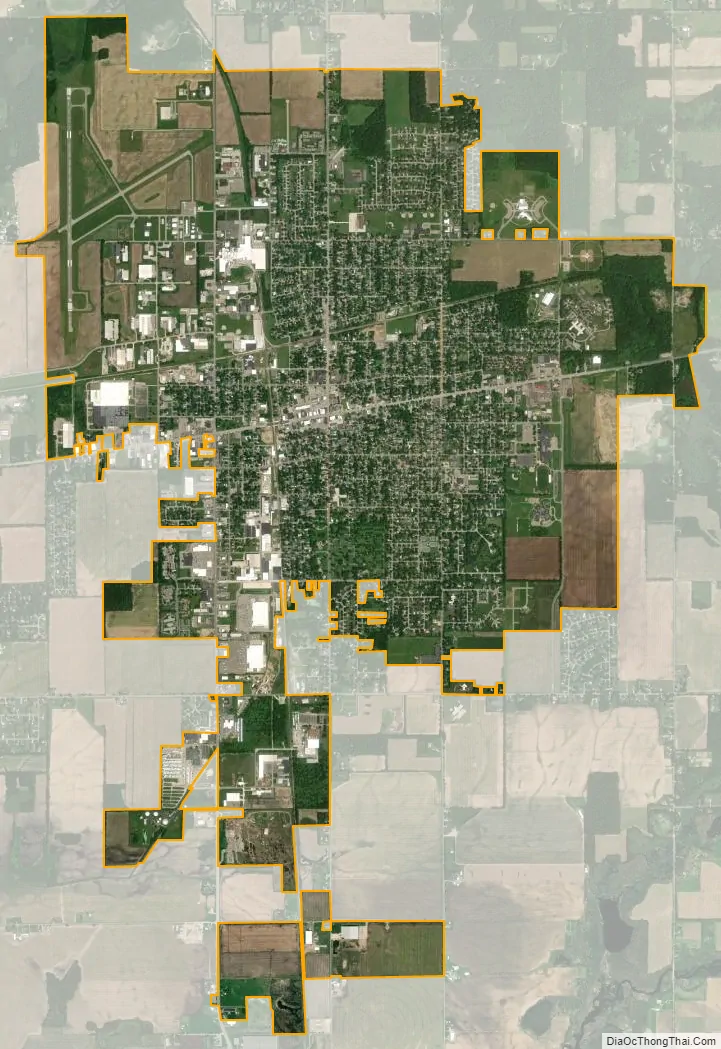
Sturgis city Satellite Map
Geography
Sturgis is located at 41°47′57″N 85°25′09″W / 41.79917°N 85.41917°W / 41.79917; -85.41917. According to the United States Census Bureau, the city has a total area of 6.49 square miles (16.81 km), all land.
See also
Map of Michigan State and its subdivision:- Alcona
- Alger
- Allegan
- Alpena
- Antrim
- Arenac
- Baraga
- Barry
- Bay
- Benzie
- Berrien
- Branch
- Calhoun
- Cass
- Charlevoix
- Cheboygan
- Chippewa
- Clare
- Clinton
- Crawford
- Delta
- Dickinson
- Eaton
- Emmet
- Genesee
- Gladwin
- Gogebic
- Grand Traverse
- Gratiot
- Hillsdale
- Houghton
- Huron
- Ingham
- Ionia
- Iosco
- Iron
- Isabella
- Jackson
- Kalamazoo
- Kalkaska
- Kent
- Keweenaw
- Lake
- Lake Hurron
- Lake Michigan
- Lake St. Clair
- Lake Superior
- Lapeer
- Leelanau
- Lenawee
- Livingston
- Luce
- Mackinac
- Macomb
- Manistee
- Marquette
- Mason
- Mecosta
- Menominee
- Midland
- Missaukee
- Monroe
- Montcalm
- Montmorency
- Muskegon
- Newaygo
- Oakland
- Oceana
- Ogemaw
- Ontonagon
- Osceola
- Oscoda
- Otsego
- Ottawa
- Presque Isle
- Roscommon
- Saginaw
- Saint Clair
- Saint Joseph
- Sanilac
- Schoolcraft
- Shiawassee
- Tuscola
- Van Buren
- Washtenaw
- Wayne
- Wexford
- Alabama
- Alaska
- Arizona
- Arkansas
- California
- Colorado
- Connecticut
- Delaware
- District of Columbia
- Florida
- Georgia
- Hawaii
- Idaho
- Illinois
- Indiana
- Iowa
- Kansas
- Kentucky
- Louisiana
- Maine
- Maryland
- Massachusetts
- Michigan
- Minnesota
- Mississippi
- Missouri
- Montana
- Nebraska
- Nevada
- New Hampshire
- New Jersey
- New Mexico
- New York
- North Carolina
- North Dakota
- Ohio
- Oklahoma
- Oregon
- Pennsylvania
- Rhode Island
- South Carolina
- South Dakota
- Tennessee
- Texas
- Utah
- Vermont
- Virginia
- Washington
- West Virginia
- Wisconsin
- Wyoming