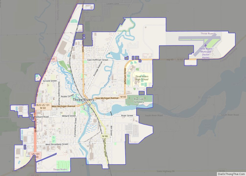
Three Rivers is a city in St. Joseph County, Michigan. The population was 7,973 at the time of the 2020 census.
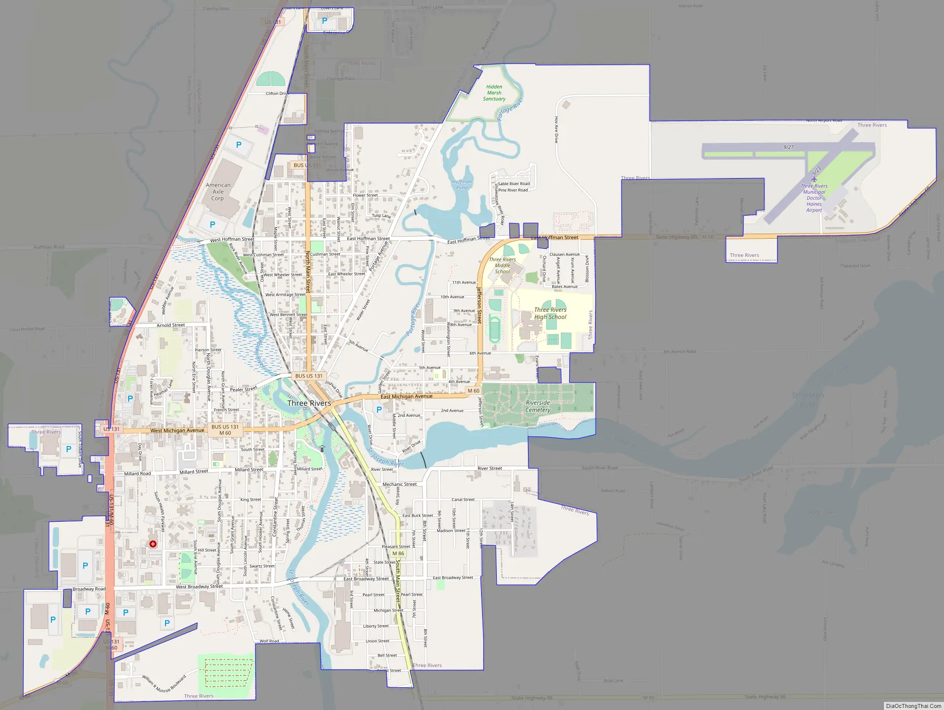
Three Rivers derives its name from its location at the confluence of the St. Joseph River and two tributaries, the Rocky and Portage rivers. The St. Joseph River flows into Lake Michigan.
The city is the home of St. Gregory’s Abbey, a Benedictine monastery of the Episcopal Church, which was established in 1946.
| Name: | Three Rivers city |
|---|---|
| LSAD Code: | 25 |
| LSAD Description: | city (suffix) |
| State: | Michigan |
| County: | St. Joseph County |
| Elevation: | 804 ft (245 m) |
| Total Area: | 5.83 sq mi (15.10 km²) |
| Land Area: | 5.56 sq mi (14.40 km²) |
| Water Area: | 0.27 sq mi (0.70 km²) |
| Total Population: | 7,973 |
| Population Density: | 1,433.73/sq mi (553.55/km²) |
| ZIP code: | 49093 |
| Area code: | 269 |
| FIPS code: | 2679760 |
| GNISfeature ID: | 1624987 |
Online Interactive Map
Click on ![]() to view map in "full screen" mode.
to view map in "full screen" mode.
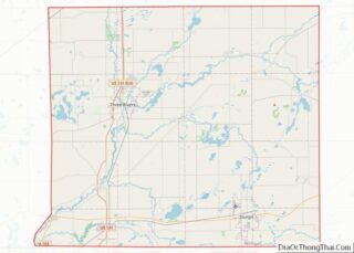
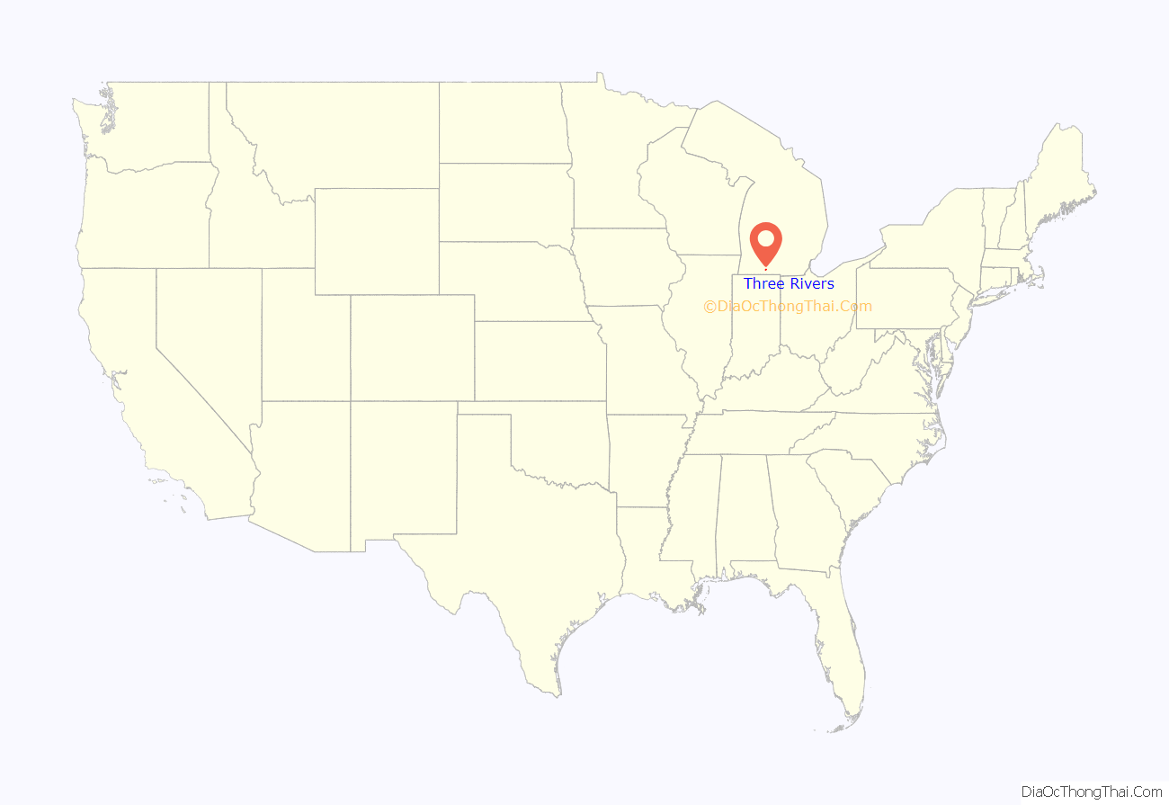
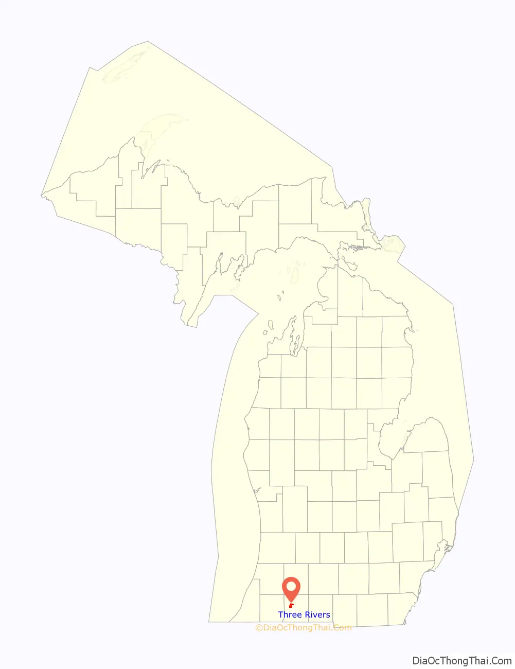
Three Rivers location map. Where is Three Rivers city?
Three Rivers Road Map
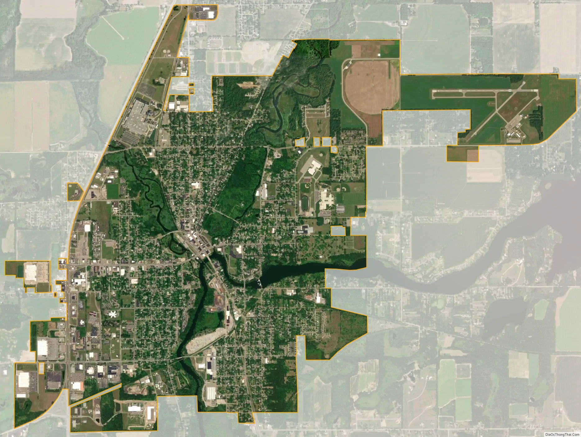
Three Rivers city Satellite Map
Geography
According to the United States Census Bureau, the city has a total area of 5.66 square miles (14.66 km), of which 5.40 square miles (13.99 km) is land and 0.26 square miles (0.67 km) is water.
Highways
- US 131
- Bus. US 131
- M-60
- M-86
Climate
See also
Map of Michigan State and its subdivision:- Alcona
- Alger
- Allegan
- Alpena
- Antrim
- Arenac
- Baraga
- Barry
- Bay
- Benzie
- Berrien
- Branch
- Calhoun
- Cass
- Charlevoix
- Cheboygan
- Chippewa
- Clare
- Clinton
- Crawford
- Delta
- Dickinson
- Eaton
- Emmet
- Genesee
- Gladwin
- Gogebic
- Grand Traverse
- Gratiot
- Hillsdale
- Houghton
- Huron
- Ingham
- Ionia
- Iosco
- Iron
- Isabella
- Jackson
- Kalamazoo
- Kalkaska
- Kent
- Keweenaw
- Lake
- Lake Hurron
- Lake Michigan
- Lake St. Clair
- Lake Superior
- Lapeer
- Leelanau
- Lenawee
- Livingston
- Luce
- Mackinac
- Macomb
- Manistee
- Marquette
- Mason
- Mecosta
- Menominee
- Midland
- Missaukee
- Monroe
- Montcalm
- Montmorency
- Muskegon
- Newaygo
- Oakland
- Oceana
- Ogemaw
- Ontonagon
- Osceola
- Oscoda
- Otsego
- Ottawa
- Presque Isle
- Roscommon
- Saginaw
- Saint Clair
- Saint Joseph
- Sanilac
- Schoolcraft
- Shiawassee
- Tuscola
- Van Buren
- Washtenaw
- Wayne
- Wexford
- Alabama
- Alaska
- Arizona
- Arkansas
- California
- Colorado
- Connecticut
- Delaware
- District of Columbia
- Florida
- Georgia
- Hawaii
- Idaho
- Illinois
- Indiana
- Iowa
- Kansas
- Kentucky
- Louisiana
- Maine
- Maryland
- Massachusetts
- Michigan
- Minnesota
- Mississippi
- Missouri
- Montana
- Nebraska
- Nevada
- New Hampshire
- New Jersey
- New Mexico
- New York
- North Carolina
- North Dakota
- Ohio
- Oklahoma
- Oregon
- Pennsylvania
- Rhode Island
- South Carolina
- South Dakota
- Tennessee
- Texas
- Utah
- Vermont
- Virginia
- Washington
- West Virginia
- Wisconsin
- Wyoming