Trenton is a city in Wayne County, Michigan, United States. At the 2010 census, the city population was 18,853.
A Shawnee village was built in the area by war chief Blue Jacket after the 1795 Treaty of Greenville. The area later became the site of the Battle of Monguagon between Americans and a British-Indian coalition during the War of 1812. The battle is commemorated with a Michigan State Historical Site marker in present-day Elizabeth Park, which was the first county park in Michigan when it was established in 1919. Portions of the Detroit River International Wildlife Refuge are within the southern portion of Trenton.
The area was once part of the now-defunct Monguagon Township. Trenton was incorporated as a village in 1855 and again as a city in 1957. The city is part of the Downriver collection of communities south of Detroit on the west bank of the Detroit River. Trenton is known for its waterfront and growing boating community. Major industries include Stellantis-Chrysler’s Trenton Engine Plant, Solutia, and the DTE Energy Trenton Channel Power Plant. Beaumont Hospital – Trenton is located within city limits and has 203 beds. The former McLouth Steel plant is also located in the city. The city operates the 21,000-square-foot (2,000 m) Trenton Veterans Memorial Library and a historical museum.
| Name: | Trenton city |
|---|---|
| LSAD Code: | 25 |
| LSAD Description: | city (suffix) |
| State: | Michigan |
| County: | Wayne County |
| Incorporated: | 1855 (village) 1957 (city) |
| Elevation: | 597 ft (182 m) |
| Land Area: | 7.24 sq mi (18.76 km²) |
| Water Area: | 0.30 sq mi (0.79 km²) |
| Population Density: | 2,559.91/sq mi (988.38/km²) |
| Area code: | 734 |
| FIPS code: | 2680420 |
| GNISfeature ID: | 1615062 |
| Website: | www.trentonmi.org |
Online Interactive Map
Click on ![]() to view map in "full screen" mode.
to view map in "full screen" mode.
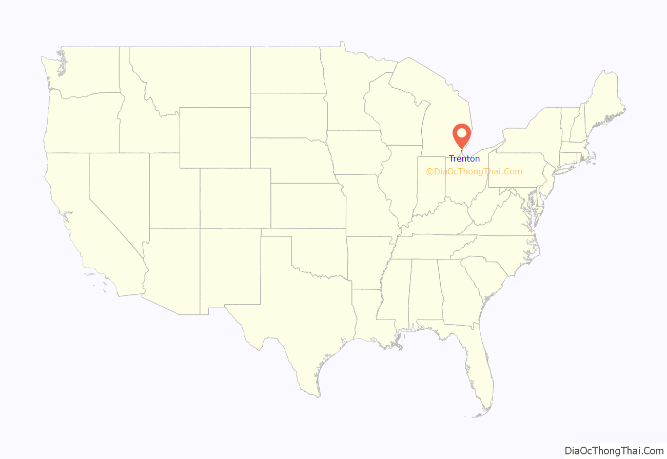
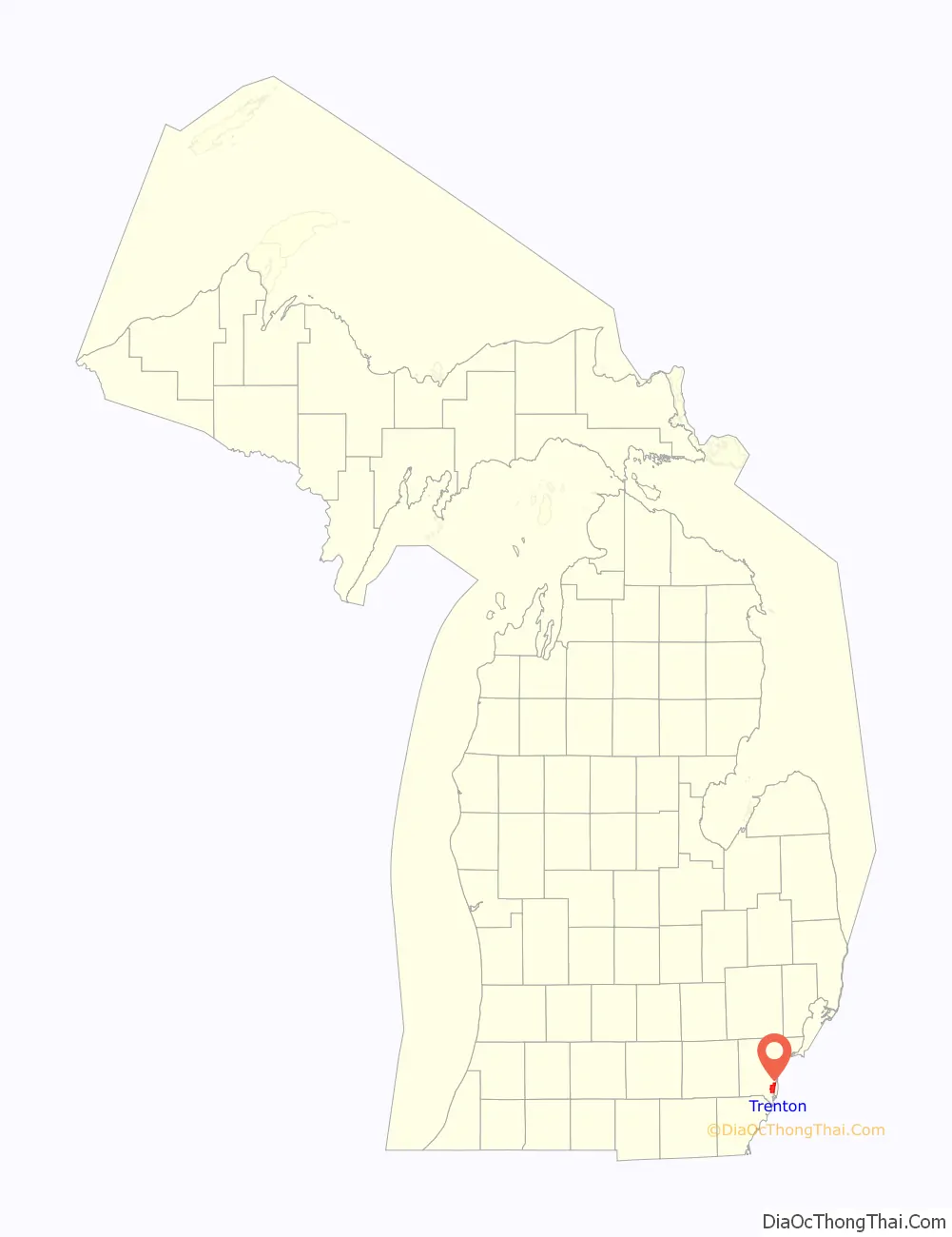
Trenton location map. Where is Trenton city?
History
The founder of Trenton is considered to be Abram Caleb Truax, a member of the territorial militia in attendance when General William Hull surrendered Detroit to the British General Isaac Brock early in the War of 1812. After the war, in 1816, Truax acquired a large tract of land in the Michigan Territory along the Detroit River from the U.S. government and constructed a sawmill, church and store in what is today downtown Trenton. When Territorial Governor Lewis Cass organized Monguagon Township in 1827, Truax became the first Township Supervisor. He laid out the village of Truaxton in 1834. A post office had been established there named “Monguago” in 1828 with Truax as the first postmaster. The post office name was changed to “Truago” in 1837, and to “Trenton” in 1847, after a type of limestone mined from a local quarry. The village was platted and recorded under the name Trenton in 1850 by Abram Truax’s son and daughter George Brigham Truax and Sophia Slocum, the wife of industrialist Giles Slocum. The Slocum family estate was given to the county, becoming what is known as Elizabeth Park, named after Elizabeth Slocum.
In 1834 an industrialist, Giles Bryan Slocum, constructed a dock, making Trenton a major hub of steamboat traffic. In 1846, Capt. Arthur Edwards founded the Detroit & Cleveland Steamboat Company in Trenton. Through the late 1880s Trenton, like several Downriver communities, was known for its extensive shipyards. Sibley, Michigan would not be incorporated into Trenton until 1929.
Trenton was incorporated as a village in 1855.
A Detroit businessman and later Michigan’s first U.S. attorney, Solomon Sibley, started a limestone quarry near Trenton, near what is today Fort Street and Sibley Road. Materials from the quarry were used to construct structures in Detroit, most notably Fort Detroit along the Detroit River. The quarry was later sold to Austin Church, who used limestone to make baking soda, which he sold under his family’s nameplate, Arm & Hammer. In 1900 the quarry was the site of the Sibley Quarry explosion.
Through the late 1880s and even early 1900s, Trenton prospered because it was roughly a day’s journey between Detroit and Monroe, Michigan, which meant people traveling between the two cities would have to stop overnight in Trenton. Painted center lines a innovation vital to the traffic control of modern road transport were first implemented in 1911 by legendary road developer Edward N. Hines on River Road (modern West Jefferon Avenue).
Trenton annexed the village of Sibley (along the modern Riverview border) in 1929, extending the city’s northern boundary to modern-day Sibley Road. Trenton was incorporated as a city in 1957. In 1920 a small light railroad ran along West Jefferson to Wyandotte. The rail services ended in 1934. The tracks were removed in 1942 for the war effort.
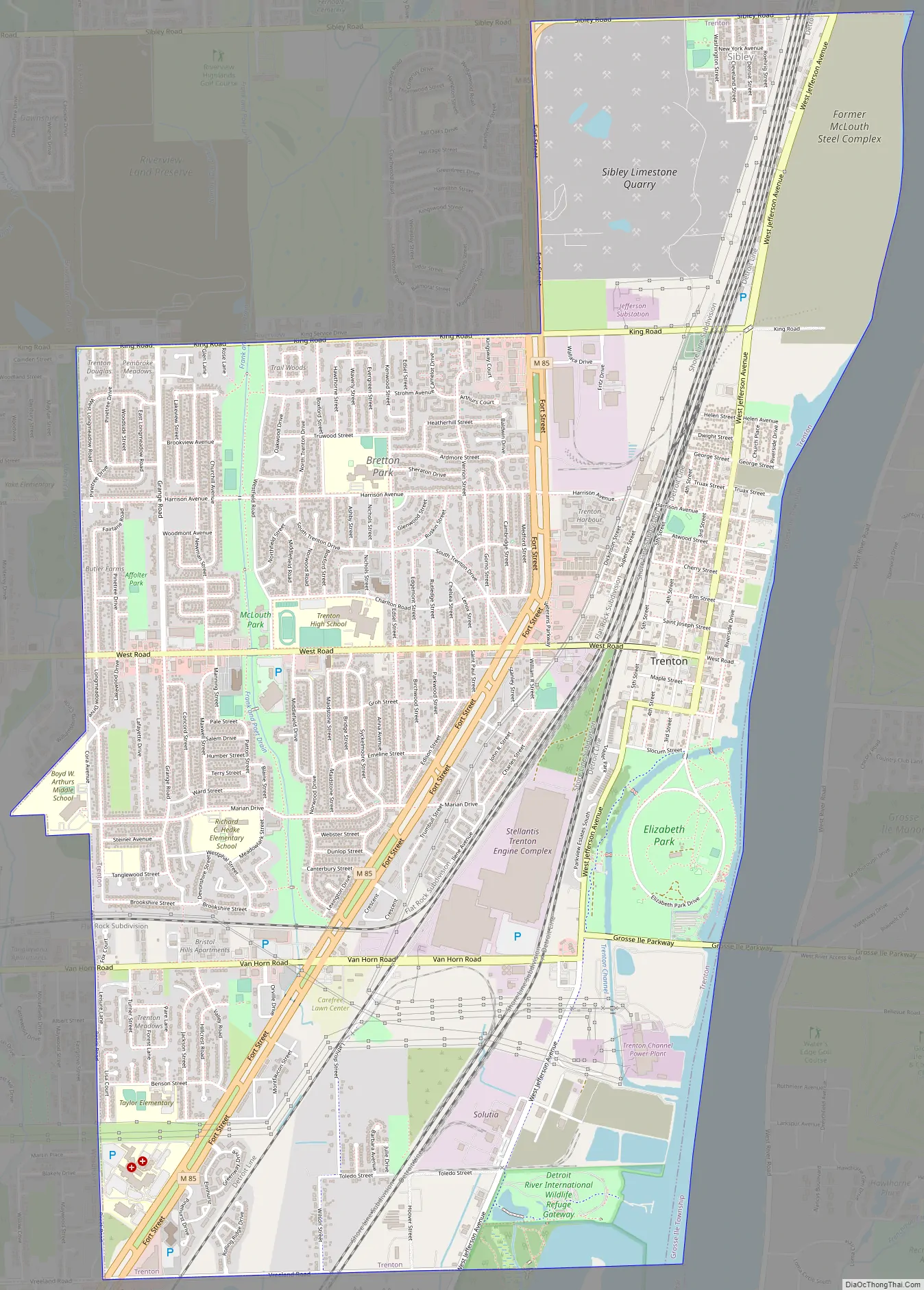
Trenton Road Map
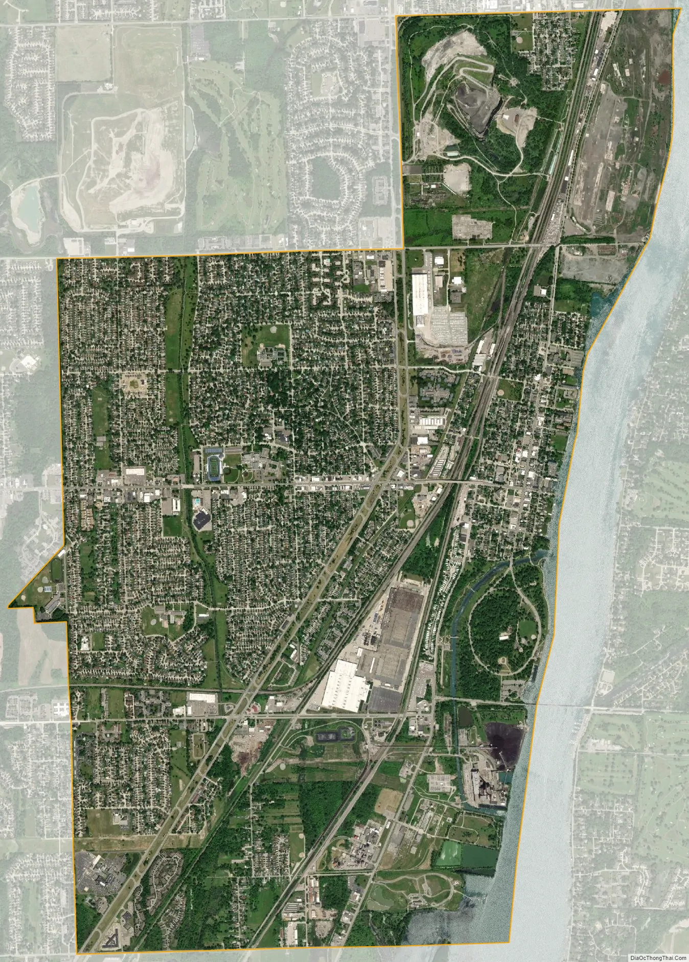
Trenton city Satellite Map
Geography
According to the United States Census Bureau, the city has a total area of 7.51 square miles (19.45 km), of which 7.28 square miles (18.86 km) is land and 0.23 square miles (0.60 km) is water. The city is located between Detroit and Monroe, Michigan, in the southeastern part of the state. The city is located on the western bank of the Detroit River and is bounded by Grosse Ile to the east, Riverview to the north, Brownstown Township to the west and south and Woodhaven to the west.
See also
Map of Michigan State and its subdivision:- Alcona
- Alger
- Allegan
- Alpena
- Antrim
- Arenac
- Baraga
- Barry
- Bay
- Benzie
- Berrien
- Branch
- Calhoun
- Cass
- Charlevoix
- Cheboygan
- Chippewa
- Clare
- Clinton
- Crawford
- Delta
- Dickinson
- Eaton
- Emmet
- Genesee
- Gladwin
- Gogebic
- Grand Traverse
- Gratiot
- Hillsdale
- Houghton
- Huron
- Ingham
- Ionia
- Iosco
- Iron
- Isabella
- Jackson
- Kalamazoo
- Kalkaska
- Kent
- Keweenaw
- Lake
- Lake Hurron
- Lake Michigan
- Lake St. Clair
- Lake Superior
- Lapeer
- Leelanau
- Lenawee
- Livingston
- Luce
- Mackinac
- Macomb
- Manistee
- Marquette
- Mason
- Mecosta
- Menominee
- Midland
- Missaukee
- Monroe
- Montcalm
- Montmorency
- Muskegon
- Newaygo
- Oakland
- Oceana
- Ogemaw
- Ontonagon
- Osceola
- Oscoda
- Otsego
- Ottawa
- Presque Isle
- Roscommon
- Saginaw
- Saint Clair
- Saint Joseph
- Sanilac
- Schoolcraft
- Shiawassee
- Tuscola
- Van Buren
- Washtenaw
- Wayne
- Wexford
- Alabama
- Alaska
- Arizona
- Arkansas
- California
- Colorado
- Connecticut
- Delaware
- District of Columbia
- Florida
- Georgia
- Hawaii
- Idaho
- Illinois
- Indiana
- Iowa
- Kansas
- Kentucky
- Louisiana
- Maine
- Maryland
- Massachusetts
- Michigan
- Minnesota
- Mississippi
- Missouri
- Montana
- Nebraska
- Nevada
- New Hampshire
- New Jersey
- New Mexico
- New York
- North Carolina
- North Dakota
- Ohio
- Oklahoma
- Oregon
- Pennsylvania
- Rhode Island
- South Carolina
- South Dakota
- Tennessee
- Texas
- Utah
- Vermont
- Virginia
- Washington
- West Virginia
- Wisconsin
- Wyoming


