Monroe is the largest city and county seat of Monroe County, Michigan, United States. The population was 20,462 as of the 2020 census. The city is bordered on the south by Monroe Charter Township, but the two are administered autonomously. Monroe is the core city in the Monroe metropolitan area, which is coterminous with Monroe County and had a population of 154,809 in 2020. Located on the western shores of Lake Erie approximately 14 miles (23 km) north of Toledo, Ohio and 25 miles (40 km) south of Detroit, the city is part of the Detroit–Ann Arbor–Flint combined statistical area.
The Monroe area was the scene of several military conflicts during the War of 1812 against the United Kingdom and is known for the Battle of Frenchtown. In 1817, portions of the Frenchtown settlement along the River Raisin were platted and renamed Monroe after then-president James Monroe. When Michigan became a state in 1837, Monroe was incorporated as a city.
Monroe is known as the childhood residence of George Armstrong Custer and other members of his family, including his brother Boston Custer and wife Elizabeth Bacon. Several structures are named after Custer, including Custer Airport. Founded in 1928, the La-Z-Boy world headquarters are located in Monroe.
| Name: | Monroe city |
|---|---|
| LSAD Code: | 25 |
| LSAD Description: | city (suffix) |
| State: | Michigan |
| County: | Monroe County |
| Incorporated: | 1837 |
| Elevation: | 594 ft (182 m) |
| Land Area: | 9.05 sq mi (23.43 km²) |
| Water Area: | 1.17 sq mi (3.03 km²) |
| Population Density: | 2,261.99/sq mi (873.34/km²) |
| Area code: | 734 |
| FIPS code: | 2655020 |
| GNISfeature ID: | 0632572 |
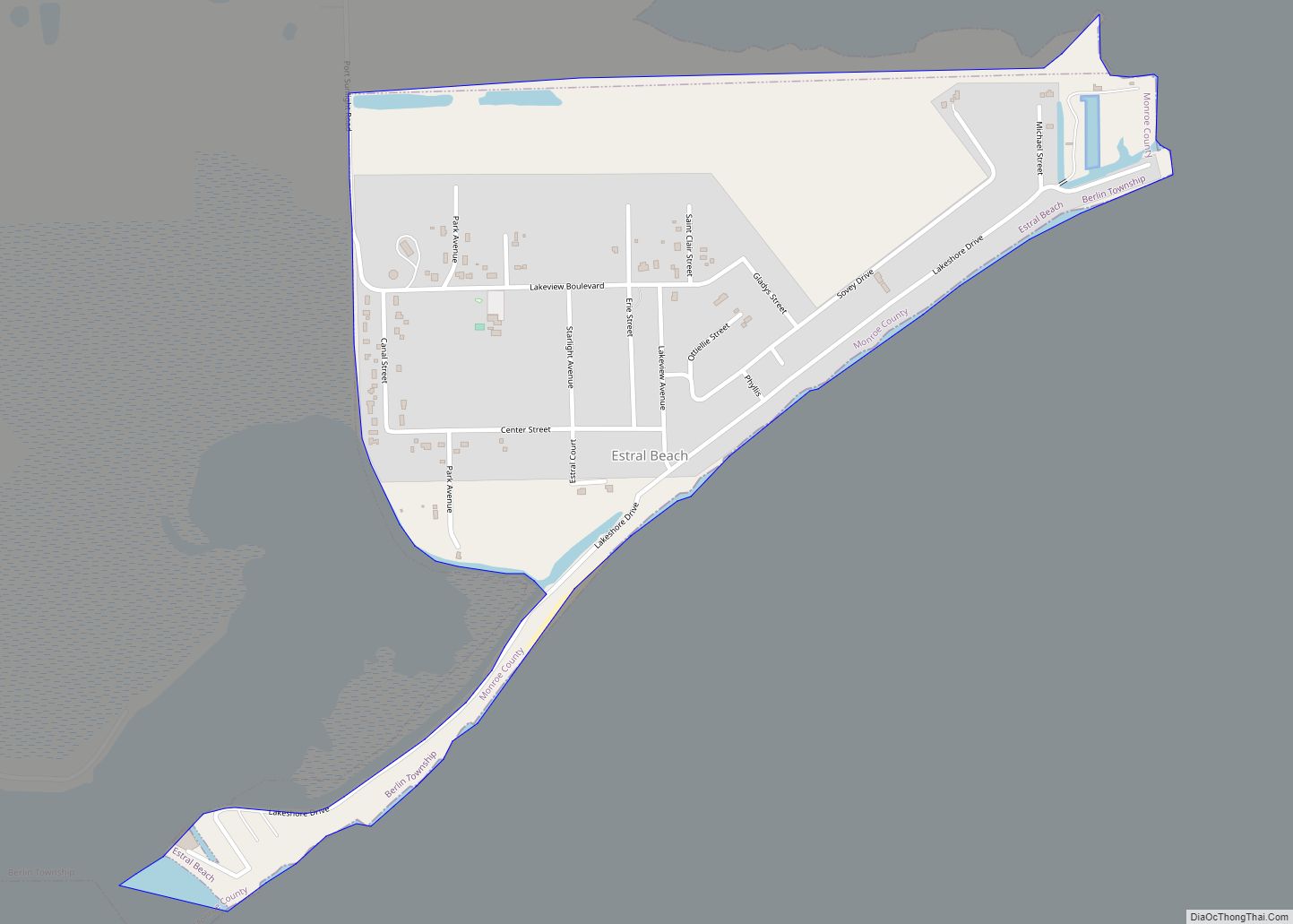
Online Interactive Map
Click on ![]() to view map in "full screen" mode.
to view map in "full screen" mode.
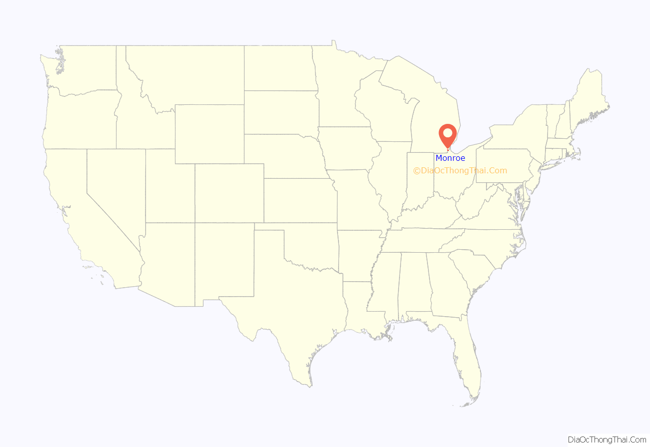
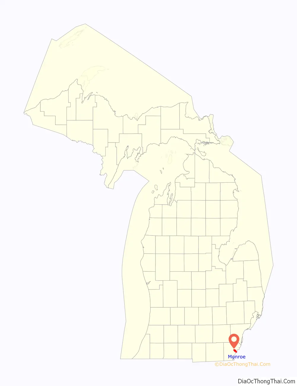
Monroe location map. Where is Monroe city?
History
Long occupied by varying cultures of indigenous peoples, the area around the River Raisin was settled by the historic Potawatomi hundreds of years before French explorers and colonists reached it in the late seventeenth century. Robert de LaSalle claimed the area for New France after his 1679 expedition on the Griffon.
In 1784, after the American Revolutionary War, Francis Navarre of Canada was given a portion of land south of the River Raisin by the Potawatomi. Colonists settled Frenchtown shortly thereafter as the third European community in what in the early 19th century became the state of Michigan. Around the same time, the Sandy Creek Settlement was established just north of Frenchtown by French-Canadian Joseph Porlier Benec.
Because of its proximity to Detroit, the area was of strategic importance during the War of 1812 between the United States and Great Britain, especially after Fort Detroit surrendered to the British in August 1812. American forces en route to retake Detroit had camped in the area of the River Raisin in the winter of 1812–13. A force of 200 Native Americans and 63 Canadian militia were forced to retreat north away from the River Raisin by 600 Kentucky militiamen and 100 French, under the command of James Winchester, on January 18, 1813. This skirmish was later dubbed the ‘First Battle of the River Raisin’.
But, on January 22, 1813, a force of 800 Native Americans and 597 British, under Henry Proctor, surprised the force of 1,000 Americans and captured Frenchtown. Many of the American militia were inexperienced, ill-trained, and badly equipped. They suffered 397 killed and 547 captured. The British and their allies had only slight losses.
When the British departed with their captives to Detroit, they left those Americans too wounded to walk in the homes of Frenchtown inhabitants under the guard of a small British detachment and Native American allies, including Potawatomi. The morning after the battle, other Native Americans returned to Frenchtown. They plundered and burned homes, and killed and ritually scalped many of the remaining American captives, taking others as slaves. The official U.S. estimate of casualties in this aftermath include a dozen named individuals killed and up to 30 more who were likely killed. The British estimated six Americans were killed.
This event became known throughout the United States as the “River Raisin Massacre”. This was also known as the Battle of Frenchtown (or the Second Battle of the River Raisin). Today, the site of the battle is preserved as the River Raisin National Battlefield Park, authorized in 2009. It is the first and so far the only national battlefield established for a War of 1812 site. It has a small visitor center.
The area of Frenchtown was renamed after the War of 1812 and incorporated as the village of Monroe in honor of President James Monroe. He visited the Michigan Territory in 1817. In the same year, the city of Monroe was named as the county seat of the newly created Monroe County. Monroe was re-incorporated as a city in 1837.
Settled mostly by American migrants from New York and New England, Monroe later became associated with events in the West in the later 19th century, particularly the Indian Wars. It is known as the childhood home of George Armstrong Custer (1839–1876), who had a military career in which he reached the rank of major general. His family moved here when he was young, and he lived in Monroe for much of his childhood. Here he later met and in 1864 married Elizabeth Bacon (1842–1933), during the Civil War. In the later 19th century, he led troops in the Indian Wars and died at the Battle of the Little Bighorn, in which his forces were killed by the Lakota. They call it the Battle of the Greasy Grass.
In 1910, President William Howard Taft and the widow Elizabeth Bacon Custer unveiled an equestrian statue of Custer, which now stands at the corner of Elm Avenue and Monroe Street. Custer is also honored in street names, various historic markers, buildings, schools, and the regional Custer Airport. City limit signs for Monroe describe the city as “the home of General Custer.”
The La-Z-Boy furniture company, which became known for its reclining easy chairs, was founded in Monroe in 1927. Their world headquarters are located in Monroe, south of the intersection of La-Z-Boy Blvd and Stewart Road. This new facility is roughly 1/2 a mile east of the original location on Telegraph Road; the old building was demolished in 2021 and the site is being redeveloped.
In 1974, the Monroe Power Plant opened. It is the third largest coal fired plant in the United States, with a capacity of 3,280 megawatts. At 805 feet (245 m) tall, the dual smokestacks are visible from more than 25 miles (40 km) away and are among the tallest structures in the state.
In December 1989, a combination of Zebra Mussels and ice clogged the sole intake pipe of the Monroe water treatment plant, forcing a two-day shutdown of the city’s schools, industries, and businesses.
Monroe Road Map
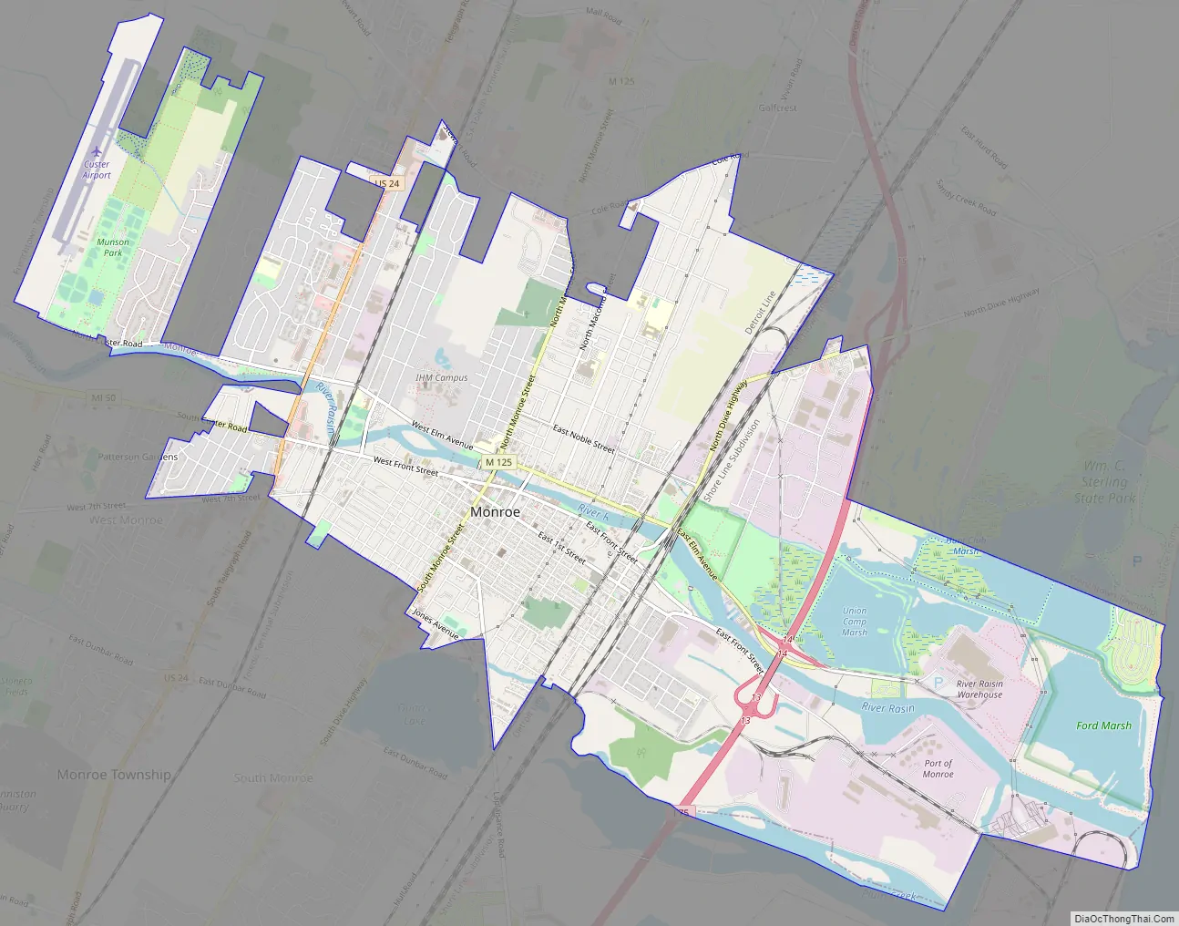
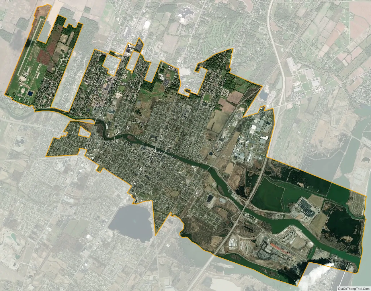
Monroe city Satellite Map
Geography
According to the United States Census Bureau, the city has a total area of 10.18 square miles (26.37 km), of which 9.17 square miles (23.75 km) is land and 1.01 square miles (2.62 km) (9.92%) is water. Monroe sits at the lowest elevation in state of Michigan, which is the shores of Lake Erie at 571 feet (174 meters). The average elevation of the city of Monroe is 594 feet (181 meters). The Port of Monroe is the only Michigan port on Lake Erie, and Sterling State Park is the only of Michigan’s 103 state parks located on or near Lake Erie. The River Raisin and Sandy Creek travel through Monroe; they are non-navigable because of the several dams and other obstructions.
Climate
Monroe lies in the humid continental climate zone. Monroe receives an average of 28.5 inches (72 cm) of snow a year — the lowest average snowfall for any large city in the state. July is the warmest month with an average high temperature of 84 °F (29 °C), and January is the coldest month with an average low temperature of 16 °F (−9 °C). Monroe does not normally have extremely hot or cold temperatures, as its climate is moderated by the lake. On average, the temperature only drops below 0 °F (−18 °C) a couple of times during a winter season, and it is even rarer for the temperature to rise above 100 °F (38 °C) during the summer. The coldest recorded temperature was −21 °F (−29 °C) on February 5, 1918. The highest recorded temperature was 106 °F (41 °C) on July 24, 1934, with another equal temperature recorded on one occasion many years earlier.
See also
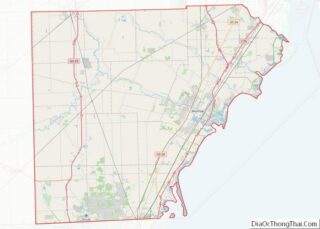
Map of Michigan State and its subdivision:- Alcona
- Alger
- Allegan
- Alpena
- Antrim
- Arenac
- Baraga
- Barry
- Bay
- Benzie
- Berrien
- Branch
- Calhoun
- Cass
- Charlevoix
- Cheboygan
- Chippewa
- Clare
- Clinton
- Crawford
- Delta
- Dickinson
- Eaton
- Emmet
- Genesee
- Gladwin
- Gogebic
- Grand Traverse
- Gratiot
- Hillsdale
- Houghton
- Huron
- Ingham
- Ionia
- Iosco
- Iron
- Isabella
- Jackson
- Kalamazoo
- Kalkaska
- Kent
- Keweenaw
- Lake
- Lake Hurron
- Lake Michigan
- Lake St. Clair
- Lake Superior
- Lapeer
- Leelanau
- Lenawee
- Livingston
- Luce
- Mackinac
- Macomb
- Manistee
- Marquette
- Mason
- Mecosta
- Menominee
- Midland
- Missaukee
- Monroe
- Montcalm
- Montmorency
- Muskegon
- Newaygo
- Oakland
- Oceana
- Ogemaw
- Ontonagon
- Osceola
- Oscoda
- Otsego
- Ottawa
- Presque Isle
- Roscommon
- Saginaw
- Saint Clair
- Saint Joseph
- Sanilac
- Schoolcraft
- Shiawassee
- Tuscola
- Van Buren
- Washtenaw
- Wayne
- Wexford
- Alabama
- Alaska
- Arizona
- Arkansas
- California
- Colorado
- Connecticut
- Delaware
- District of Columbia
- Florida
- Georgia
- Hawaii
- Idaho
- Illinois
- Indiana
- Iowa
- Kansas
- Kentucky
- Louisiana
- Maine
- Maryland
- Massachusetts
- Michigan
- Minnesota
- Mississippi
- Missouri
- Montana
- Nebraska
- Nevada
- New Hampshire
- New Jersey
- New Mexico
- New York
- North Carolina
- North Dakota
- Ohio
- Oklahoma
- Oregon
- Pennsylvania
- Rhode Island
- South Carolina
- South Dakota
- Tennessee
- Texas
- Utah
- Vermont
- Virginia
- Washington
- West Virginia
- Wisconsin
- Wyoming